Törökszentmiklós, by Georg Braun and Frans Hogenberg. 1618
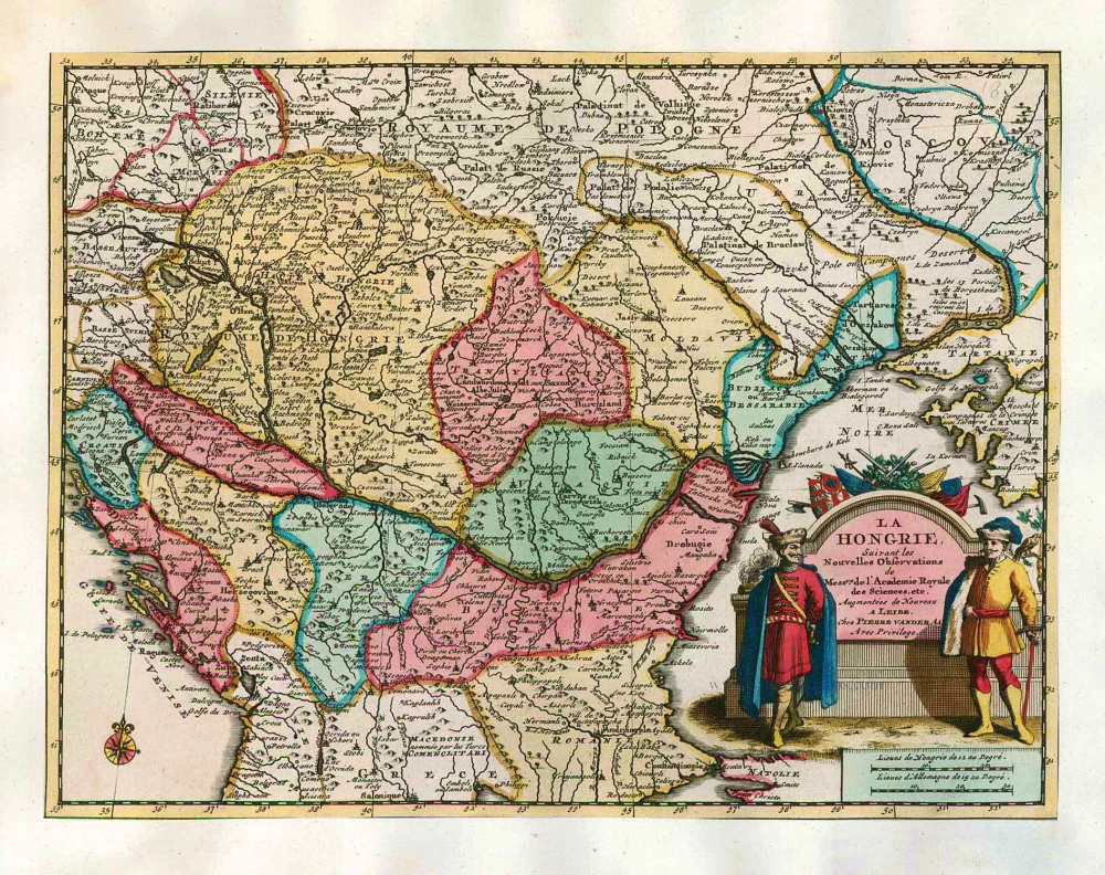
The item displayed on this page has been sold. However, we have a similar map in stock:
Törökszentmiklos by Braun G. & Hogenberg F. c. 1625
Sanctonicolaum vulgo S. Nicolas Oppidum in ...
[Item number: 16453]
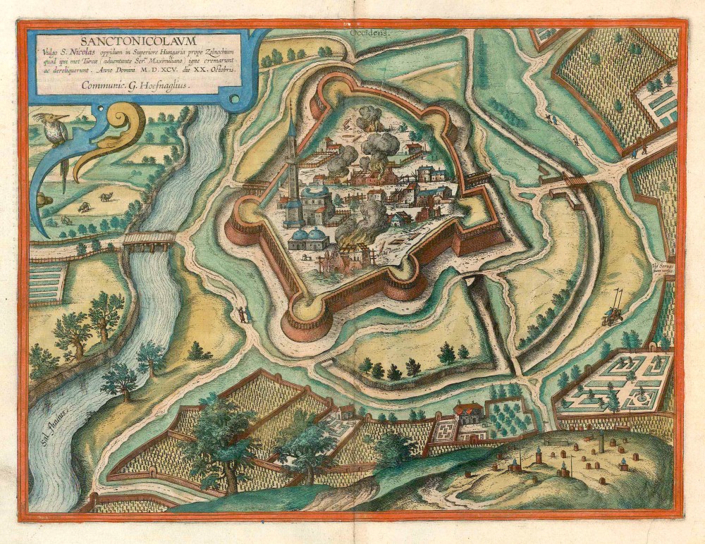
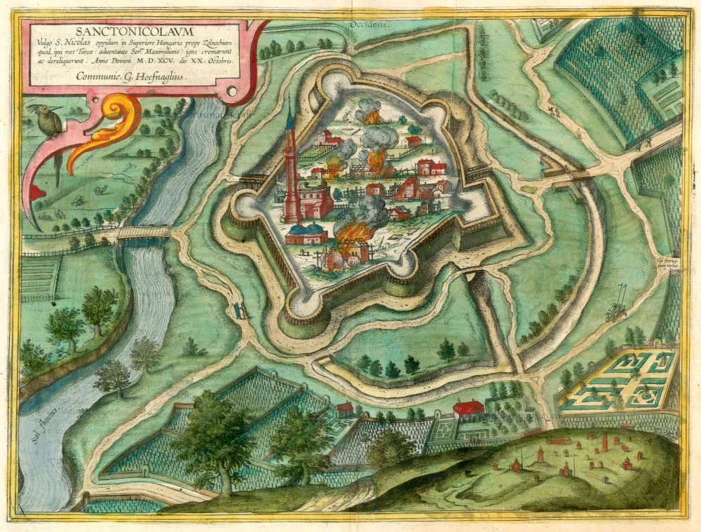


CARTOUCHE: Sanctonicolaum, in the vernacular Törökszentmiklós, a town in Upper Hungary near Zolnochium, was set on fire and abandoned by the Turks on the arrival of Emperor Maximilian. 20 October 1595. Procured by Georg Hoefnagel.
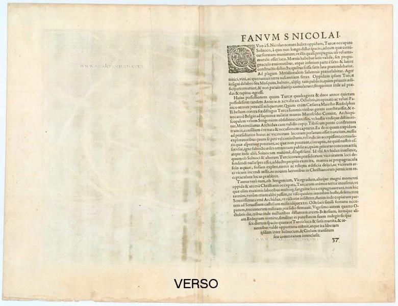
COMMENTARY BY BRAUN (on verso): "The soil of the surrounding farmland is very fertile for vines, grain and root crops. For this reason, the Turks would have liked to stay longer, as is clear from the splendid mosque, the baths and other fine houses they built here. Particularly as it was also a real robbers' den and well-situated for good booty. [...] After the Christians had captured Esztergom, Weissengrad and other castles and fortresses, the Turks became so stricken with fear that they abandoned not only this but also other fortresses and fled without good cause."
The Turkish fortress is shown from a birds-eye perspective looking towards the east. It lies to the east of Szolnok and is shown at the moment when many of the buildings are going up in flames or have already been destroyed. The cartouche text tells us that this event took place on 20 October 1595, the Turks having set their own fortress on fire during their retreat when Emperor Rudolf II (erroneously called Maximilian in the cartouche) was approaching with his troops. A few of the buildings have been preserved, including the minaret of the partially destroyed mosque and, in front of it, the Turkish bath with its two domes. An Ottoman cemetery can be seen in the bottom right-hand corner. (Taschen)
Braun G. & Hogenberg F. and the Civitates Orbis Terrarum.
The Civitates Orbis Terrarum, or the "Braun & Hogenberg", is a six-volume town atlas and the most excellent book of town views and plans ever published: 363 engravings, sometimes beautifully coloured. It was one of the best-selling works in the last quarter of the 16th century. Georg Braun wrote the text accompanying the plans and views on the verso. Many plates were engraved after the original drawings of a professional artist, a professional artist, Joris Hoefnagel (1542-1600). The first volume was published in Latin in 1572, and the sixth in 1617. Frans Hogenberg created the tables for volumes I through IV, and Simon van den Neuwel made those for volumes V and VI. Other contributors were cartographers Daniel Freese and Heinrich Rantzau. Works by Jacob van Deventer, Sebastian Münster, and Johannes Stumpf were also used. Translations appeared in German and French.
Following the original publication of Volume 1 of the Civitates in 1572, seven further editions of 1575, 1577, 1582, 1588, 1593, 1599 and 1612 can be identified. Vol.2, first issued in 1575, was followed by further editions in 1597 and 1612. The subsequent volumes appeared in 1581, 1588, 1593, 1599 and 1606. The German translation of the first volume appeared from 1574 on, and the French edition from 1575 on.
Several printers were involved: Theodor Graminaeus, Heinrich von Aich, Gottfried von Kempen, Johannis Sinniger, Bertram Buchholtz and Peter von Brachel, who all worked in Cologne.
Georg Braun (1541-1622)
Georg Braun was born in Cologne in 1541. After his studies in Cologne, he entered the Jesuit Order as a novice. 1561, he obtained his bachelor's degree, and in 1562, he received his Magister Artium. Although he left the Jesuit Order, he studied theology, gaining a licentiate in theology.
Frans Hogenberg (1535-1590)
Frans Hogenberg was a Flemish and German painter, engraver, and mapmaker. He was born in Mechelen as the son of Nicolaas Hogenberg.
By the end of the 1560s, Frans Hogenberg was employed upon Abraham Ortelius's Theatrum Orbis Terrarum, published in 1570; he is named an engraver of numerous maps. In 1568, he was banned from Antwerp by the Duke of Alva and travelled to London, where he stayed a few years before emigrating to Cologne. He immediately embarked on his two most important works, the Civitates, published in 1572 and the Geschichtsblätter, which appeared in several series from 1569 until about 1587.
Thanks to large-scale projects like the Geschichtsblätter and the Civitates, Hogenberg's social circumstances improved with each passing year. He died as a wealthy man in Cologne in 1590.
Sanctonicolaum vulgo S. Nicolas Oppidum in Superiore Hungaria prope Zolnochium quod ipsi met Turcae ...
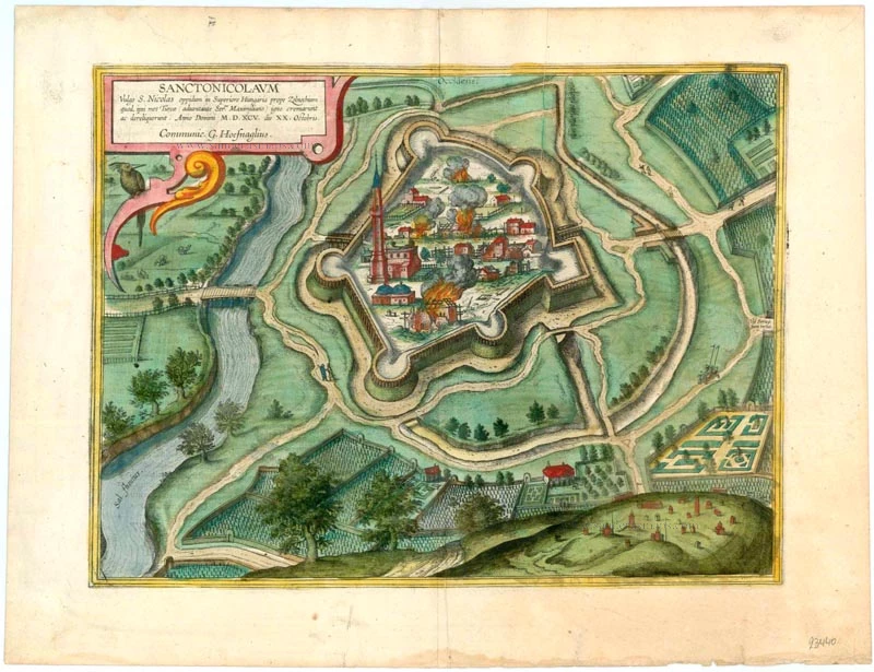
Item Number: 23440 Authenticity Guarantee
Category: Antique maps > Europe > Central Europe
Old, antique bird’s-eye view plan of Törökszentmiklós, by Georg Braun and Frans Hogenberg after G. Hoefnagel.
Title: Sanctonicolaum vulgo S. Nicolas Oppidum in Superiore Hungaria prope Zolnochium quod ipsi met Turcae ...
Date of the first edition: 1617.
Date of this map: 1618.
Copper engraving, printed on paper.
Image size: 330 x 450mm (12.99 x 17.72 inches).
Sheet size: 410 x 540mm (16.14 x 21.26 inches).
Verso: Latin text.
Condition: Excellent, superb old colour.
Condition Rating: A+.
From: Theatri praecipuarum Totius Mundi Urbium Liber Sextus Anno MDCXVIII. (Van der Krogt 4, 41:1.6)
CARTOUCHE: Sanctonicolaum, in the vernacular Törökszentmiklós, a town in Upper Hungary near Zolnochium, was set on fire and abandoned by the Turks on the arrival of Emperor Maximilian. 20 October 1595. Procured by Georg Hoefnagel.
COMMENTARY BY BRAUN (on verso): "The soil of the surrounding farmland is very fertile for vines, grain and root crops. For this reason, the Turks would have liked to stay longer, as is clear from the splendid mosque, the baths and other fine houses they built here. Particularly as it was also a real robbers' den and well-situated for good booty. [...] After the Christians had captured Esztergom, Weissengrad and other castles and fortresses, the Turks became so stricken with fear that they abandoned not only this but also other fortresses and fled without good cause."
The Turkish fortress is shown from a birds-eye perspective looking towards the east. It lies to the east of Szolnok and is shown at the moment when many of the buildings are going up in flames or have already been destroyed. The cartouche text tells us that this event took place on 20 October 1595, the Turks having set their own fortress on fire during their retreat when Emperor Rudolf II (erroneously called Maximilian in the cartouche) was approaching with his troops. A few of the buildings have been preserved, including the minaret of the partially destroyed mosque and, in front of it, the Turkish bath with its two domes. An Ottoman cemetery can be seen in the bottom right-hand corner. (Taschen)
Braun G. & Hogenberg F. and the Civitates Orbis Terrarum.
The Civitates Orbis Terrarum, or the "Braun & Hogenberg", is a six-volume town atlas and the most excellent book of town views and plans ever published: 363 engravings, sometimes beautifully coloured. It was one of the best-selling works in the last quarter of the 16th century. Georg Braun wrote the text accompanying the plans and views on the verso. Many plates were engraved after the original drawings of a professional artist, a professional artist, Joris Hoefnagel (1542-1600). The first volume was published in Latin in 1572, and the sixth in 1617. Frans Hogenberg created the tables for volumes I through IV, and Simon van den Neuwel made those for volumes V and VI. Other contributors were cartographers Daniel Freese and Heinrich Rantzau. Works by Jacob van Deventer, Sebastian Münster, and Johannes Stumpf were also used. Translations appeared in German and French.
Following the original publication of Volume 1 of the Civitates in 1572, seven further editions of 1575, 1577, 1582, 1588, 1593, 1599 and 1612 can be identified. Vol.2, first issued in 1575, was followed by further editions in 1597 and 1612. The subsequent volumes appeared in 1581, 1588, 1593, 1599 and 1606. The German translation of the first volume appeared from 1574 on, and the French edition from 1575 on.
Several printers were involved: Theodor Graminaeus, Heinrich von Aich, Gottfried von Kempen, Johannis Sinniger, Bertram Buchholtz and Peter von Brachel, who all worked in Cologne.
Georg Braun (1541-1622)
Georg Braun was born in Cologne in 1541. After his studies in Cologne, he entered the Jesuit Order as a novice. 1561, he obtained his bachelor's degree, and in 1562, he received his Magister Artium. Although he left the Jesuit Order, he studied theology, gaining a licentiate in theology.
Frans Hogenberg (1535-1590)
Frans Hogenberg was a Flemish and German painter, engraver, and mapmaker. He was born in Mechelen as the son of Nicolaas Hogenberg.
By the end of the 1560s, Frans Hogenberg was employed upon Abraham Ortelius's Theatrum Orbis Terrarum, published in 1570; he is named an engraver of numerous maps. In 1568, he was banned from Antwerp by the Duke of Alva and travelled to London, where he stayed a few years before emigrating to Cologne. He immediately embarked on his two most important works, the Civitates, published in 1572 and the Geschichtsblätter, which appeared in several series from 1569 until about 1587.
Thanks to large-scale projects like the Geschichtsblätter and the Civitates, Hogenberg's social circumstances improved with each passing year. He died as a wealthy man in Cologne in 1590.