
Poland by Ottens R. & I. 1730-45


The Ottens Family
Joachim Ottens (1663-1719), was a copper-engraver and the founder of the print- and mapsellers’ firm in Amsterdam. In 1710 he became a member of the art- and printsellers guild. After he died in 1719, his widow and the sons continued the business under the name “In de Wereldcaert” (In the world map). On the whole, the Ottens’s financial position was rather weak, and the stock was not very large.
In a notary contract dated 20 October 1726, the partnership between the two brothers, Reinier and Josua, was stipulated. Despite separate shops, the brothers’ partnership continued until the death of Renier in 1750.
After Joshua died in 1765, his widow continued the firm, together with her son, Renier II, until c. 1780.
The firm flourished mainly between 1719 and c. 1750. In that period, they advertised at various times the publication of new maps.
Ottens’s greatest fame comes from the voluminous atlases assembled to order. A small number of these so-called ‘Atlas factice’, splendid copies with gorgeous illumination, have survived. These collector’s copies are known to exist in 2, 6, 8, 11, and even 15 volumes. Ottens also published atlases in one volume, with a varying number of maps, pocket atlases, collections of military plans, and Renard’s atlas de la navigation.
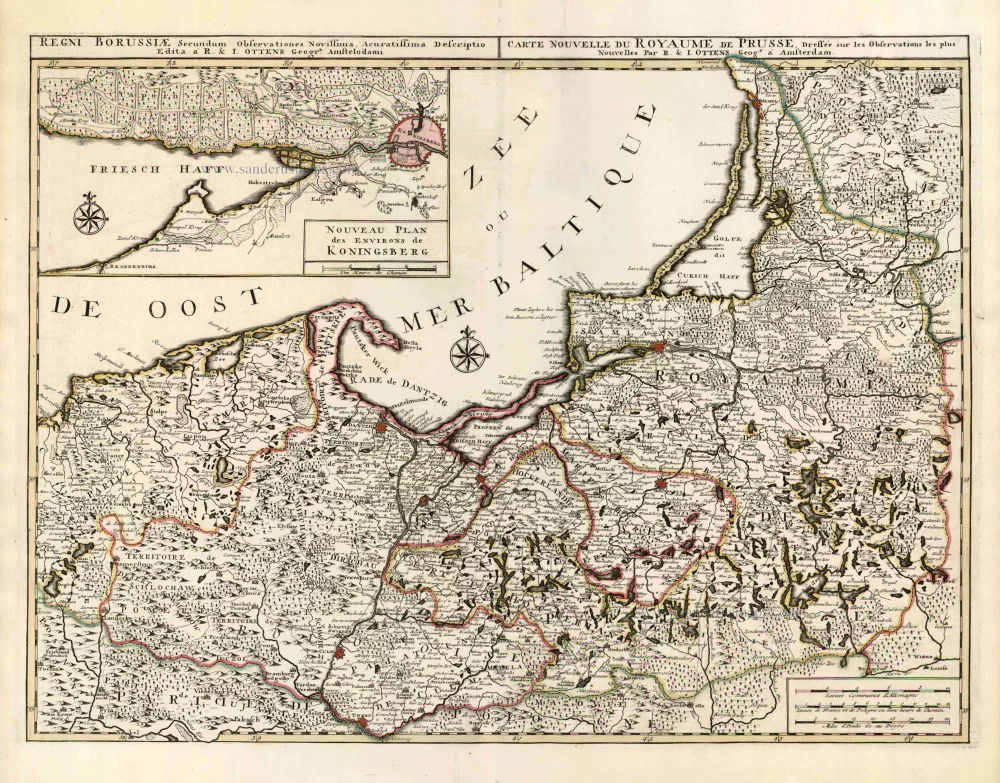
Regni Borussiae Secundum Observationes Novissima, Acuratissima Descriptio. / Carte Nouvelle du Royaume de Prusse, Dressée sur les Observations les Plus Nouvelles.
Item Number: 25845 Authenticity Guarantee
Category: Antique maps > Europe > Eastern Europe
Old, antique map of Northern Poland by R. & I. Ottens.
With inset map showing the vicinity of Koningsberg.
Rare first state.
Copper engraving, printed on paper.
Size (not including margins): 46 x 61cm (17.9 x 23.8 inches)
Verso: Blank
Condition: Original coloured in outline, excellent.
Condition Rating: A+
From: Atlas sive Geographia compendiosa in qua Orbis Terrarum pacis attamen novissimis Tabulis Ostenditur. - Atlas Nouveau, contenant toutes les partis du monde ... R. & I. Ottens, c. 1745. (Composite Atlas).
The Ottens Family
Joachim Ottens (1663-1719), was a copper-engraver and the founder of the print- and mapsellers’ firm in Amsterdam. In 1710 he became a member of the art- and printsellers guild. After he died in 1719, his widow and the sons continued the business under the name “In de Wereldcaert” (In the world map). On the whole, the Ottens’s financial position was rather weak, and the stock was not very large.
In a notary contract dated 20 October 1726, the partnership between the two brothers, Reinier and Josua, was stipulated. Despite separate shops, the brothers’ partnership continued until the death of Renier in 1750.
After Joshua died in 1765, his widow continued the firm, together with her son, Renier II, until c. 1780.
The firm flourished mainly between 1719 and c. 1750. In that period, they advertised at various times the publication of new maps.
Ottens’s greatest fame comes from the voluminous atlases assembled to order. A small number of these so-called ‘Atlas factice’, splendid copies with gorgeous illumination, have survived. These collector’s copies are known to exist in 2, 6, 8, 11, and even 15 volumes. Ottens also published atlases in one volume, with a varying number of maps, pocket atlases, collections of military plans, and Renard’s atlas de la navigation.
Related items
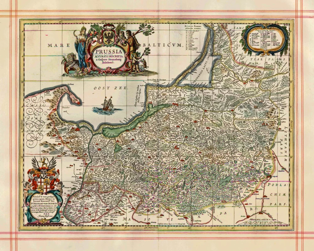
Prussia Accurate Descripta. 1680
Poland - Prussia by J. Janssonius, published by Moses Pitt & J. Janssonius-Waesberge.
[Item number: 999]
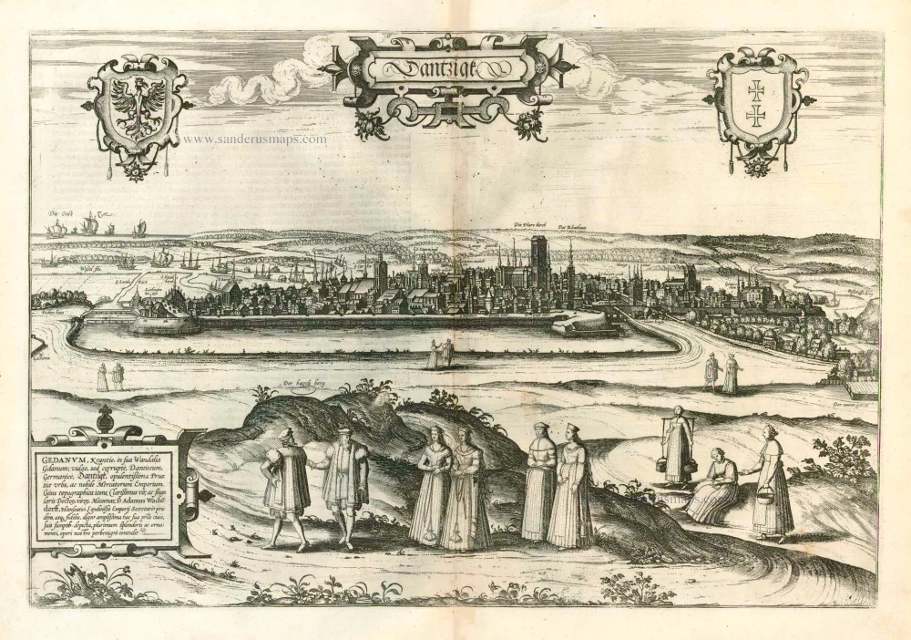
Dantzigk - Gedanum, Krantio, in sua Wandalia Gdanum; . . . 1576
Gdansk, by Georg Braun and Frans Hogenberg.
[Item number: 4056]
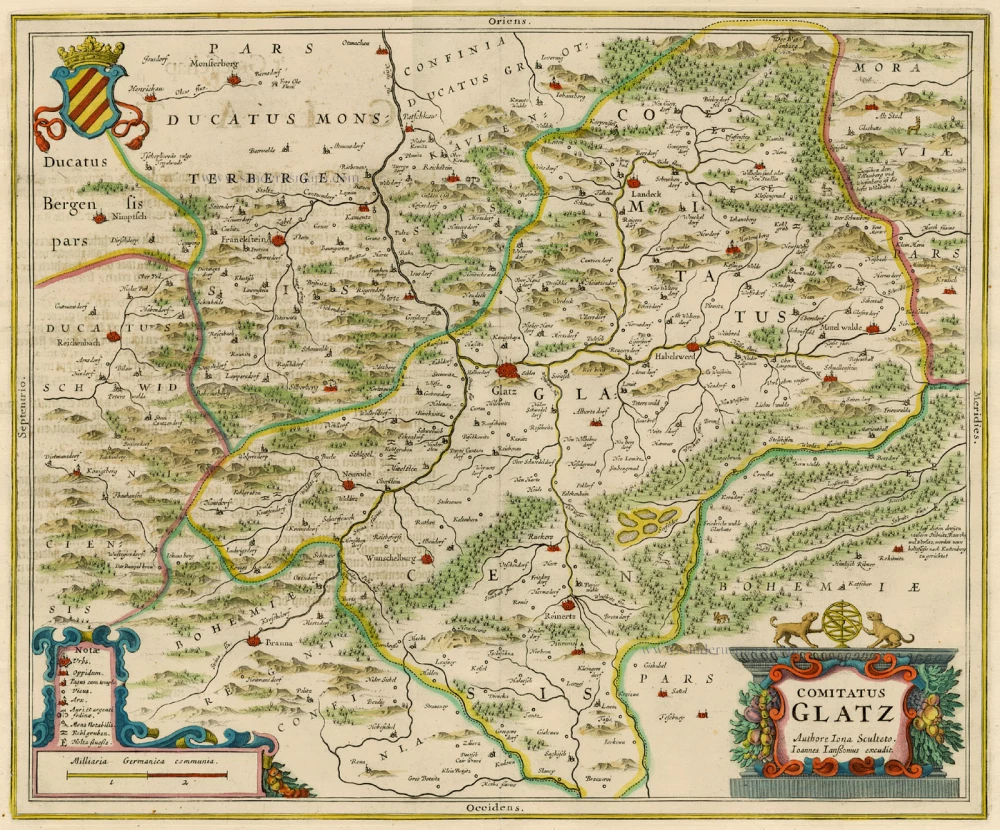
Comitatus Glatz. 1658
Poland - Klodzko, by J. Janssonius.
[Item number: 15619]

Poloniae Finitimarumque Locorum Descriptio Auctore Wenceslao Godreccio Polono. 1572
Poland, by Abraham Ortelius.
[Item number: 16790]
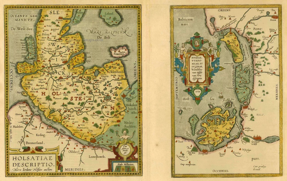
Holsatiae Descriptio [on sheet with] Rugiae, Usedomiae, et Iulinae, Wandalicarum Insularum Vera Descriptio. 1601
Poland - Rügen - Holstein, by Ortelius A.
[Item number: 21277]
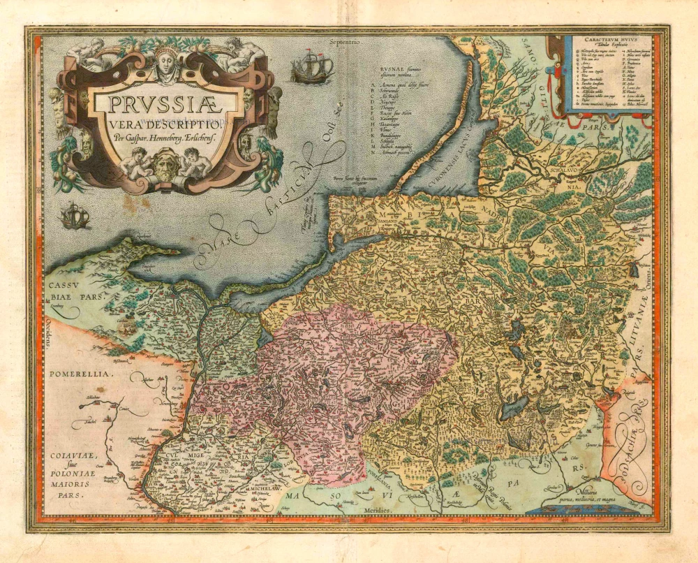
Prussiae Vera Descriptio. 1601
Prussia (Poland) by Abraham Ortelius.
[Item number: 25260]
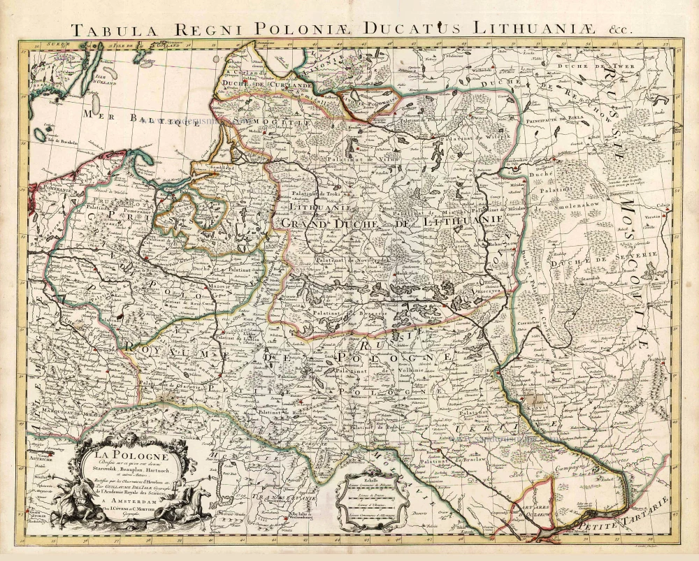
La Pologne Dressée sur ce qu'en ont donné Starovolsk, Beauplan, Hartnoch, et autres auteurs. [Latin title in upper margin:] Tabula Regni Poloniae, Ducatus Lithuaniae &c. 1730
Poland - Lithuania by Guillaume Delisle, published by Covens & Mortier.
[Item number: 25890]
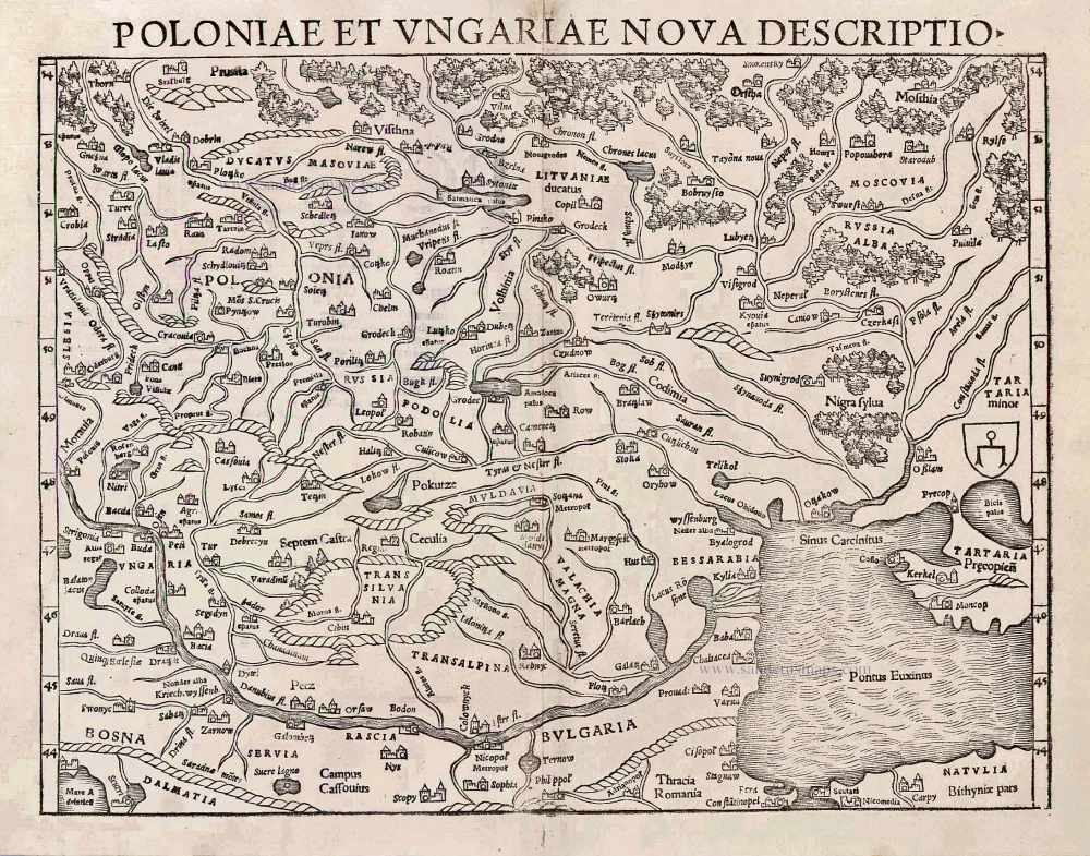
Poloniae et Ungariae Nova Descriptio. 1552
Poland and Hungary, by S. Münster.
[Item number: 25905]
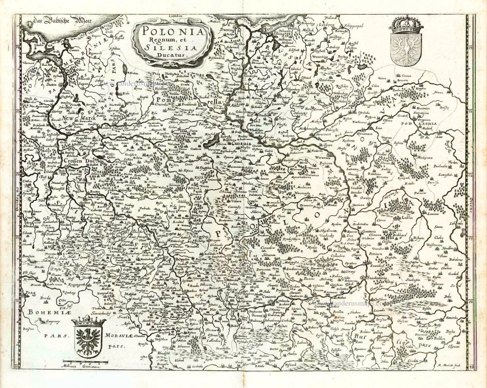
Polonia Regnum et Silesia Ducatus. 1638
Poland, by M. Merian.
[Item number: 25927]
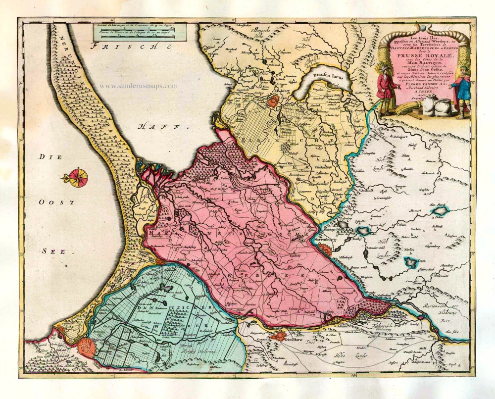
Les trois Iles, appellées en Allemand Werders, ou sont les Territoires de Dantzic, Marienbourg et Elbing dans la Prusse Royale, avec les Côtes de la Mer Baltique, suivant la description de Olaus Jean Gotho, ... 1713
Gdansk, Marlbork and Elblag, by Pieter van der Aa.
[Item number: 26041]
Polonia. 1641
Poland, by Henricus Hondius.
[Item number: 26267]
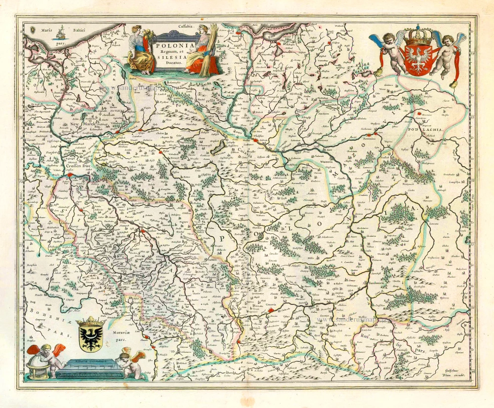
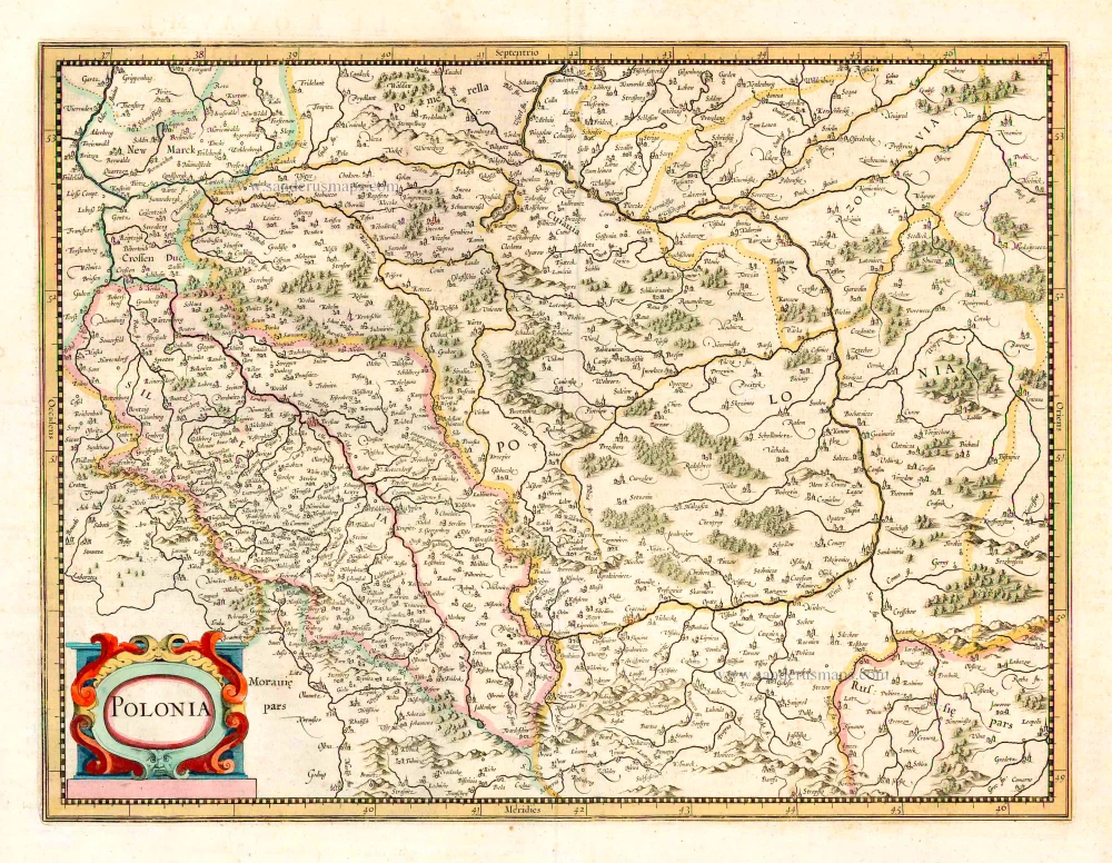
Polonia Regnum et Silesia Ducatus. 1644-45
Poland and Silesia, by W. & J. Blaeu.
[Item number: 26488]
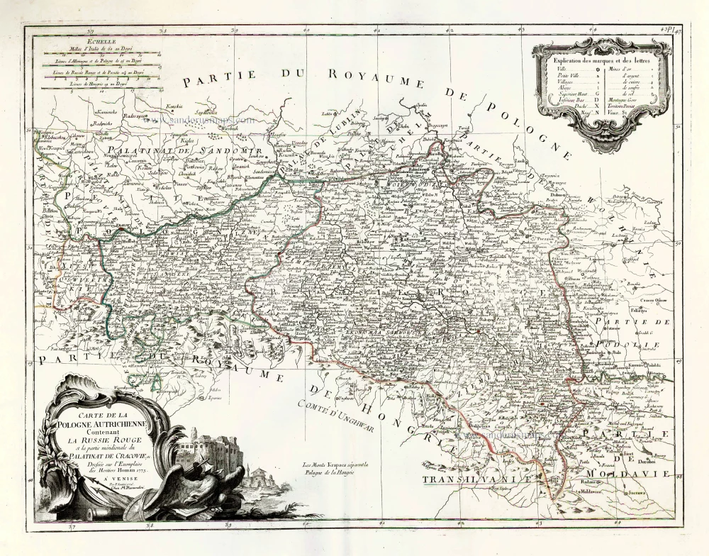
Carte de la Pologne Autrichienne Contenant la Russie Rouge et la Partie Méridionale du Palatinat de Cracovie. 1776-79
Poland, by Francesco Santini.
[Item number: 26966]
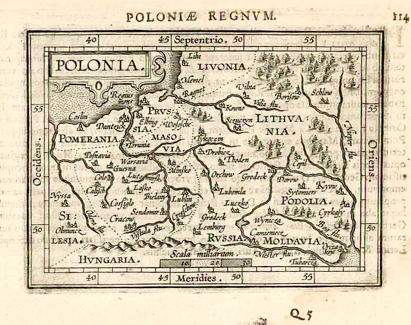
Polonia. 1609
Poland, by Abraham Ortelius.
[Item number: 27696]