
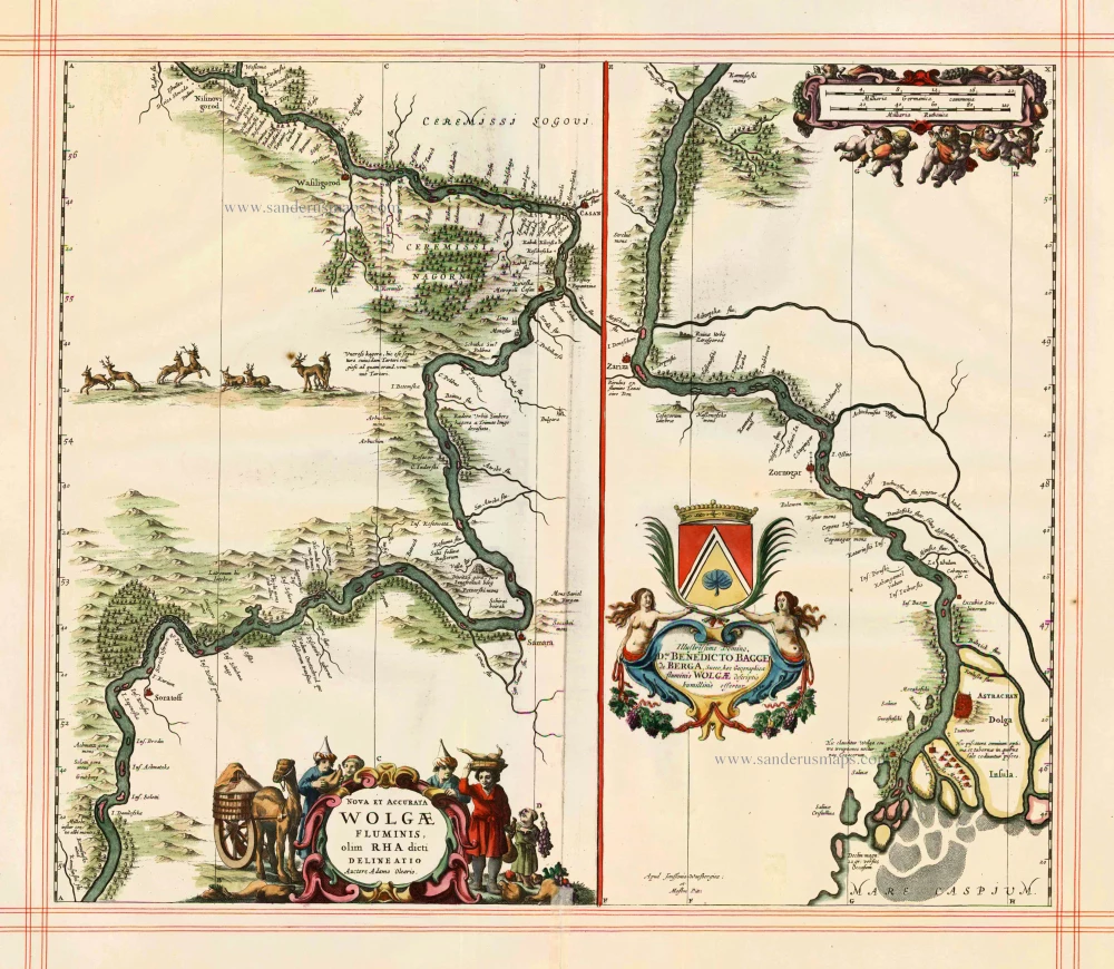
The Volga River in two sections, by J. Janssonius and published by Moses Pitt & J. Janssonius-Waesberge 1680
Moses Pitt (1641-1697)
Moses Pitt, a London based map publisher and bookseller, planned a 12-volume world atlas based on Janssonius’ Atlas Maior. He entered into a partnership with Johann van Waesbergen, one of the heirs of Johannes Janssonius, and Steven Swart. Both publishers had versions with their own imprint. Only four volumes were issued. The undertaking ruined him, and he was imprisoned for two years for debt.
The maps are generally printed from reworked plates of Janssonius. The imprint of Janssonius van Waesbergen and Pitt is added and, to facilitate finding places with the index, the grid of parallels and meridians is added. In all probability, the maps were printed in Amsterdam and shipped to Oxford to be bound with the text.
Nova & Accurata Wolgae Fluminis, olim Rha dicti, delineatio Auctore Adamo Oleario.
Item Number: 25060 Authenticity Guarantee
Category: Antique maps > Europe > Eastern Europe
Old, antique map of the Volga River in two sections, by J. Janssonius and published by Moses Pitt & J. Janssonius-Waesberge
Cartographer: Adam Olearius (c.1603-1671)
Date of the first edition: 1656
Date of this map: 1680
Copper engraving
Size: 47.5 x 55cm
Verso: Blank
Condition: Hand coloured, on large, heavy paper, ruled in red, excellent.
Condition Rating: A
References: Van der Krogt 1, 1825:1.2.
From: The English Atlas. Oxford, Moses Pitt, 1680. (Van der Krogt 1, 451)
Moses Pitt (1641-1697)
Moses Pitt, a London based map publisher and bookseller, planned a 12-volume world atlas based on Janssonius’ Atlas Maior. He entered into a partnership with Johann van Waesbergen, one of the heirs of Johannes Janssonius, and Steven Swart. Both publishers had versions with their own imprint. Only four volumes were issued. The undertaking ruined him, and he was imprisoned for two years for debt.
The maps are generally printed from reworked plates of Janssonius. The imprint of Janssonius van Waesbergen and Pitt is added and, to facilitate finding places with the index, the grid of parallels and meridians is added. In all probability, the maps were printed in Amsterdam and shipped to Oxford to be bound with the text.
Related items
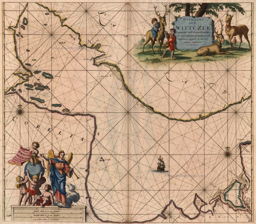
Paskaart van de Witte Zee Beginnende van Pelitza tot Kandalox en van Catsnoes tot aan Kodova. 1697-1709
The White Sea, by Van Keulen Johannes.
[Item number: 5422]
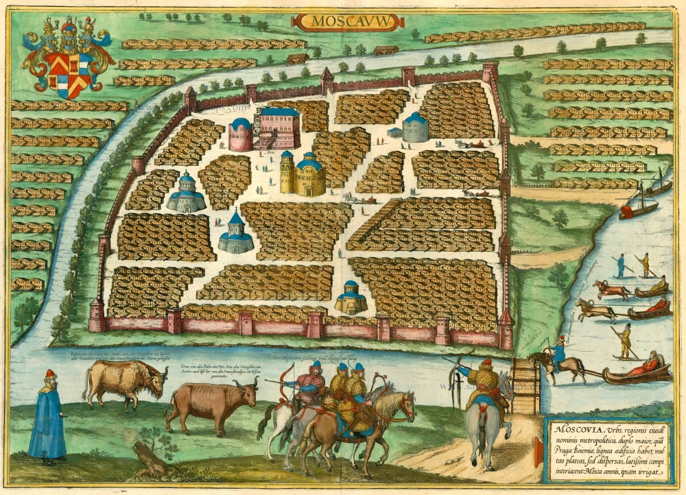
Moscauw - Moscovia, Urbs regionis eiusde nominis metropolitica, duplo maior, ... 1597
Moscow, by Braun and Hogenberg.
[Item number: 24001]

Paskaart van de Rivier de Dwina of Archangel 1697-1709
Sea chart of the Dwina River, by Johannes Van Keulen.
[Item number: 13678]
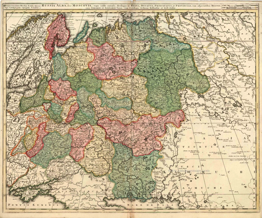
Russia Alba, sive Moscoviae, Regio Valde Extensa, Divisaque in Regna, Ducatus, Principatus, et Provincias, cum Adjacentibus Regnis c. 1702
Russia, by Valk & Schenk.
[Item number: 5099]
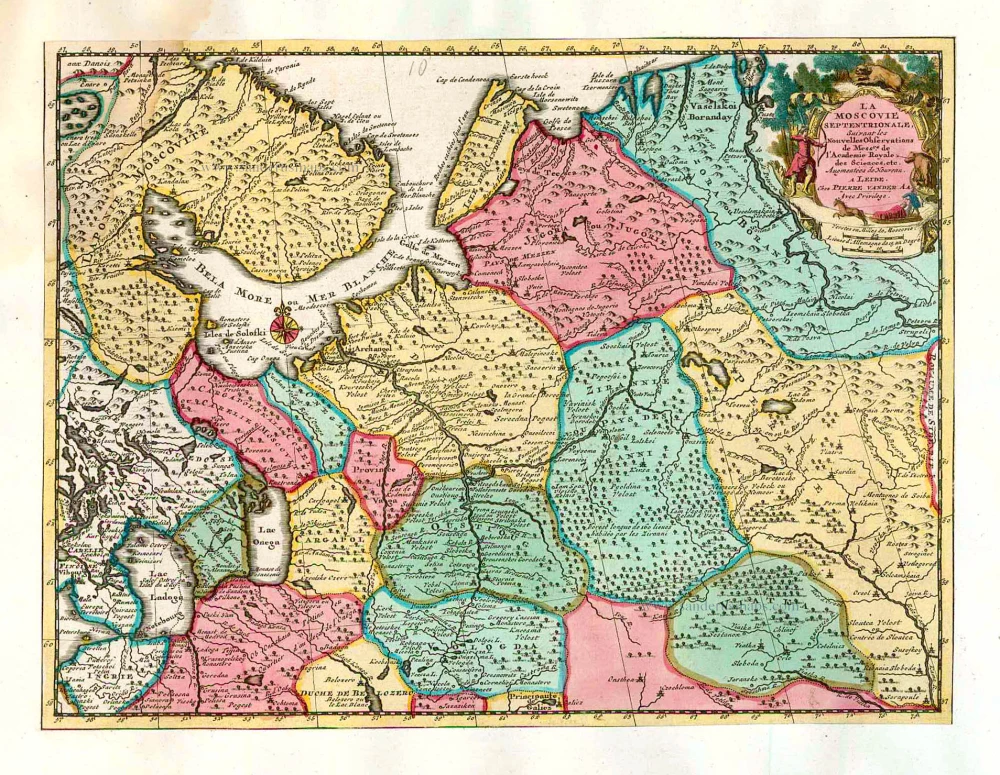
La Moscovie Septentrionale Suivant les Nouvelles Observations ... 1713
Northern Muscovy, by Pieter van der Aa.
[Item number: 26039]

La Moscovie Meridionale Suivant les Nouvelles Observations ... 1713
Southern Muscovy, by Pieter van der Aa.
[Item number: 26040]
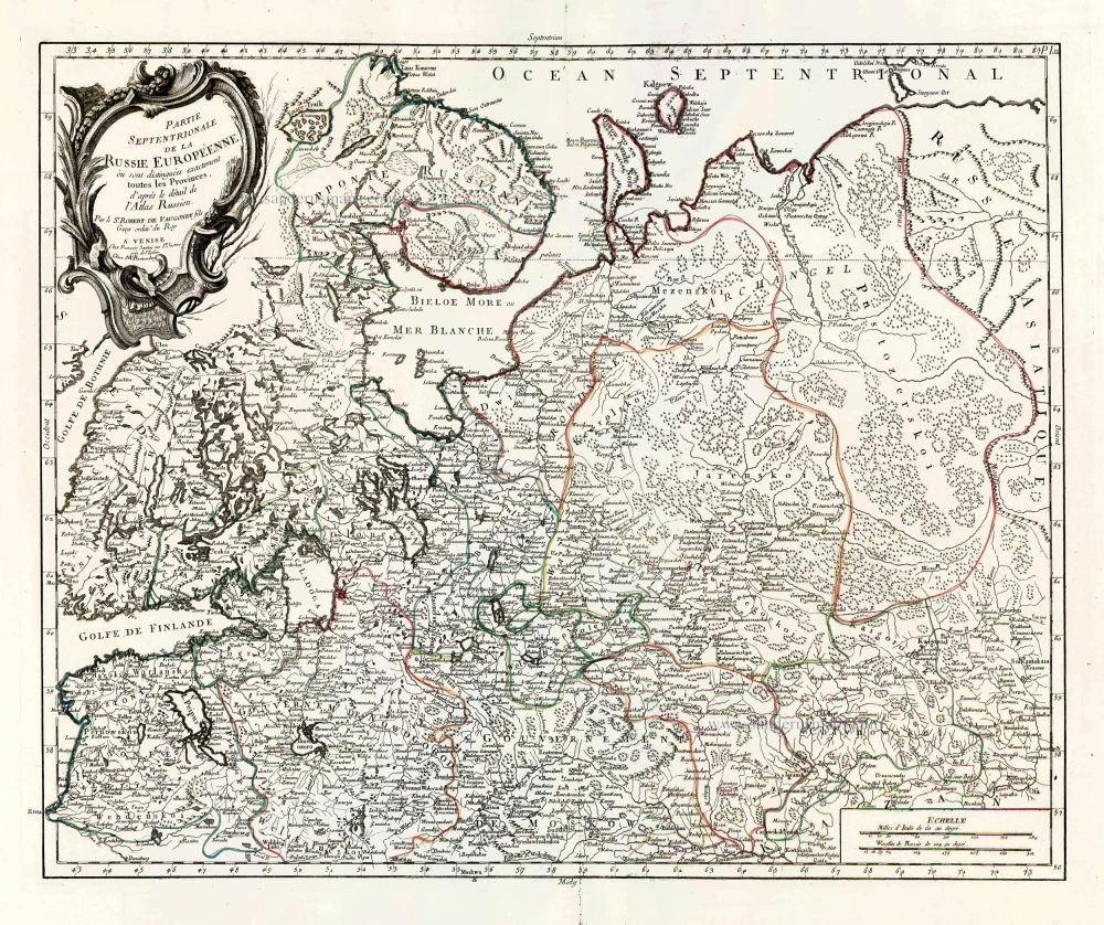
Partie Septentrionale de la Russie Européenne où sont distingées exactement toutes les Provinces, d'après le détail de l'Atlas Russien. 1776-79
Northern European Russia, by Francesco Santini.
[Item number: 26970]
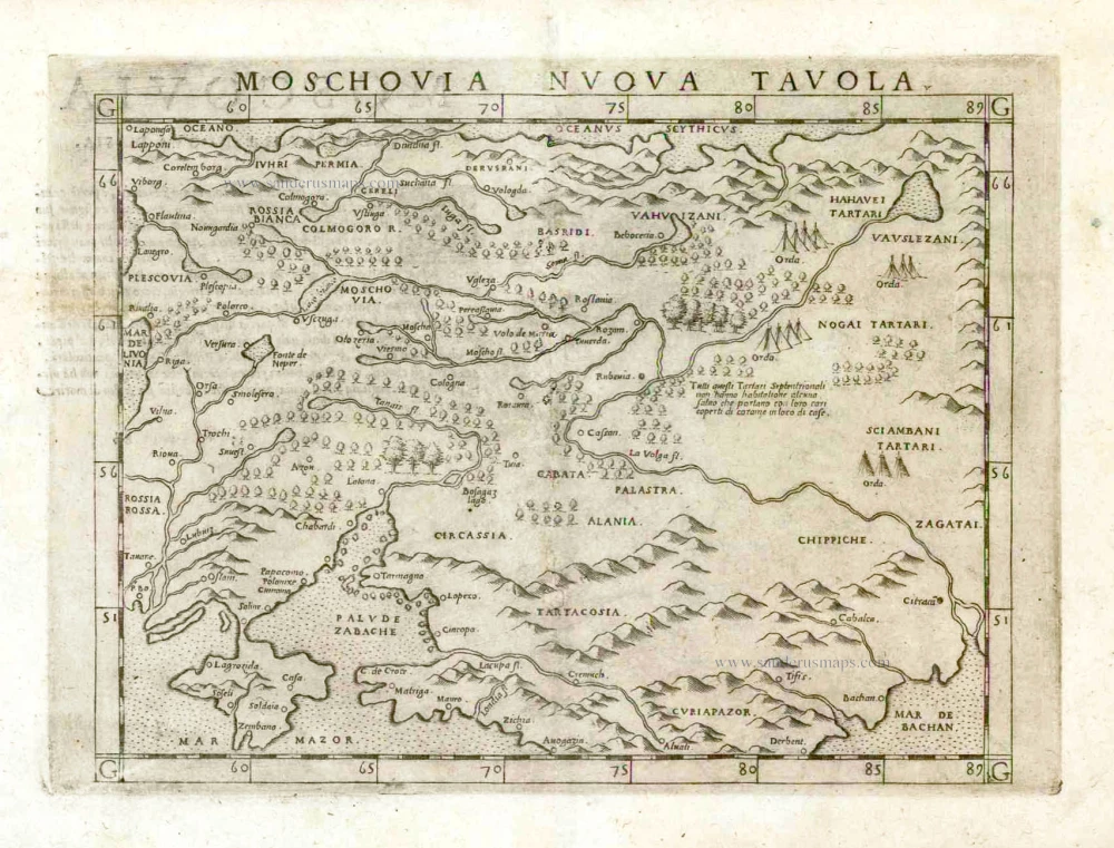
Moschovia Nuova Tavola. 1561
Russia, by Girolamo Ruscelli.
[Item number: 27072]