
Brittany (Bretagne) by H. Jaillot. ca. 1730
Alexis-Hubert JAILLOT (1632-1712)
A.-H. Jaillot first started as a sculptor. In 1664 he married Jeanne Berey, daughter of the publisher and dealer of prints Nicolas I Berey. Jaillot soon rushed into the print business due to his father-in-law's deaths in 1665 and his brother-in-law in 1667. In 1668, A.-H. Jaillot and his wife acquire the Berey fund's geographical part, which consists of globes, maps, city views and atlases. He becomes the tenant of his father-in-law's shop, Aux Deux Globes, which he buys two years later.
Jaillot enters into an agreement with Guillaume Sanson to publish his maps that will form his Atlas Nouveau's embryo. Sanson undertakes to obtain the privilege for his maps for twenty years and to cede it to Jaillot, as is the custom. Jaillot, for its part, takes care of the engraving, printing and sale of the maps. He engages engravers, François Caumartin and Louis Cordier, to engrave his maps.
A conflict arises between Jaillot and Sanson, and in 1674 it comes to a lawsuit. In 1677 they came back to an agreement.
The Atlas Nouveau first appeared in 1681 and brought great prosperity to his publisher. Jaillot owes him his title of the geographer to the king, awarded on July 20, 1686. He continues to issue maps and signs more and more himself. In 1695, he published the Atlas Français, two-thirds of which are his maps and only one third by Sanson.
A.H. Jaillot dies in 1712 and leaves a vast trading fund.
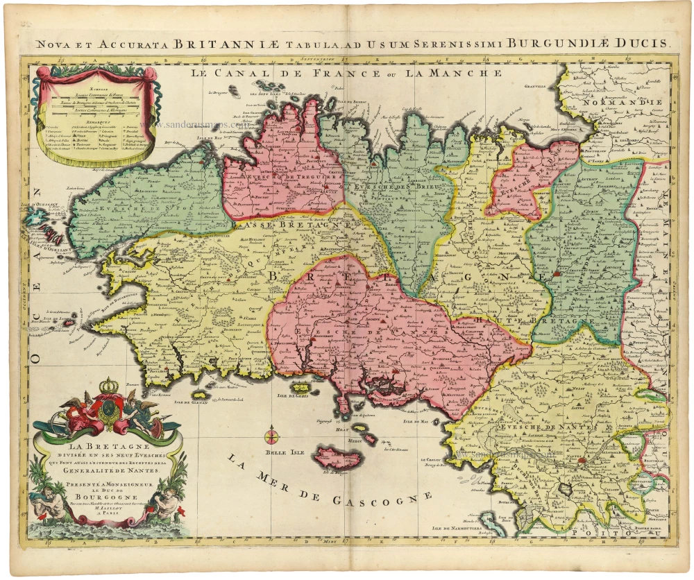
La Bretagne Divisee en ses Neuf Evesches qui font aussi l'Estendue des Receptes de la Generalite de Nantes.
Item Number: 33382 new Authenticity Guarantee
Category: Antique maps > Europe > France
Brittany (Bretagne) by H. Jaillot.
Title: La Bretagne Divisee en ses Neuf Evesches qui font aussi l'Estendue des Receptes de la Generalite de Nantes.
Presenté à Monseigneur le Duc de Bourgogne Par son tres Humble et tres Obeissant Serviteur | H. IAILLOT. A Paris.
Date of the first edition: 1696.
Date of this map: ca. 1730.
Copper engraving, printed on paper.
Image size (excl. upper title): 460 x 615mm (18 x 24¼ inches).
Sheet size: 530 x 635mm (20¾ x 25 inches).
Condition: Original body colour, excellent.
Condition Rating: A+.
From: Atlas Nouveau. Amsterdam, Covens & Mortier, c. 1730.
Alexis-Hubert JAILLOT (1632-1712)
A.-H. Jaillot first started as a sculptor. In 1664 he married Jeanne Berey, daughter of the publisher and dealer of prints Nicolas I Berey. Jaillot soon rushed into the print business due to his father-in-law's deaths in 1665 and his brother-in-law in 1667. In 1668, A.-H. Jaillot and his wife acquire the Berey fund's geographical part, which consists of globes, maps, city views and atlases. He becomes the tenant of his father-in-law's shop, Aux Deux Globes, which he buys two years later.
Jaillot enters into an agreement with Guillaume Sanson to publish his maps that will form his Atlas Nouveau's embryo. Sanson undertakes to obtain the privilege for his maps for twenty years and to cede it to Jaillot, as is the custom. Jaillot, for its part, takes care of the engraving, printing and sale of the maps. He engages engravers, François Caumartin and Louis Cordier, to engrave his maps.
A conflict arises between Jaillot and Sanson, and in 1674 it comes to a lawsuit. In 1677 they came back to an agreement.
The Atlas Nouveau first appeared in 1681 and brought great prosperity to his publisher. Jaillot owes him his title of the geographer to the king, awarded on July 20, 1686. He continues to issue maps and signs more and more himself. In 1695, he published the Atlas Français, two-thirds of which are his maps and only one third by Sanson.
A.H. Jaillot dies in 1712 and leaves a vast trading fund.
Related items

Pas-kaert vande Canael, Tusschen Engelandt en Vrancryck Beginnende van C. de la Hague tot Heyssant, als mede van Poortland tot Lezard. 1697-1709
Bretagne and the Channel, by Van Keulen Johannes.
[Item number: 5406]

Cenomanorum Galliae regionis typus. [on sheet with] Britanniae, et Normandiae Typus, 1594. 1612
Maine and Bretagne / Normandy by Abraham Ortelius
[Item number: 23070]

Carte du Gouvernement de Bretagne. 1713
Bretagne, by P. Van der Aa.
[Item number: 26166]

Carte du Gouvernement de Bretagne. 1776-79
Bretagne by Francesco & Paolo Santini
[Item number: 26956]

Britannia Ducatus. 1640
Bretagne, by Willem Blaeu.
[Item number: 27970]

La Bretagne divisée en ses Neuf Evesches qui font aussi l'esiendue des Receptes Generalite de Nantes. c. 1660
Bretagne par Nicolas Sanson.
[Item number: 28380]

Duche et Gouvernement de Bretagne. 1700-1710
Bretagne by Nicolas Sanson. - 4th state.
[Item number: 28511]

Brest. c. 1780
View of Brest (Bretagne - France), published in Paris by the Jean family.
[Item number: 28902]

Duché, et Gouvernement de Bretagne. 1652
Bretagne par Nicolas Sanson. 1st state.
[Item number: 29668]

Rare
Description du Pays Armorique a pres Bretaigne. 1619-21
Bretagne by Maurice Bouguereau, published by Jean Leclerc.
[Item number: 30899]

Britannia. 1618
Bretagne by Petrus Bertius, published by Jodocus Hondius II.
[Item number: 31595]
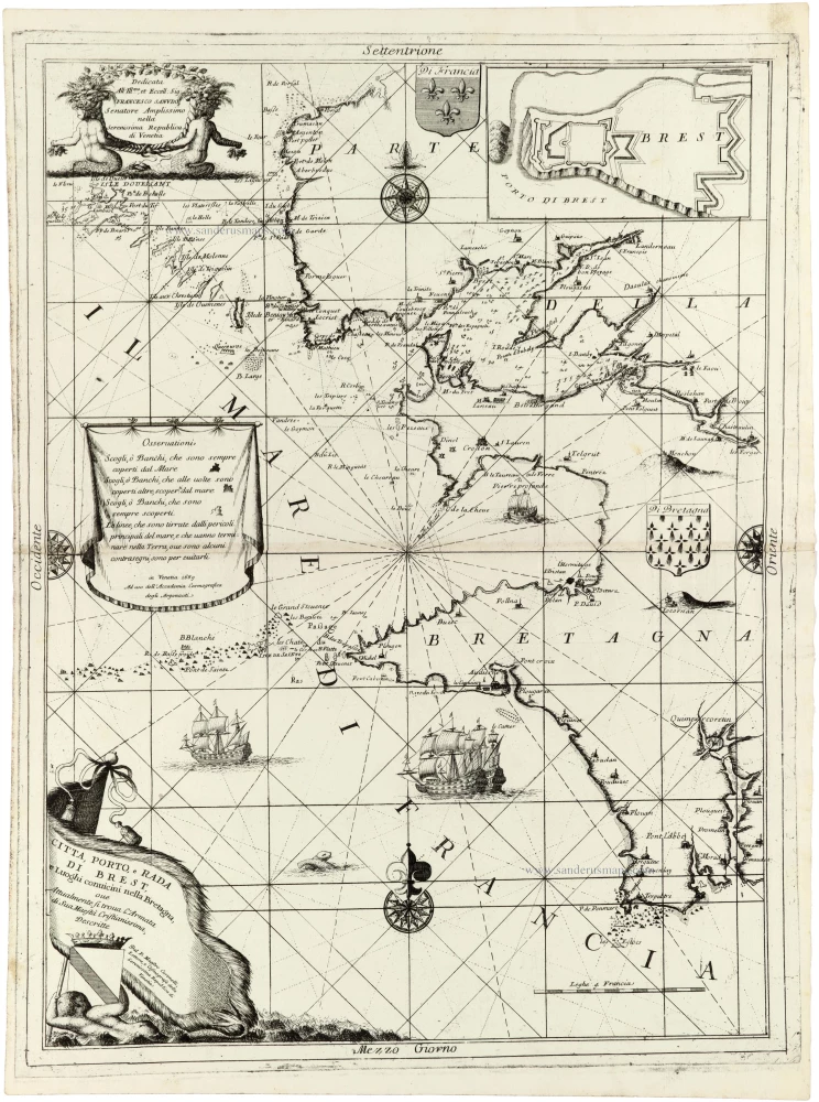
Citta, Porto, e Rada di Brest eLuoghi conuicini nella Bretagna, ove Attualmente si trova l'Armata di Sua Maestà Cristianissima, 1691
Brest and the coast of Brittany (Bretagne) by V.M. Coronelli.
[Item number: 33374]
new