
France and Belgium by Ptolemy C. - Berlinghieri F. 1482
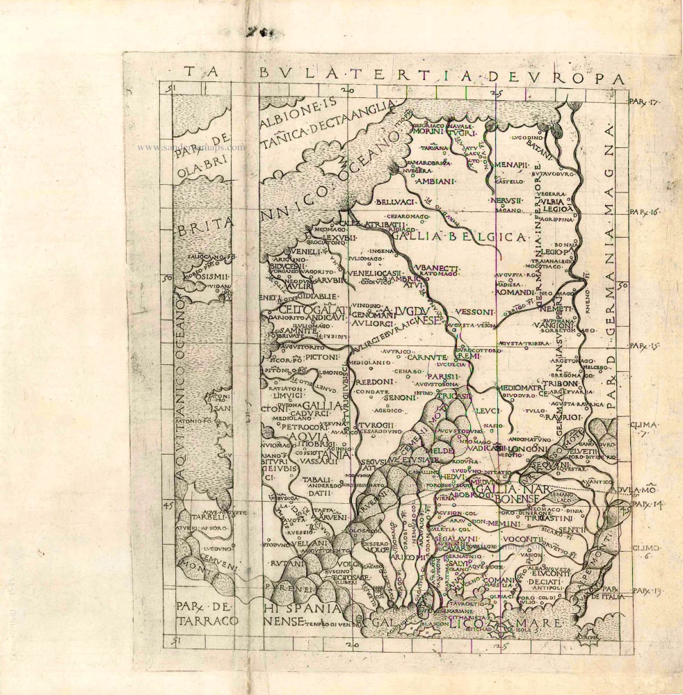
Although not published until mid-1482, the maps in Berlinghieri's Geographia, were perhaps printed as early as 1479. Remainder sheets were bound up and reissued at the beginning of the 16th century.
Tabula Tertia Deuropa.
Item Number: 25587 Authenticity Guarantee
Category: Antique maps > Europe > France
Old, antique map of France & Belgium by Ptolemy C. - Berlinghieri F.
Date: 1482
Copper engraving
Plate size (not including margins): 36.5 x 33cm (14.2 x 12.9 inches)
Verso: Blank
Condition: Excellent.
Condition Rating: A+
References: Campbell (Earliest Printed Maps), 152.
From: [Geographia.] In questo Volume si contengono septe Giornate della Geographia di Francesco Berlingeri Fiorentino allo Illustrissimo Federigo Duca dUrbino. Florence, 1482. (Shirley (Brit.Lib.), T.Ptol-3)
Although not published until mid-1482, the maps in Berlinghieri's Geographia, were perhaps printed as early as 1479. Remainder sheets were bound up and reissued at the beginning of the 16th century.
Related items
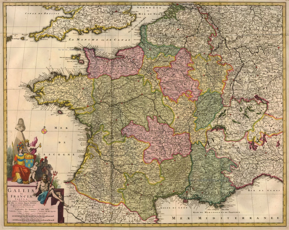
Galliae seu Franciae Tabula, ... 1683-1696
France, by Visscher N. II.
[Item number: 15637]
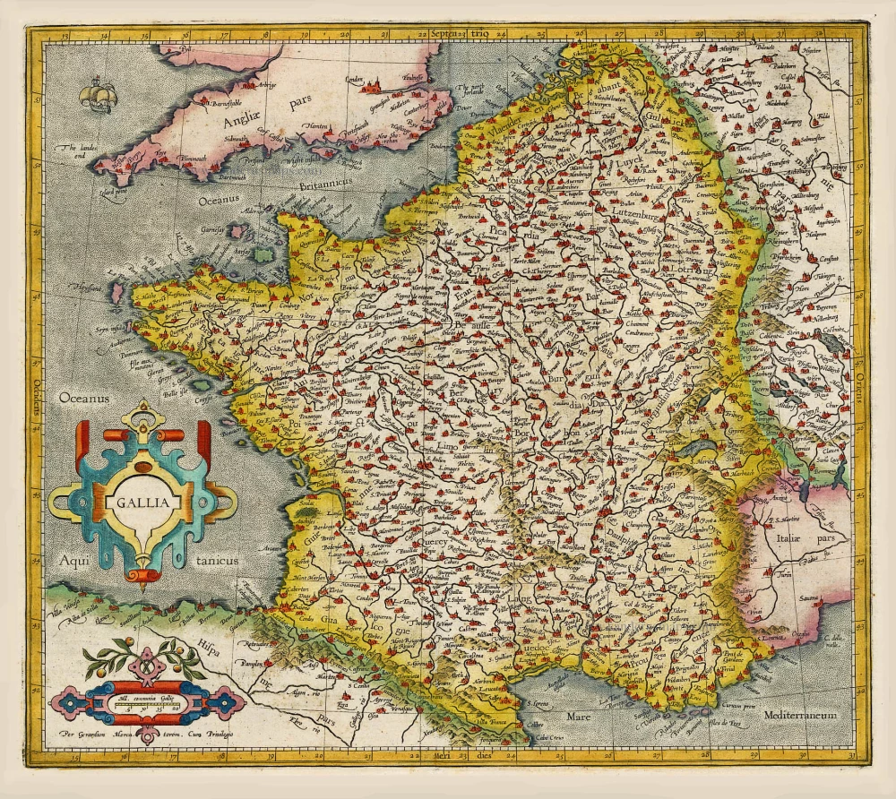
Gallia / Per Gerardum Mercatorem. 1609
France, by Gerard Mercator.
[Item number: 19119]
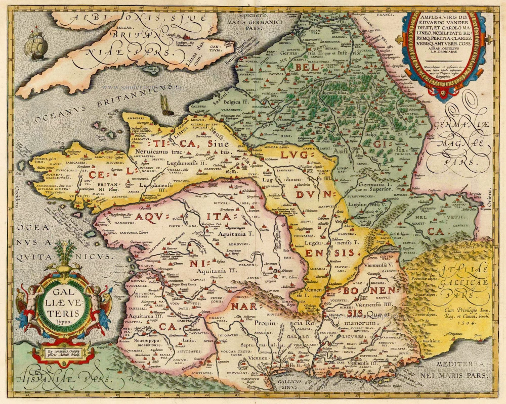
Galliae Veteris. 1601
France, by Ortelius A.
[Item number: 21253]
Le Royaume de France Distingué suivant l'estendue de Toutes ses Provinces, et ses Acquisitions, dans l'Espagne, dans l'Italie, dans l'Allemagne, et dans la Flandre, l'Artois, le Haynaut, le Namur, et le Luxembourg, Provinces des Pays-Bas c. 1705
France, by Pieter Mortier.
[Item number: 27773]