
Brescia, by Paolo Santini. 1776-79
Francesco and Paolo Santini (c.1729-1793)
Francesco Santini, a Venetian publisher, acquired the printing plates of Vaugondy’s Atlas Universel …, a commercial and cartographic success, with widespread influence on mapmakers throughout Europe. Together with his brother Paolo, he commissioned a new set of plates and reissued the atlas in 1776. The following year, Paolo Santini assigned all his publication rights to M. Remondini, who in 1777 reissued the same atlas but with his name.
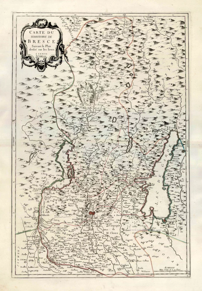
Carte du Territoire de Bresce.
Item Number: 27714 Authenticity Guarantee
Category: Antique maps > Europe > Italy
Old, antique map of Brescia, by Paolo Santini. Mappa antica di Brescia, di Paolo Santini. Date of the first edition: 1777 Date of this map: 1777 Date on map: 1777 Copper engraving, printed on paper. Size (not including margins): 65.5 x 45.5cm (25.5 x 17.7 inches)
Verso: Blank Condition: Original coloured in outline, excellent. Condition Rating: A+ From: Atlas Universel dressé sur les meilleures cartes modernes. Venice, Remondini, 1776-79.
Francesco and Paolo Santini (c.1729-1793)
Francesco Santini, a Venetian publisher, acquired the printing plates of Vaugondy’s Atlas Universel …, a commercial and cartographic success, with widespread influence on mapmakers throughout Europe. Together with his brother Paolo, he commissioned a new set of plates and reissued the atlas in 1776. The following year, Paolo Santini assigned all his publication rights to M. Remondini, who in 1777 reissued the same atlas but with his name.
Related items
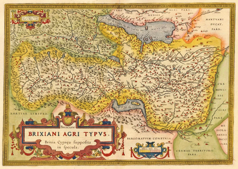
Bresciano Brixiani Agri Typus. Brixia, Cygnea supposita in specula. 1612
Brescia by Ortelius Abraham
[Item number: 20474]
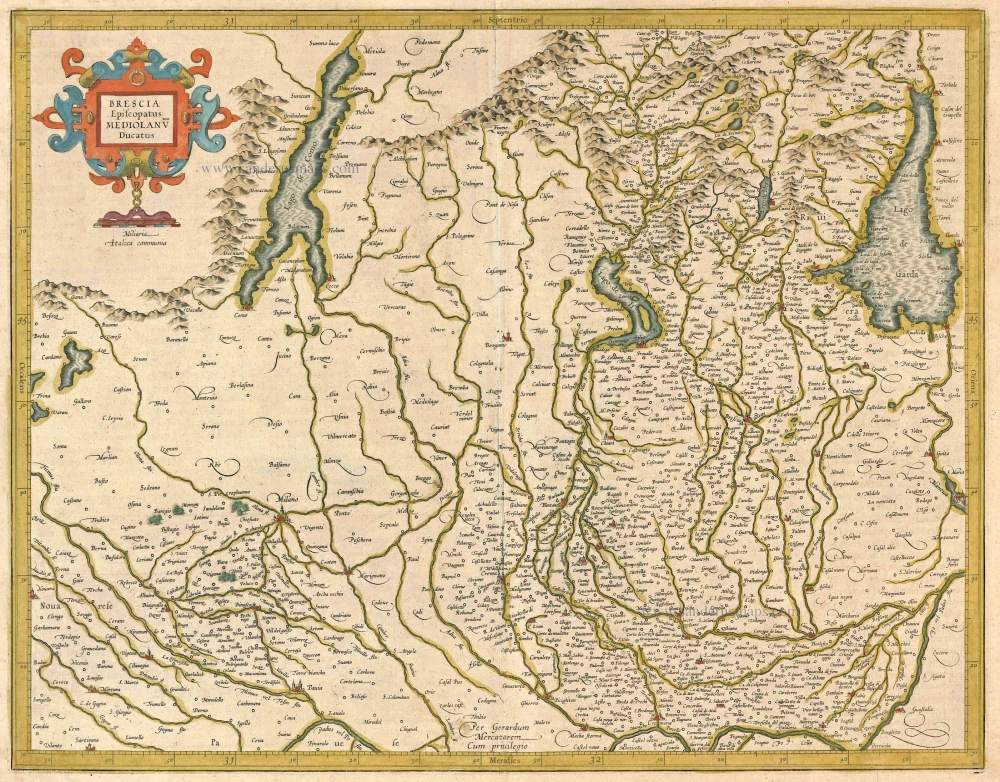
Brescia Episcopanus Mediolanu Ducatus. 1613
Brescia - Milano, by Gerard Mercator.
[Item number: 24513]

Territorio di Brescia et di Crema. 1640
Brescia and Crema, by Willem & Joan Blaeu.
[Item number: 27219]