
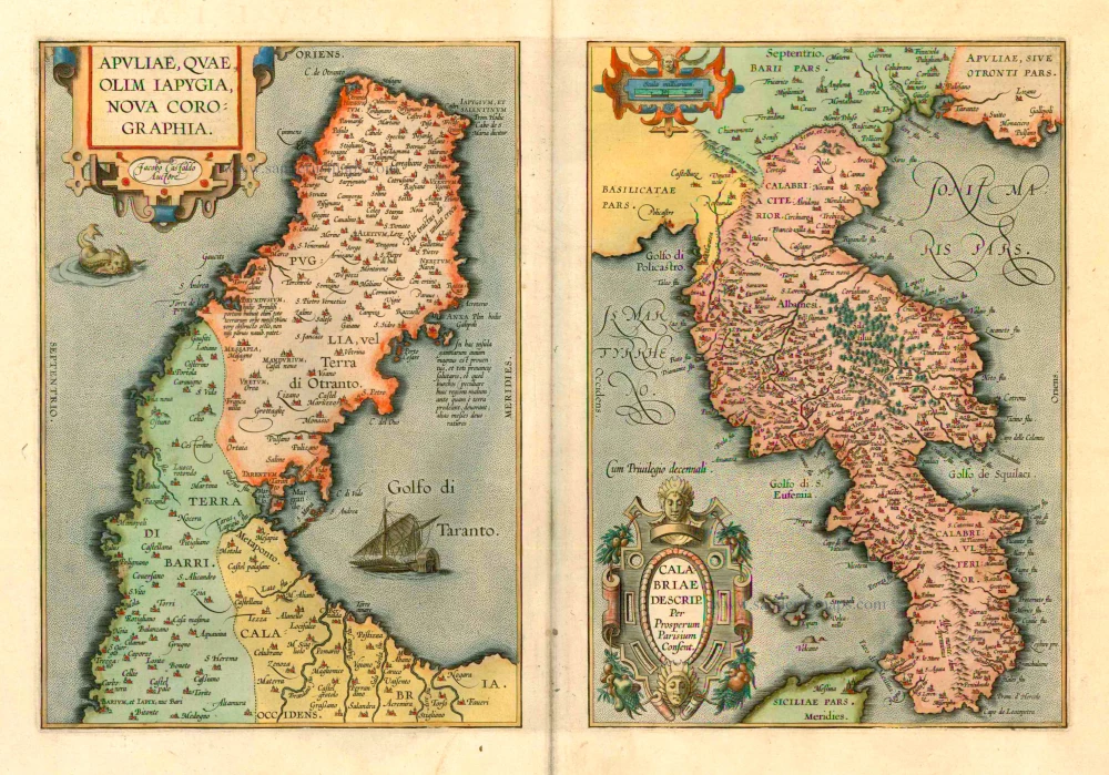
Puglia - Calabria by Ortelius A. 1601
The item displayed on this page has been sold. However, we have a similar map in stock:
Puglia and Calabria by Abraham Ortelius. 1595
Apuliae, quae olim Iapygia, Nova Corographia. ...
[Item number: 29976]
![Apuliae, quae olim Iapygia, Nova Corographia. Jacobo Castaldo Auctore. [On sheet with:] Calabriae Descrip.](https://sanderusmaps.com/assets/RESIZED/thumb_m29976.jpg)


Abraham Ortelius (1527-1598)
The maker of the 'first atlas', the Theatrum Orbis Terrarum (1570), was born on 4 April 1527 into an old Antwerp family. He learned Latin and studied Greek and mathematics.
Abraham and his sisters Anne and Elizabeth took up map colouring. He was admitted to the Guild of St. Luke as an "illuminator of maps." Besides colouring maps, Ortelius was a dealer in antiques, coins, maps, and books, with the book and map trade gradually becoming his primary occupation.
Business went well because his means permitted him to start an extensive collection of medals, coins, antiques, and a library of many volumes. In addition, he travelled a lot and visited Italy and France, made contacts everywhere with scholars and editors, and maintained extensive correspondence with them.
In 1564 he published his first map, a large and ambitious world wall map. The inspiration for this map may well have been Gastaldi's large world map. In 1565 he published a map of Egypt and a map of the Holy Land, a large map of Asia followed.
In 1568 the production of individual maps for his atlas Theatrum Orbis Terrarum was already in full swing. He completed the atlas in 1569, and in May of 1570, the Theatrum was available for sale. It was one of the most expensive books ever published.
This first edition contained seventy maps on fifty-three sheets. Franciscus Hogenberg engraved the maps.
Later editions included Additamenta (additions), resulting in Ortelius' historical atlas, the Parergon, mostly bound together with the atlas. The Parergon can be called a truly original work of Ortelius, who drew the maps based on his research.
The importance of the Theatrum Orbis Terrarum for geographical knowledge in the last quarter of the sixteenth century is difficult to overemphasize. Nothing was like it until Mercator's atlas appeared twenty-five years later. Demand for the Theatrum was remarkable. Some 24 editions appeared during Ortelius's lifetime and another ten after his death in 1598. Editions were published in Dutch, German, French, Spanish, English, and Italian. The number of map sheets grew from 53 in 1570 to 167 in 1612 in the last edition.
In 1577, engraver Philip Galle and poet-translator Pieter Heyns published the first pocket-sized edition of the Theatrum, the Epitome. The work was trendy. Over thirty editions of this Epitome were published in different languages.
Giacomo Gastaldi (c. 1500 – 1566)
Giacomo Gastaldi was born in Villafranca, in Piedmont, to a wealthy family. Although he is considered one of the greatest cartographers of the sixteenth century, the events of his life and his professional training in the field of cartography are unknown to us until he arrives in Venice, where, in 1539, he obtained a perpetual printing privilege from the Venetian Senate.
One of the first Venetian contacts took place with the geographer and humanist Giovanni Battista Ramusio, with whom he collaborated. At the beginning of the 1540s, Gastaldi was already an established cartographer and began to work on a series of maps first published separately and then included in the Italian edition of Ptolemy's Geography of 1548 and others made from scratch.
By the 1540s, he had developed his distinctive style of copper engraving for his increasingly prolific output of maps. His maps were used as a source by many mapmakers, including Camocio, Bertelli, Forlani, Ramusio, Cock, Luchini and Ortelius.
With the support of his influential friendships, Gastaldi also obtained public positions: in 1549, the Council of Ten commissioned him to make a large map of Africa, for a wall from the armoury in the Doge's Palace and, again for the same room, one map of Asia and one of North America.
It is difficult to quantify the number of maps he produced; more than a hundred have been attributed to him.
Paolo Forlani collaborated for a long time with Gastaldi and published numerous counterfeits and not authorized editions.
Gastaldi died in Venice on 14 October 1566.
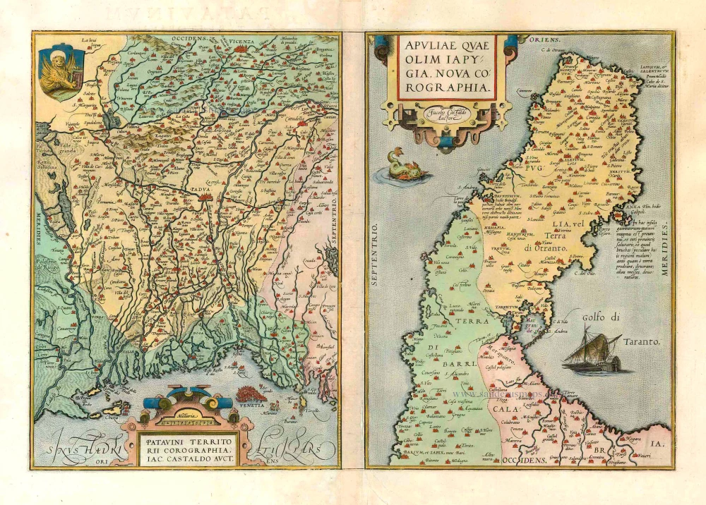
Apuliae, quae olim Iapygia, Nova Corographia. Jacobo Castaldo Auctore. [On sheet with:] Calabriae Descrip. Per Prosperum Parisium Consent.
Item Number: 8073 Authenticity Guarantee
Category: Antique maps > Europe > Italy
Old, antique map of Puglia and Calabria, by Abraham Ortelius.
Title: Apuliae, quae olim Iapygia, Nova Corographia. Jacobo Castaldo Auctore. [On sheet with:] Calabriae Descrip. Per Prosperum Parisium Consent.
Cartographer: Giacomo Gastald and Prosperus Parisius.
Date of the first edition: 1595.
Date of this map: 1601.
Copper engraving, printed on paper.
Size (not including margins): 313 x 465mm (12.32 x 18.31 inches).
Verso: Latin text.
Condition: Contemporary old coloured, excellent.
Condition Rating: .
References: Van der Krogt 3, 7450+7490:31; Van den Broecke, 140ab; Karrow, 1/93a+196
From: Theatrum Orbis Terrarum Abrahami Ortelii Antverp. Geographi Regii. Antwerpen, Plantin Press, 1601. (Van der Krogt 3, 1:052)
Abraham Ortelius (1527-1598)
The maker of the 'first atlas', the Theatrum Orbis Terrarum (1570), was born on 4 April 1527 into an old Antwerp family. He learned Latin and studied Greek and mathematics.
Abraham and his sisters Anne and Elizabeth took up map colouring. He was admitted to the Guild of St. Luke as an "illuminator of maps." Besides colouring maps, Ortelius was a dealer in antiques, coins, maps, and books, with the book and map trade gradually becoming his primary occupation.
Business went well because his means permitted him to start an extensive collection of medals, coins, antiques, and a library of many volumes. In addition, he travelled a lot and visited Italy and France, made contacts everywhere with scholars and editors, and maintained extensive correspondence with them.
In 1564 he published his first map, a large and ambitious world wall map. The inspiration for this map may well have been Gastaldi's large world map. In 1565 he published a map of Egypt and a map of the Holy Land, a large map of Asia followed.
In 1568 the production of individual maps for his atlas Theatrum Orbis Terrarum was already in full swing. He completed the atlas in 1569, and in May of 1570, the Theatrum was available for sale. It was one of the most expensive books ever published.
This first edition contained seventy maps on fifty-three sheets. Franciscus Hogenberg engraved the maps.
Later editions included Additamenta (additions), resulting in Ortelius' historical atlas, the Parergon, mostly bound together with the atlas. The Parergon can be called a truly original work of Ortelius, who drew the maps based on his research.
The importance of the Theatrum Orbis Terrarum for geographical knowledge in the last quarter of the sixteenth century is difficult to overemphasize. Nothing was like it until Mercator's atlas appeared twenty-five years later. Demand for the Theatrum was remarkable. Some 24 editions appeared during Ortelius's lifetime and another ten after his death in 1598. Editions were published in Dutch, German, French, Spanish, English, and Italian. The number of map sheets grew from 53 in 1570 to 167 in 1612 in the last edition.
In 1577, engraver Philip Galle and poet-translator Pieter Heyns published the first pocket-sized edition of the Theatrum, the Epitome. The work was trendy. Over thirty editions of this Epitome were published in different languages.
Giacomo Gastaldi (c. 1500 – 1566)
Giacomo Gastaldi was born in Villafranca, in Piedmont, to a wealthy family. Although he is considered one of the greatest cartographers of the sixteenth century, the events of his life and his professional training in the field of cartography are unknown to us until he arrives in Venice, where, in 1539, he obtained a perpetual printing privilege from the Venetian Senate.
One of the first Venetian contacts took place with the geographer and humanist Giovanni Battista Ramusio, with whom he collaborated. At the beginning of the 1540s, Gastaldi was already an established cartographer and began to work on a series of maps first published separately and then included in the Italian edition of Ptolemy's Geography of 1548 and others made from scratch.
By the 1540s, he had developed his distinctive style of copper engraving for his increasingly prolific output of maps. His maps were used as a source by many mapmakers, including Camocio, Bertelli, Forlani, Ramusio, Cock, Luchini and Ortelius.
With the support of his influential friendships, Gastaldi also obtained public positions: in 1549, the Council of Ten commissioned him to make a large map of Africa, for a wall from the armoury in the Doge's Palace and, again for the same room, one map of Asia and one of North America.
It is difficult to quantify the number of maps he produced; more than a hundred have been attributed to him.
Paolo Forlani collaborated for a long time with Gastaldi and published numerous counterfeits and not authorized editions.
Gastaldi died in Venice on 14 October 1566.
Related items
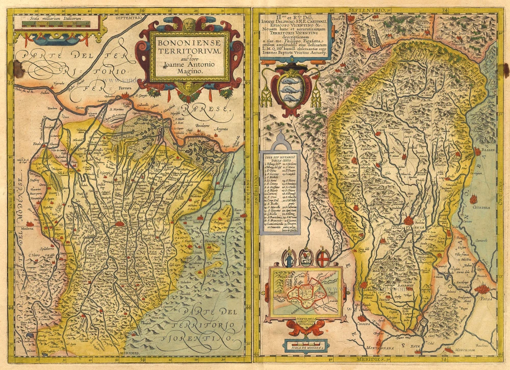
Bononiense Territorium [on sheet with] Territori Vicentini. 1612
Bologna and Vicenza by Ortelius A.
[Item number: 1034]
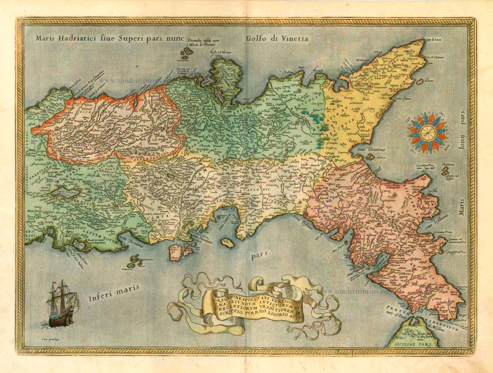
Regni Neapolitani Verissima Secundum Antiquorum et Recentiorum Traditionem Descriptio, Pyrrho Ligorio Auct. 1601
Napoli, by A. Ortelius.
[Item number: 8072]
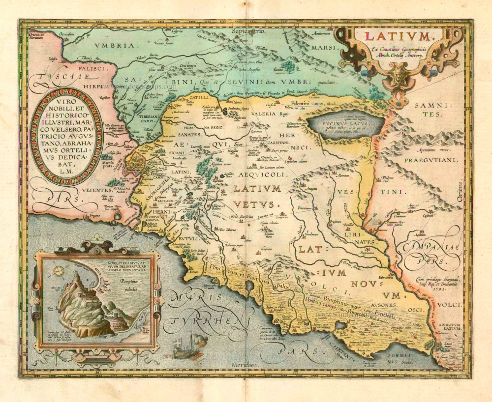
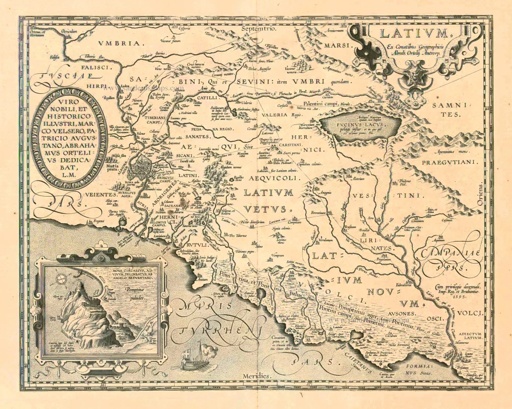
Latium. 1601
Lazio by Abraham Ortelius
[Item number: 12421]
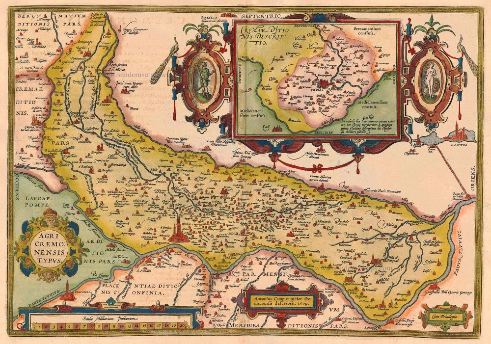
Agri Cremonensis Typus. 1612
Cremona, by Ortelius A.
[Item number: 20470]
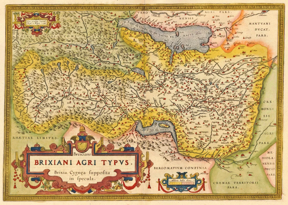
Bresciano Brixiani Agri Typus. Brixia, Cygnea supposita in specula. 1612
Brescia by Ortelius Abraham
[Item number: 20474]
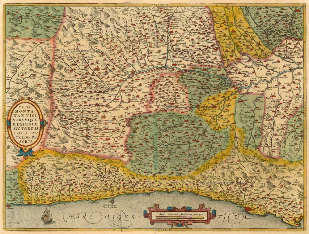
Pedemontanae Vicinorumquae Regionum. 1601
Piemonte, by Abraham Ortelius.
[Item number: 21259]
Latium. 1601
Lazio, by A. Ortelius.
[Item number: 22666]
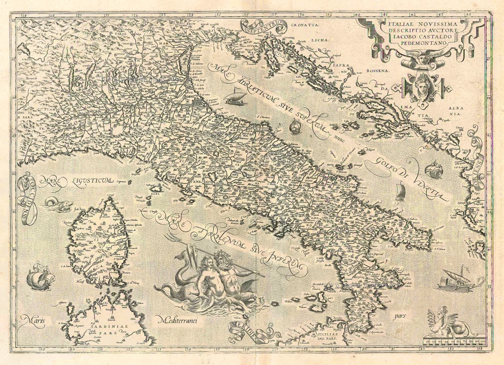
Italiae Novissima Descriptio Auctore Iacobo Castaldo Pedemontano 1612
Italy, by Abraham Ortelius.
[Item number: 22962]
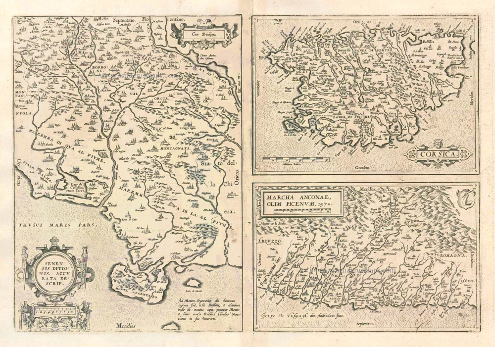
Senensis Ditionis - Corsica - Marcha Anconae olim Picenum. 1572. 1612
Siena - Corsica - Ancona, by Ortelius A.
[Item number: 22975]
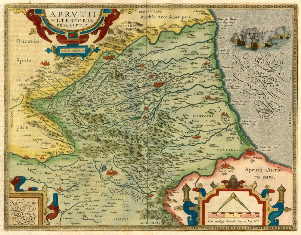
Aprutii Ulterioris Descriptio 1612
Abruzzi, by A. Ortelius.
[Item number: 23016]
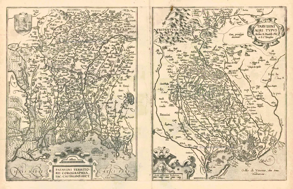
Patavini Territorii Corographia [on sheet with:] Tarvisini Agri Typus. 1612
Padova and Tarviso, by A. Ortelius.
[Item number: 23017]
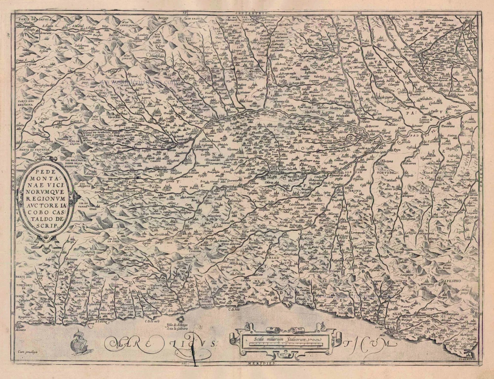
Pedemontanae Vicinorumquae Regionum 1612
Piemonte, by Abraham Ortelius.
[Item number: 23019]
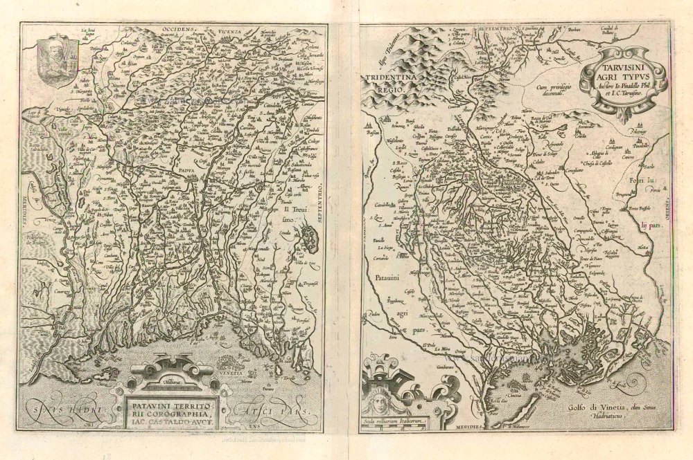
Patavini Territorii Corographia [on sheet with:] Tarvisini Agri Typus. 1612
Padova and Tarviso, by Abraham Ortelius.
[Item number: 23123]
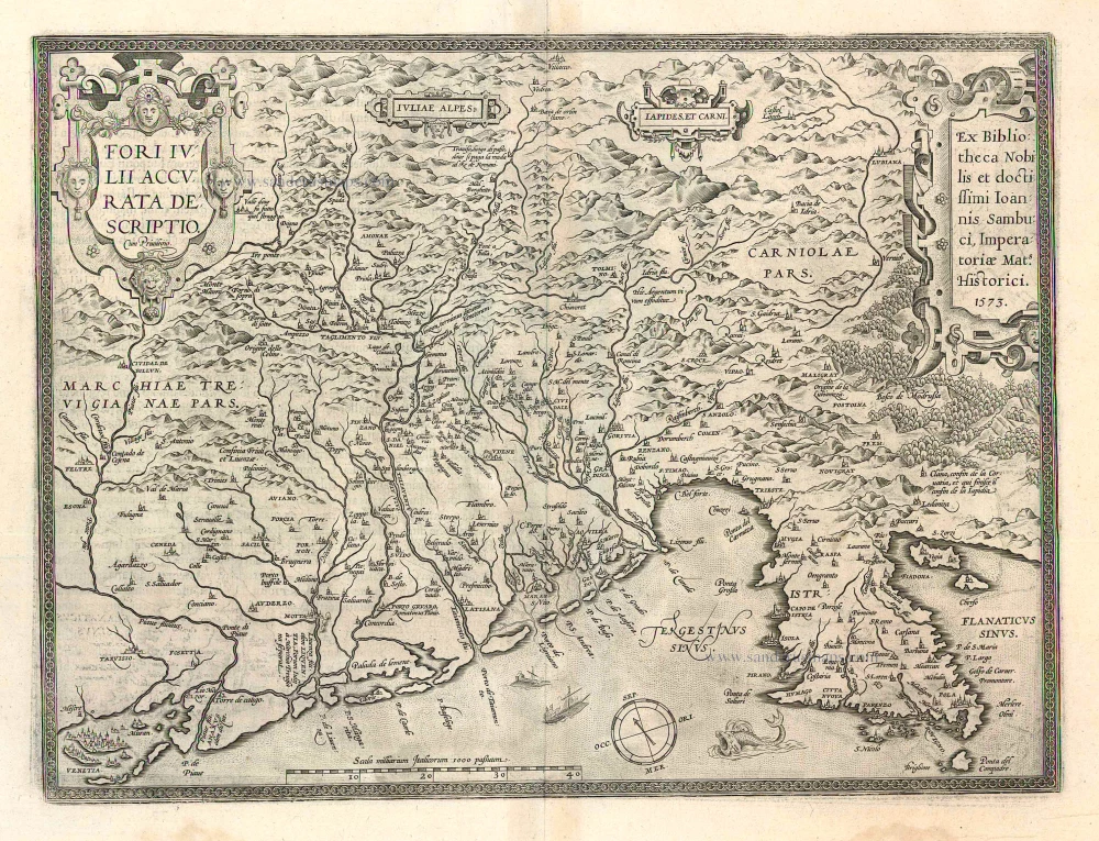
Fori Iulii Accurata Descriptio 1612
Friuli, by A. Ortelius.
[Item number: 23125]
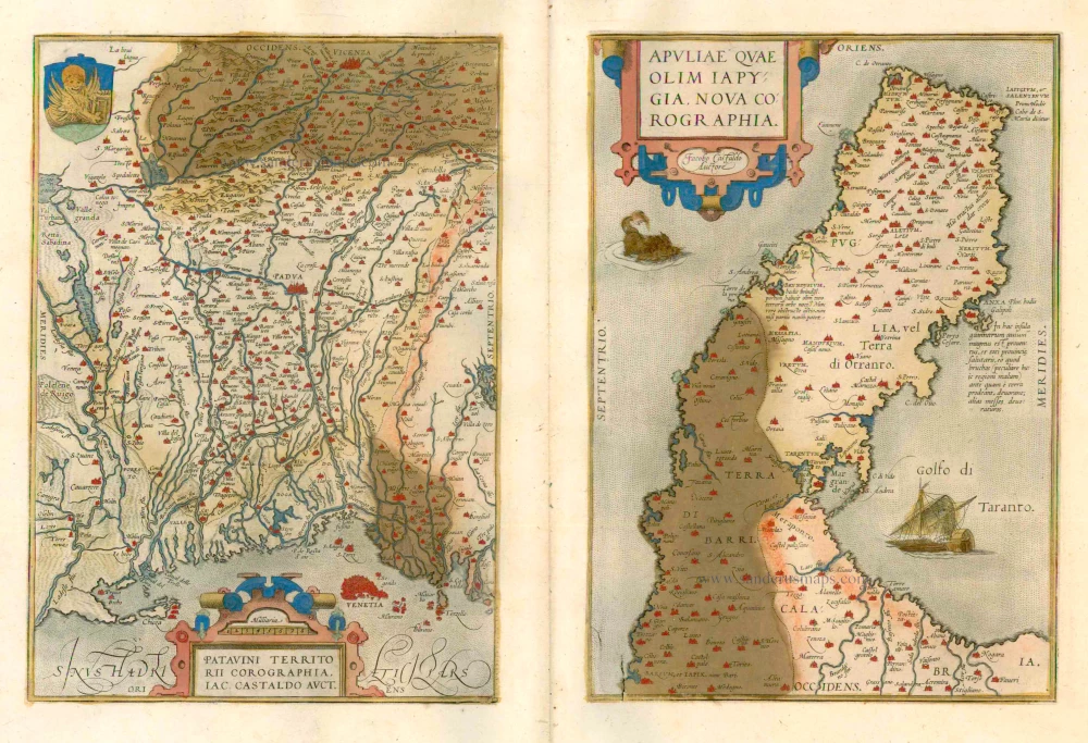
Patavini Territorii Corographia - Apuliae quae olim Iapygia, Nova Corographia 1579
Padova and Apulia by Abraham Ortelius..
[Item number: 23490]
Patavini Territorii Corographia [on sheet with:] Apuliae quae olim Iapygia, Nova Corographia. 1573
Padova & Puglia, by Abraham Ortelius.
[Item number: 25875]
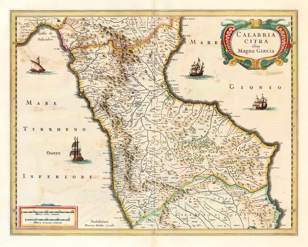
Calabria Citra olim Magna Graecia. 1641
Calabria, by Henricus Hondius.
[Item number: 26414]
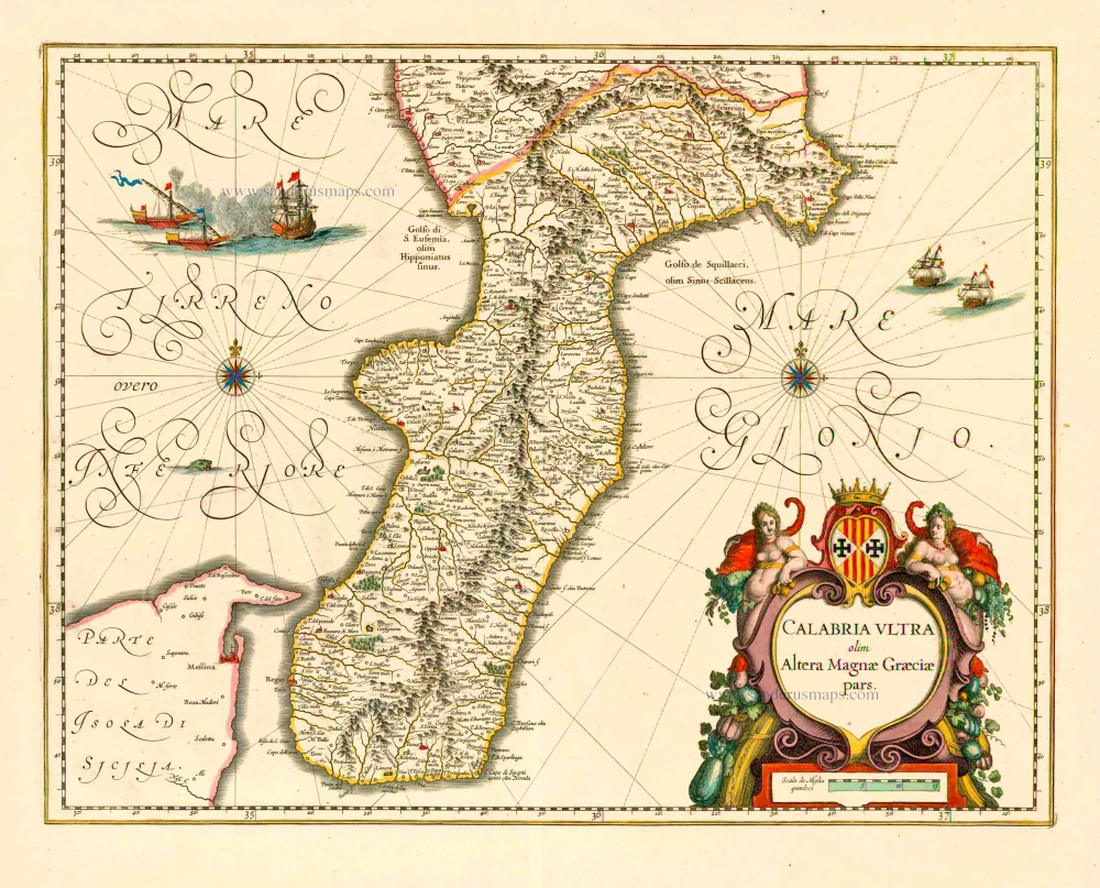
Calabria Ultra olim Altera Magnae Graeciae pars. 1640
Calabria Ultra, by Joan Blaeu.
[Item number: 27258]