
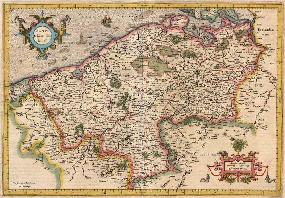
Antique map of Flanders (Vlaanderen) by G. Mercator 1613-16
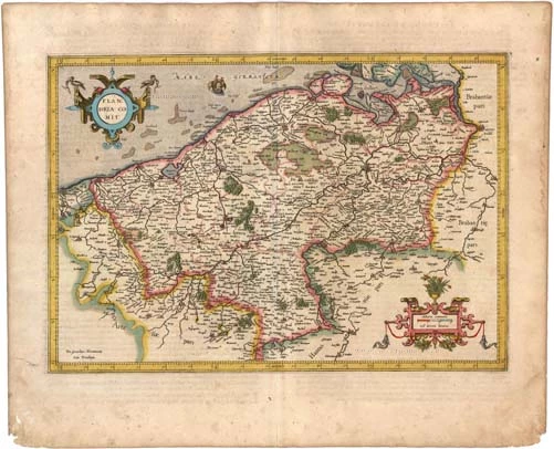


back
References: Van der Krogt 1 - 3200:1A
Flandria Comit:
SOLD
Item Number: 12514 Authenticity Guarantee
Category: Antique maps > Europe > Belgium
Antique map of Flanders (Vlaanderen) by G. Mercator, oriented to the North
Date of the first edition: 1585
Date of this map: 1613-16
Copper engraving
Size: 32.5 x 47cm (12.7 x 18.3 inches)
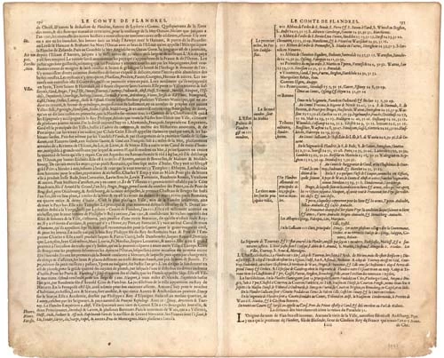
Verso text: French
Condition: Old coloured.
Condition Rating: A
References: Van der Krogt 1, 3200:1A.
From: Gerardi Mercatoris - L'Atlas ou Méditations Cosmographiques de la Fabrique du Monde et Figure diceluy. Amsterdam, J. Hondius, 1613-16. (Van der Krogt 1, 112)