
Antique military manuscript map of the western vicinity of Namur 1746
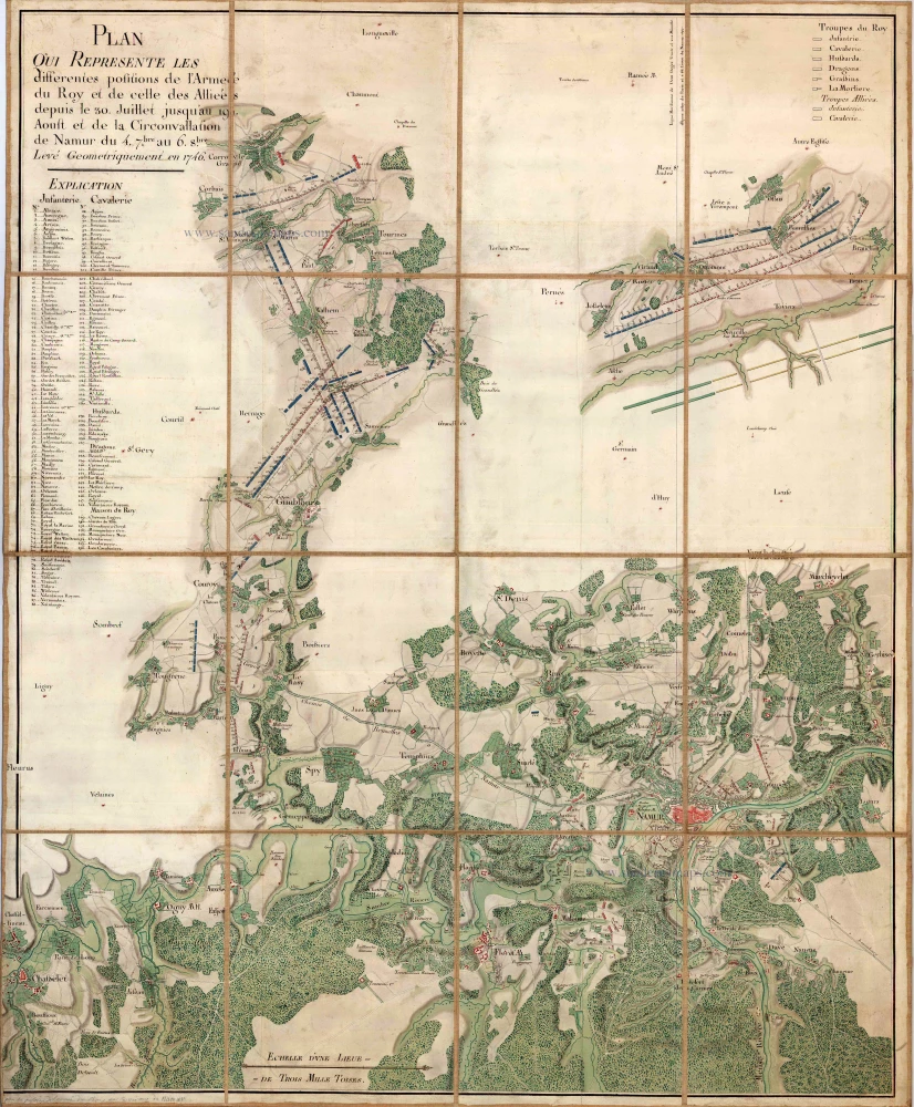
Plan qui représente les différentes positions de l'Armée du Roy et de celles des Alliées depuis le 30. Juillet jusqu'au 19 Aoust et de la Circonvallation de Namur du 4.7.bre au 6.8.bre. Levé Geométriquement en 1746.
Item Number: 24864 Authenticity Guarantee
Category: Antique maps > Europe > Belgium
Antique military manuscript map of the western vicinity of Namur
With a key to locations.
Title: Plan qui représente les différentes positions de l'Armée du Roy et de celles des Alliées depuis le 30. Juillet jusqu'au 19 Aoust et de la Circonvallation de Namur du 4.7.bre au 6.8.bre. Levé Geométriquement en 1746.
Cartographer: Gayet
Date on map: 1746
Manuscript on paper.
Size (not including margins): 1250 x 1020mm (49.21 x 40.16 inches).
Condition: Ink and wash colour on paper, dissected in 16 sections, on original linnen backing.
Condition Rating: A.
Related items
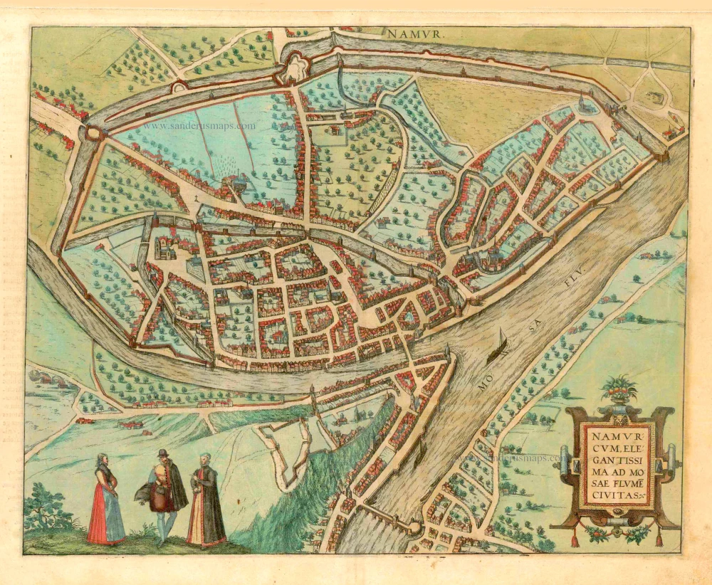
Namurcum, Elegantissima ad Mosae Flume Civitas. 1581
Namur, by Georg Braun and Frans Hogenberg.
[Item number: 25415]
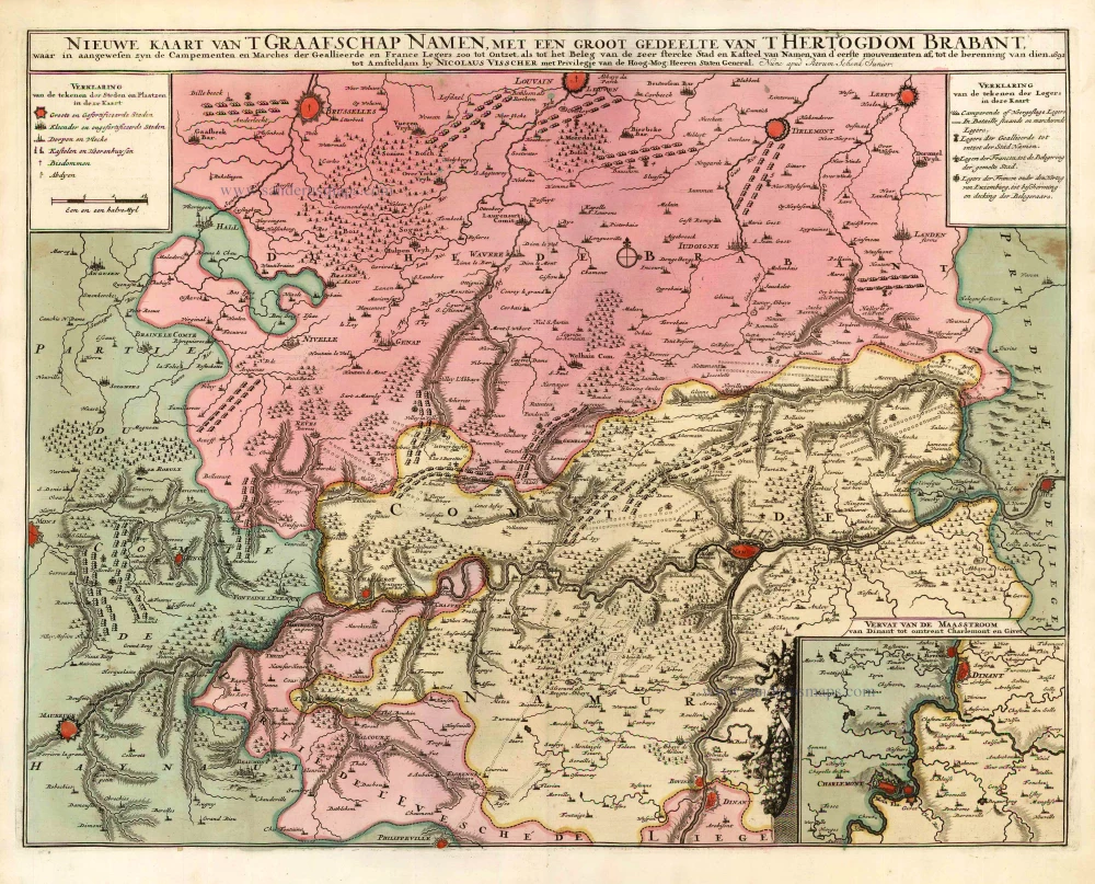
Nieuwe Kaart van 't Graafschap Namen, met een groot gedeelte van 't Hertogdom Brabant, ... 1720-30
Namur by N. Visscher II, published by P. Schenk.
[Item number: 25921]
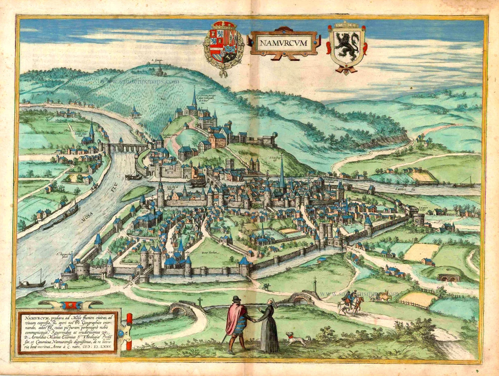
Namurcum, preclara ad Mosae flumen civitas, ... 1576
Namur, by Georg Braun & Frans Hogenberg.
[Item number: 26786]