
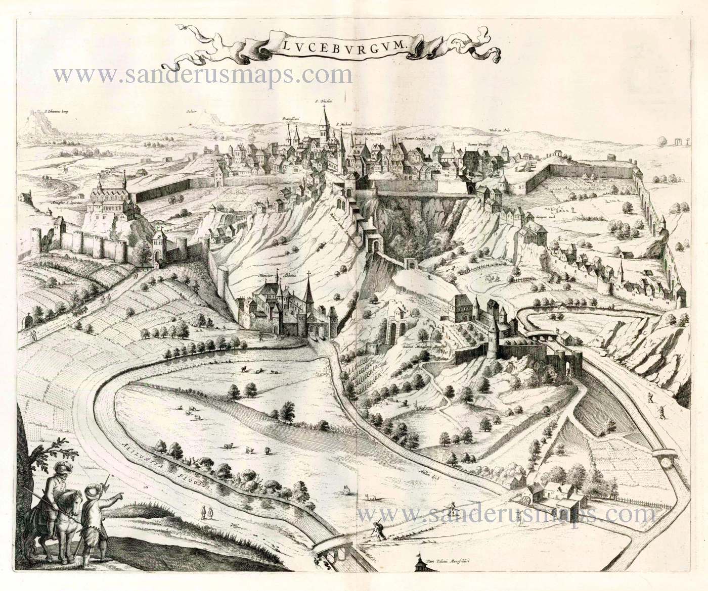
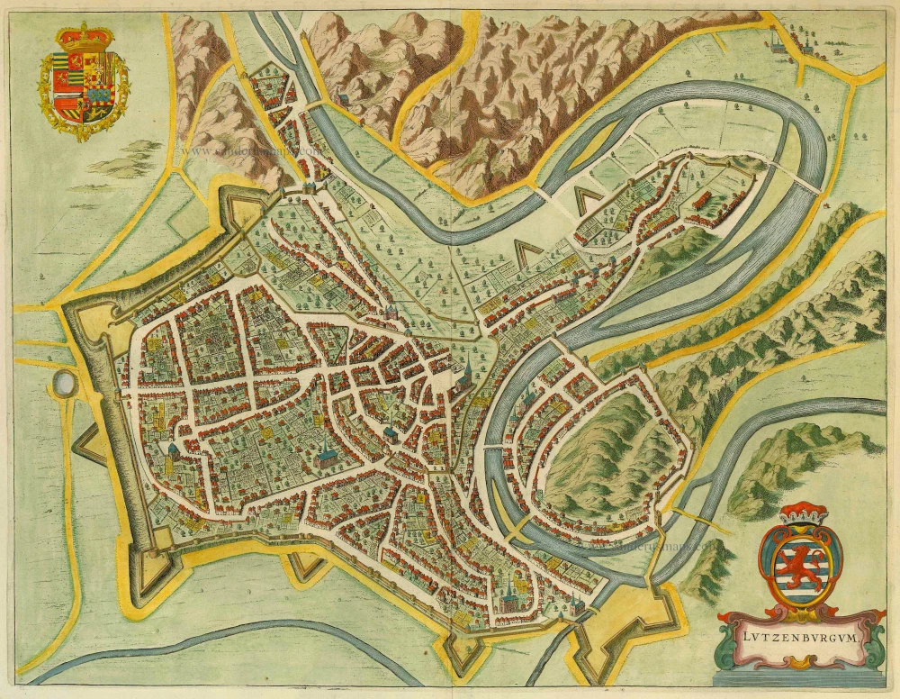
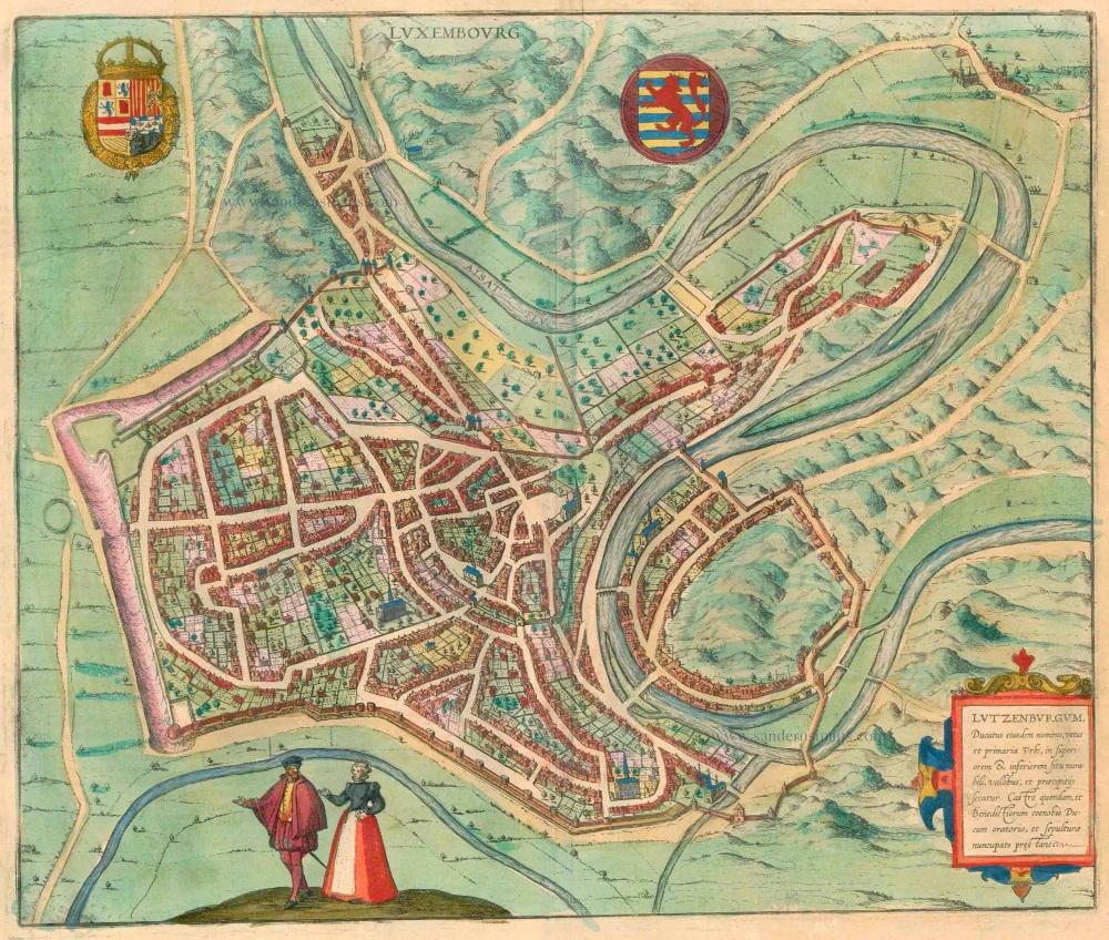
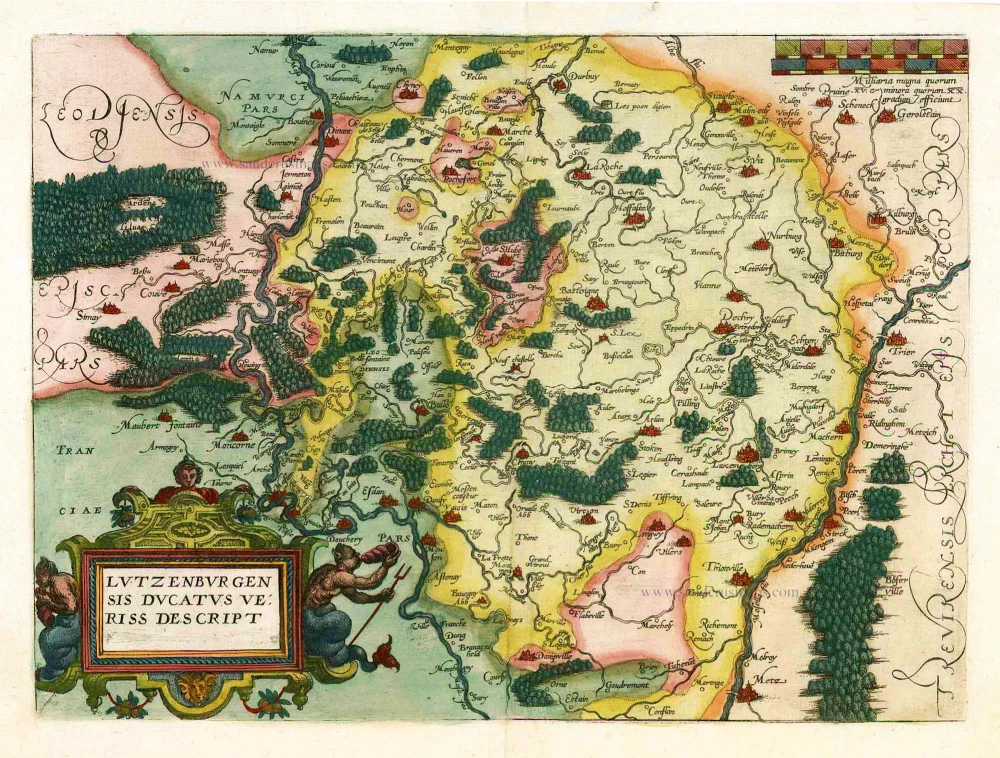
Luxembourg by P. Kaerius (Van den Keere) 1617
The item displayed on this page has been sold. However, we have a similar map in stock:
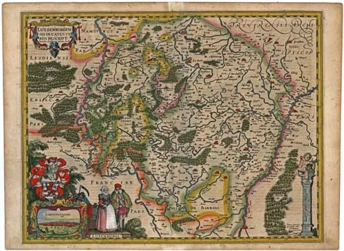
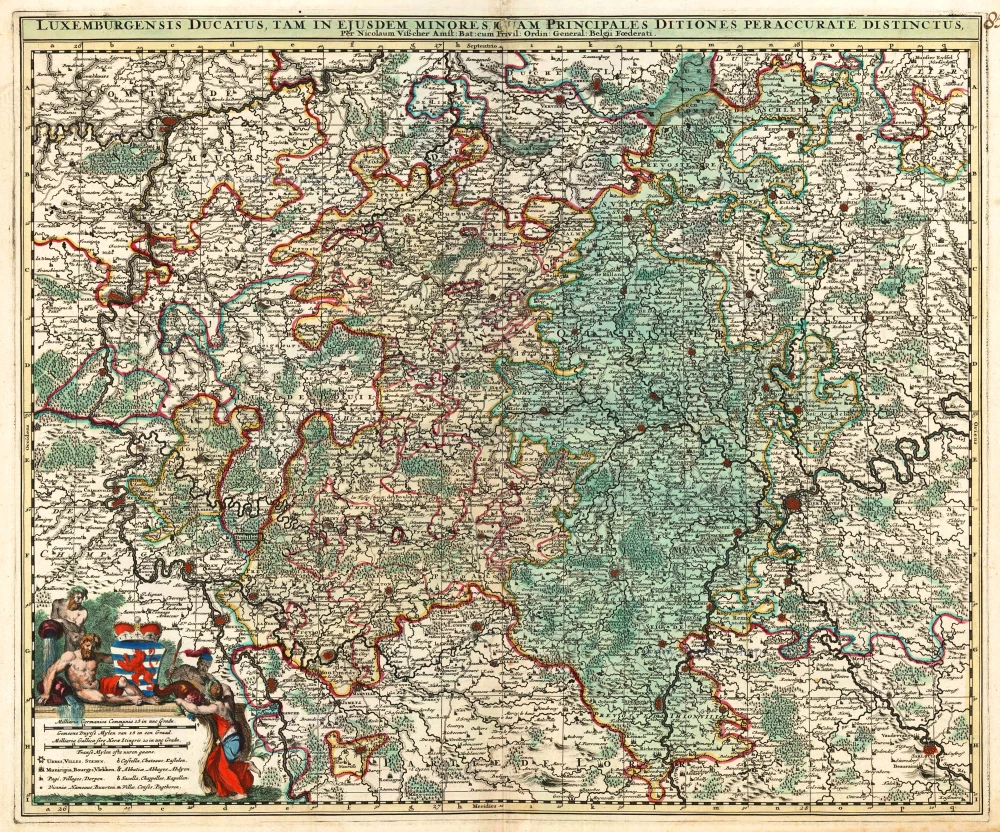
Luxembourg by P. Kaerius (Van den Keere), published by C.J. Visscher. 1634
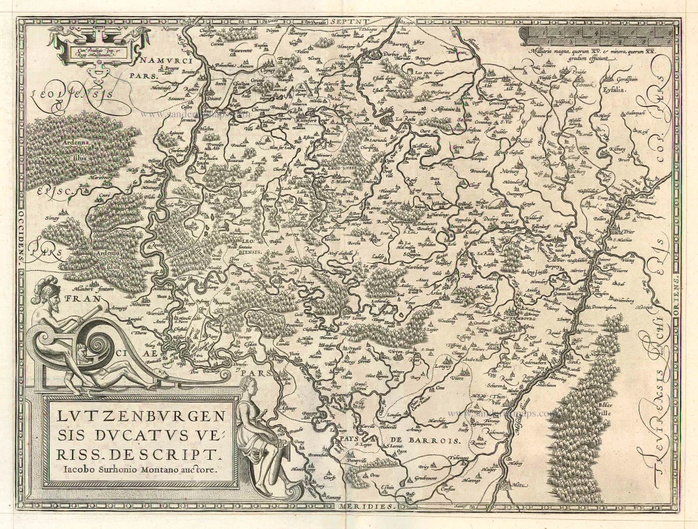
Lutzenburgensis Ducatus Veriss. Descript.
[Item number: 29610]


Pieter Van den Keere (Petrus Kaerius) (1571-c.1650)
Pieter van den Keere was born in Ghent in 1571 as the son of the type-founder, Hendrik van den Keere. In 1584 he moved with his family for religious reasons to London. There, Van den Keere received training as an engraver from Jodocus Hondius, his brother-in-law. Not only the companionship with Jodocus Hondius but also the acquaintanceship with Pieter van den Berghe (Petrus Montanus) author of the text of the Germania Inferior originates from the years of refuge in London.
In 1593, both Keere and Hondius settled in Amsterdam. There, one of the first big enterprises was the large wall map of Europe, dated 1595: Nova totius Europae descriptio.
In 1610 he set up a workshop in the Kalverstraat that he called ‘In den onseeckeren tijd’ (In the uncertain time). In this period, he made numerous copperplates, including for maps for his atlas of the Netherlands and the Atlas Minor published by Jodocus Hondius.
The Germania Inferior (1617) is the first original atlas of the Netherlands published in folio size. The text for the atlas, both in Dutch and in French, was written by Petrus Montanus. After 1623, Claes Jansz. Visscher bought the plates and substituted his name for that of Kaerius’s. In 1634, Visscher included many of these maps in his Germana Inferior.
The fame of Kaerius is not only based on his atlas of the Netherlands. He is even better known as an engraver of many loose-leaf maps and as a collaborator of book publishers. His maps are found, i.a., in the Caert thresoor (Barent Langenes, 1598), Licht der Zeevaert (Blaeu, 1608), Atlas Minor (Hondius, 1628), and Caertboeck vande Midellandsche Zee (Barents, 1595).
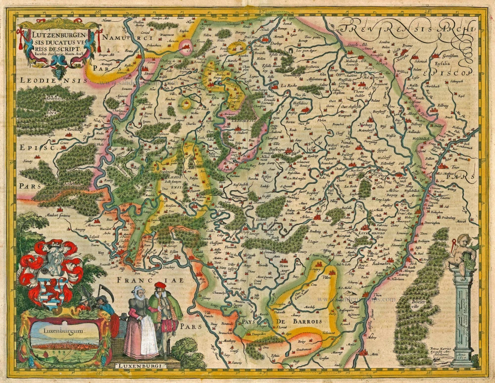
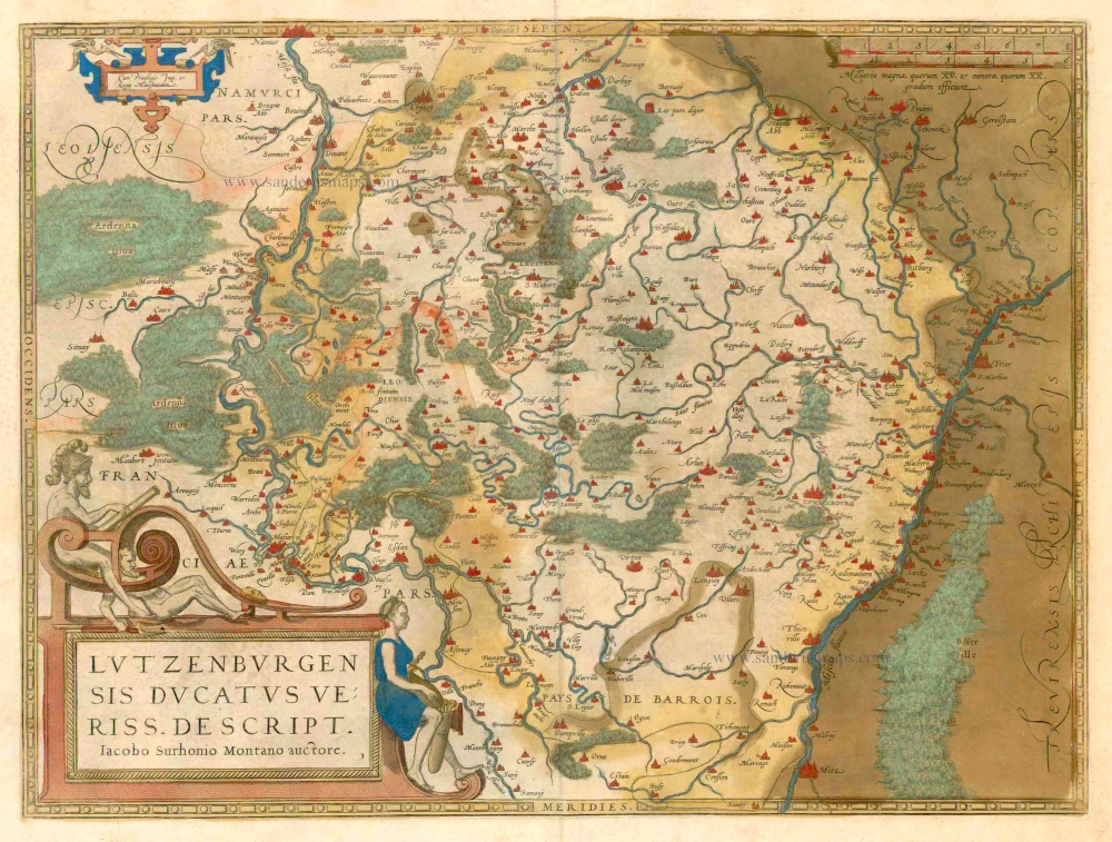
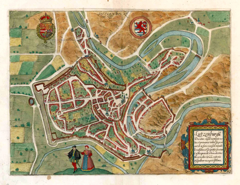
Lutzenburgensis Ducatus Veriss. Descript.
Item Number: 13765 Authenticity Guarantee
Category: Antique maps > Europe > Luxembourg
Antique map of Luxembourg by P. Kaerius (Van den Keere), oriented to the North
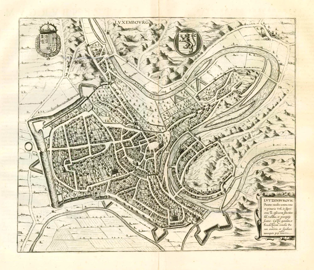
With inset view of the town of Luxembourg
Cartographer: Jacques de Surhon
Date of the first edition: 1617
Date of this map: 1617
Copper engraving
Size: 37.5 x 48.5cm (14.6 x 18.9 inches)
Verso text: Latin
Condition: Old coloured, excellent.
Condition Rating: A
References: Van der Krogt 3, 3380:364; Van der Vekene, 2.07.A.
From: Petri Kaerii Germania Inferior id est, XVII provinciarum ejus novae et exactae Tabulae Geographicae, cum Luculentis Singularum descriptionibus additis. À Petro Montano. Amsterdam, 1617. (Koeman, Kee1; Van der Krogt 3, 64:01)
Pieter Van den Keere (Petrus Kaerius) (1571-c.1650)
Pieter van den Keere was born in Ghent in 1571 as the son of the type-founder, Hendrik van den Keere. In 1584 he moved with his family for religious reasons to London. There, Van den Keere received training as an engraver from Jodocus Hondius, his brother-in-law. Not only the companionship with Jodocus Hondius but also the acquaintanceship with Pieter van den Berghe (Petrus Montanus) author of the text of the Germania Inferior originates from the years of refuge in London.
In 1593, both Keere and Hondius settled in Amsterdam. There, one of the first big enterprises was the large wall map of Europe, dated 1595: Nova totius Europae descriptio.
In 1610 he set up a workshop in the Kalverstraat that he called ‘In den onseeckeren tijd’ (In the uncertain time). In this period, he made numerous copperplates, including for maps for his atlas of the Netherlands and the Atlas Minor published by Jodocus Hondius.
The Germania Inferior (1617) is the first original atlas of the Netherlands published in folio size. The text for the atlas, both in Dutch and in French, was written by Petrus Montanus. After 1623, Claes Jansz. Visscher bought the plates and substituted his name for that of Kaerius’s. In 1634, Visscher included many of these maps in his Germana Inferior.
The fame of Kaerius is not only based on his atlas of the Netherlands. He is even better known as an engraver of many loose-leaf maps and as a collaborator of book publishers. His maps are found, i.a., in the Caert thresoor (Barent Langenes, 1598), Licht der Zeevaert (Blaeu, 1608), Atlas Minor (Hondius, 1628), and Caertboeck vande Midellandsche Zee (Barents, 1595).
Related items
Luceburgum. 1649
Luxembourg, by Joan Blaeu.
[Item number: 105]
Luxembourg - Lutzenburgum, Ducatus eiusdem Nominis, Vetus et Primaria Urbs ... 1657
Luxembourg, by J. Janssonius.
[Item number: 9528]
Lutzenburgum 1649
Luxembourg by Blaeu J.
[Item number: 14317]
Luxemburgensis Ducatus, tam in ejusdem Minores, quam Principales, ... 1683-1696
Luxembourg, by N. Visscher II.
[Item number: 14831]
Lutzenburgensis Ducatus Veriss. Descript. 1579
Luxembourg, by A. Ortelius.
[Item number: 21720]
Lutzenburgensis Ducatus Veriss. Descript. 1601
Luxembourg by Abraham Ortelius.
[Item number: 22703]
Lutzenburgensis Ducatus Veriss. Descript. 1598
Luxembourg, by A. Ortelius.
[Item number: 22910]
Luxembourg - Lutzenburgum, Ducatus eiusdem Nominis, Vetus et Primaria Urbs ... 1581-88
Luxembourg by Georg Braun & Frans Hogenberg
[Item number: 23308]
Lucenburgum Urbs eiusdem nominis Ducatus primaria et Tribunam supremum, montoso inaequali situ spectabilis. 1596-1640
Luxembourg, by Braun & Hogenberg.
[Item number: 23366]

Trier & Lutzenburg 1623
Luxembourg and Trier, by Gerard Mercator.
[Item number: 24918]
Luceburgum. 1652
Luxembourg, by Joan Blaeu.
[Item number: 25510]
Lutzenburgu(m) Ducatus eiyusde(m) nominis, vetus et primaria urbis, ... 1609
Luxembourg, by L. Guicciardini.
[Item number: 26119]
Lutzenburgensis Ducatus Veriss Descript. 1581
Luxembourg, by Ludovico Guicciardini.
[Item number: 26805]
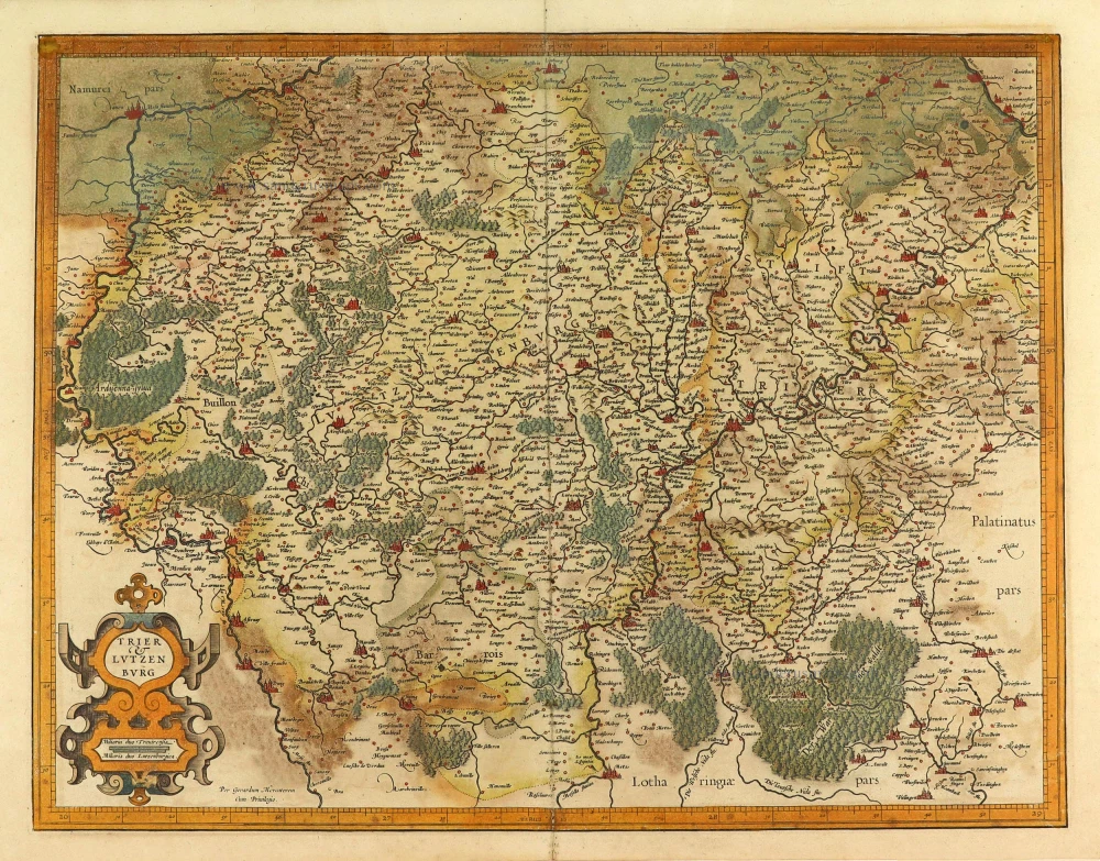
Trier & Lutzenburg. 1623
Luxembourg and Trier, by Gerard Mercator.
[Item number: 28135]
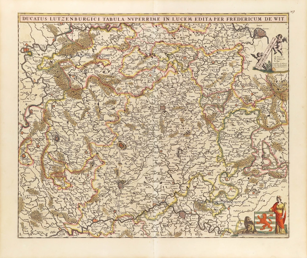
Ducatus Lutzenburgici Tabula Nuperrimi in Lucem Edita per Fredericum De Wit. ca. 1707-10
Luxembourg, by Frederick de Wit.
[Item number: 29006]