
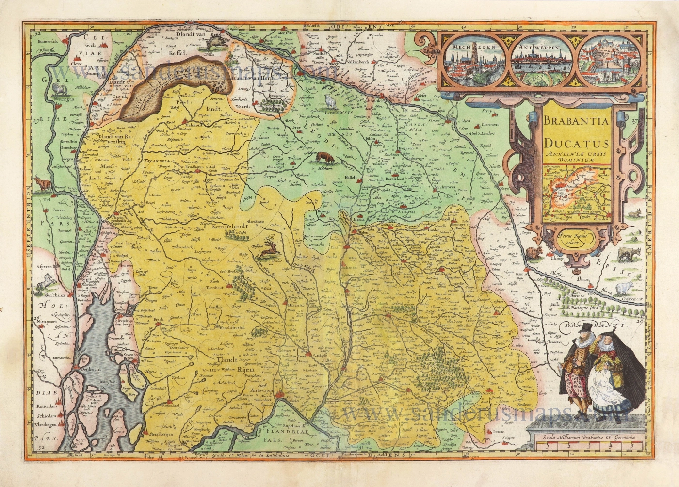
Brabant by M. Quad - J. Bussemacher. 1602
Matthias Quad (Deventer, 1557 – Eppingen, 1613)
Matthias Quad, born in Deventer in 1557, was trained there as an engraver by the Van Deutecum brothers. He also studied with Hendrick Goltzius in Haarlem. Later, he settled in Germany after spending some time in France and England.
He lived in Cologne since 1587, where he met the renowned engraver and mapmaker Frans Hogenberg and the printer and publisher Johann Bussemacher. For the next 15 years, Quad worked closely with Bussemacher, especially in publishing atlases. In 1592 he published a translation of an atlas by Botero, and in the following years, several geographical works followed.
With Bussemacher, he prepared a hand and travel atlas in a small format for which he mainly took engraving to heart. From 1592, they published some editions under the name of Bussemacher without text. In 1594 appeared the Europae … descriptio as an atlas with 50 maps with text by Quad. Bussemacher printed the maps, but the text was printed by Lambert Andreae, with whom Bussemacher often collaborated. In 1600 followed the Geographisch Handtbuch, a world atlas with 82 maps.
From that time on, Quad releases a series of Itineraries. The Deliciae Germaniae (1600), the Deliciae Galliae (1600), the Itinearium universae Germaniae (1602), and others on Northern Europe, Italy and Spain.
He spent the last years of his life as a teacher in Eppingen, where he died in 1613.
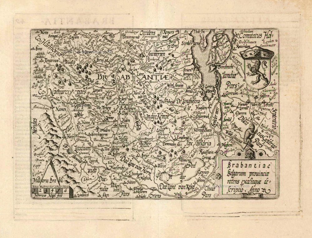
Brabantiae Belgarum provinciae recens exactaque descriptio.
Item Number: 25235 Authenticity Guarantee
Category: Antique maps > Europe > The Netherlands
Old, antique map of Brabant, by Matthias Quad and Johan Bussemacher.
Oude, antieke kaart van Brabant, door Matthias Quad en Johan Bussemacher.
Oriented to the West.
Date of the first edition: 1590
Date of this map: 1602
Copper engraving
Size: 18.5 x 27cm (7.2 x 10.4 inches)
Verso text: Latin
Condition: Excellent.
Condition Rating: A+
References: Meurer (Cologne), Qua 29; Dorigo-Franssen (Brabant), #19.
From: Evropae Totius Orbis Terrarum Partis Prae- Stantissimae Universalis et Particularis Descriptio. Cologne, J. Bussemacher, 1602. (Meurer, Qua3)
Matthias Quad (Deventer, 1557 – Eppingen, 1613)
Matthias Quad, born in Deventer in 1557, was trained there as an engraver by the Van Deutecum brothers. He also studied with Hendrick Goltzius in Haarlem. Later, he settled in Germany after spending some time in France and England.
He lived in Cologne since 1587, where he met the renowned engraver and mapmaker Frans Hogenberg and the printer and publisher Johann Bussemacher. For the next 15 years, Quad worked closely with Bussemacher, especially in publishing atlases. In 1592 he published a translation of an atlas by Botero, and in the following years, several geographical works followed.
With Bussemacher, he prepared a hand and travel atlas in a small format for which he mainly took engraving to heart. From 1592, they published some editions under the name of Bussemacher without text. In 1594 appeared the Europae … descriptio as an atlas with 50 maps with text by Quad. Bussemacher printed the maps, but the text was printed by Lambert Andreae, with whom Bussemacher often collaborated. In 1600 followed the Geographisch Handtbuch, a world atlas with 82 maps.
From that time on, Quad releases a series of Itineraries. The Deliciae Germaniae (1600), the Deliciae Galliae (1600), the Itinearium universae Germaniae (1602), and others on Northern Europe, Italy and Spain.
He spent the last years of his life as a teacher in Eppingen, where he died in 1613.
Related items
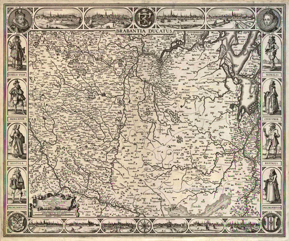
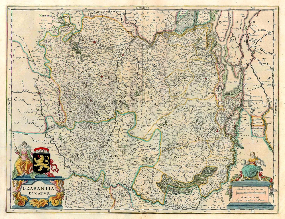
Brabantia Ducatus / Tabula Ducatus Brabantiae Continens Marchionatum Sacri Imperij et Dominium Mechliniense Magna cura edita à Nicolao Iohannis Visscher. Anno 1622. 1622
Brabant by C.J. Visscher.
[Item number: 2640]
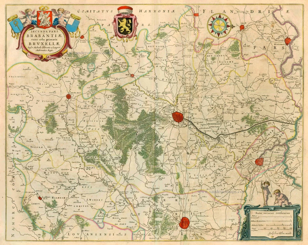
Secunda Pars Brabantiae cuius urbs primaria Bruxellae. 1659-72
Old antique map of Brussels by W. & J. Blaeu.
[Item number: 2966]
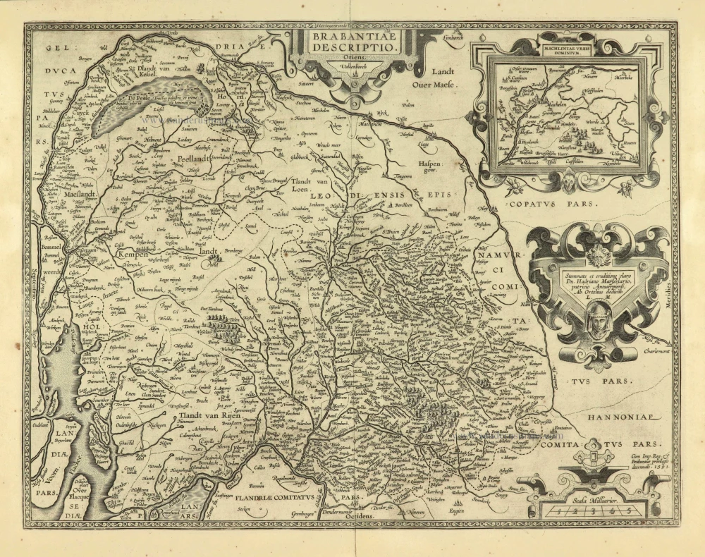
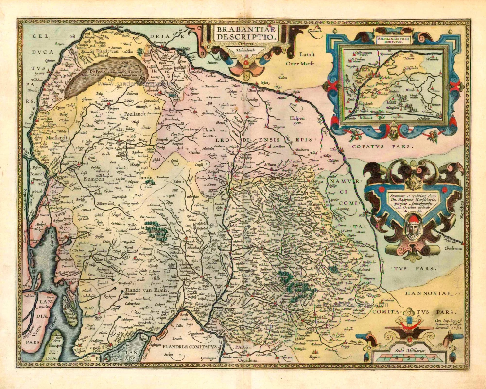
Brabantiae Descriptio 1601
Brabant, with an inset map of the district of Mechelen, by Abraham Ortelius.
[Item number: 12909]
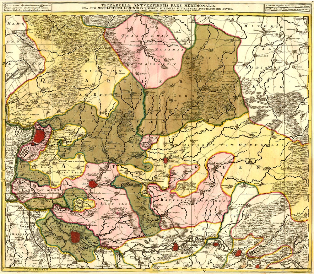
Tetrarchiae Antverpiensis Pars Meridionalis 1683-1696
Antwerpen - Mechelen by Visscher N. II.
[Item number: 14777]
Ducatus Brabantiae. 1631
Brabant by Abraham Goos,published by Joannes Janssonius.
[Item number: 17723]

Novissima et Accuratissima Brabantiae Ducatus Tabula. 1638
Brabant by Henricus Hondius, published by J. Janssonius.
[Item number: 19012]
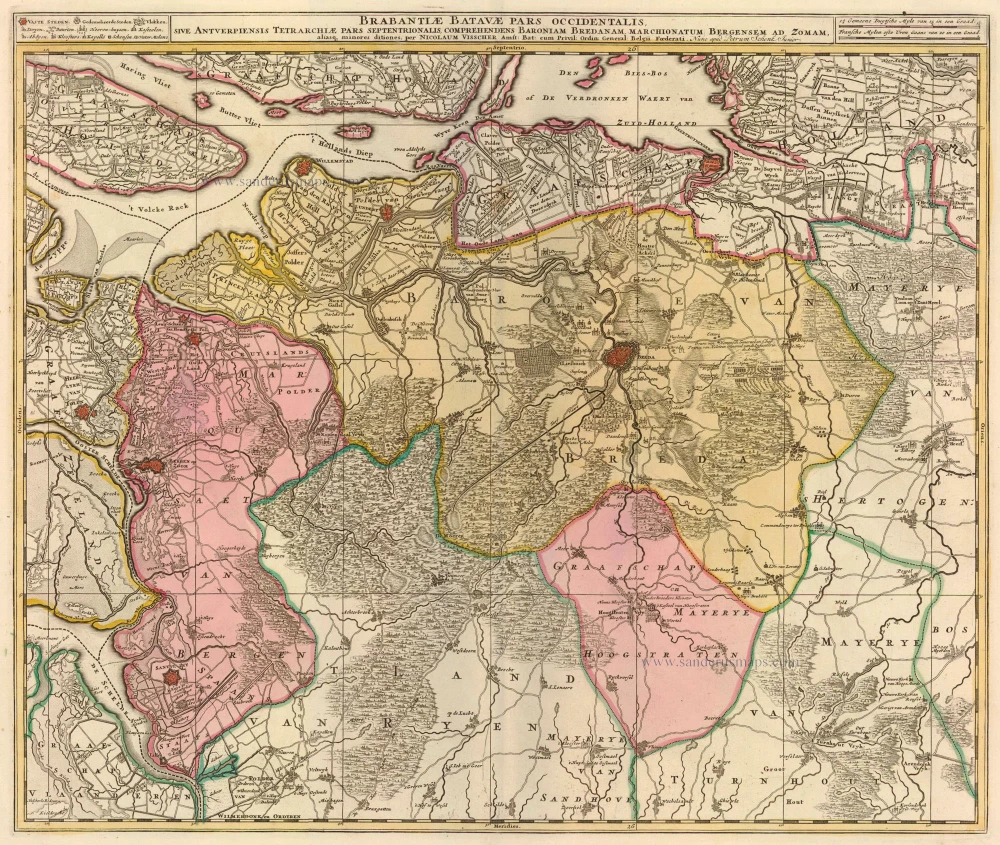
Brabantiae Batavae Pars Occidentalis 1683-1696
Breda - Bergen op Zoom, by Visscher N. II
[Item number: 20266]
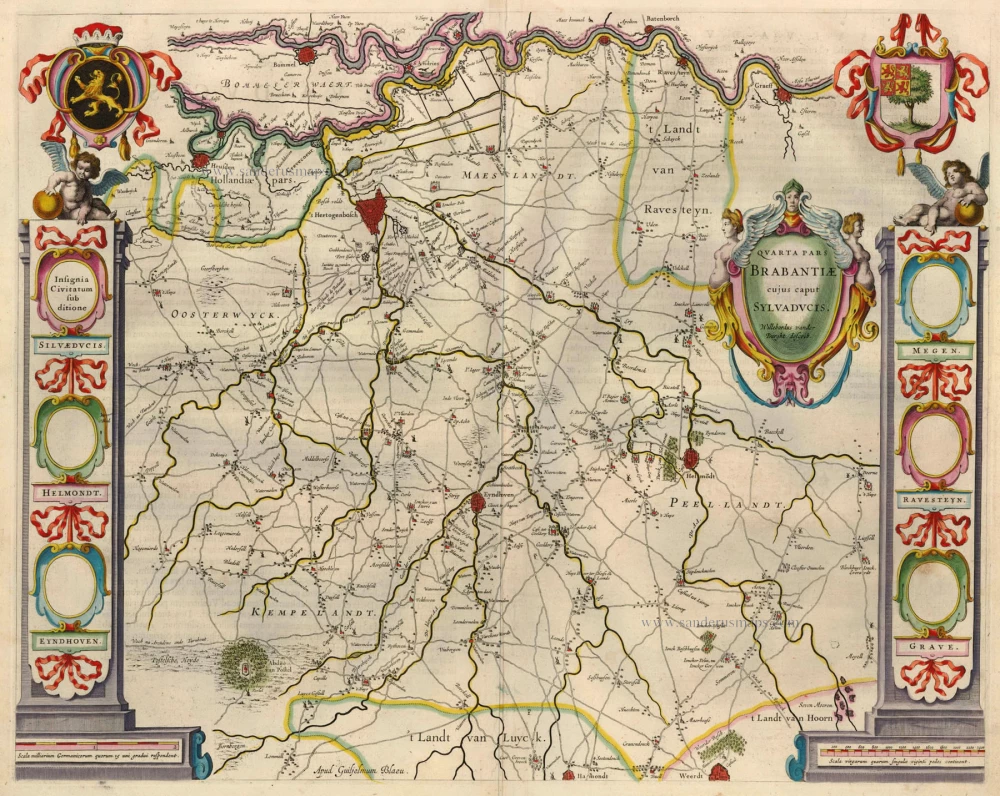
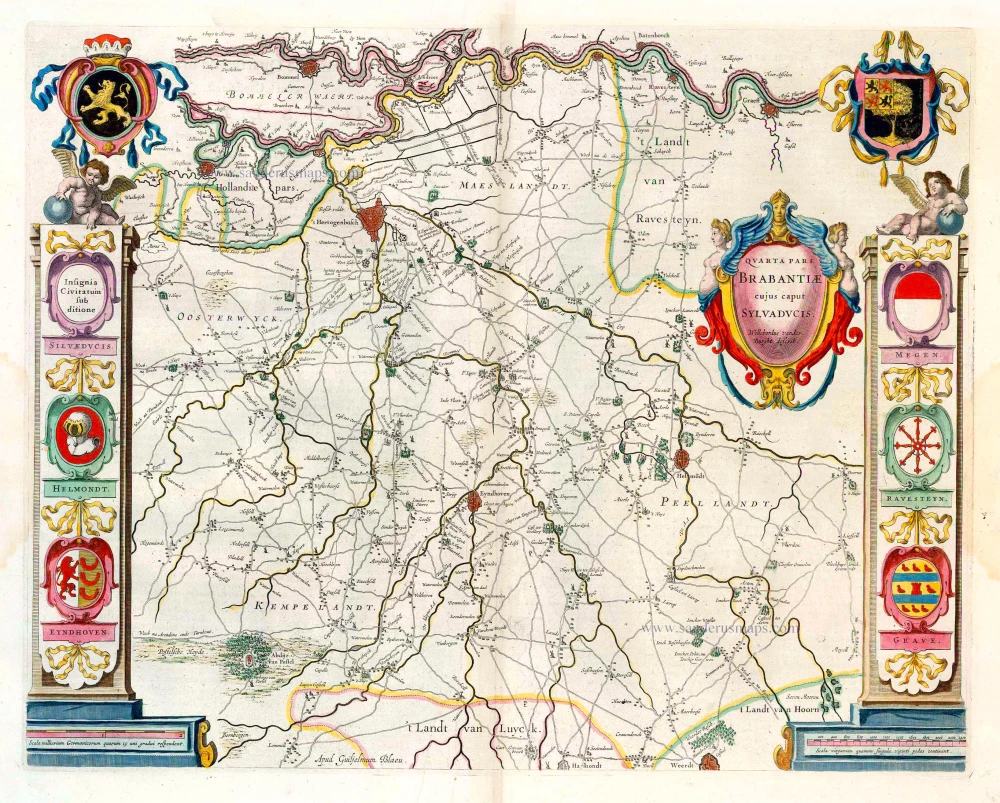
Quarta Pars Brabantiae cujus caput Sylvaducis. 1635
Northern Brabant, by Blaeu W. & J.
[Item number: 20384]
Brabantia Ducatus. 1647-50
Brabant, by W. Blaeu.
[Item number: 22657]
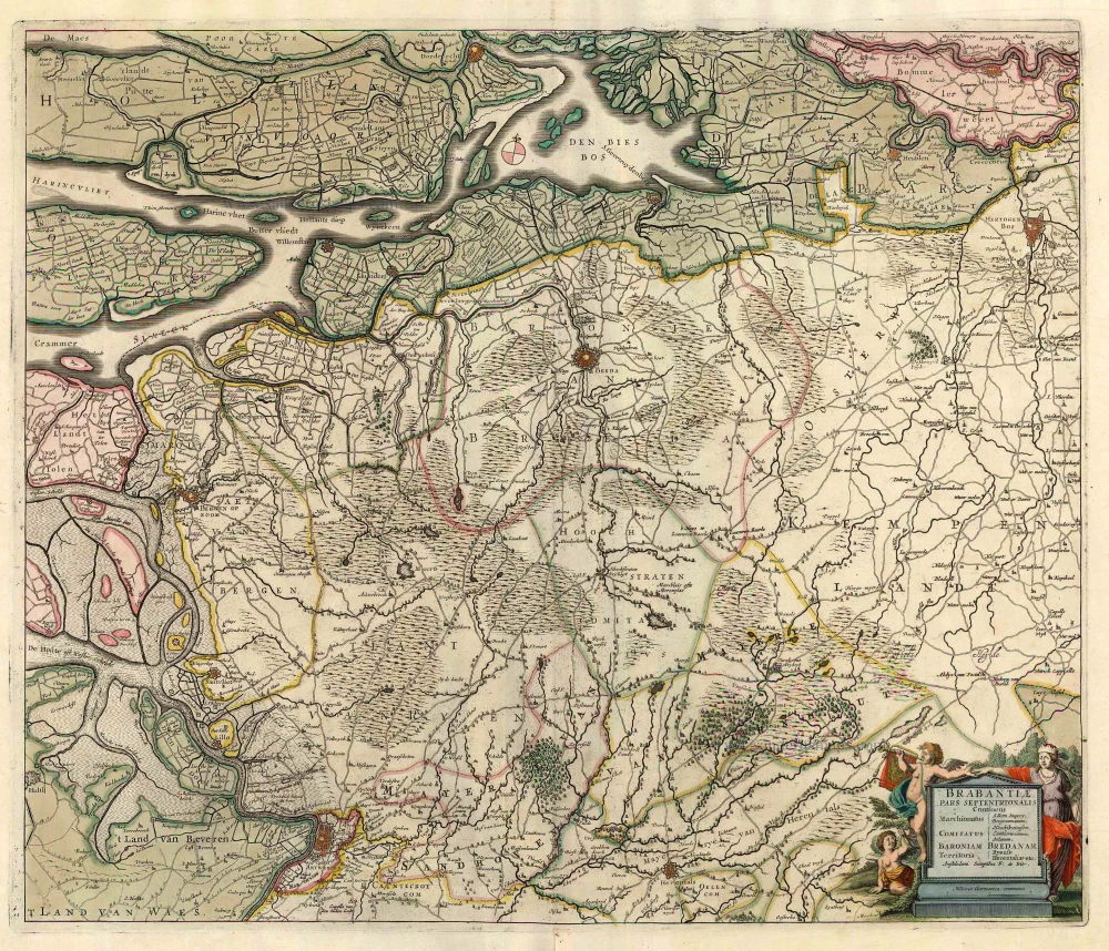
Brabantiae, pars Septentrionalis c. 1680
Northern Brabant, by Frederick de Wit.
[Item number: 24653]
Brabantiae Descriptio. 1595
Brabant, by A. Ortelius.
[Item number: 25573]
Quarta Pars Brabantiae cujus caput Sylvaducis. 1643-50
Northern Brabant, by W. Blaeu.
[Item number: 26304]

Important and rare map.
Brabantiae Belgarum Provinciae Recens Exactaque Descriptio. 1558
Brabant, by Michele Tramezini.
[Item number: 26713]

Brabantiae Germaniae Inferioris Nobilissimmae Provinciae Descriptio. 1572
Brabant by Abraham Ortelius
[Item number: 26734]
Brabantia Ducatus Machliniae Urbis Dominium. 1617
The Duchy of Brabant by Pieter van den Keere (Petrus Kaerius).
[Item number: 28672]
First edition, woodcut
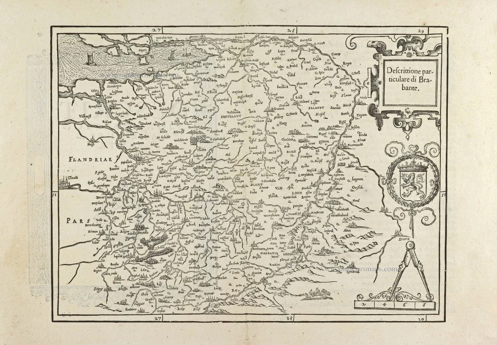
Descrittione particulare di Brabante. 1567
Brabant by Lodovico Guicciardini.
[Item number: 29504]
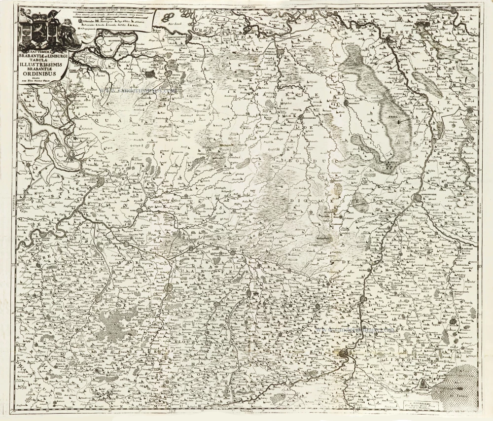
Exactissima Brabantiae et Limburgi Tabula Illustrissimis Brabantiae Ordinibus. 1712
Brabant & Zuid Limburg by Eugene Fricx.
[Item number: 29546]

Ducatus Brabantiae Nova Tabula in qua Lovanii Bruxellarum March S. Imperii Sulvaeu Ducis et Mechliniae Dominia c. 1730-37
Brabant by Johann Baptist Homann.
[Item number: 30250]
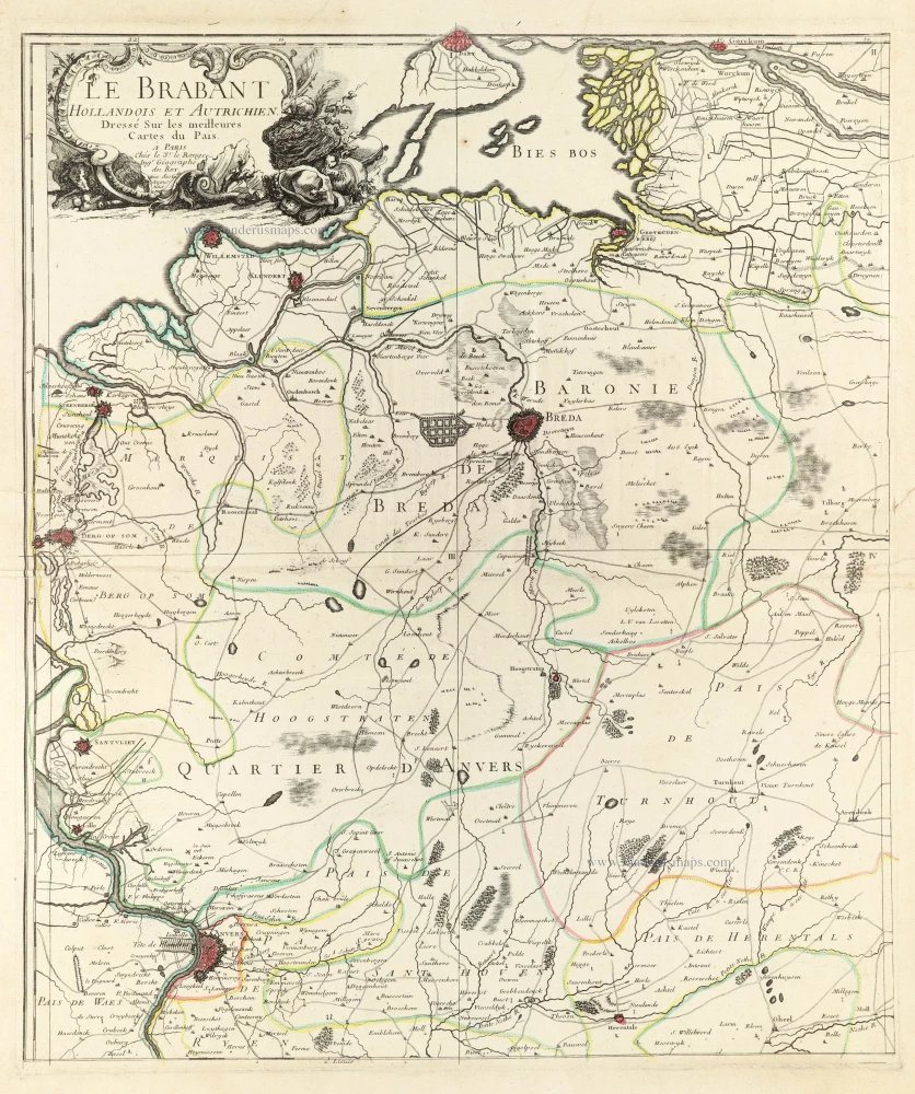
Le Brabant Hollandois et Autrichien. 1747
Northwest Brabant by G.L. Le Rouge.
[Item number: 30255]
Very rare first state.
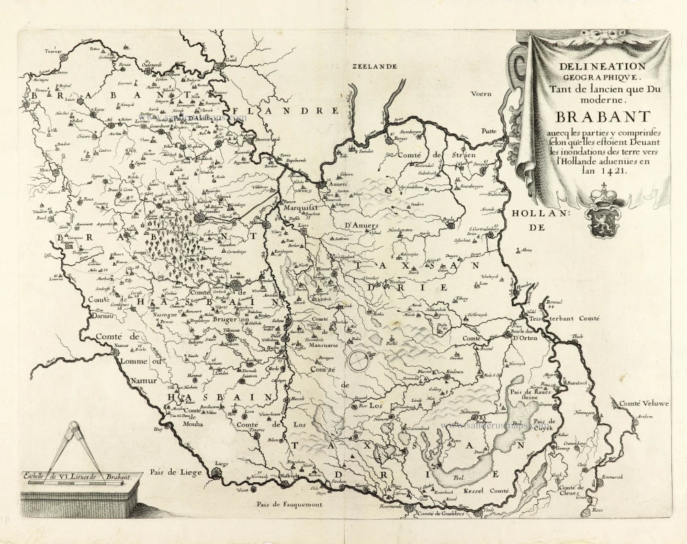
Delineation Geographique. Tant de lancien que Du moderne. Brabant avecq les parties y comprinses selon qu'elles estoient Devant les inondations des terre vers l'Hollande advenües en lan 1421. 1637
Historical map of Brabant by Christophe Butkens.
[Item number: 30291]
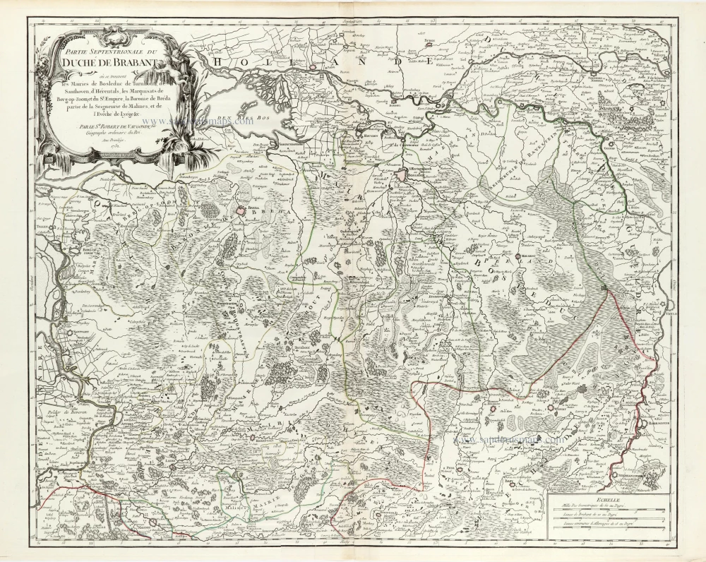
Partie Septentrionale du Duché de Brabant où se trouvent les Mairies de Bosleduc de Turnhout, de Santhoven, d'Herentals, les Marquisats de Berg-op-Zoom, et du St Empire, la Baronie de Bréda partie de la Seigneurie de Malines, et de l'Evêché de Lyége &c. 1757
Southern Brabant par Robert de Vaugondy.
[Item number: 30403]
new

Tabula Ducatus Brabantiae continens Marchionatum Sacri Imperiii et Dominium Mechliniense 1670-71
Brabant by Frederick De Wit.
[Item number: 30526]
new