
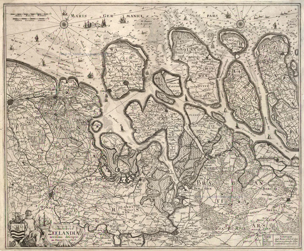
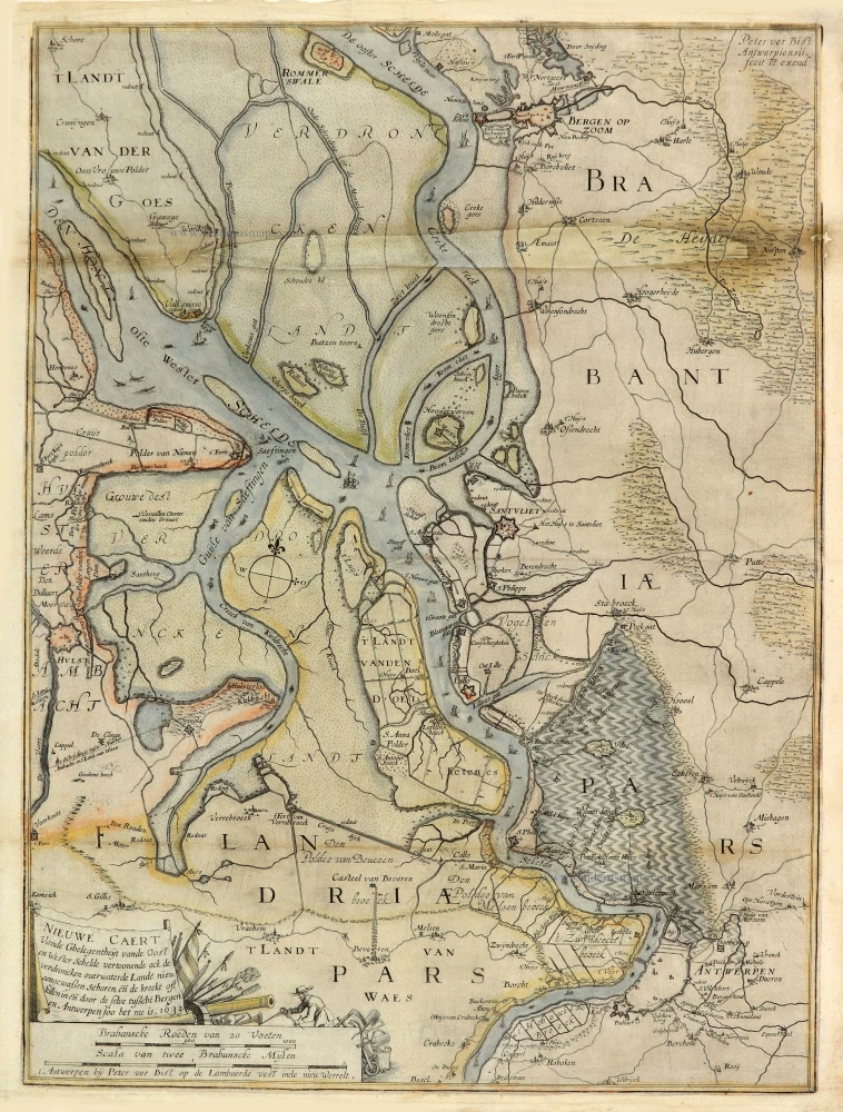
Zeeland by Pieter Verbiest 1632
Pieter Verbiest (Petrus Verbist) and Isaak Verbiest (Isack Verbist)
Pieter Verbiest (Antwerpen, 1607-1674) was an Antwerp cartographer and engraver. Little is known about his life.
One of his most important works is the Novus Tabularum Geographicorum Belgicae (Antwerp, 1636), a pocket atlas of which two more editions were published later (1644 and 1652). Isaak Verbiest, probably a brother of Pieter, drew and engraved certain maps. Their collaboration also led to the production of two rare world maps.
Pieter Verbiest also published folio maps as separate publications. Koeman describes three editions of a Verbiest atlas of the Netherlands, published between 1636 and 1652. Only one copy of each of these atlases is known.
Verbiest-maps, some with beautiful decorative borders with city views, costumed figures and coats of arms, were sometimes bound in composite atlases. Occasionally, copies of these scarce maps come onto the market.
Comitatus Zeelandiae novissima descriptio.
Item Number: 2685 Authenticity Guarantee
Category: Antique maps > Europe > The Netherlands
Old, antique map of Zeeland by Pieter Verbiest, oriented to the Northwest
Very nice copy of the first state of this extremely rare map.
Copper engraving
Size: 46.5 x 56.5cm (18.1 x 22 inches)
Verso: Blank
Condition: Excellent.
Condition Rating: A+
References: Blonk-van der Wijst (Zeeland), 28.1.
Separate publication
Pieter Verbiest (Petrus Verbist) and Isaak Verbiest (Isack Verbist)
Pieter Verbiest (Antwerpen, 1607-1674) was an Antwerp cartographer and engraver. Little is known about his life.
One of his most important works is the Novus Tabularum Geographicorum Belgicae (Antwerp, 1636), a pocket atlas of which two more editions were published later (1644 and 1652). Isaak Verbiest, probably a brother of Pieter, drew and engraved certain maps. Their collaboration also led to the production of two rare world maps.
Pieter Verbiest also published folio maps as separate publications. Koeman describes three editions of a Verbiest atlas of the Netherlands, published between 1636 and 1652. Only one copy of each of these atlases is known.
Verbiest-maps, some with beautiful decorative borders with city views, costumed figures and coats of arms, were sometimes bound in composite atlases. Occasionally, copies of these scarce maps come onto the market.
Related items
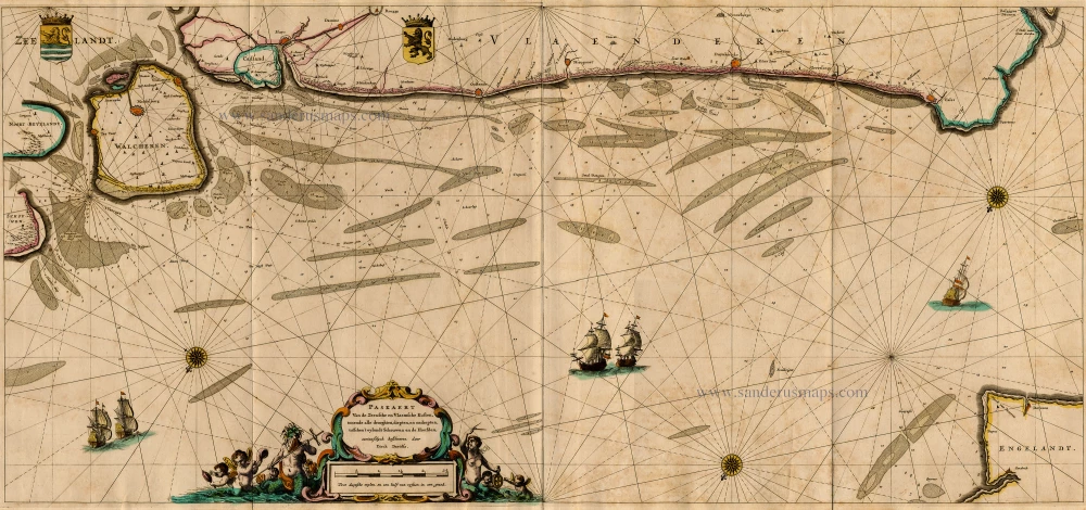
Paskaert van de Zeeusche en Vlaemsche Kusten, tonende Alle Drooghten, Diepten, en Ondiepten, tusschen t'Eylandt Schouwen en de Hoofden, Curieuselyck Beschreven door Dirck Davidsz 1667
Sea chart of Flanders (Vlaanderen) & Zeeland, by Pieter Goos.
[Item number: 19054]
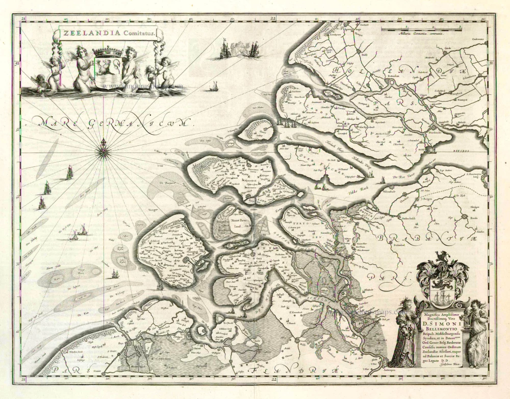
Zeelandia Comitatus 1635
Zeeland by Willem Blaeu.
[Item number: 3626]
Extremely rare sea chart.
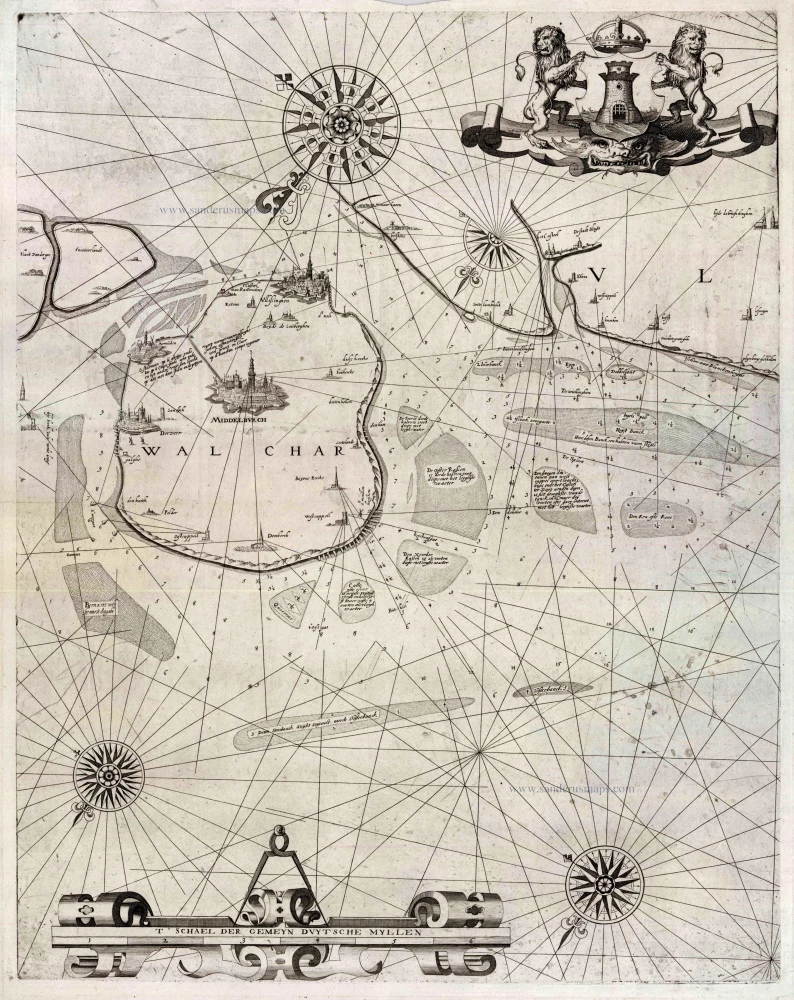
[No title] 1617
Zeeland - Flanders by Willem den Dooven.
[Item number: 25614]
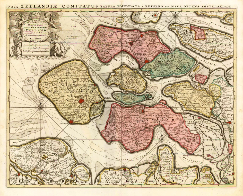
Nieuwe Kaart van het Graafschap Zeeland. 1730-45
Zeeland, by Ottens R. & I.
[Item number: 25736]
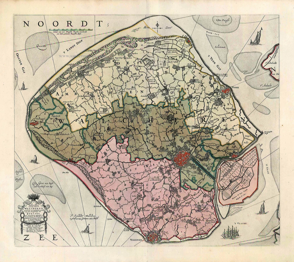
Nieuwe Kaart van het Eiland Walcheren zynde het vermakelykste gedeelte van het Graafschap van Zeeland ... 1765-70
Walcheren, by Widow J. Ottens & Son.
[Item number: 25773]
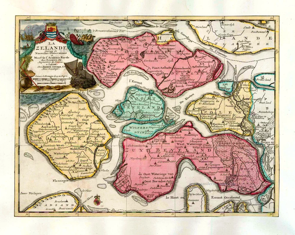
La Zelande. 1713
Zeeland, by Pieter Van der Aa.
[Item number: 26058]
Very rare!
Nieuwe Caert Vande Ghelegentheijt vande Oost en Wester Schelde vertoonende ock de verdroncken overwaterde Lande nieu aengewaßen Schoren, eñ de kreeke oft killen in eñ door de selve tußche Bergen en Antwerpen soo het nu is. 1633. 1633
Schelde River (Antwerp), by Pieter Verbiest (Petrus Verbist).
[Item number: 28023]
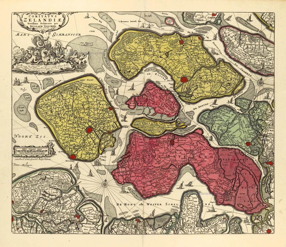
Comitatus Zelandiae. c. 1715
Zeeland by Nicolaas Visscher I, published by Petrus Schenk II.
[Item number: 28275]