
Very rare!
Schelde River (Antwerp), by Pieter Verbiest (Petrus Verbist). 1633
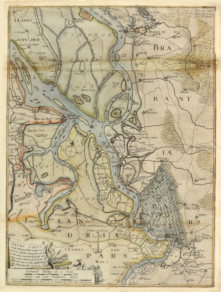
Extremely rare map of the River Schelde near Antwerp, by Pieter Verbiest.
Hollstein knows five states of this map:
State 1: Dated 1631 - one copy recorded (damaged) - Brussels, Cartes et Plans.
State 2: Dated 1633 - two copies recorded - Brussels, Cartes et Plans; Vienna, Nationalbibliothek.
State 3: Dated 1636 - one copy recorded - Great Britain, private collection.
State 4: Dated 1638 - one copy recorded (damaged) - Brussels, Cartes et Plans.
State 5: Infantry troops near fortress Callo removed.
Pieter Verbiest (Petrus Verbist) and Isaak Verbiest (Isack Verbist)
Pieter Verbiest (Antwerpen, 1607-1674) was an Antwerp cartographer and engraver. Little is known about his life.
One of his most important works is the Novus Tabularum Geographicorum Belgicae (Antwerp, 1636), a pocket atlas of which two more editions were published later (1644 and 1652). Isaak Verbiest, probably a brother of Pieter, drew and engraved certain maps. Their collaboration also led to the production of two rare world maps.
Pieter Verbiest also published folio maps as separate publications. Koeman describes three editions of a Verbiest atlas of the Netherlands, published between 1636 and 1652. Only one copy of each of these atlases is known.
Verbiest-maps, some with beautiful decorative borders with city views, costumed figures and coats of arms, were sometimes bound in composite atlases. Occasionally, copies of these scarce maps come onto the market.
Nieuwe Caert Vande Ghelegentheijt vande Oost en Wester Schelde vertoonende ock de verdroncken overwaterde Lande nieu aengewaßen Schoren, eñ de kreeke oft killen in eñ door de selve tußche Bergen en Antwerpen soo het nu is. 1633.
Item Number: 28023 Authenticity Guarantee
Category: Antique maps > Europe > The Netherlands
Old, antique map of Schelde River near Antwerp, by Pieter Verbiest (Petrus Verbist).
Title: Nieuwe Caert Vande Ghelegentheijt vande Oost en Wester Schelde vertoonende ock de verdroncken overwaterde Lande nieu aengewaßen Schoren, eñ de kreeke oft killen in eñ door de selve tußche Bergen en Antwerpen soo het nu is. 1633.
[Upper right corner:] Peter ver Bist | Antwerpiensii. | fecit et excud.
[Bottom left corner:] t' Antwerpen bij Peter ver Bist op de Lombaerde vest inde nieu Werelt.
Second state (of five).
Engraver: Pieter Verbiest (Petrus Verbist).
Date of the first edition: 1631.
Date of this map: 1633.
Date on map: 1633.
Copper engraving, printed on paper.
Size (not including margins): 545 x 405mm (21.46 x 15.94 inches).
Verso: Blank.
Condition: Original coloured, reinstatement of an area in the upper centre (2 x 28 cm).
Condition Rating: B
References: Hollstein XXXV, Pieter Verbiest II, #3-2
Separate publication.
Extremely rare map of the River Schelde near Antwerp, by Pieter Verbiest.
Hollstein knows five states of this map:
State 1: Dated 1631 - one copy recorded (damaged) - Brussels, Cartes et Plans.
State 2: Dated 1633 - two copies recorded - Brussels, Cartes et Plans; Vienna, Nationalbibliothek.
State 3: Dated 1636 - one copy recorded - Great Britain, private collection.
State 4: Dated 1638 - one copy recorded (damaged) - Brussels, Cartes et Plans.
State 5: Infantry troops near fortress Callo removed.
Pieter Verbiest (Petrus Verbist) and Isaak Verbiest (Isack Verbist)
Pieter Verbiest (Antwerpen, 1607-1674) was an Antwerp cartographer and engraver. Little is known about his life.
One of his most important works is the Novus Tabularum Geographicorum Belgicae (Antwerp, 1636), a pocket atlas of which two more editions were published later (1644 and 1652). Isaak Verbiest, probably a brother of Pieter, drew and engraved certain maps. Their collaboration also led to the production of two rare world maps.
Pieter Verbiest also published folio maps as separate publications. Koeman describes three editions of a Verbiest atlas of the Netherlands, published between 1636 and 1652. Only one copy of each of these atlases is known.
Verbiest-maps, some with beautiful decorative borders with city views, costumed figures and coats of arms, were sometimes bound in composite atlases. Occasionally, copies of these scarce maps come onto the market.
Related items

Tertia Pars Brabantiae qua continetur Marchionat S.R.I. horum urbs primaria Antverpia. 1641-42
The Marquisate of Antwerp, by Willem Blaeu.
[Item number: 17537]
Rare.
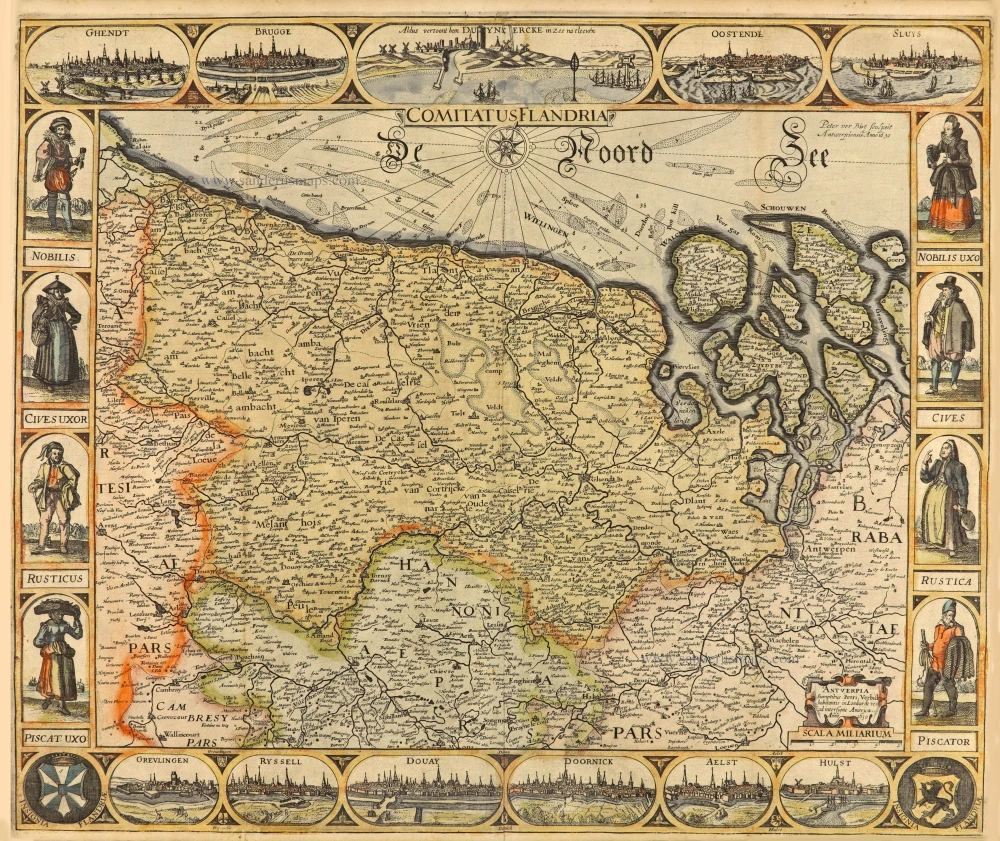
Comitatus Flandria. 1630
Vlaanderen (Flanders), by Pieter Verbiest.
[Item number: 28002]
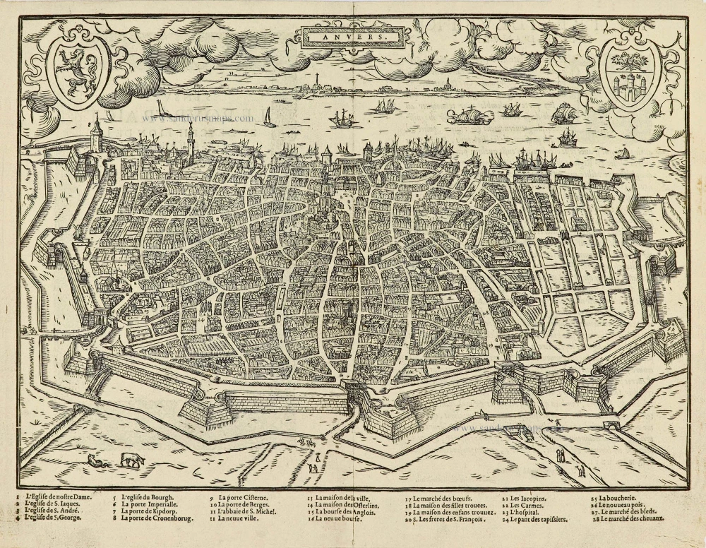
Anvers. 1567
Antwerpen by Lodovico Guicciardini.
[Item number: 28175]
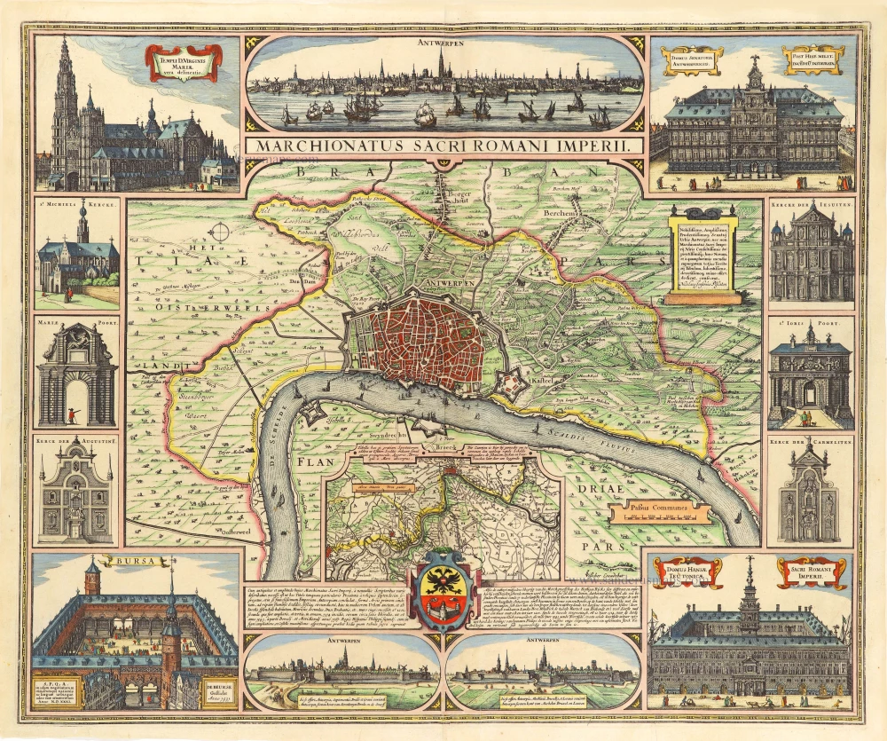
Marchionatus Sacri Romani Imperii. 1656-80
Antwerp, by Nicolaes Visscher I.
[Item number: 28974]
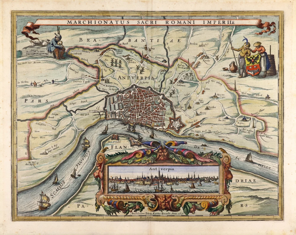
Marchionatus Sacri Romani Imperii. 1617
Antwerp (Antwerpen), by Petrus Kaerius.
[Item number: 30101]
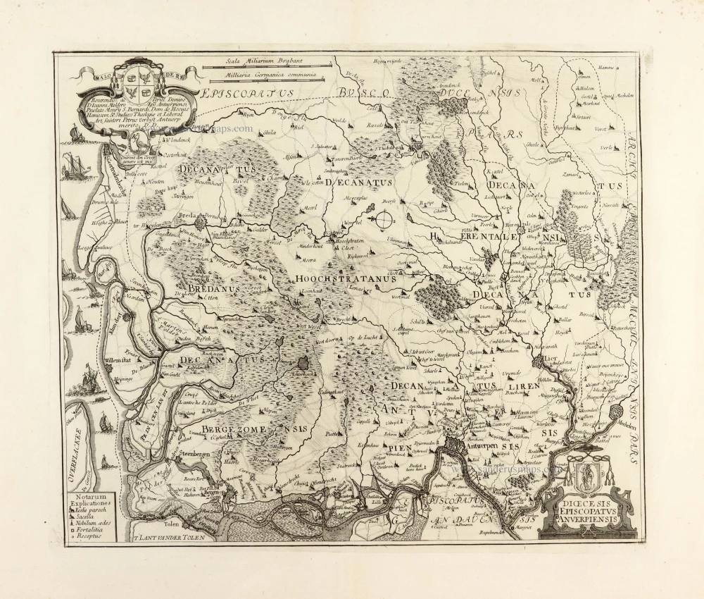
Dioecesis Episcopatus Anverpiensis. Before 1678
Diocese of Antwerp by Petrus Verbiest.
[Item number: 30172]