
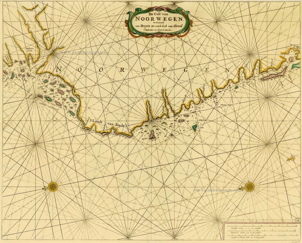
Sea chart of Norway, by Doncker H. 1686
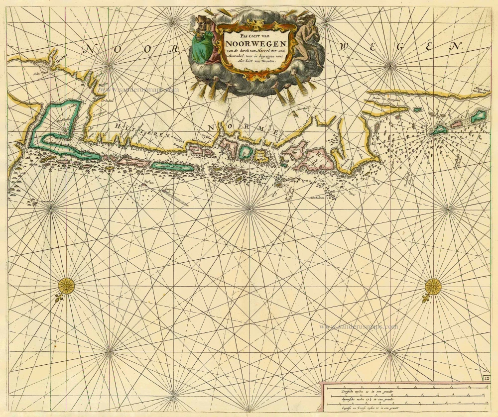
Pas caert van Noorwegen van de hoeck van Horrel tot aen Momendael, waer in begreepen wort Het Liet van Dronten.
Item Number: 17060 Authenticity Guarantee
Category: Antique maps > Europe > Northern Europe
Sea chart of Norway, by Doncker H.
Title: Pas caert van Noorwegen van de hoeck van Horrel tot aen Momendael, waer in begreepen wort Het Liet van Dronten.
Date: 1686.
Copper engraving, printed on paper.
Image size: 434 x 517mm (17.09 x 20.35 inches).
Sheet size: 500 x 550mm (19.69 x 21.65 inches).
Verso: Blank.
Condition: Original coloured, lower margin extended.
Condition Rating: A.
From: Le Grand & Nouveau Miroir ou Flambeau, De la Mer contenant la description de toutes les costes Marines Occidentalled & Septentrionalles, . . . Traduit de Flaman en François par Paul Yvounet. A Amsterdam Chés Henri Donker, . . . l'An 1686.
Related items
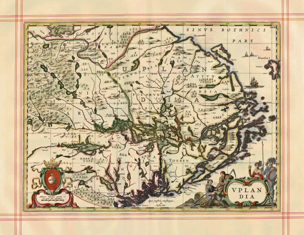
Uplandia 1680
Uppland by J. Janssonius, published by Moses Pitt and J. Janssonius-Waesberge.
[Item number: 1246]
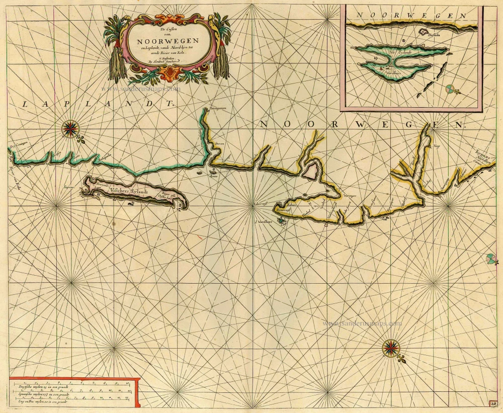
De Custen van Noorwegen en Laplandt, vande Noord-kyn tot aende Rivier van Kola. 1686
Sea chart of the coast of Norway, by Doncker H.
[Item number: 12920]
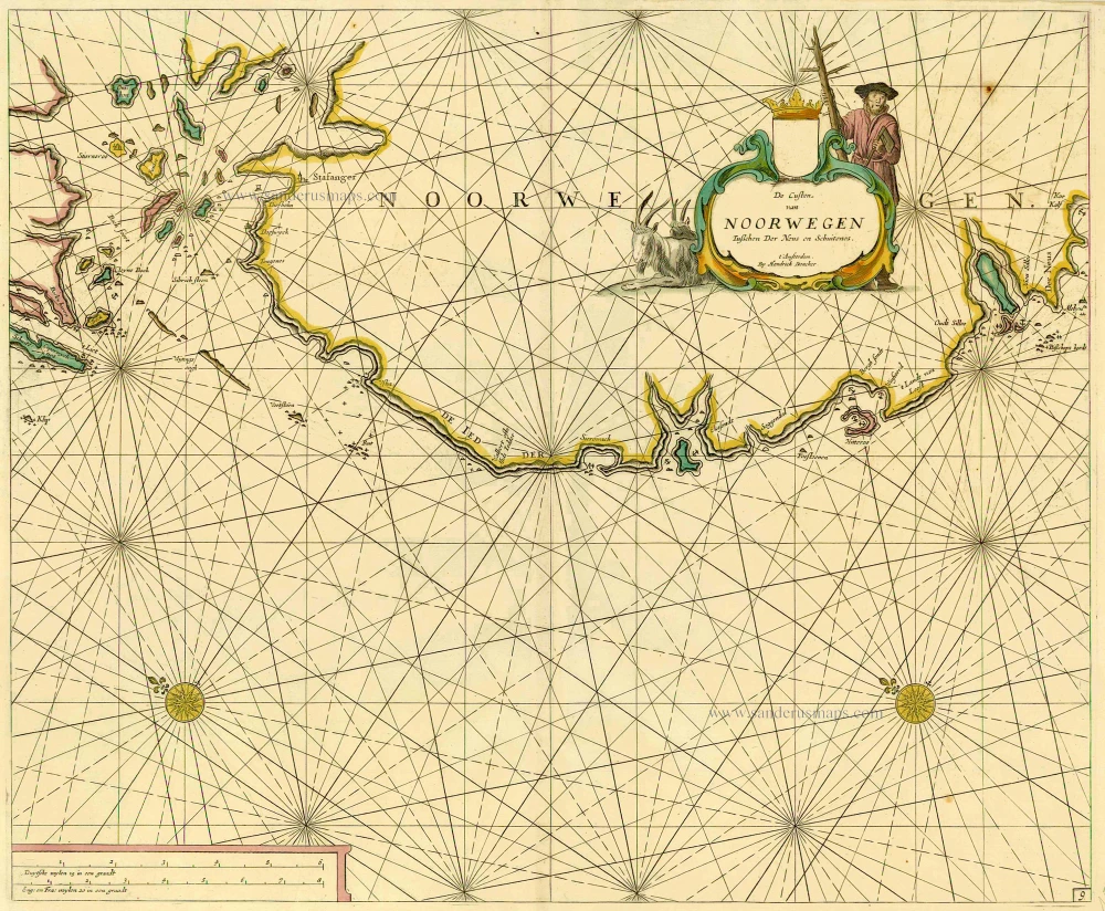
De Custen van Noorwegen tusschen Der Neus en Schuitenes. 1686
Sea chart of Norway, by Doncker H.
[Item number: 15775]
De Cust van Noorwegen vertoonende van Bergen tot aen de hoek van Horrel. 1686
Norway, by Doncker H.
[Item number: 17064]
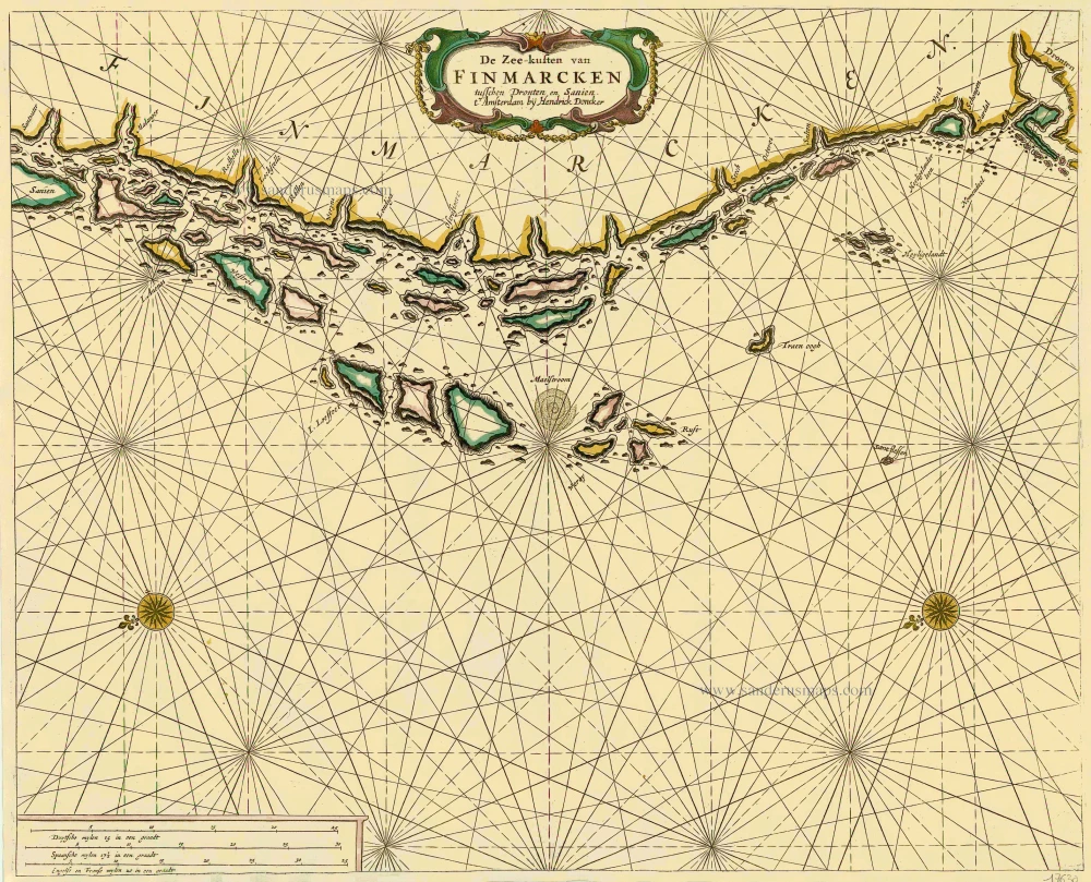
De Zee-kusten van Finmarcken tusschen Dronten en Sanien. 1686
Sea chart of Norway - Finnmark, by Doncker H.
[Item number: 17630]

Caarte van Finmargken van 't Eylandt Sanien tot Noordkyn. 1686
Sea chart of Norway - Finnmark, by Doncker H.
[Item number: 17900]
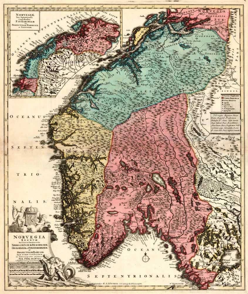
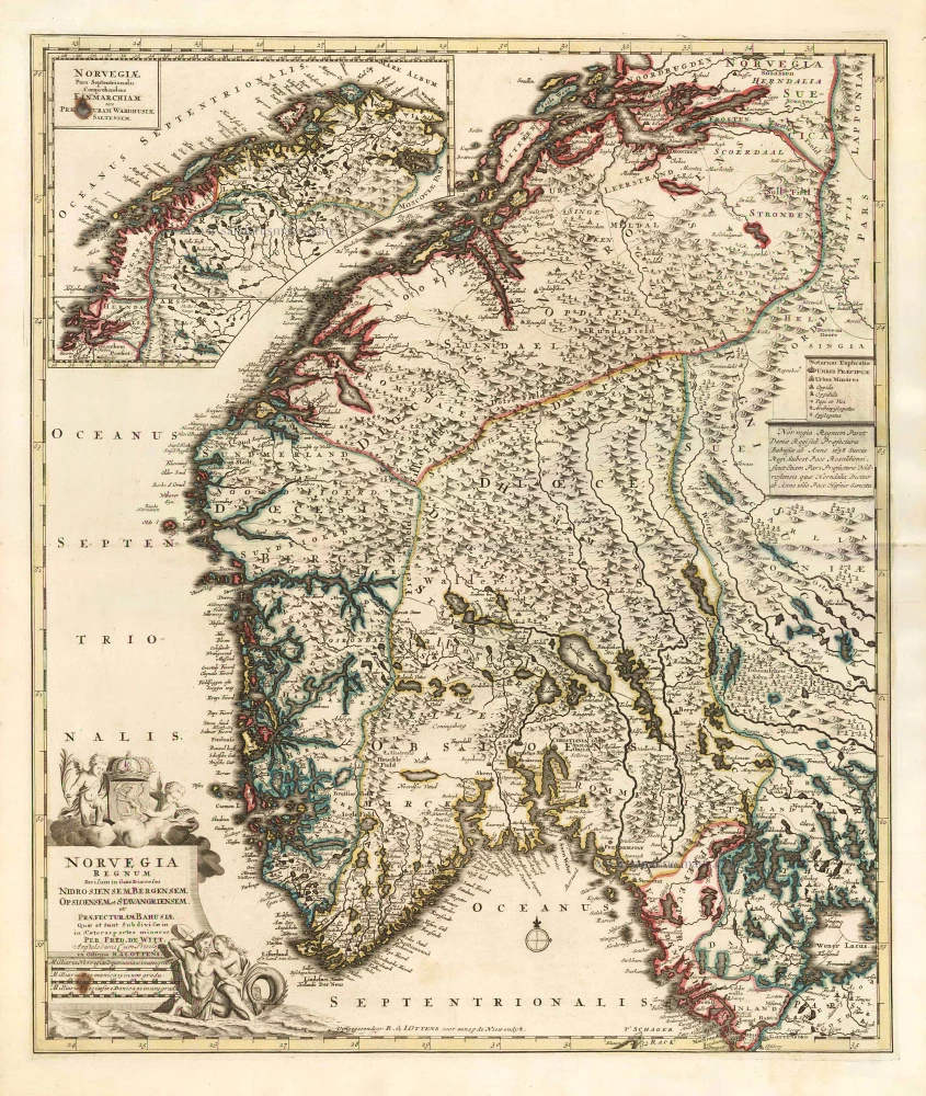
Norvegia Regnum Divisum in suos Dioeceses Nidrosiensem, Bergensem, Opsloensem, et Stavangriensem et Praefecturam Bahusiae ... 1756
Norway by F. de Wit - R. & J. Ottens.
[Item number: 23499]
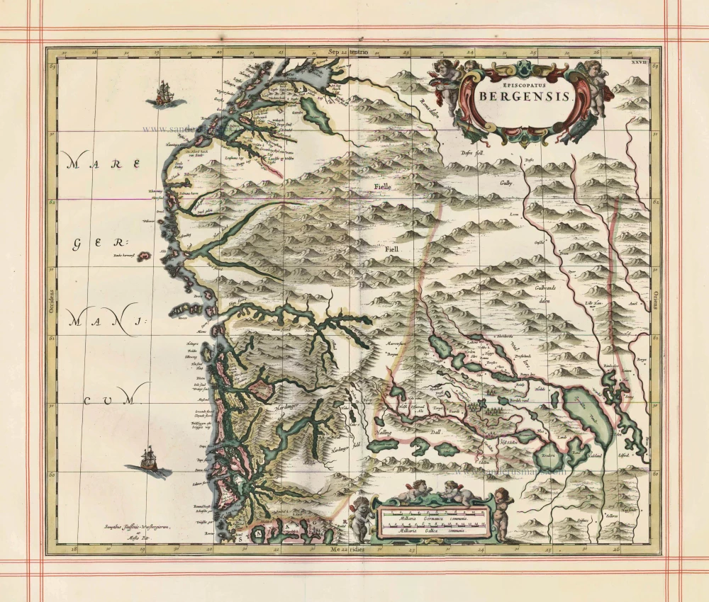
Episcopatus Bergensis 1680
Norway - Bergen, by J. Janssonius, published by Moses Pitt and J. Janssonius-Waesberge.
[Item number: 25068]
Norvegia Regnum Divisum in suos Dioeceses Nidrosiensem, Bergensem, Opsloensem, et Stavangriensem et Praefecturam Bahusiae ... 1756
Norway by F. De Wit, published by R. & J. Ottens.
[Item number: 25857]