
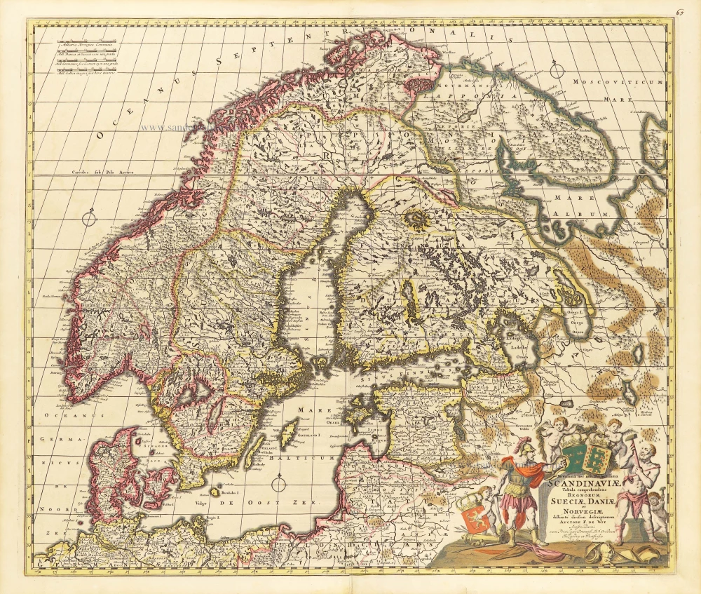
Scandinavia by Frederick de Wit. c. 1697-1704
Frederick de Wit (1630-1706)
The engraver and map-seller, Frederick de Wit, was born in Gouda (Netherlands) in 1630 as a son of Hendrick Fredericksz de Wit. Through his marriage with Maria van der Waag of Amsterdam in 1661, he obtained citizenship of the city where he had been working since 1648 and where he became one of the most famous engravers of maps of the second half of the 17th century. Although De Wit was a Catholic, which meant that he was not favoured at the time by the city council, he was awarded the honour of being listed as one of the "excellent citizens" on the roll of the city council in the years 1694-1704. However, his name was not written in the Guild of St. Luke book before 1664. At that time, he lived on the Kalverstraat "in de Witte Pascaert", where he stayed until his death in 1706. His earliest dates on maps engraved are 1659 (Regni Daniae) and 1660 (World map).
Frederick de Wit published several world atlases, a sea atlas, and an atlas of the Netherlands.
The dating of the maps is difficult. However, as a privilege was granted in 1689, the annotation 'cum privilegio' marks an edition after 1688.
Around 1700, Frederick de Wit entered the market with a town atlas. He produced two volumes with a total of 260 plans and views. Most were printed from plates used for Janssonius and Blaeu town atlases.
After he died in 1706, his widow continued the shop until 1709. The plates and stock of De Wit's atlas were sold to Covens & Mortier in 1710, who sold the atlas for an extended period.
Novissima nec non Perfectissima Scandinaviae Tabula Comprehendens Regnorum Sueciae, Daniae et Novegiae.
Item Number: 28738 Authenticity Guarantee
Category: Antique maps > Europe > Northern Europe
Old, antique map of Scandinavia by Frederick de Wit.
Title: Novissima nec non Perfectissima Scandinaviae Tabula Comprehendens Regnorum Sueciae, Daniae et Novegiae.
distincte dicisam descriptionem Auctore F. de Wit Amstelodami
cum Privilegio Potentiß. D.D. Ordinum Hollandiae et Westfrisiae.
Date of the first edition: c. 1689-90.
Date of this map: c. 1697-1704.
Copper engraving, printed on paper.
Map size: 500 x 585mm (19.69 x 23.03 inches).
Sheet size: 535 x 630mm (21.06 x 24.8 inches).
Condition: Original coloured, excellent.
Condition Rating: A.
From: Atlas Maior. Amsterdam, Frederick de Wit, after 1688.
Frederick de Wit (1630-1706)
The engraver and map-seller, Frederick de Wit, was born in Gouda (Netherlands) in 1630 as a son of Hendrick Fredericksz de Wit. Through his marriage with Maria van der Waag of Amsterdam in 1661, he obtained citizenship of the city where he had been working since 1648 and where he became one of the most famous engravers of maps of the second half of the 17th century. Although De Wit was a Catholic, which meant that he was not favoured at the time by the city council, he was awarded the honour of being listed as one of the "excellent citizens" on the roll of the city council in the years 1694-1704. However, his name was not written in the Guild of St. Luke book before 1664. At that time, he lived on the Kalverstraat "in de Witte Pascaert", where he stayed until his death in 1706. His earliest dates on maps engraved are 1659 (Regni Daniae) and 1660 (World map).
Frederick de Wit published several world atlases, a sea atlas, and an atlas of the Netherlands.
The dating of the maps is difficult. However, as a privilege was granted in 1689, the annotation 'cum privilegio' marks an edition after 1688.
Around 1700, Frederick de Wit entered the market with a town atlas. He produced two volumes with a total of 260 plans and views. Most were printed from plates used for Janssonius and Blaeu town atlases.
After he died in 1706, his widow continued the shop until 1709. The plates and stock of De Wit's atlas were sold to Covens & Mortier in 1710, who sold the atlas for an extended period.
Related items
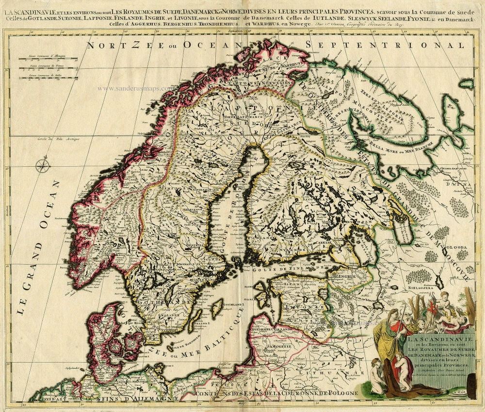
La Scandinavie, et les Environs, ou sont les Royaumes de Suede, de Danemark et de Norwege, divises en leurs principales Provinces. c. 1700
SCANDINAVIA by Schenk P.
[Item number: 19145]
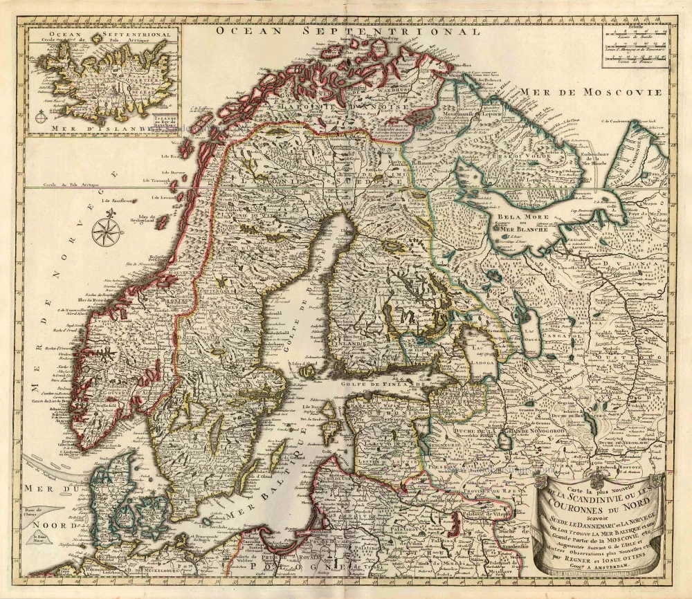
Carte la Plus Nouvelle de la Scandinivie ou les Couronnes du Nord Scavoir La Suede le Dannemarc et La Norvege Ou Lon Trouve La Mer Baltique et une Grande Partie de la Moscovie etc. 1730-45
Scandinavia par R. & I. Ottens.
[Item number: 25858]
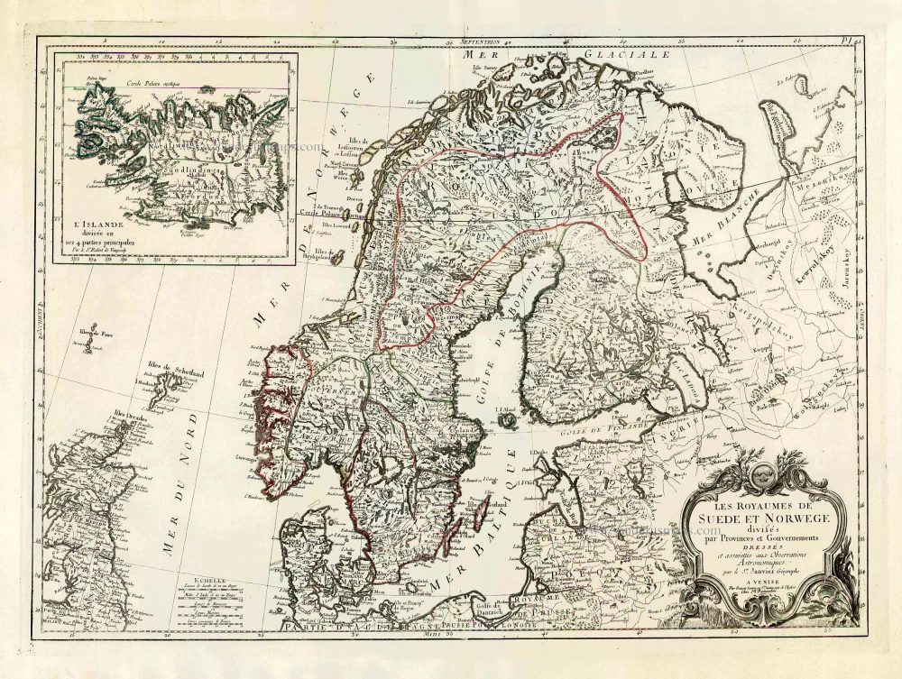
Les Royaumes de Suede et Norwege Divisés par Provinces et Gouvernements. 1776-79
Scandinavia, by Francesco Santini.
[Item number: 26964]
Rare and important map.
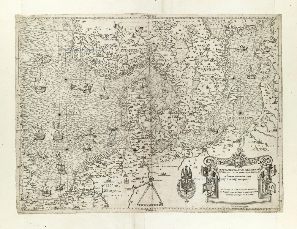
Septemtrionalium Regionum Svetiae Gothiae Norvegiae Daniae et terrarum adiacentium recens exactaq[ue] descriptio. 1558
Scandinavia, by Michele Tramezini.
[Item number: 27045]
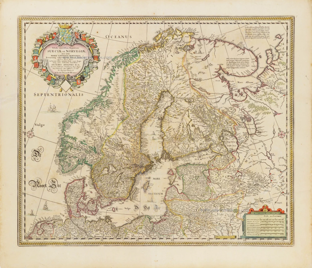
Tabula exactissima Regnorum Sueciae et Norvegiae, nec non Maris Universi Orientalis, 1656-80
Scandinavia by Nicolaas Visscher.
[Item number: 28742]
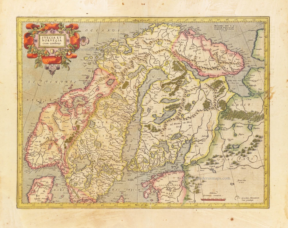
Svecia et Norvegia cum confinijs. 1628
Scandinavia, by Gerard Mercator.
[Item number: 28815]

Finmarchiae et Laplandiae Maritima. = Nieuwe Pascaert vande kusten Finmarcken en Lapland Streckende van Dronten tot Archangel. ca. 1680
The Coast of Lapland, by Frederick de Wit.
[Item number: 29219]
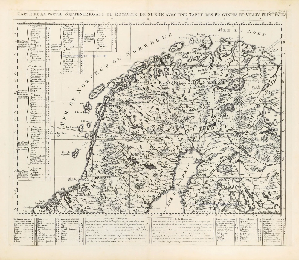
Carte de la Partie Septentrionale du Royaume de Suède avec une Table des Provinces et Villes Principales. 1714
Northern Scandinavia by Zacharias Châtelain.
[Item number: 29412]
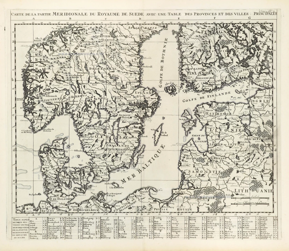
Carte de la Partie Meridionale du Royaume de Suède avec une Table des Provinces et Villes Principales. 1714
Southern Scandinavia by Zacharias Châtelain.
[Item number: 29413]