
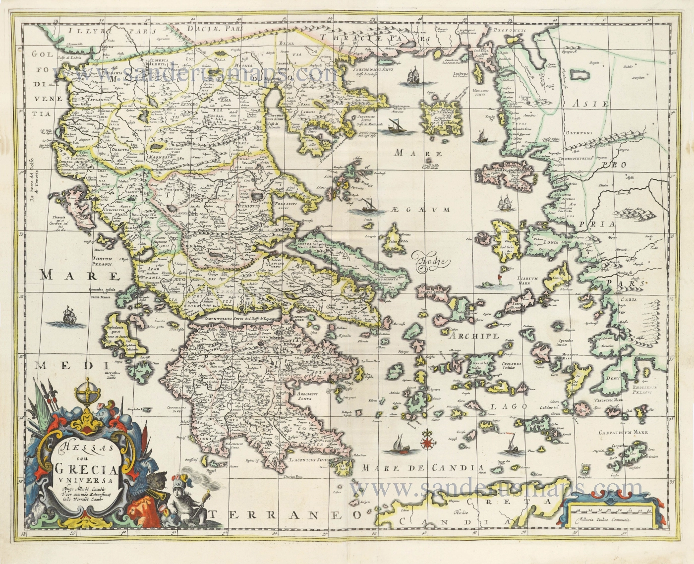
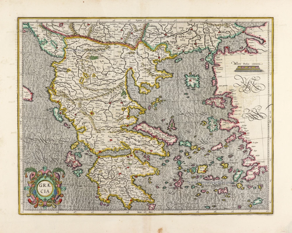
Greece by Hugo Allard. c. 1680
The Allard Family
The founder of this family of map-makers, publishers and print-sellers was Huych (Hugo) Allard (1625-1691). He worked in Amsterdam in 1684 and is supposed to have begun his business as early as 1645. He died in 1691, leaving his shop to his son, Carel Allard (1648-c. 1706). Carel brought out many maps and some atlases. His atlases are mainly composed of maps from the stock of other publishers like Janssonius and De Wit. However, some maps were his original creations. For these maps, the States of Holland granted him a privilege in 1683.
One of the sons of Carel, Abraham Allard (1676-c.1730), joined his father in the map trade and was accepted as a member of the ‘Constvercoopers gilde’ (Art dealer’s Guild) in 1708.
The original geographical maps by Allard, designed and cut between 1680 and 1700, are very decorative, well-composed and up-to-date.
Hellas seu Grecia Universa.
Item Number: 28523 Authenticity Guarantee
Category: Antique maps > Europe > Southeastern Europe
Old, antique map of Greece, by Hugo Allard.
Title: Hellas seu Grecia Universa.
Hugo Allardt Excudit Voor aen inde Kalverstraat inde Wereldt Caart.
VERY RARE.
Date: c. 1680.
Copper engraving, printed on paper.
Map size: 450 x 565mm (17.72 x 22.24 inches).
Sheet size: 490 x 590mm (19.29 x 23.23 inches).
Verso: Blank.
Condition: Original coloured, lower centrefold split reinforced.
Condition Rating: A.
References: Zacharakis, 95/84
Separate publication.
The Allard Family
The founder of this family of map-makers, publishers and print-sellers was Huych (Hugo) Allard (1625-1691). He worked in Amsterdam in 1684 and is supposed to have begun his business as early as 1645. He died in 1691, leaving his shop to his son, Carel Allard (1648-c. 1706). Carel brought out many maps and some atlases. His atlases are mainly composed of maps from the stock of other publishers like Janssonius and De Wit. However, some maps were his original creations. For these maps, the States of Holland granted him a privilege in 1683.
One of the sons of Carel, Abraham Allard (1676-c.1730), joined his father in the map trade and was accepted as a member of the ‘Constvercoopers gilde’ (Art dealer’s Guild) in 1708.
The original geographical maps by Allard, designed and cut between 1680 and 1700, are very decorative, well-composed and up-to-date.
Related items
Parergon map
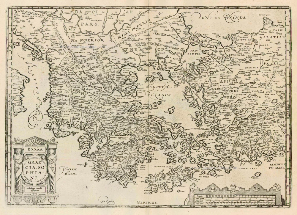
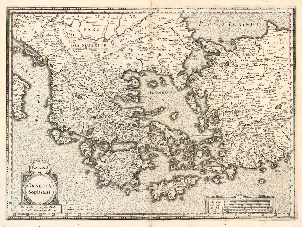
Graecia, Sophiani. 1624
Greece, by Ortelius A.
[Item number: 2050]
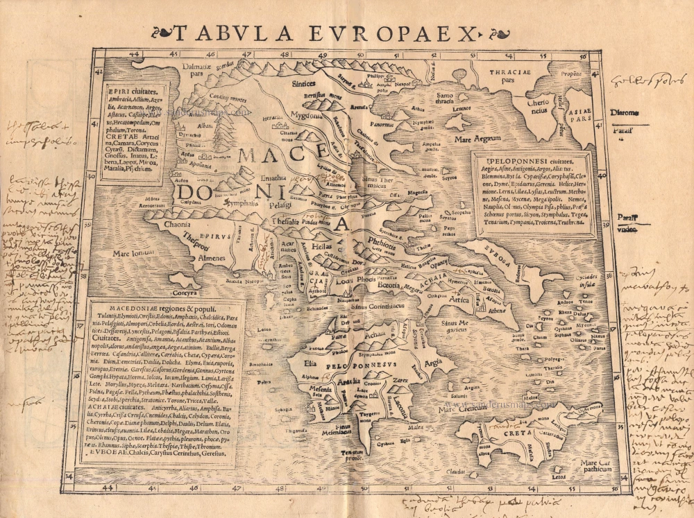
Tabula Europae X 1542
Greece, by Sebastian Münster.
[Item number: 14704]
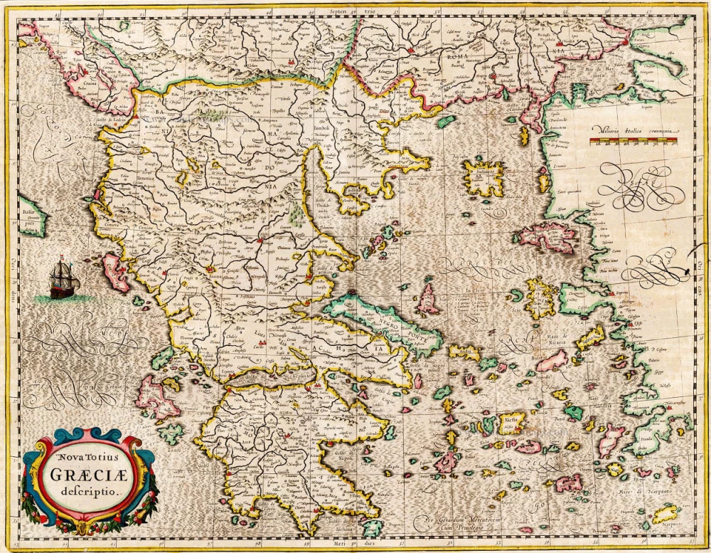
Nova Totius Graeciae descriptio. 1638
Greece, by J. Janssonius.
[Item number: 15357]
Graecia. 1633
Greece, by Gerard Mercator.
[Item number: 16999]

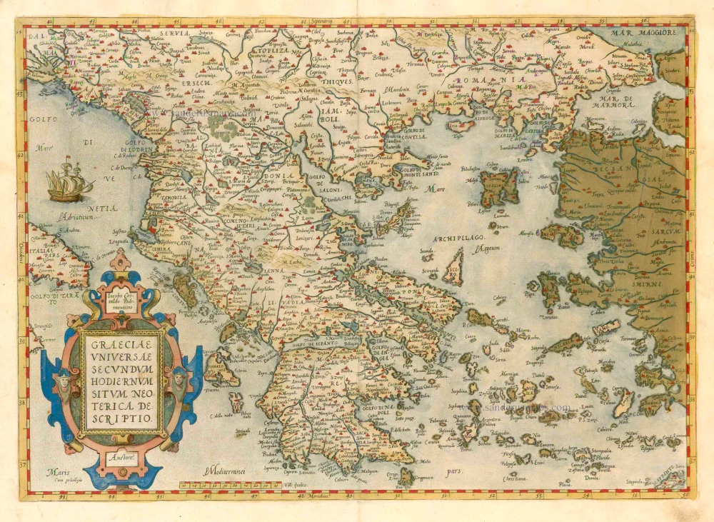
Graeciae Universae Secundum Hodiernum Situm Neoterica Descriptio. Jacobo Castaldo Pedemontano Autore. 1608
Greece, by Matthias Quad.
[Item number: 18856]
Graeciae Universae Secundum Hodiernum Situm Neoterica Descriptio. 1579
GREECE by Abraham Ortelius
[Item number: 23539]
Graecia Sophiani / Ex conatibus geographicis Abrahami Ortelii Antuerpiensis Ao. 1596 / Judocus Hondius excudit. 1618
Greece, by Bertius P. - Hondius J.
[Item number: 24541]
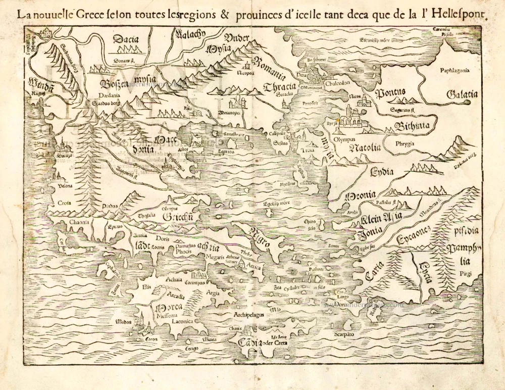
La nouvelle Grece selon toutes les regions & provinces d'icelle tant deca que de la l'Hellespont. 1555
Greece, by S. Munster.
[Item number: 25168]
Rare
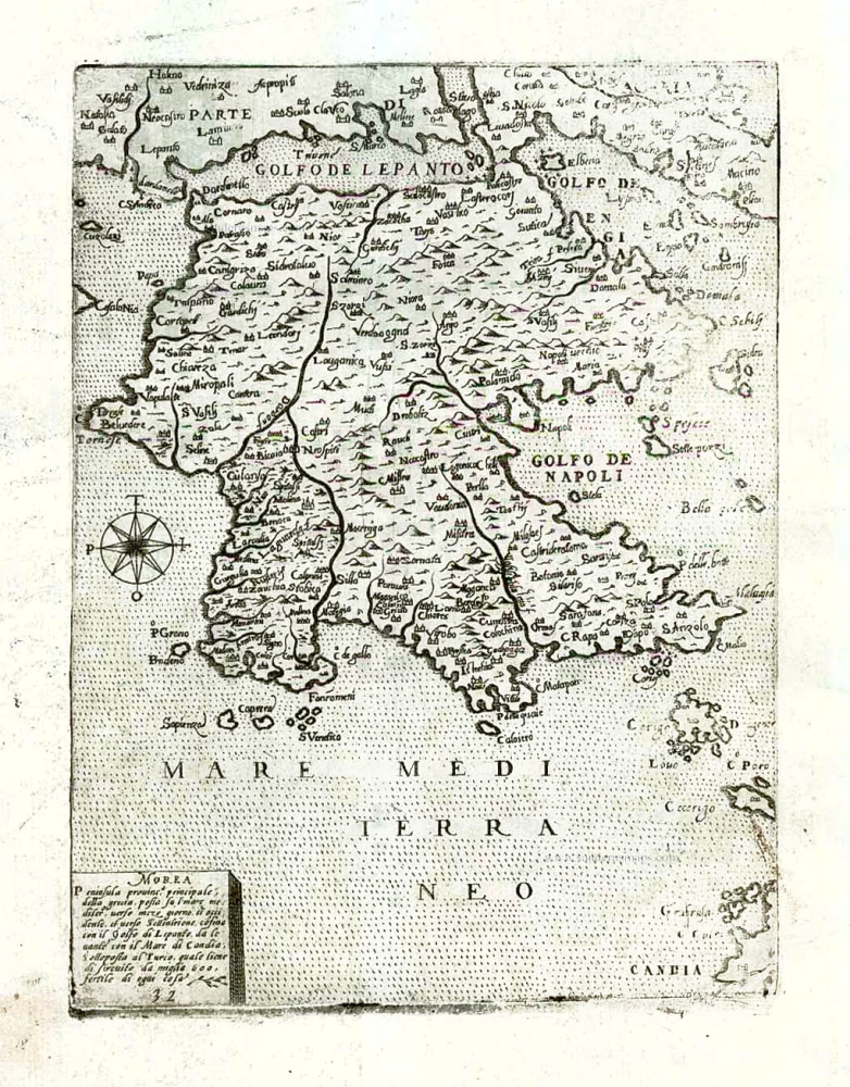
Morea Peninsula Provinc. principale della grecia posta sul mare mediter. ... After 1575
Peloponnese by Giovanni Francesco Camocio.
[Item number: 27584]
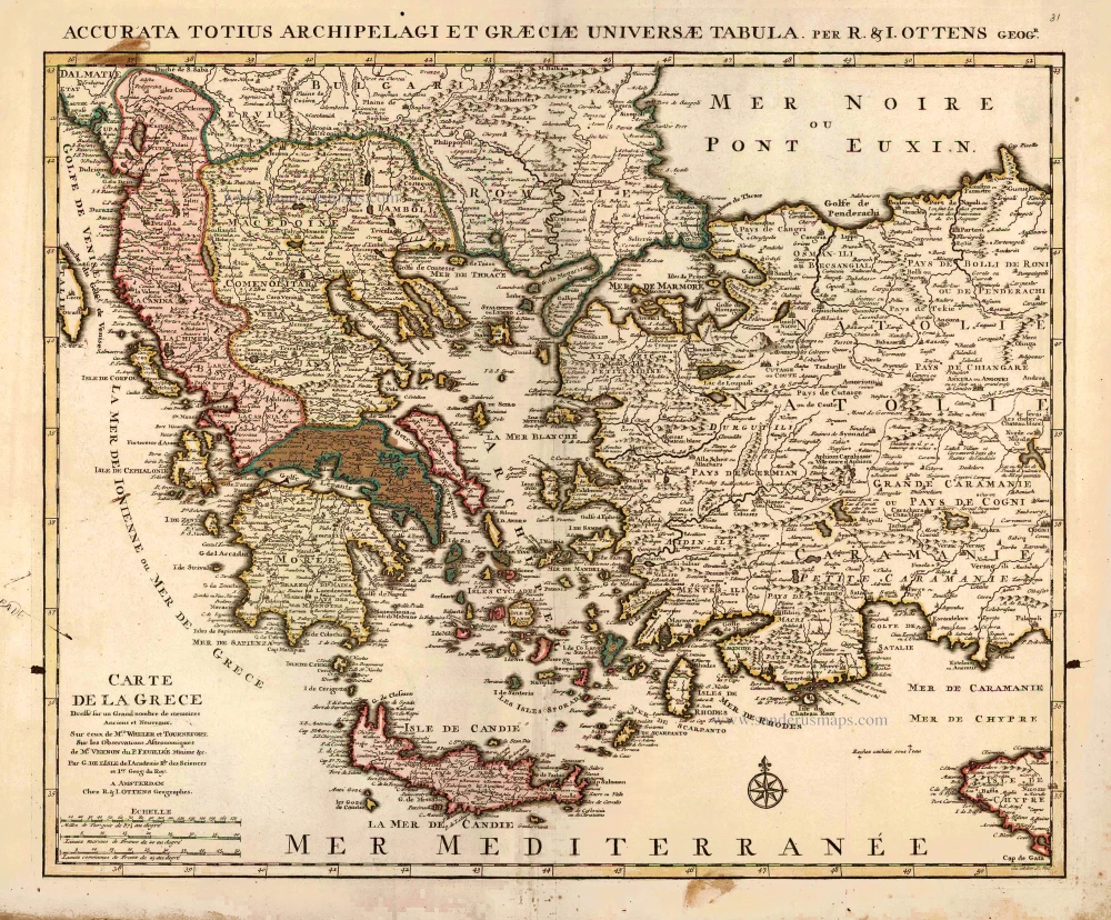
Carte de la Grece. 1725-50
Greece by Reinier & Josua Ottens
[Item number: 27699]
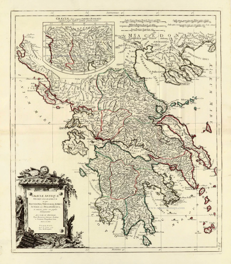
Graeciae Antiquae 1776-79
Ancient Greece, by Paolo Santini, after Jean-Baptiste Bourguignon d'Anville.
[Item number: 28108]
Ta Moder Bossinae, Serviae, Graeciae, et Sclavoniae. [From verso] 1525
Greece (Balkan), by Lorenz Fries after Martin Waldseemüller.
[Item number: 28117]
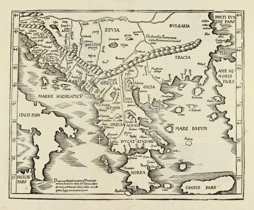
Tabula .X. Europae. [Title on verso] 1525
Ptolemy map of Greece by Lorenz Fries, after Martin Waldseemüller.
[Item number: 28196]
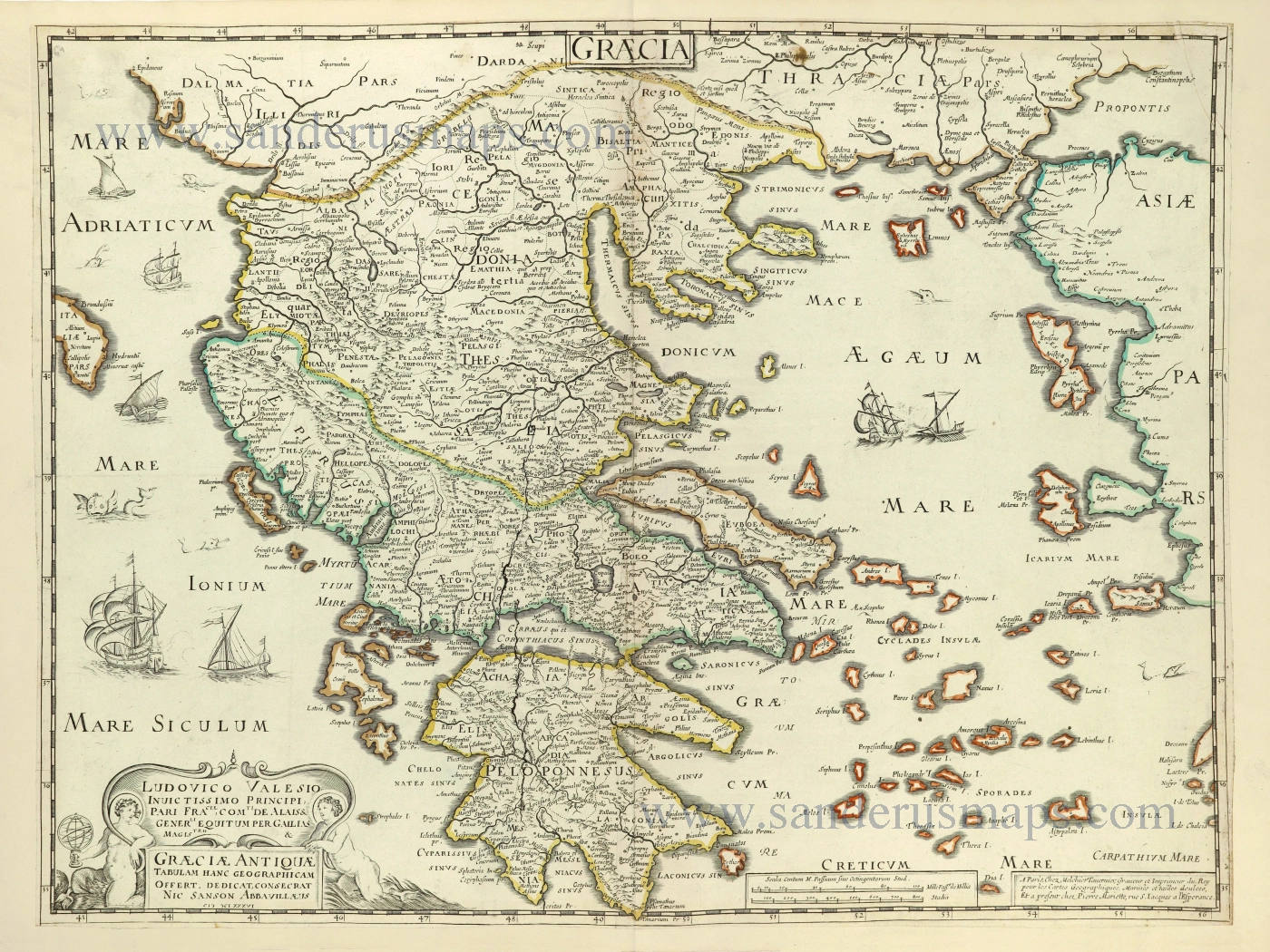
Graecia. 1658
Greece by Nicolas Sanson.
[Item number: 28498]
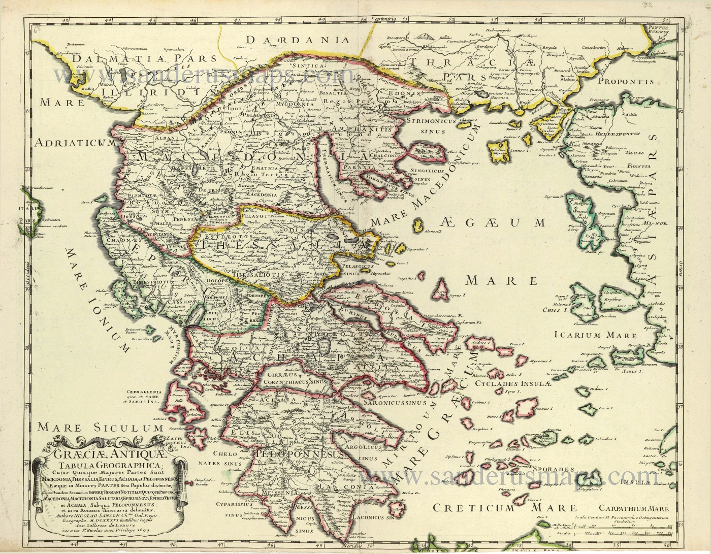
Graeciae Antique Tabula Geographica; 1699-1710
Greece by Nicolas & Guillaume Sanson.
[Item number: 28575]