
San Adrian by Georg Braun & Frans Hogenberg 1596
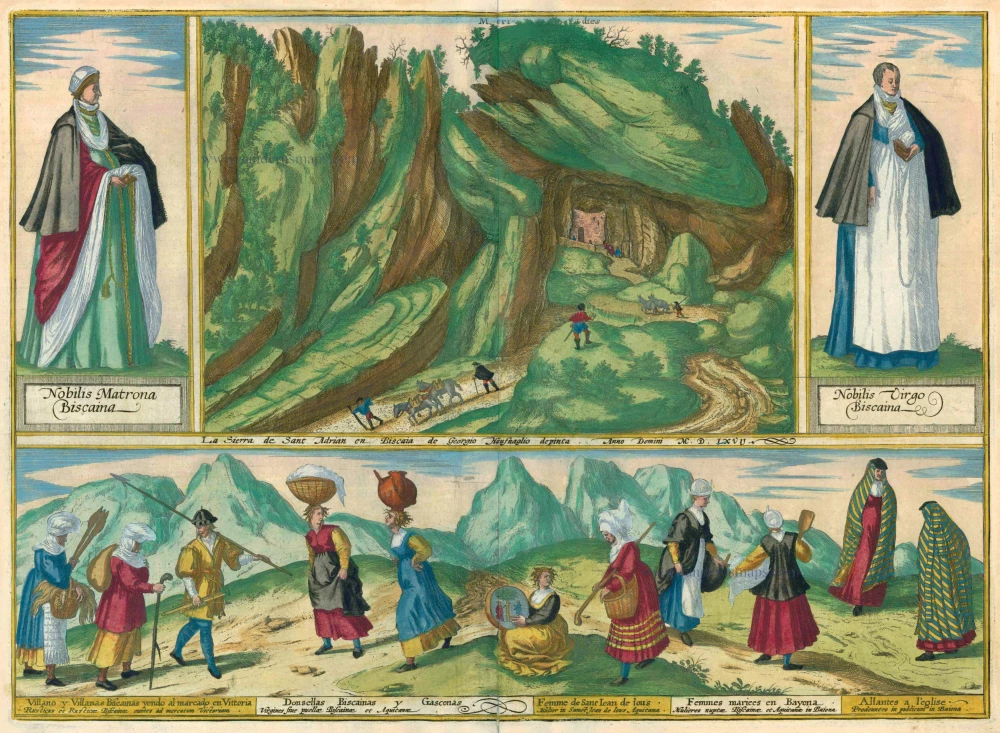


COMMENTARY BY BRAUN: "Spain is mountainous almost everywhere, but the Pyrenees surpass the other ranges in breadth and length. And since there are very many experienced miners in Spain, they have been able to survey the rocks, dig tunnels and thereby make it possible to pass through. A particularly fine example can be seen in this place in the Pyrenees, on the border of Spain and France. In the mountain of St Adrian, on the road that leads to France, there is a tunnel through which travellers can pass backwards and forwards."
Presented across this double page is a rocky landscape in the western foothills of the Pyrenees, south of the Bay of Biscay between San Sebastian and Vitoria-Gasteiz, capital of the province of Alava. A natural cave carved out of the rock by water was enlarged to create a tunnel easily large enough for pedestrian traffic between Spain and France, on a section of the way of St James. As one of the central routes through the Pyrenees, the tunnel was heavily used from the 15th to the 18th century. In the 16th century an inn for pilgrims opened inside the tunnel; on the French side, which was shut with gates at night, a toll post was established. Only in the 18th century, when the king of Spain built a paved road from Madrid to France, did the volume of traffic through the San Adrian tunnel start to decline. Illustrated on either side of the picture of the tunnel entrance and in the lower half of the plate are a number of costumed figures in traditional dress: on the left a noble Biscayan matron, on the right a noble Biscayan maiden and below (from left to right): a Biscayan peasant man and women on the way to market in Vitoria / Biscayan and Gascon maidens or girls / Woman from Saint-Jean-de-Luz, Aquitaine / Married Biscayan and Gascon women from Bayonne / Women on the way to church in Bayonne. (Taschen)
Braun G. & Hogenberg F. and the Civitates Orbis Terrarum.
The Civitates Orbis Terrarum, or the "Braun & Hogenberg", is a six-volume town atlas and the most excellent book of town views and plans ever published: 363 engravings, sometimes beautifully coloured. It was one of the best-selling works in the last quarter of the 16th century. Georg Braun wrote the text accompanying the plans and views on the verso. Many plates were engraved after the original drawings of a professional artist, a professional artist, Joris Hoefnagel (1542-1600). The first volume was published in Latin in 1572, and the sixth in 1617. Frans Hogenberg created the tables for volumes I through IV, and Simon van den Neuwel made those for volumes V and VI. Other contributors were cartographers Daniel Freese and Heinrich Rantzau. Works by Jacob van Deventer, Sebastian Münster, and Johannes Stumpf were also used. Translations appeared in German and French.
Following the original publication of Volume 1 of the Civitates in 1572, seven further editions of 1575, 1577, 1582, 1588, 1593, 1599 and 1612 can be identified. Vol.2, first issued in 1575, was followed by further editions in 1597 and 1612. The subsequent volumes appeared in 1581, 1588, 1593, 1599 and 1606. The German translation of the first volume appeared from 1574 on, and the French edition from 1575 on.
Several printers were involved: Theodor Graminaeus, Heinrich von Aich, Gottfried von Kempen, Johannis Sinniger, Bertram Buchholtz and Peter von Brachel, who all worked in Cologne.
Georg Braun (1541-1622)
Georg Braun was born in Cologne in 1541. After his studies in Cologne, he entered the Jesuit Order as a novice. 1561, he obtained his bachelor's degree, and in 1562, he received his Magister Artium. Although he left the Jesuit Order, he studied theology, gaining a licentiate in theology.
Frans Hogenberg (1535-1590)
Frans Hogenberg was a Flemish and German painter, engraver, and mapmaker. He was born in Mechelen as the son of Nicolaas Hogenberg.
By the end of the 1560s, Frans Hogenberg was employed upon Abraham Ortelius's Theatrum Orbis Terrarum, published in 1570; he is named an engraver of numerous maps. In 1568, he was banned from Antwerp by the Duke of Alva and travelled to London, where he stayed a few years before emigrating to Cologne. He immediately embarked on his two most important works, the Civitates, published in 1572 and the Geschichtsblätter, which appeared in several series from 1569 until about 1587.
Thanks to large-scale projects like the Geschichtsblätter and the Civitates, Hogenberg's social circumstances improved with each passing year. He died as a wealthy man in Cologne in 1590.
La Sierra de Sant Adrian en Biscaia de Georgio Houfnaglio depinta. Anno Domini M.D.LXVII.
Item Number: 24147 Authenticity Guarantee
Category: Antique maps > Europe > Spain and Portugal
One mountain view, two costumed figures and a country scene of Biscayan peasants going to market in Vitoria and other costumed locals.
COMMENTARY BY BRAUN: "Spain is mountainous almost everywhere, but the Pyrenees surpass the other ranges in breadth and length. And since there are very many experienced miners in Spain, they have been able to survey the rocks, dig tunnels and thereby make it possible to pass through. A particularly fine example can be seen in this place in the Pyrenees, on the border of Spain and France. In the mountain of St Adrian, on the road that leads to France, there is a tunnel through which travellers can pass backwards and forwards."
Presented across this double page is a rocky landscape in the western foothills of the Pyrenees, south of the Bay of Biscay between San Sebastian and Vitoria-Gasteiz, capital of the province of Alava. A natural cave carved out of the rock by water was enlarged to create a tunnel easily large enough for pedestrian traffic between Spain and France, on a section of the way of St James. As one of the central routes through the Pyrenees, the tunnel was heavily used from the 15th to the 18th century. In the 16th century an inn for pilgrims opened inside the tunnel; on the French side, which was shut with gates at night, a toll post was established. Only in the 18th century, when the king of Spain built a paved road from Madrid to France, did the volume of traffic through the San Adrian tunnel start to decline. Illustrated on either side of the picture of the tunnel entrance and in the lower half of the plate are a number of costumed figures in traditional dress: on the left a noble Biscayan matron, on the right a noble Biscayan maiden and below (from left to right): a Biscayan peasant man and women on the way to market in Vitoria / Biscayan and Gascon maidens or girls / Woman from Saint-Jean-de-Luz, Aquitaine / Married Biscayan and Gascon women from Bayonne / Women on the way to church in Bayonne. (Taschen)
The engraving is made after a drawing by Georg Hoefnagel.
Date of this print: 1596/97
Date of the first edition: 1596/97
Copper engraving
Size: 35.5 x 49cm (13.8 x 19.1 inches)
Verso text: Latin
Condition: Old coloured, excellent.
Condition Rating: A
References: Van der Krogt 4, 3836; ; Taschen, Braun and Hogenberg, p.366.
From: Urbium Praeipuarum Mundi Theatrum Quintum Auctore Georgio Braunio Agrippinate. Part 5. Köln, 1596/97. (Van der Krogt 4, 41:1.5)
COMMENTARY BY BRAUN: "Spain is mountainous almost everywhere, but the Pyrenees surpass the other ranges in breadth and length. And since there are very many experienced miners in Spain, they have been able to survey the rocks, dig tunnels and thereby make it possible to pass through. A particularly fine example can be seen in this place in the Pyrenees, on the border of Spain and France. In the mountain of St Adrian, on the road that leads to France, there is a tunnel through which travellers can pass backwards and forwards."
Presented across this double page is a rocky landscape in the western foothills of the Pyrenees, south of the Bay of Biscay between San Sebastian and Vitoria-Gasteiz, capital of the province of Alava. A natural cave carved out of the rock by water was enlarged to create a tunnel easily large enough for pedestrian traffic between Spain and France, on a section of the way of St James. As one of the central routes through the Pyrenees, the tunnel was heavily used from the 15th to the 18th century. In the 16th century an inn for pilgrims opened inside the tunnel; on the French side, which was shut with gates at night, a toll post was established. Only in the 18th century, when the king of Spain built a paved road from Madrid to France, did the volume of traffic through the San Adrian tunnel start to decline. Illustrated on either side of the picture of the tunnel entrance and in the lower half of the plate are a number of costumed figures in traditional dress: on the left a noble Biscayan matron, on the right a noble Biscayan maiden and below (from left to right): a Biscayan peasant man and women on the way to market in Vitoria / Biscayan and Gascon maidens or girls / Woman from Saint-Jean-de-Luz, Aquitaine / Married Biscayan and Gascon women from Bayonne / Women on the way to church in Bayonne. (Taschen)
Braun G. & Hogenberg F. and the Civitates Orbis Terrarum.
The Civitates Orbis Terrarum, or the "Braun & Hogenberg", is a six-volume town atlas and the most excellent book of town views and plans ever published: 363 engravings, sometimes beautifully coloured. It was one of the best-selling works in the last quarter of the 16th century. Georg Braun wrote the text accompanying the plans and views on the verso. Many plates were engraved after the original drawings of a professional artist, a professional artist, Joris Hoefnagel (1542-1600). The first volume was published in Latin in 1572, and the sixth in 1617. Frans Hogenberg created the tables for volumes I through IV, and Simon van den Neuwel made those for volumes V and VI. Other contributors were cartographers Daniel Freese and Heinrich Rantzau. Works by Jacob van Deventer, Sebastian Münster, and Johannes Stumpf were also used. Translations appeared in German and French.
Following the original publication of Volume 1 of the Civitates in 1572, seven further editions of 1575, 1577, 1582, 1588, 1593, 1599 and 1612 can be identified. Vol.2, first issued in 1575, was followed by further editions in 1597 and 1612. The subsequent volumes appeared in 1581, 1588, 1593, 1599 and 1606. The German translation of the first volume appeared from 1574 on, and the French edition from 1575 on.
Several printers were involved: Theodor Graminaeus, Heinrich von Aich, Gottfried von Kempen, Johannis Sinniger, Bertram Buchholtz and Peter von Brachel, who all worked in Cologne.
Georg Braun (1541-1622)
Georg Braun was born in Cologne in 1541. After his studies in Cologne, he entered the Jesuit Order as a novice. 1561, he obtained his bachelor's degree, and in 1562, he received his Magister Artium. Although he left the Jesuit Order, he studied theology, gaining a licentiate in theology.
Frans Hogenberg (1535-1590)
Frans Hogenberg was a Flemish and German painter, engraver, and mapmaker. He was born in Mechelen as the son of Nicolaas Hogenberg.
By the end of the 1560s, Frans Hogenberg was employed upon Abraham Ortelius's Theatrum Orbis Terrarum, published in 1570; he is named an engraver of numerous maps. In 1568, he was banned from Antwerp by the Duke of Alva and travelled to London, where he stayed a few years before emigrating to Cologne. He immediately embarked on his two most important works, the Civitates, published in 1572 and the Geschichtsblätter, which appeared in several series from 1569 until about 1587.
Thanks to large-scale projects like the Geschichtsblätter and the Civitates, Hogenberg's social circumstances improved with each passing year. He died as a wealthy man in Cologne in 1590.
Related items
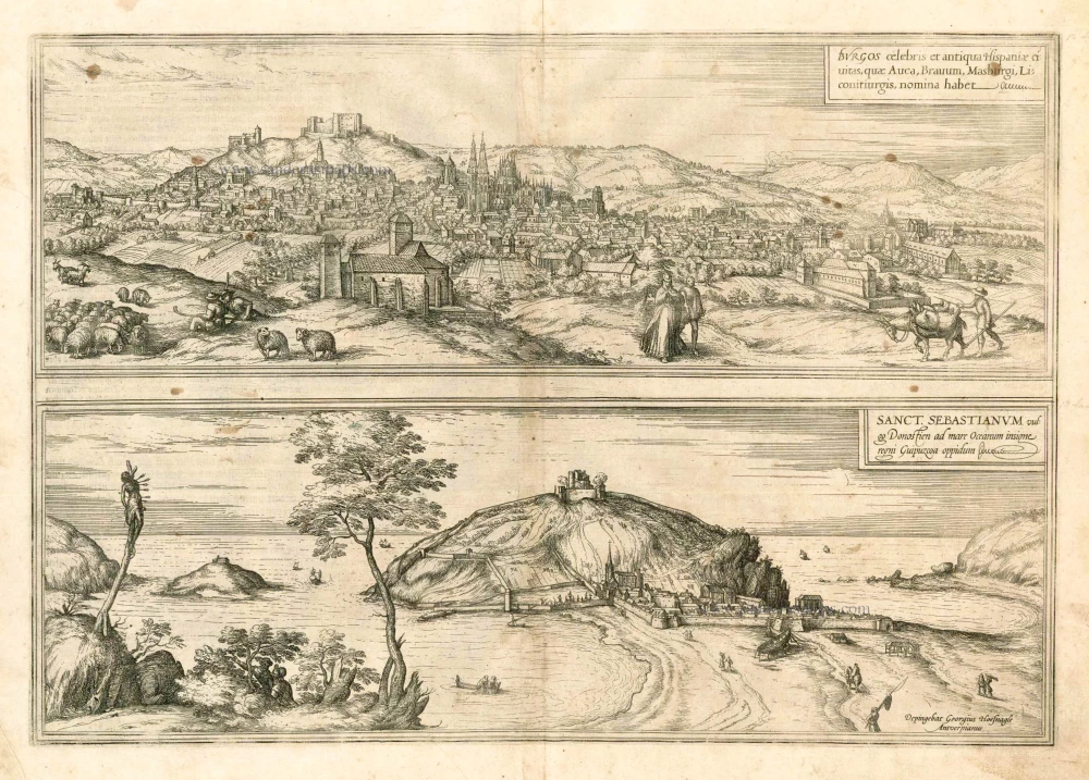
Burgos celebris et antiqua Hispaniae civitas, ... [on sheet with] Sanct. Sebastianum vulgo Donosien ad Occanum ... 1582
Burgos - San Sebastian by Braun & Hogenberg
[Item number: 14159]
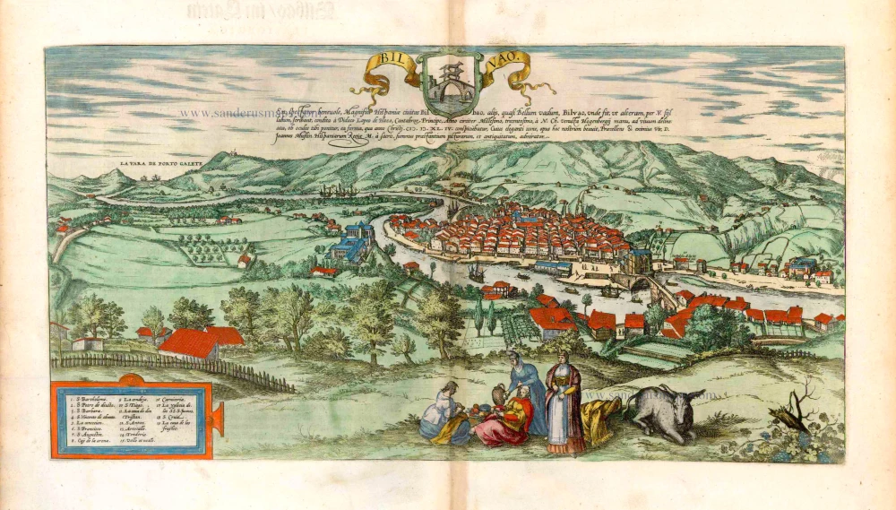
Bilvao. En, Spectator Benevole, Magnifica Hispaniae Civitas Bilbao ... 1576
Bilbao, by Georg Braun & Frans Hogenberg.
[Item number: 26703]