
Old antique map of the 17 Provinces, by Giovanni Magini. 1597
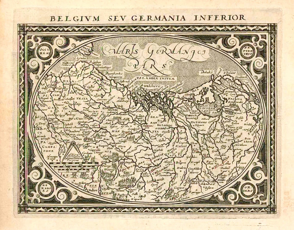
Belgium seu Germania Inferior.
Item Number: 26547 Authenticity Guarantee
Category: Antique maps > Europe > The Low Countries
Old, antique map of the 17 Provinces, by Giovanni Magini.
Oriented to the northwest.
Date of the first edition: 1596
Date of this map: 1597
Copper engraving, printed on paper.
Size (not including margins): 13 x 17cm (5.1 x 6.6 inches)
Verso text: Latin
Condition: Excellent.
Condition Rating: A+
References: Meurer (Cologne), Mag 61.
From: Geographicae Universae tum veteris novae . . . Auctore Io. Ant. Magino. Cologne, P. Keschedt, 1597. - Pirate edition after Magini's original work of 1596.
Ortelius informed Magini in November 1597 about this and the publication was stopped till 1608 when a new edition was issued by Keschedt.
Related items

Belgiae Inferioris descriptio emendata cum circu(m)jacentium regionum confinijs. 1609
The 17 Provinces, by Ludovico Guicciardini.
[Item number: 25913]
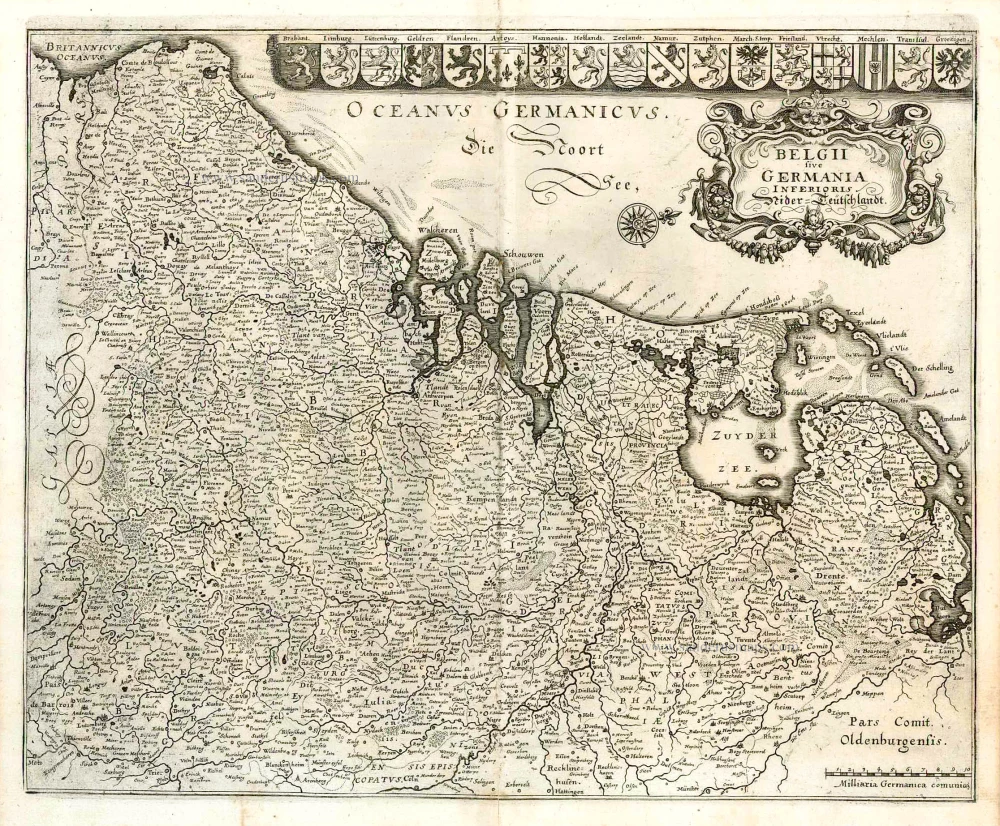
Belgii sive Germania Inferioris - Nider Teutschlandt. 1638
The 17 Provinces, by Matthäus Merian.
[Item number: 26030]
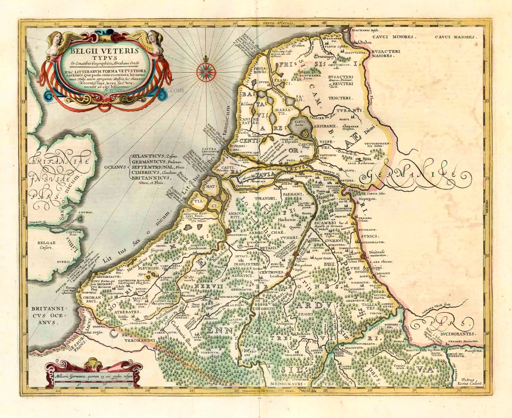
Belgii Veteris Typus. 1641
Ancient Low Countries, by Henricus Hondius.
[Item number: 26300]
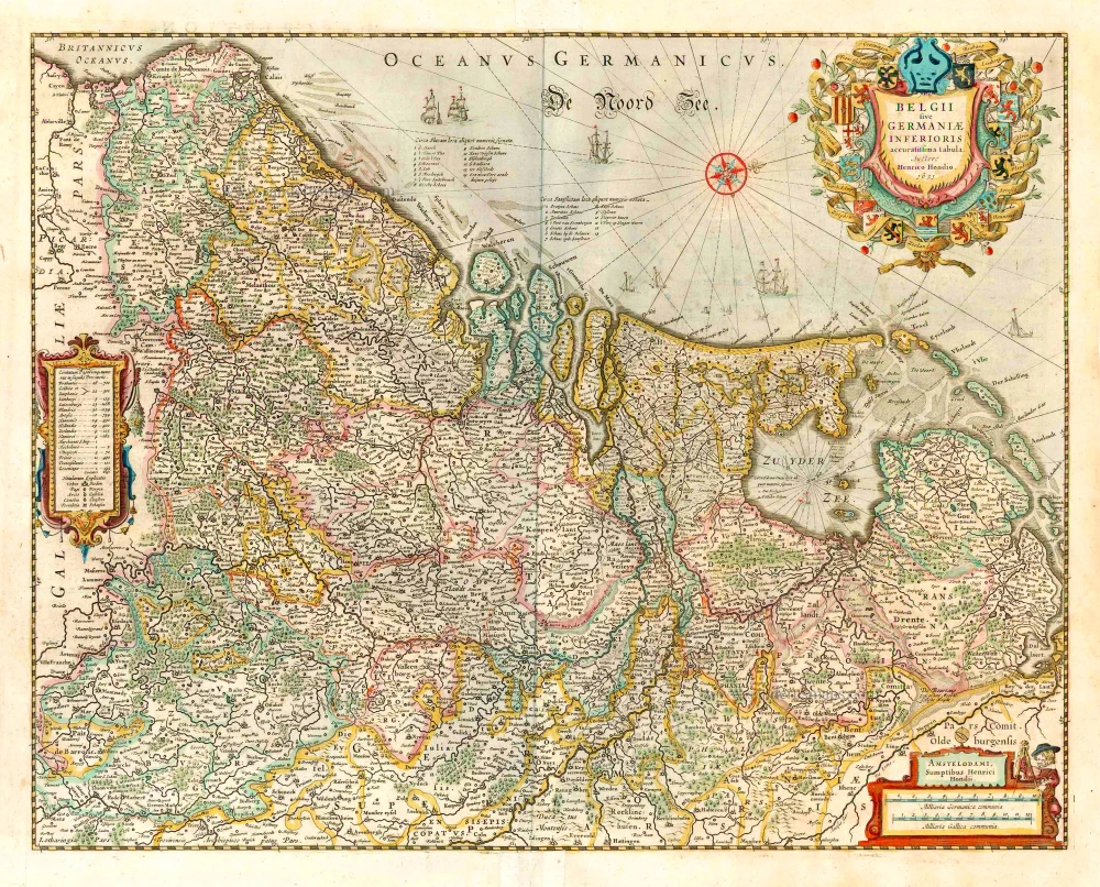
belgii sive germaniae inferioris accuratissima tabula. auctore henrico hondio 1631. amstelodami, sumptibus henrici hondio 1631. 1641
The 17 Provinces, by Henricus Hondius.
[Item number: 26301]