
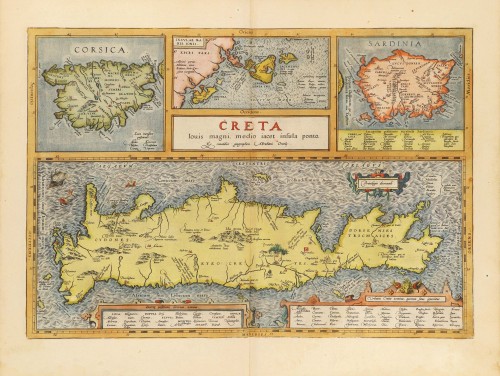
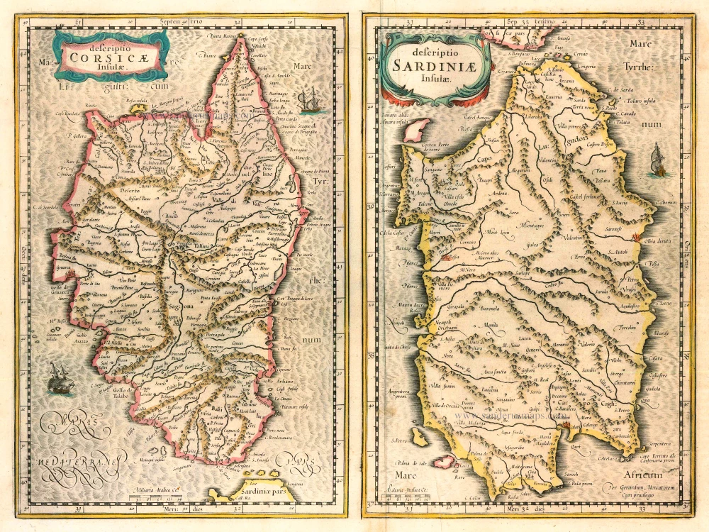
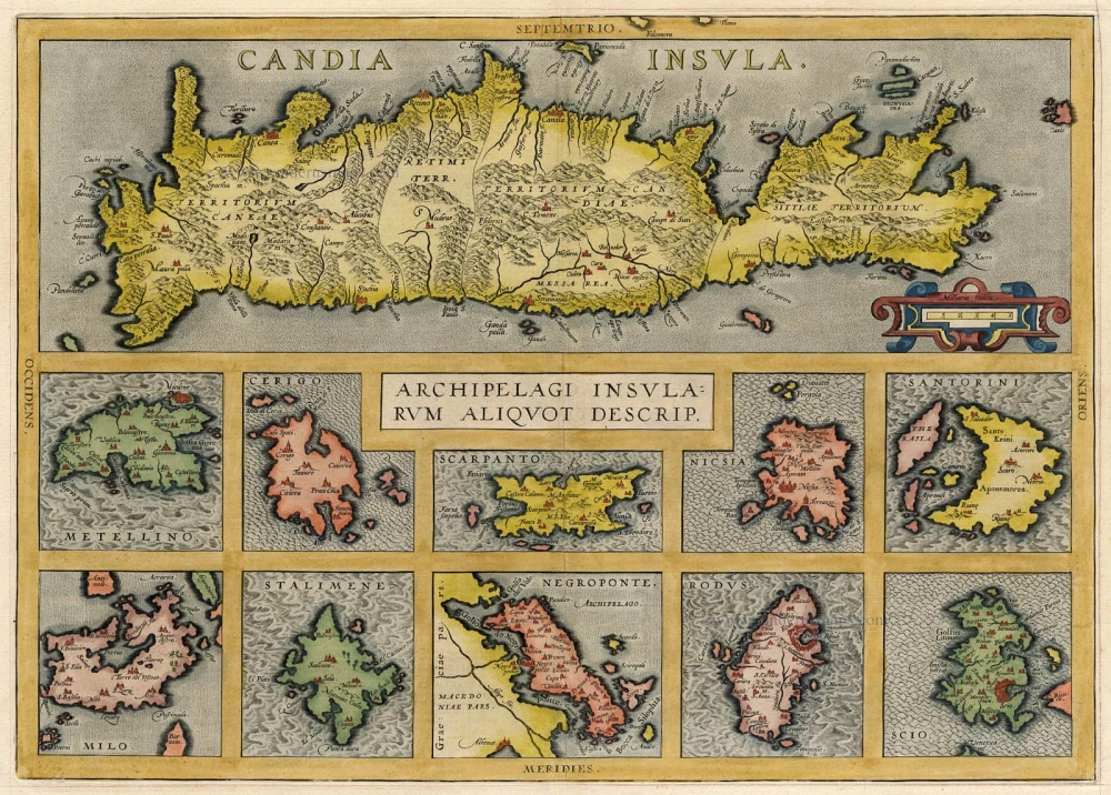
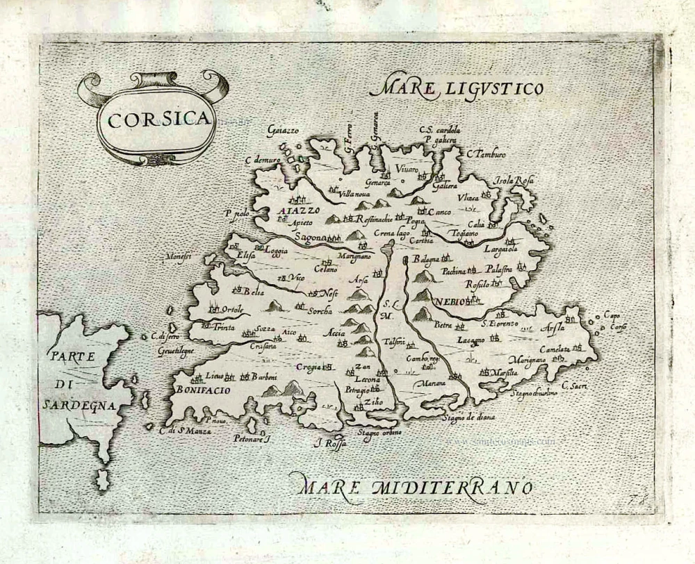
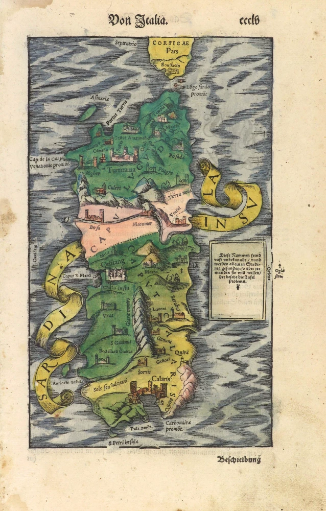
Corsica, Crete (Creta), Sardinia, by Abraham Ortelius. 1584

Abraham Ortelius (1527-1598)
The maker of the 'first atlas', the Theatrum Orbis Terrarum (1570), was born on 4 April 1527 into an old Antwerp family. He learned Latin and studied Greek and mathematics.
Abraham and his sisters Anne and Elizabeth took up map colouring. He was admitted to the Guild of St. Luke as an "illuminator of maps." Besides colouring maps, Ortelius was a dealer in antiques, coins, maps, and books, with the book and map trade gradually becoming his primary occupation.
Business went well because his means permitted him to start an extensive collection of medals, coins, antiques, and a library of many volumes. In addition, he travelled a lot and visited Italy and France, made contacts everywhere with scholars and editors, and maintained extensive correspondence with them.
In 1564 he published his first map, a large and ambitious world wall map. The inspiration for this map may well have been Gastaldi's large world map. In 1565 he published a map of Egypt and a map of the Holy Land, a large map of Asia followed.
In 1568 the production of individual maps for his atlas Theatrum Orbis Terrarum was already in full swing. He completed the atlas in 1569, and in May of 1570, the Theatrum was available for sale. It was one of the most expensive books ever published.
This first edition contained seventy maps on fifty-three sheets. Franciscus Hogenberg engraved the maps.
Later editions included Additamenta (additions), resulting in Ortelius' historical atlas, the Parergon, mostly bound together with the atlas. The Parergon can be called a truly original work of Ortelius, who drew the maps based on his research.
The importance of the Theatrum Orbis Terrarum for geographical knowledge in the last quarter of the sixteenth century is difficult to overemphasize. Nothing was like it until Mercator's atlas appeared twenty-five years later. Demand for the Theatrum was remarkable. Some 24 editions appeared during Ortelius's lifetime and another ten after his death in 1598. Editions were published in Dutch, German, French, Spanish, English, and Italian. The number of map sheets grew from 53 in 1570 to 167 in 1612 in the last edition.
In 1577, engraver Philip Galle and poet-translator Pieter Heyns published the first pocket-sized edition of the Theatrum, the Epitome. The work was trendy. Over thirty editions of this Epitome were published in different languages.
Creta Iovis magni, medio iacet insula ponto. [On sheet with:] Corsica [and:] Insulae Maris Ionii [and:] Sardinia.
Item Number: 29148 Authenticity Guarantee
Category: Antique maps > Mediterranean Sea
Old, antique map of Corsica, Crete (Creta), Sardinia, by Abraham Ortelius.
Title: Creta Iovis magni, medio iacet insula ponto. [On sheet with:] Corsica [and:] Insulae Maris Ionii [and:] Sardinia.
Ex conatibus geographicis Abrahami Ortelij.
Cartographer: Abraham Ortelius.
Date of the first edition: 1584.
Date of this map: 1584.
Copper engraving, printed on paper.
Map size: 340 x 492mm (13.39 x 19.37 inches).
Sheet size: 420 x 550mm (16.54 x 21.65 inches).
Verso: Latin text.
Condition: Original coloured, excellent.
Condition Rating: A+.
From: Theatrum Orbis Terrarum. Antwerp, Christoffel Plantin, 1584. (Van der Krogt, 31:031)
Abraham Ortelius (1527-1598)
The maker of the 'first atlas', the Theatrum Orbis Terrarum (1570), was born on 4 April 1527 into an old Antwerp family. He learned Latin and studied Greek and mathematics.
Abraham and his sisters Anne and Elizabeth took up map colouring. He was admitted to the Guild of St. Luke as an "illuminator of maps." Besides colouring maps, Ortelius was a dealer in antiques, coins, maps, and books, with the book and map trade gradually becoming his primary occupation.
Business went well because his means permitted him to start an extensive collection of medals, coins, antiques, and a library of many volumes. In addition, he travelled a lot and visited Italy and France, made contacts everywhere with scholars and editors, and maintained extensive correspondence with them.
In 1564 he published his first map, a large and ambitious world wall map. The inspiration for this map may well have been Gastaldi's large world map. In 1565 he published a map of Egypt and a map of the Holy Land, a large map of Asia followed.
In 1568 the production of individual maps for his atlas Theatrum Orbis Terrarum was already in full swing. He completed the atlas in 1569, and in May of 1570, the Theatrum was available for sale. It was one of the most expensive books ever published.
This first edition contained seventy maps on fifty-three sheets. Franciscus Hogenberg engraved the maps.
Later editions included Additamenta (additions), resulting in Ortelius' historical atlas, the Parergon, mostly bound together with the atlas. The Parergon can be called a truly original work of Ortelius, who drew the maps based on his research.
The importance of the Theatrum Orbis Terrarum for geographical knowledge in the last quarter of the sixteenth century is difficult to overemphasize. Nothing was like it until Mercator's atlas appeared twenty-five years later. Demand for the Theatrum was remarkable. Some 24 editions appeared during Ortelius's lifetime and another ten after his death in 1598. Editions were published in Dutch, German, French, Spanish, English, and Italian. The number of map sheets grew from 53 in 1570 to 167 in 1612 in the last edition.
In 1577, engraver Philip Galle and poet-translator Pieter Heyns published the first pocket-sized edition of the Theatrum, the Epitome. The work was trendy. Over thirty editions of this Epitome were published in different languages.
Related items

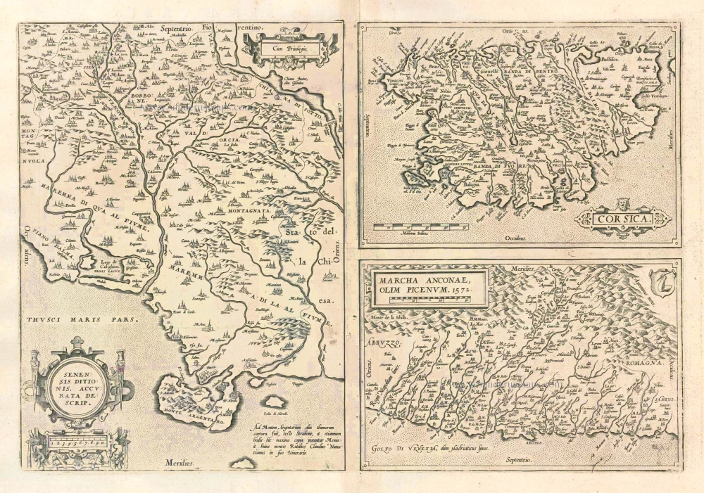
Senensis Ditionis - Corsica - Marcha Anconae olim Picenum. 1572. 1581
Siena - Corsica - Ancona, by Ortelius A.
[Item number: 6252]
Senensis Ditionis - Corsica - Marcha Anconae olim Picenum. 1572. 1612
Siena - Corsica - Ancona, by Ortelius A.
[Item number: 22975]
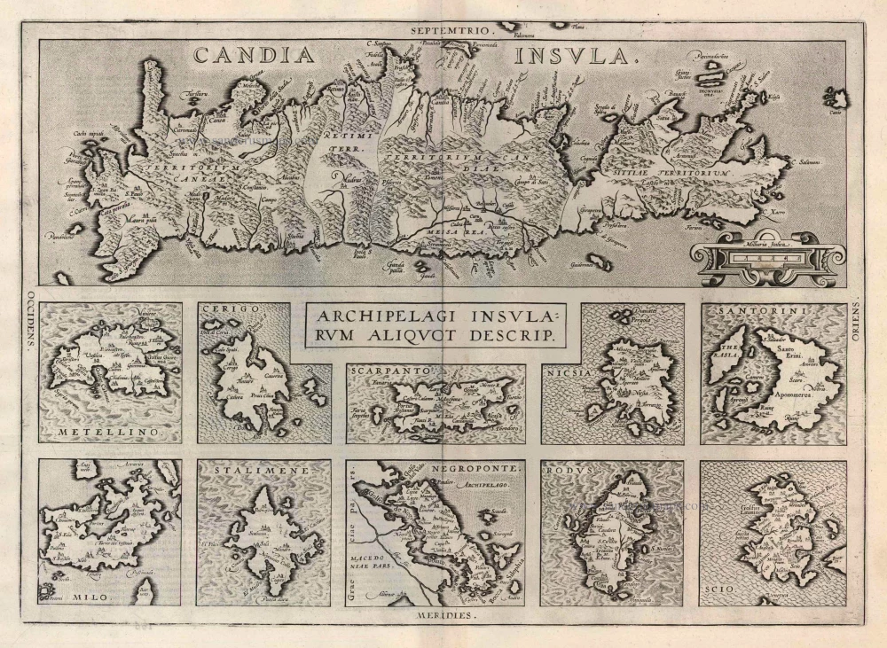
Candia Insula [on sheet with] Archipelagi Insularum aliquot descrip. 1612
Crete and 10 Aegean islands, by Abraham Ortelius.
[Item number: 22976]
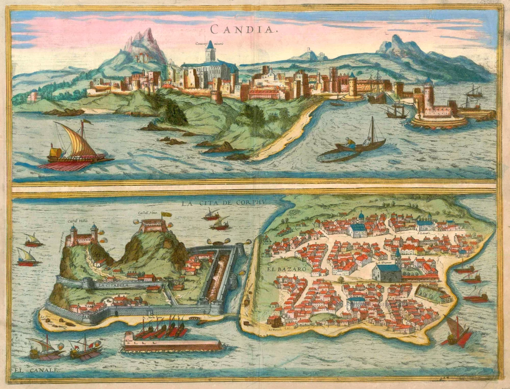
Candia [on sheet with] La Cita de Corphu 1597
Crete (Iraklion) & Corfu, by Georg Braun and Frans Hogenberg.
[Item number: 23289]
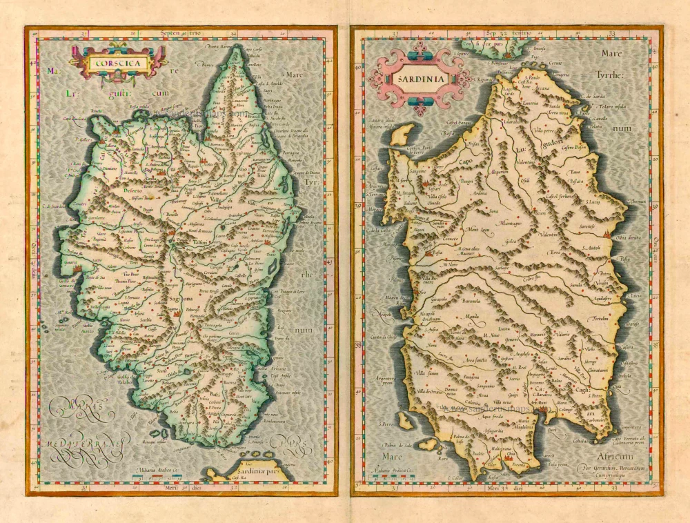
Descriptio Corsicae Insulae [on sheet with:] Descriptio Sardinae Insulae. 1639
CORSICA - SARDINIA by Mercator G. - Hondius H.
[Item number: 24455]

Creta Iovis magni, medio iacet insula ponto. Ex conatibus geographicis Abrahami Ortelij. [On sheet with:] Corsica [and:] Insulae Maris Ionii [and:] Sardinia 1624
Crete, Corsica and Sardinia by Ortelius A.
[Item number: 2052]
Corscica [on sheet with:] Sardinia. 1623
Corsica - Sardinia by Mercator Gerard - Hondius Henricus
[Item number: 24914]
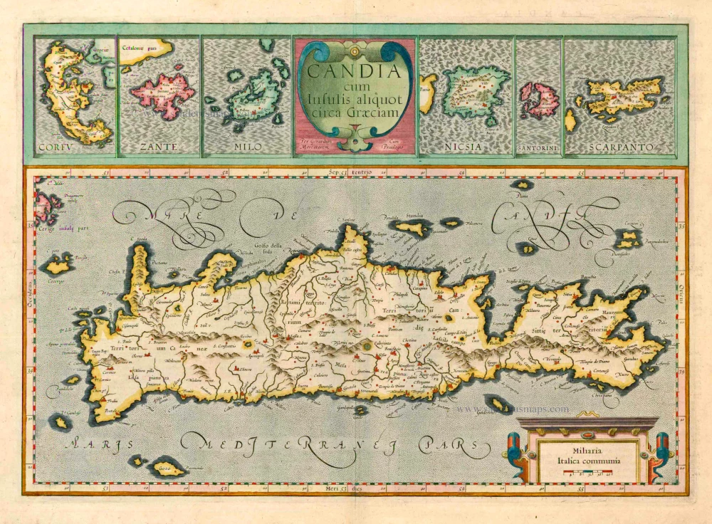
Candia cum insulis aliquot circa Graeciam. 1623
Crete with the isles of Corfu, Zante, Milo, Nicsia, Santorini and Scarpanto by Gerard Mercator.
[Item number: 20541]

Cyprus Insula - Candia, olim Creta. 1572
Cyprus - Crete, by A. Ortelius.
[Item number: 16585]
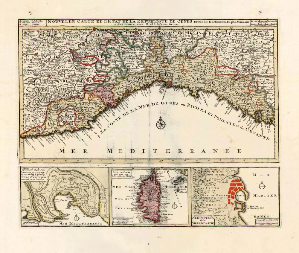
Nouvelle Carte de l'Etat et de la Republique de Genes. 1730-45
Liguria - Corsica, by Ottens R. & I.
[Item number: 25917]
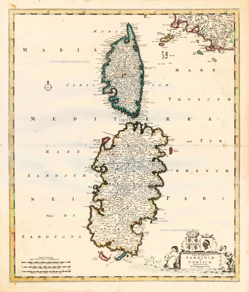
Insularum Sardiniae et Corsicae Descriptio. c. 1680
Corsica & Sardinia, by F. De Wit.
[Item number: 25914]
Candia Insula [on sheet with] Archipelagi Insularum aliquot descrip. 1598
Crete by Ortelius A.
[Item number: 14650]
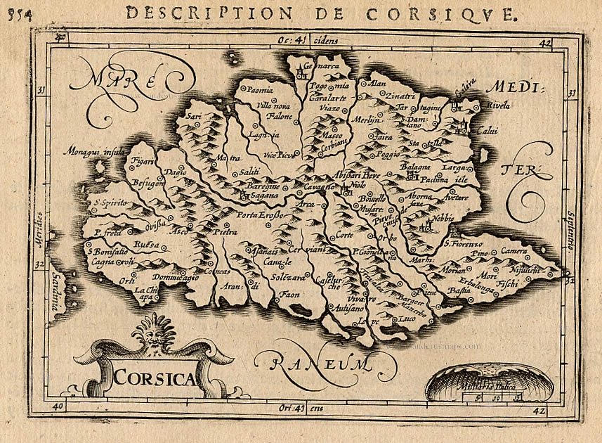
Corsica. 1618
Corse (Corsica), by P. Bertius.
[Item number: 26538]
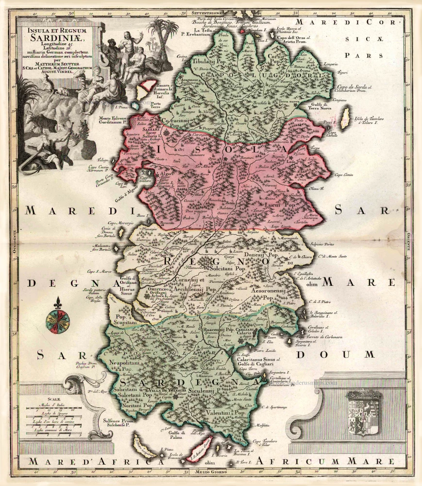
Insula et Regnum Sardiniae. c. 1741
Sardinia, by George Matthaus Seutter.
[Item number: 1857]
Sardinia Insula. 1640
Sardinia, by Willem & Joan Blaeu
[Item number: 27240]

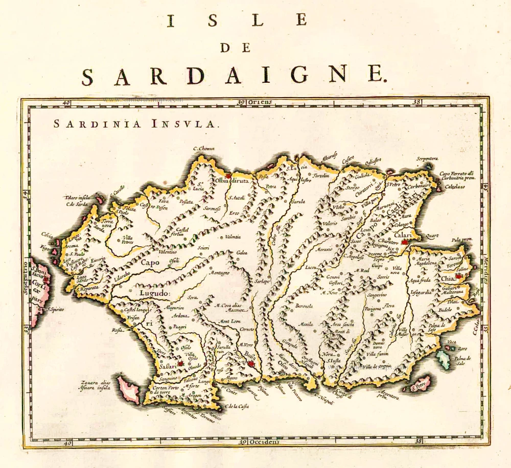
Sardinia.. 1575
Sardinia., by François de Belleforest.
[Item number: 27284]

De L'Isle de Corse. 1575
Corsica, by François de Belleforest.
[Item number: 27286]
Rare et important
Corsica. After 1575
Corsica by Giovanni Francesco Camocio
[Item number: 27565]
Rare
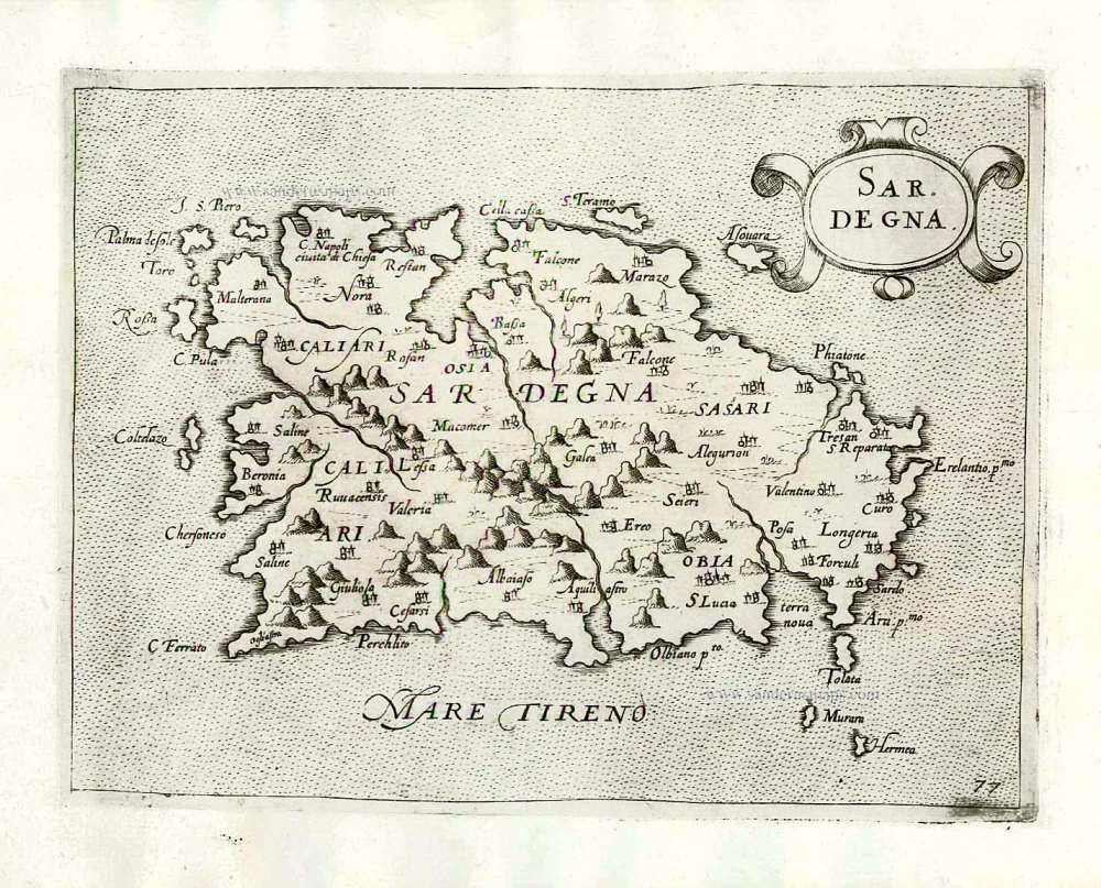
Sardegna. c. 1575
Sardinia (Sardegna) by Giovanni Francesco Camocio
[Item number: 27576]
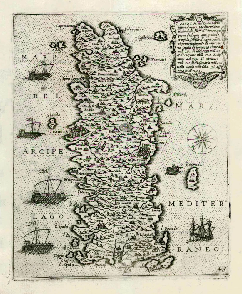
Candia vel Creta insula posta nel mare Mediterraneo ... After 1575
Crete (Creta) by Giovanni Francesco Camocio
[Item number: 27579]
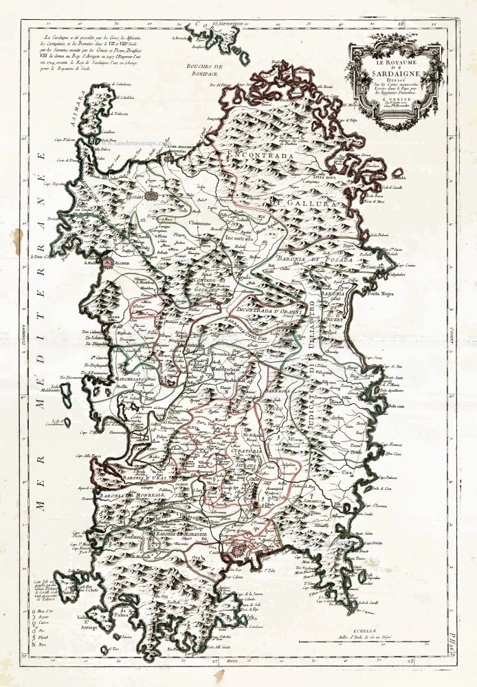
Le Royaume de Sardaigne. 1776-79
Sardinia, by Paolo Santini.
[Item number: 27734]
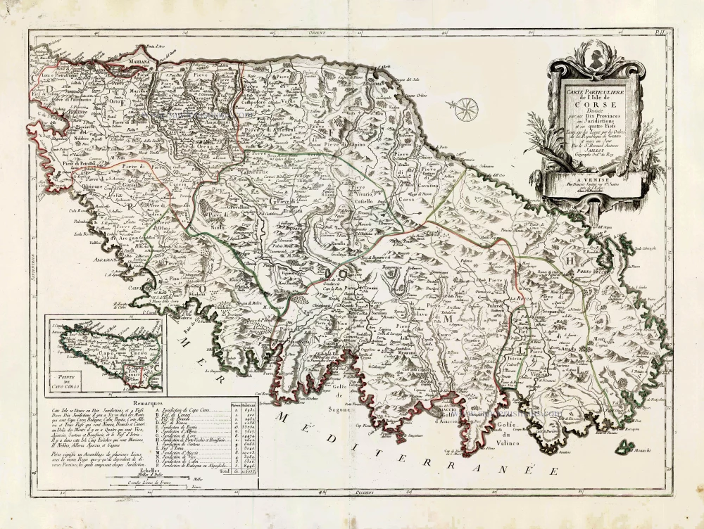
Carte Particulière de l'Isle de Corse. 1776-79
Corsica, by Francesco Santini.
[Item number: 27735]

Candia [on sheet with:] Corphu. 1638
Crete - Corfu, by Matthäus Merian.
[Item number: 27982]
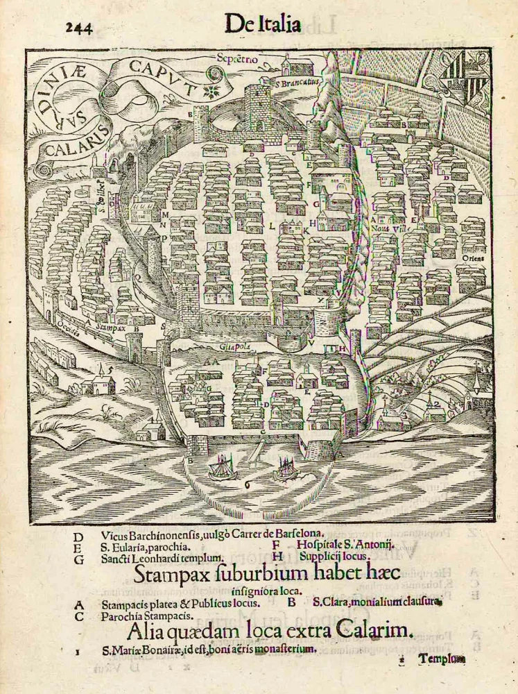
Calaris Sardiniae Caput. 1550
Cagliari (Sardinia), by Sebastian Münster.
[Item number: 27985]

Tabula . VII . Euro. 1525
Sardinia & Sicily by Lorenz Fries.
[Item number: 28385]
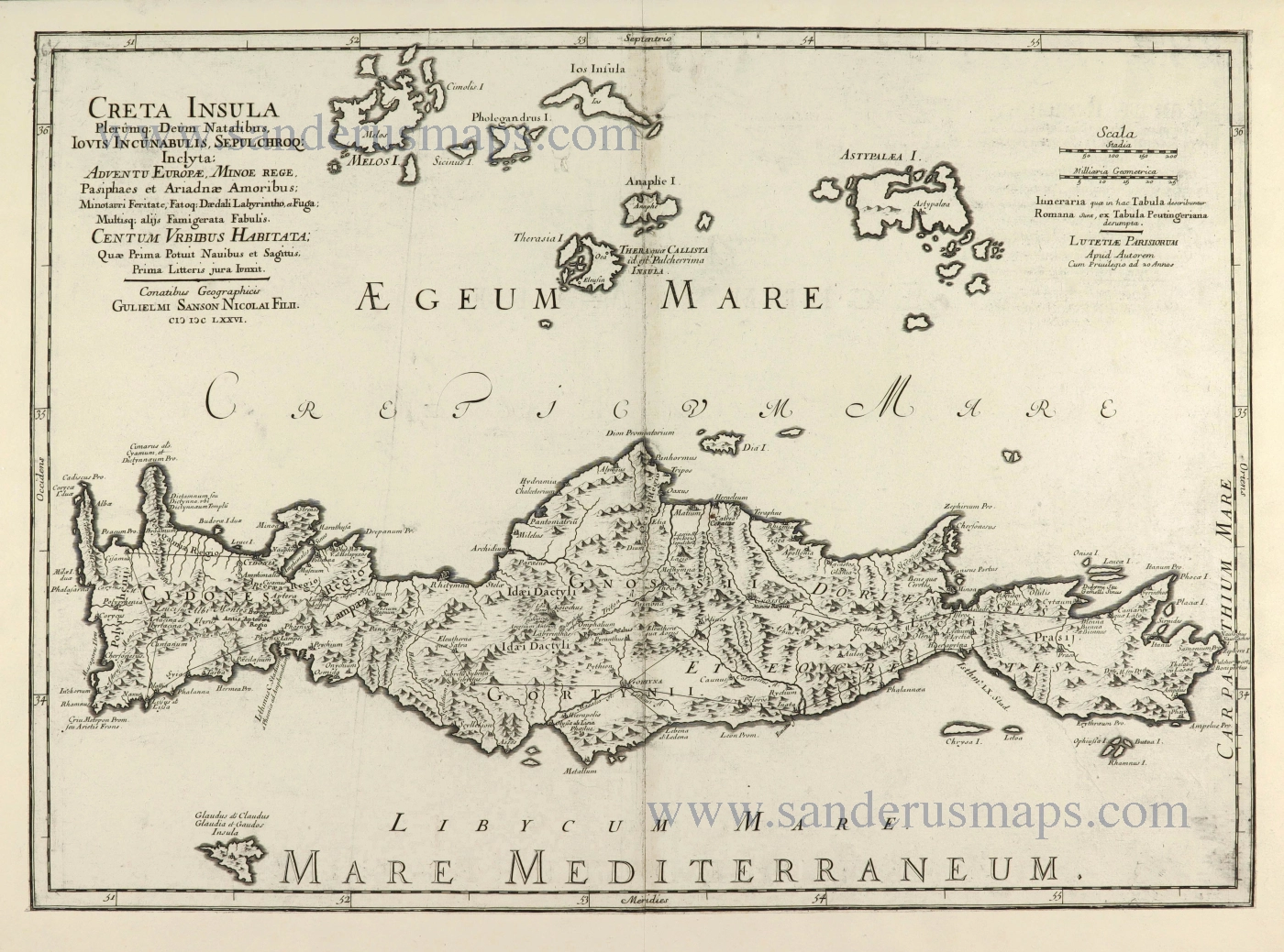
Creta Insula Olerumq: Deum Natalibus, Iovis Incunabulis, Sepulchroq: Inclyta: ... 1676
Crete by Guillaume Sanson.
[Item number: 28522]
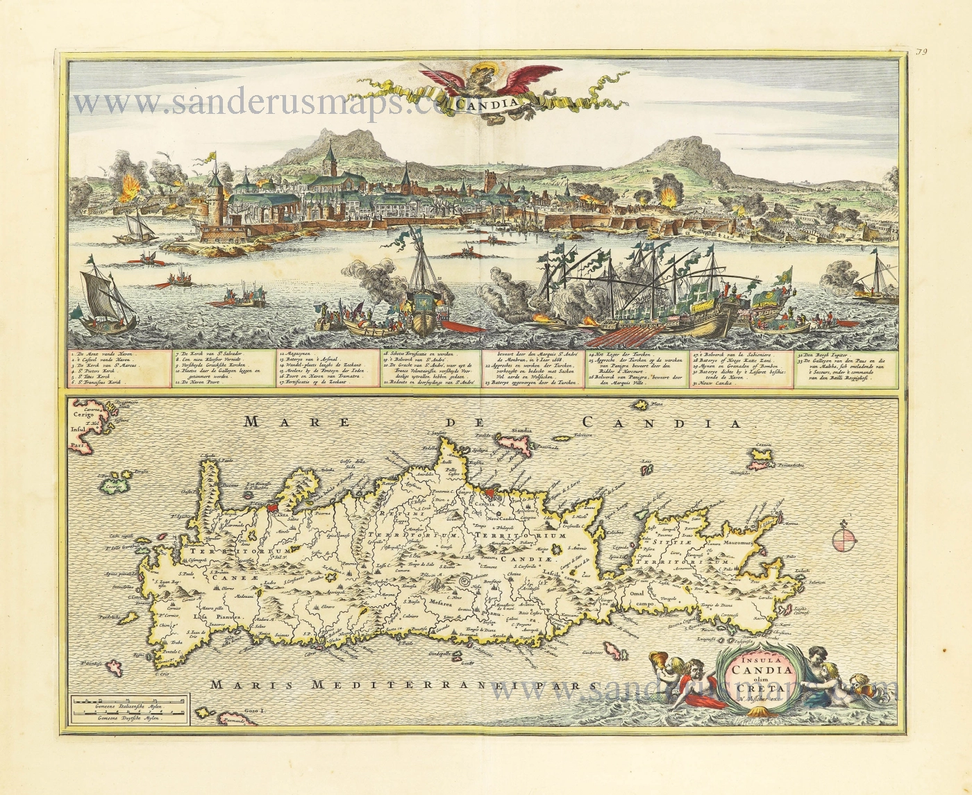
Insula Candia olim Creta. 1666-77
Crete + view of the Turkish siege of Iraklion, by Nicolaes Visscher I
[Item number: 28574]
Original colour
Sardinia Insula. 1592
Sardegna by Sebastian Münster.
[Item number: 29467]
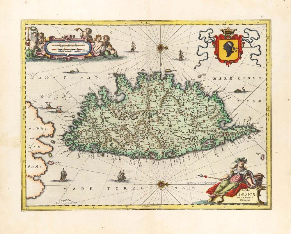
Insulae Corsicae Nova & accurata Descriptio. 1666
Corse (Corsica) by Johannes Janssonius.
[Item number: 29793]
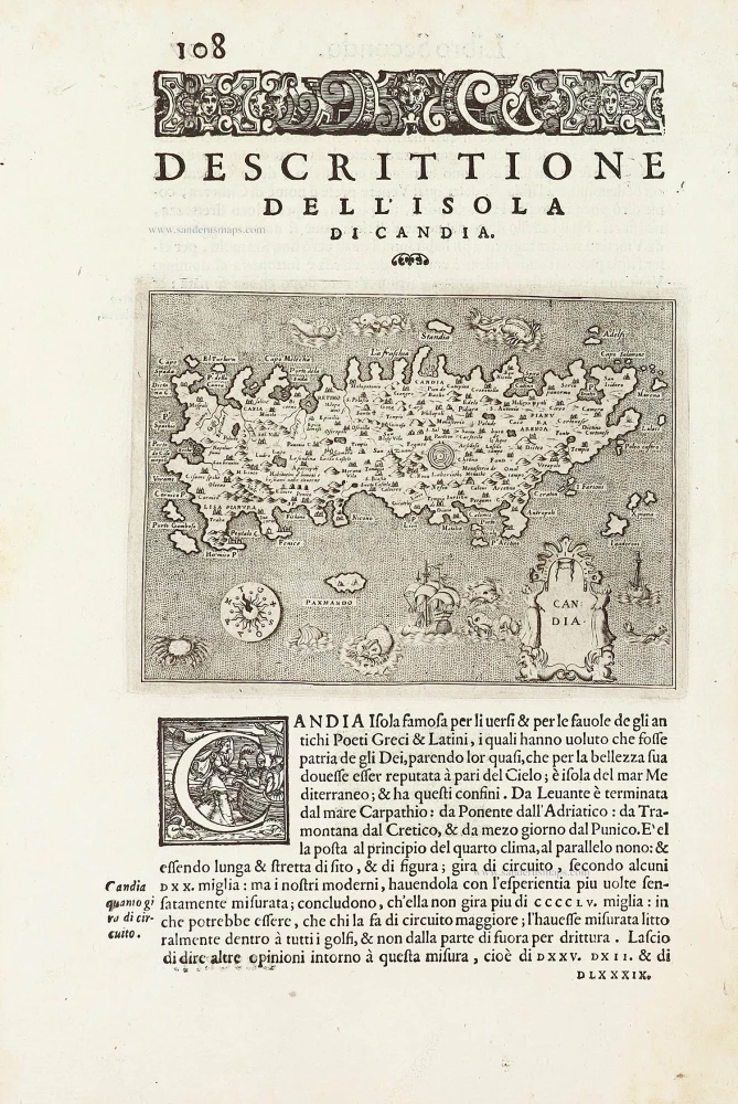
Candia - [Above map :] Descrittione del l'Isola di Candia. 1590
Crete by Thomasso Porcacchi.
[Item number: 29838]
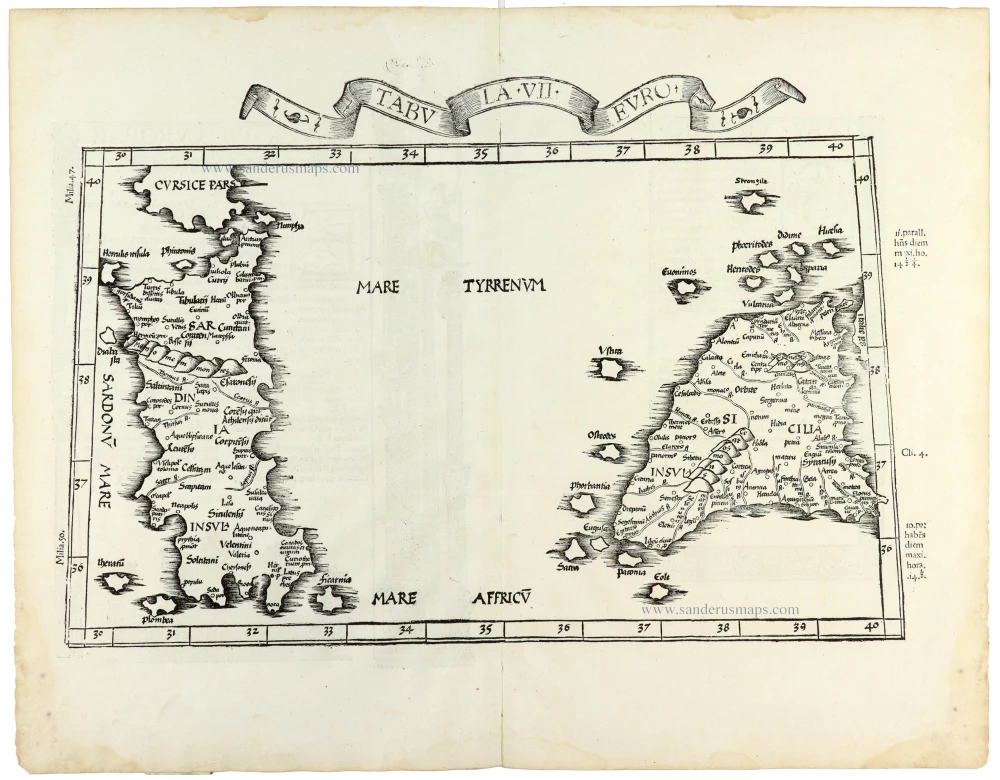
Tabula . VII . Euro. 1525
Sardinia & Sicily by Lorenz Fries.
[Item number: 30534]