
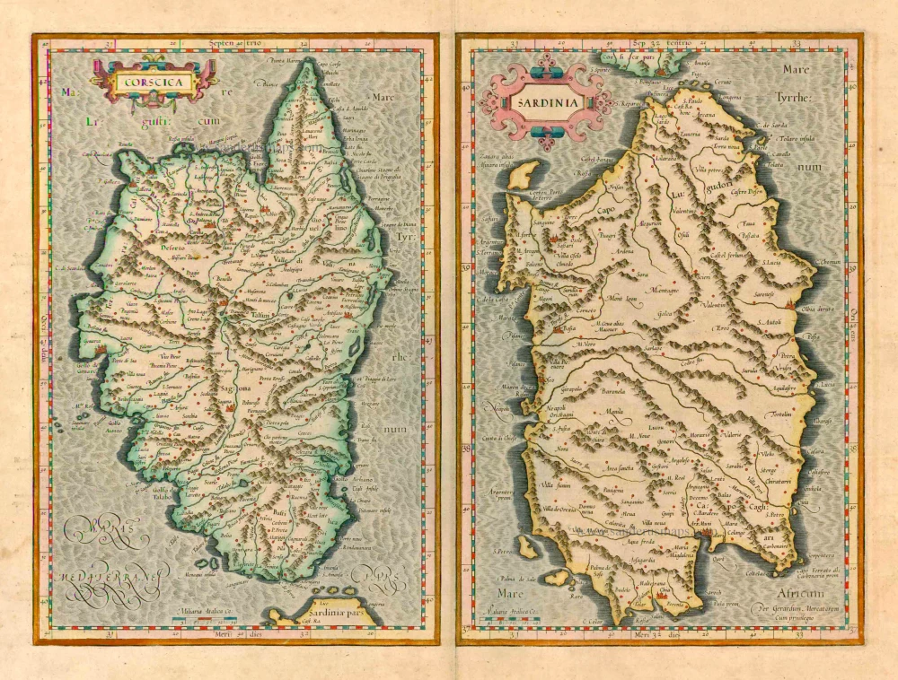
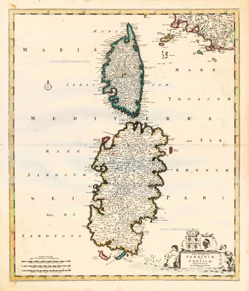
Corsica - Sardinia by Mercator Gerard - Hondius Henricus 1623


Gerard Mercator (1512 – 1594)
Gerard Mercator was born Gerard de Cremere in Rupelmonde (near Antwerp) on 5 March 1512.
Young Gerard learned what Latin he could in Rupelmonde, and when he was about fifteen, his uncle sent him to s'Hertogenbosch to study at a school run by the Brothers of the Common Life. One of Mercator’s teachers was the celebrated humanist Macropedius. After three and a half years with the brothers, Gerard went to Louvain, where he enrolled in the university in 1530 as one of the poor students at Castle College.
By this time, he had Latinized his name to Mercator. He studied philosophy and took his master’s degree in 1532. The problems of the creation of the Universe and the Earth interested him in particular; this is reflected by his works written in later years.
After spending a few years in Antwerp, he returned to Louvain in c. 1535, where he took courses in mathematics under Gemma Frisius. Soon, he was recognised as an expert on the construction of mathematical instruments, as a land surveyor and, after 1537, as a cartographer. He drew his income from these activities after his marriage on August 3, 1536. He also qualified himself as a copper engraver, the first to introduce italic handwriting to this trade. The first maps, drawn and engraved by Gerard Mercator, are Palestine, 1537; the World in double heart-shaped projection, 1538; and Flanders, 1540.
In 1544, Mercator came into great danger: he was arrested on the accusation of heresy and put into jail. Thanks to the intervention of the University of Louvain, he was released after four months. In 1552, he moved with his family to Duisburg (Germany). In 1560, Mercator became a cosmographer in service of the Duke of Jülich-Cleve-Berge, and in 1563, he became a lecturer at the Grammar School of the new University in Duisburg. During this period, he made wall maps of Europe, 1554; of Loraine, 1564; the British Isles, 1564; and the famous world map with increasing latitudes, 1569. About this time, Mercator was also working on the project for a complete description of the creation, the Heavens, Earth, Sea and world history. This resulted in his Atlas, sive cosmographicae meditationes de fabrica mundi et fabricati figura. He also worked on an edition of Ptolemy’s Geographia, which appeared in 1578. The first part of his book with modern maps (France, Germany and the Netherlands) appeared in 1585.
Shortly after the publication of the second part of his map book (not yet called Atlas) with the maps of Italy (1589), he had a stroke that ended his highly significant productivity. The great man passed away on 2 December 1594, leaving the responsibility of finishing the map book to his son Rumold. The final part of it appeared in 1595. Its title is Pars Altera, and it constitutes an essential part of what was then called Mercator’s Atlas.
The map of Europe and the world map in the Atlas are by Rumold Mercator. After Rumold died in 1599, the Atlas was reissued in 1602.
The plates of the maps, both of the Ptolemy edition and the Atlas, were sold in 1604 to Jodocus Hondius of Amsterdam. The following year, Hondius managed to bring out Ptolemy’s Geographia. In 1606, the first Amsterdam edition of the Mercator Atlas appeared in the next year. From then to 1638, the Atlas saw many enlarged editions in various languages.
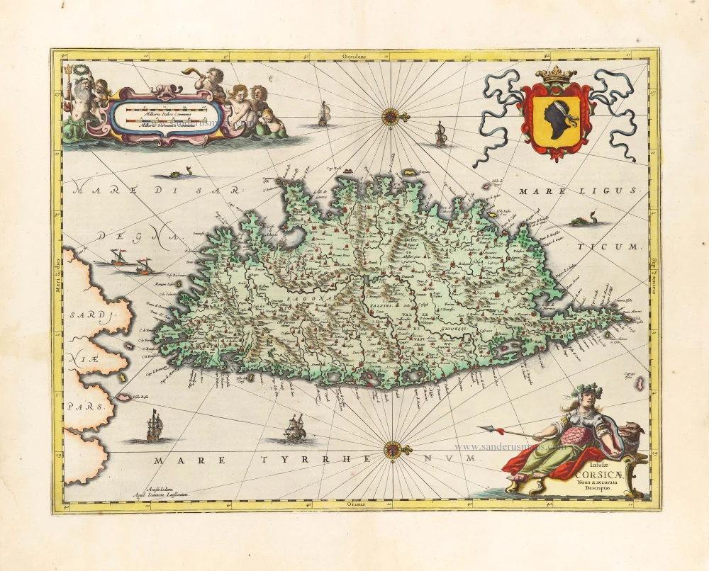
Corscica [on sheet with:] Sardinia.
Item Number: 24914 Authenticity Guarantee
Category: Antique maps > Mediterranean Sea
Old, antique map of Corsica and Sardinia by Mercator Gerard.
Title: Corscica [on sheet with:] Sardinia.
Date of the first edition: 1589.
Date of this map: 1623.
Copper engraving, printed on paper.
Size (not including margins): 340 x 230mm (13.39 x 9.06 inches).
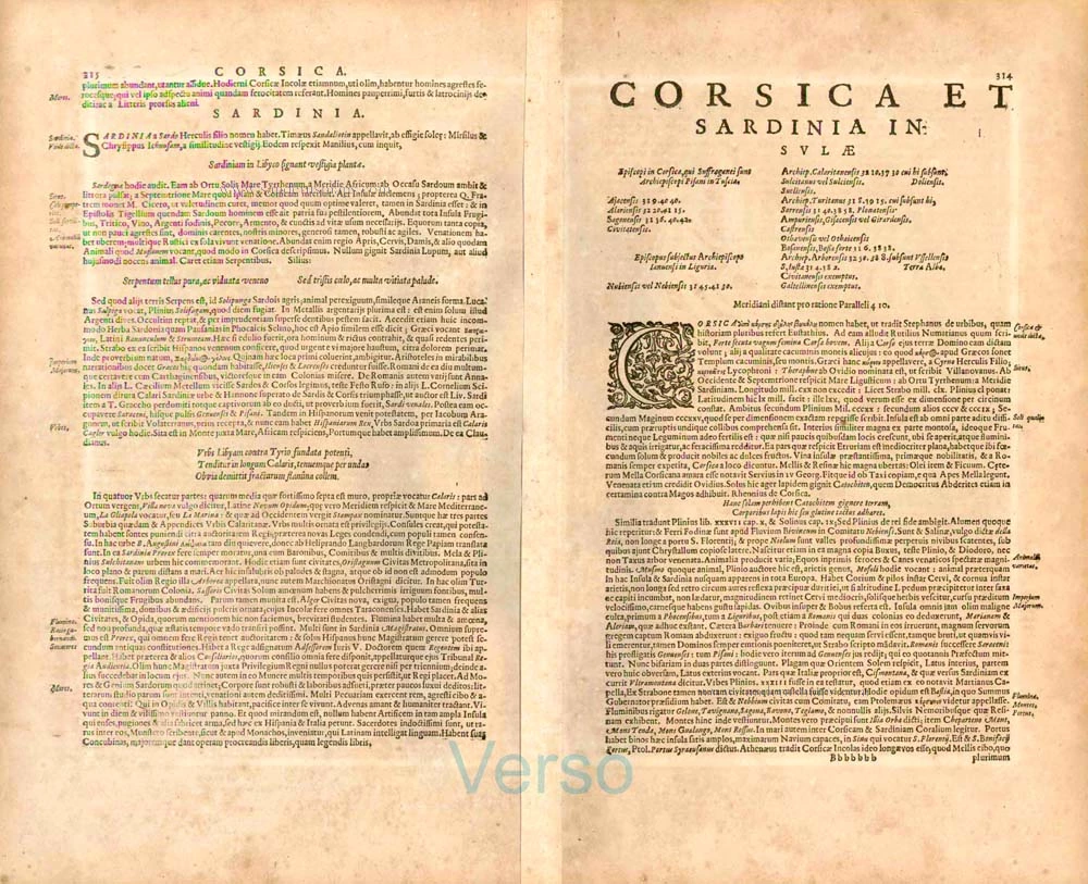
Verso: Latin text.
Condition: Original coloured, excellent.
Condition Rating: A+.
From: Gerardi Mercatoris - Atlas sive Cosmographicae Meditationes de Fabrica Mundi et Fabricati Figura. Denuo auctus Editio Quinta. Henricus Hondius. 1623. (Van der Krogt 1, 105)
Gerard Mercator (1512 – 1594)
Gerard Mercator was born Gerard de Cremere in Rupelmonde (near Antwerp) on 5 March 1512.
Young Gerard learned what Latin he could in Rupelmonde, and when he was about fifteen, his uncle sent him to s'Hertogenbosch to study at a school run by the Brothers of the Common Life. One of Mercator’s teachers was the celebrated humanist Macropedius. After three and a half years with the brothers, Gerard went to Louvain, where he enrolled in the university in 1530 as one of the poor students at Castle College.
By this time, he had Latinized his name to Mercator. He studied philosophy and took his master’s degree in 1532. The problems of the creation of the Universe and the Earth interested him in particular; this is reflected by his works written in later years.
After spending a few years in Antwerp, he returned to Louvain in c. 1535, where he took courses in mathematics under Gemma Frisius. Soon, he was recognised as an expert on the construction of mathematical instruments, as a land surveyor and, after 1537, as a cartographer. He drew his income from these activities after his marriage on August 3, 1536. He also qualified himself as a copper engraver, the first to introduce italic handwriting to this trade. The first maps, drawn and engraved by Gerard Mercator, are Palestine, 1537; the World in double heart-shaped projection, 1538; and Flanders, 1540.
In 1544, Mercator came into great danger: he was arrested on the accusation of heresy and put into jail. Thanks to the intervention of the University of Louvain, he was released after four months. In 1552, he moved with his family to Duisburg (Germany). In 1560, Mercator became a cosmographer in service of the Duke of Jülich-Cleve-Berge, and in 1563, he became a lecturer at the Grammar School of the new University in Duisburg. During this period, he made wall maps of Europe, 1554; of Loraine, 1564; the British Isles, 1564; and the famous world map with increasing latitudes, 1569. About this time, Mercator was also working on the project for a complete description of the creation, the Heavens, Earth, Sea and world history. This resulted in his Atlas, sive cosmographicae meditationes de fabrica mundi et fabricati figura. He also worked on an edition of Ptolemy’s Geographia, which appeared in 1578. The first part of his book with modern maps (France, Germany and the Netherlands) appeared in 1585.
Shortly after the publication of the second part of his map book (not yet called Atlas) with the maps of Italy (1589), he had a stroke that ended his highly significant productivity. The great man passed away on 2 December 1594, leaving the responsibility of finishing the map book to his son Rumold. The final part of it appeared in 1595. Its title is Pars Altera, and it constitutes an essential part of what was then called Mercator’s Atlas.
The map of Europe and the world map in the Atlas are by Rumold Mercator. After Rumold died in 1599, the Atlas was reissued in 1602.
The plates of the maps, both of the Ptolemy edition and the Atlas, were sold in 1604 to Jodocus Hondius of Amsterdam. The following year, Hondius managed to bring out Ptolemy’s Geographia. In 1606, the first Amsterdam edition of the Mercator Atlas appeared in the next year. From then to 1638, the Atlas saw many enlarged editions in various languages.
Related items

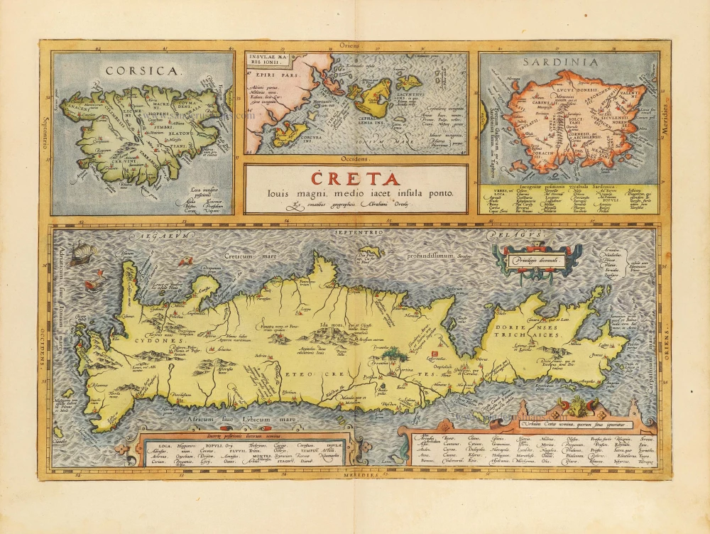
Creta Iovis magni, medio iacet insula ponto. Ex conatibus geographicis Abrahami Ortelij. [On sheet with:] Corsica [and:] Insulae Maris Ionii [and:] Sardinia 1624
Crete, Corsica and Sardinia by Ortelius A.
[Item number: 2052]

Senensis Ditionis - Corsica - Marcha Anconae olim Picenum. 1572. 1581
Siena - Corsica - Ancona, by Ortelius A.
[Item number: 6252]
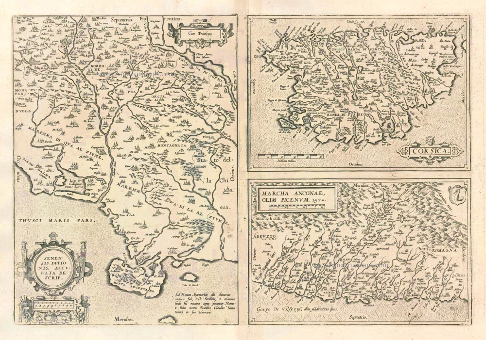
Senensis Ditionis - Corsica - Marcha Anconae olim Picenum. 1572. 1612
Siena - Corsica - Ancona, by Ortelius A.
[Item number: 22975]
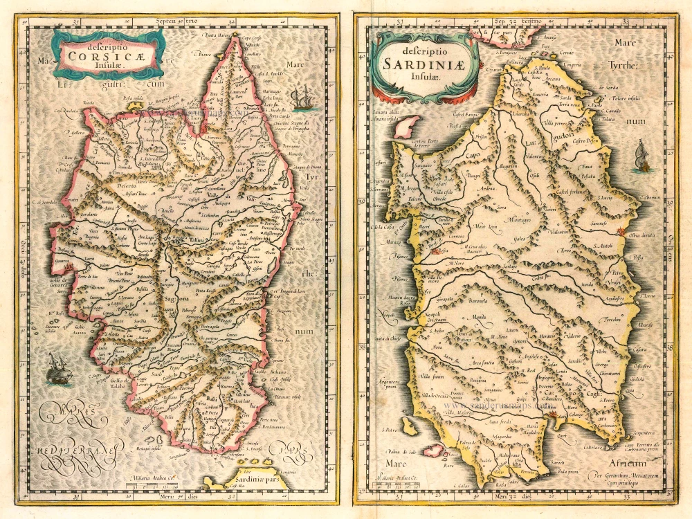
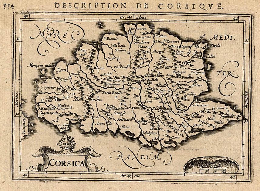
Descriptio Corsicae Insulae [on sheet with:] Descriptio Sardinae Insulae. 1639
CORSICA - SARDINIA by Mercator G. - Hondius H.
[Item number: 24455]
Insularum Sardiniae et Corsicae Descriptio. c. 1680
Corsica & Sardinia, by F. De Wit.
[Item number: 25914]
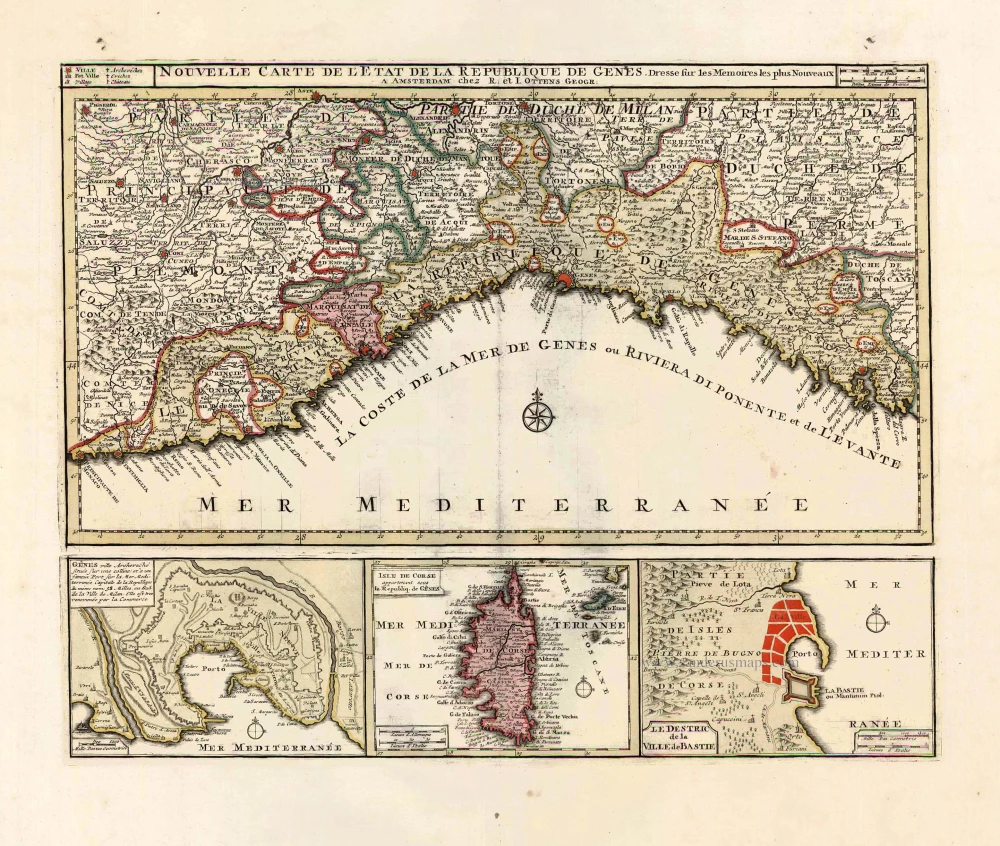
Nouvelle Carte de l'Etat et de la Republique de Genes. 1730-45
Liguria - Corsica, by Ottens R. & I.
[Item number: 25917]
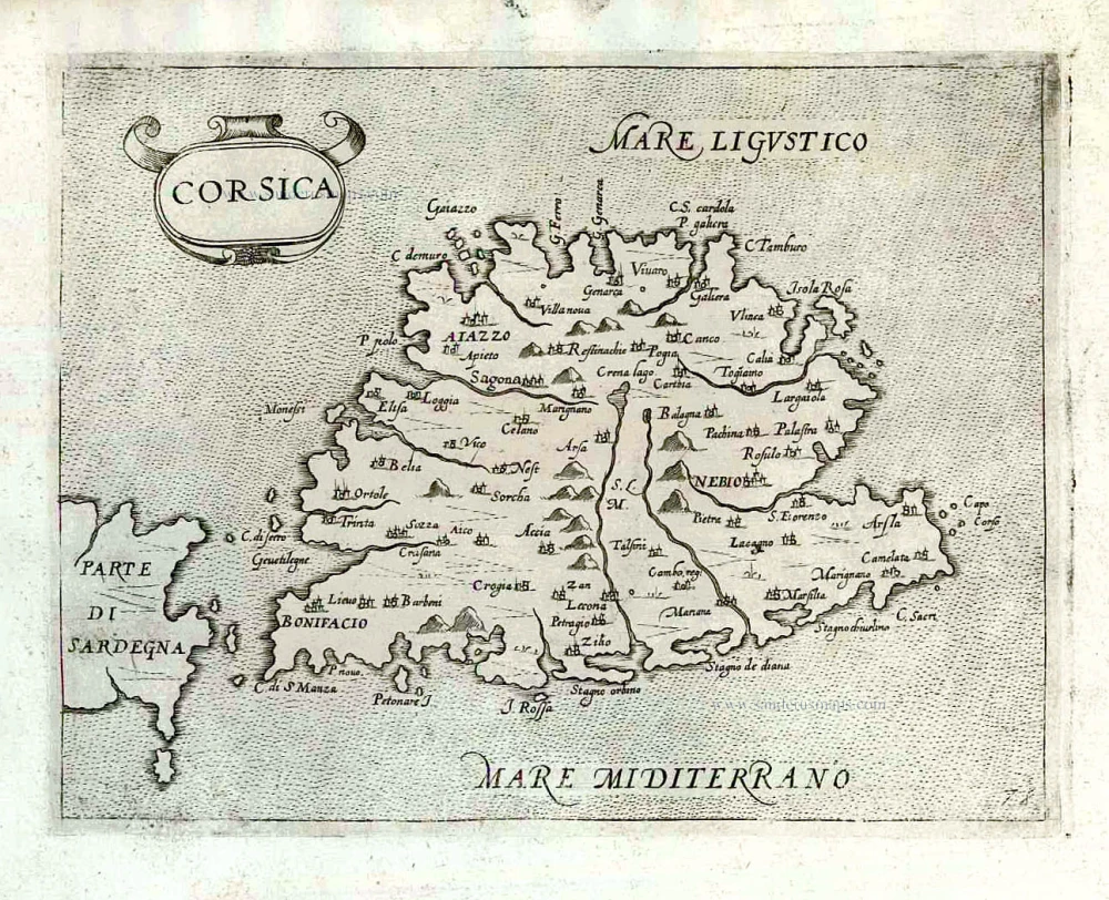
Corsica. 1618
Corse (Corsica), by P. Bertius.
[Item number: 26538]

De L'Isle de Corse. 1575
Corsica, by François de Belleforest.
[Item number: 27286]
Rare et important
Corsica. After 1575
Corsica by Giovanni Francesco Camocio
[Item number: 27565]
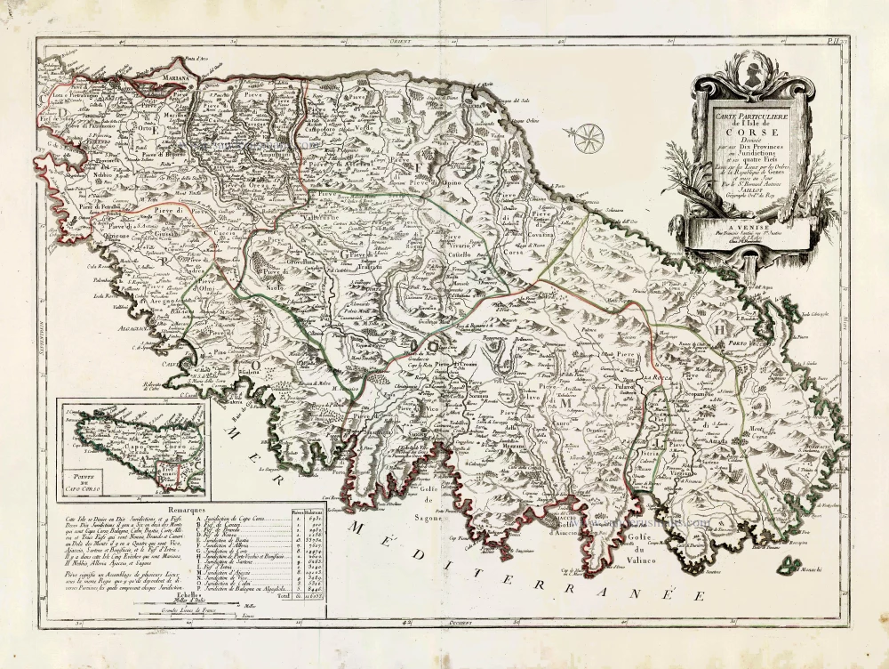
Carte Particulière de l'Isle de Corse. 1776-79
Corsica, by Francesco Santini.
[Item number: 27735]
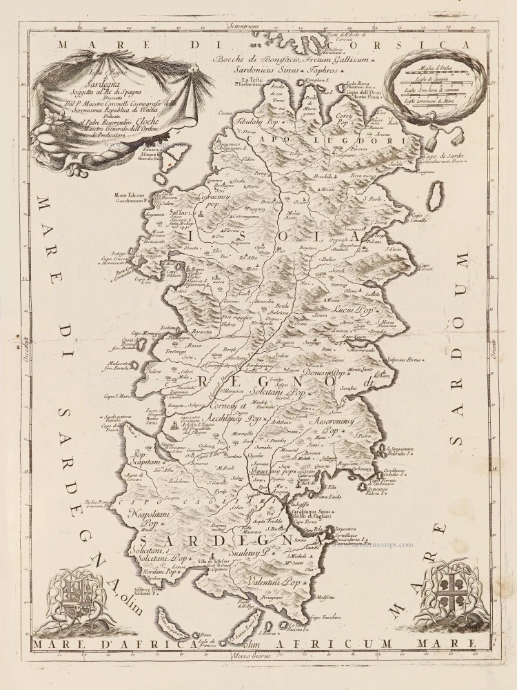
Isola è Regno di Sardegna. 1696
Sardinia (Sardegna) by Vincenzo Coronelli.
[Item number: 28715]
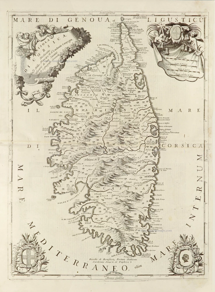
Isola di Corsica, 1696
Corsica by Vincenzo Coronelli.
[Item number: 28720]
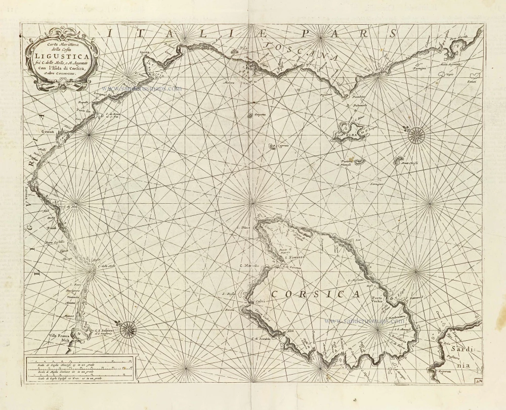
Carta Marittima della Costa Ligustica ... con l'Isola di Corsica, et altre Circonvicine. 1696
Ligurian Coast, including Corsica, by Vincenzo Coronelli.
[Item number: 29134]
Creta Iovis magni, medio iacet insula ponto. [On sheet with:] Corsica [and:] Insulae Maris Ionii [and:] Sardinia. 1584
Corsica, Crete (Creta), Sardinia, by Abraham Ortelius.
[Item number: 29148]
Original colour
Sardinia Insula. 1592
Sardegna by Sebastian Münster.
[Item number: 29467]
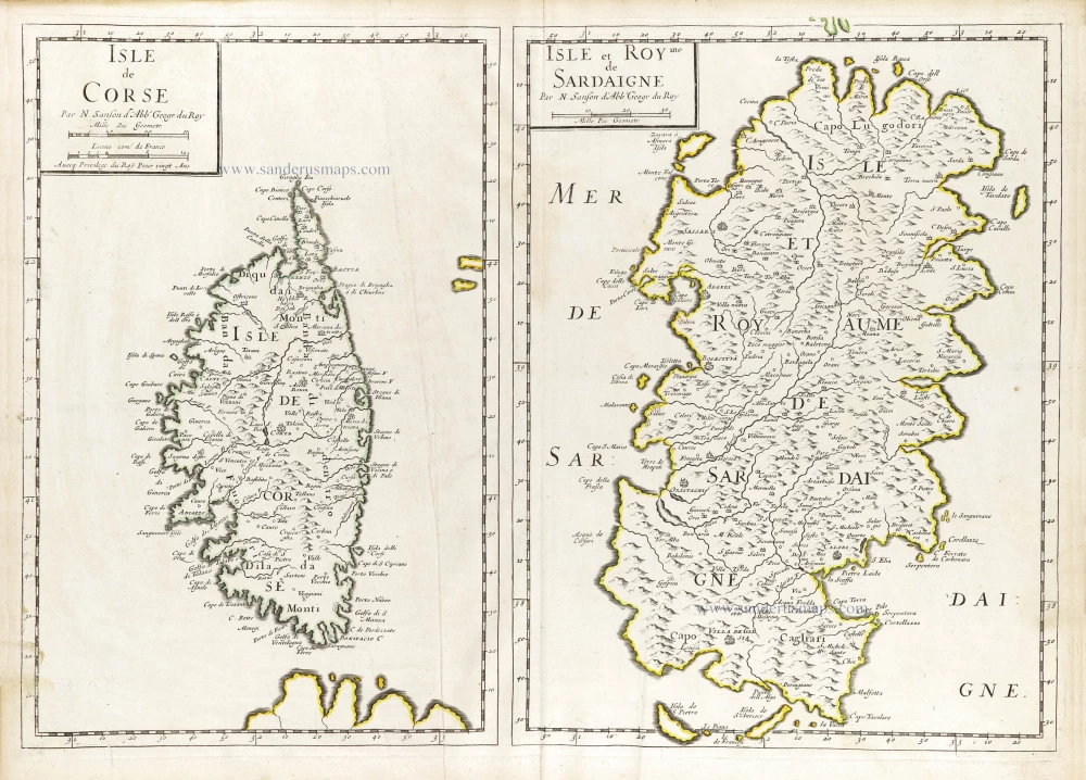
Isle de Corse. - Isle et Roy[au]me de Sardaigne. 1652
Corsica & Sardinia (Sardegna) by Nicolas Sanson.
[Item number: 29674]
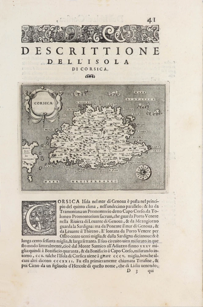
Corsica - [Above map :] Descrittione dell'Isola di Corsica. 1590
Corsica, by Thomaso Porcacchi.
[Item number: 29761]
Insulae Corsicae Nova & accurata Descriptio. 1666
Corse (Corsica) by Johannes Janssonius.
[Item number: 29793]