
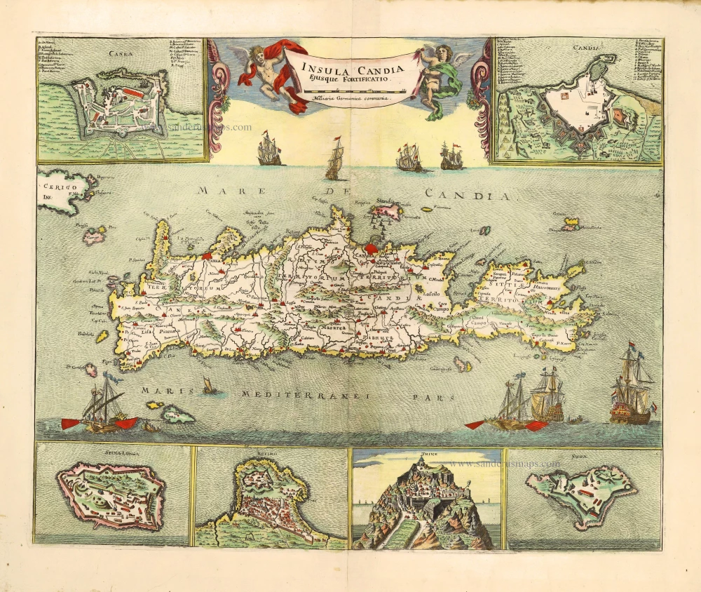
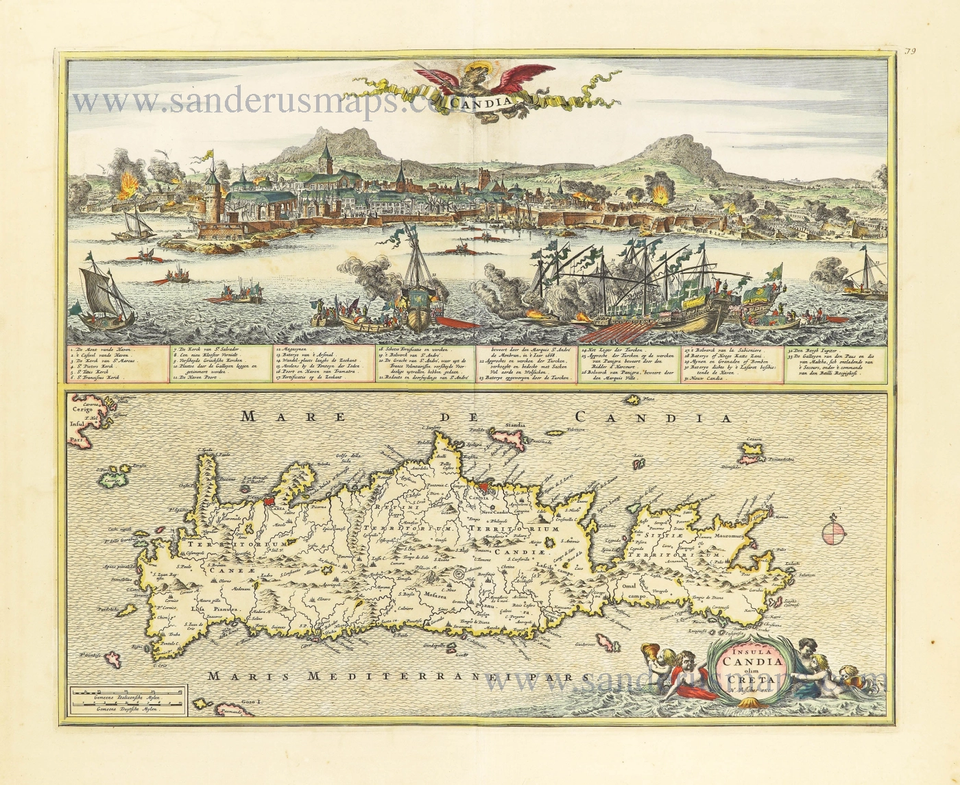
Crete by Johann Hoffmann. 1667
Scarce map of Crete, an earlier and smaller version of De Wit's Crete map. One of the most beautiful maps ever produced of Crete.
Johann Hoffmann (1629-1698)
Map publisher of Nürnberg.
Insula Candia ejusque fortificatio.
Item Number: 28466 Authenticity Guarantee
Category: Antique maps > Mediterranean Sea
Old, antique map of Crete, by Hoffmann Johann.
With six insets showing: Iraklion, Canea, Spina Long, Retimo, Thine, and Sunda.
Title: Insula Candia ejusque fortificatio.
Date of the first edition: 1667.
Date of this map: 1667.
Copper engraving, printed on paper.
Map size: 405 x 495mm (15.94 x 19.49 inches).
Sheet size: 470 x 590mm (18.5 x 23.23 inches).
Verso: Blank.
Condition: Original coloured, excellent.
Condition Rating: A+.
References: Zacharakis, 1638/2394
From: Eigentlicher Abriß und Beschreibung der uhralten Königreichs oder Insul Candien ... Nürnberg, 1667-1668.
Scarce map of Crete, an earlier and smaller version of De Wit's Crete map. One of the most beautiful maps ever produced of Crete.
Johann Hoffmann (1629-1698)
Map publisher of Nürnberg.
Related items

Creta Iovis magni, medio iacet insula ponto. Ex conatibus geographicis Abrahami Ortelij. [On sheet with:] Corsica [and:] Insulae Maris Ionii [and:] Sardinia 1624
Crete, Corsica and Sardinia by Ortelius A.
[Item number: 2052]

Cyprus Insula - Candia, olim Creta. 1572
Cyprus - Crete, by A. Ortelius.
[Item number: 16585]
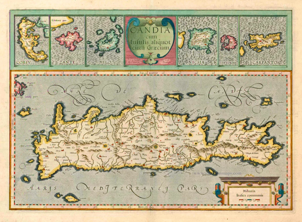
Candia cum insulis aliquot circa Graeciam. 1623
Crete with the isles of Corfu, Zante, Milo, Nicsia, Santorini and Scarpanto by Gerard Mercator.
[Item number: 20541]
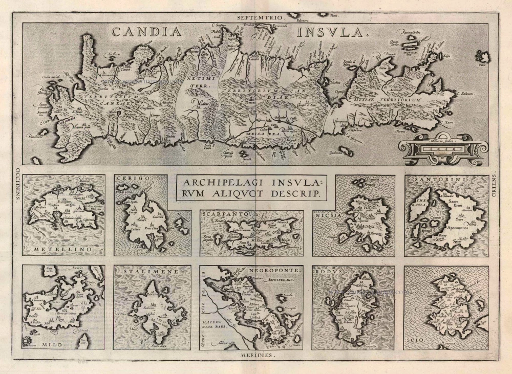
Candia Insula [on sheet with] Archipelagi Insularum aliquot descrip. 1612
Crete and 10 Aegean islands, by Abraham Ortelius.
[Item number: 22976]
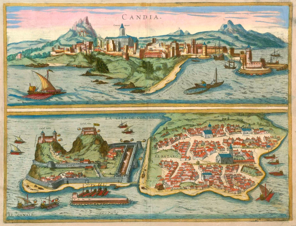
Candia [on sheet with] La Cita de Corphu 1597
Crete (Iraklion) & Corfu, by Georg Braun and Frans Hogenberg.
[Item number: 23289]
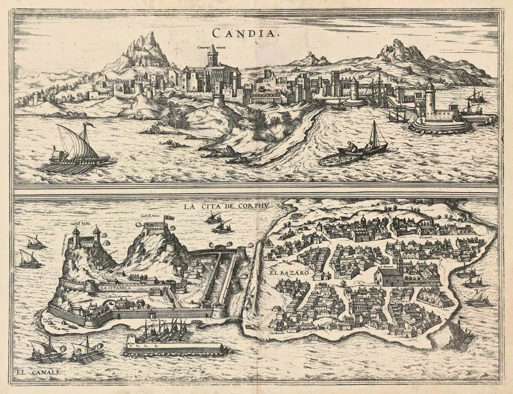
Candia [on sheet with] La Cita de Corphu 1575-1612
Crete - Heraklion (Irákleio) & Corfu (Kérkyra), by Georg Braun and Frans Hogenberg.
[Item number: 24007]
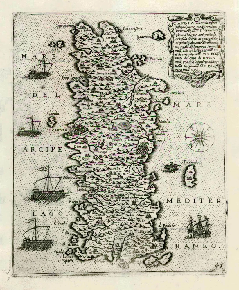
Candia vel Creta insula posta nel mare Mediterraneo ... After 1575
Crete (Creta) by Giovanni Francesco Camocio
[Item number: 27579]

Candia [on sheet with:] Corphu. 1638
Crete - Corfu, by Matthäus Merian.
[Item number: 27982]
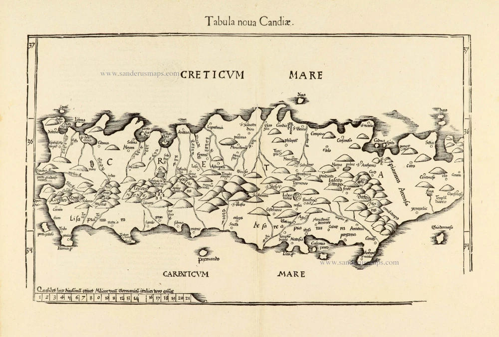
Tabula nova Candiae. 1541
Crete, by Lorenz Fries
[Item number: 28127]
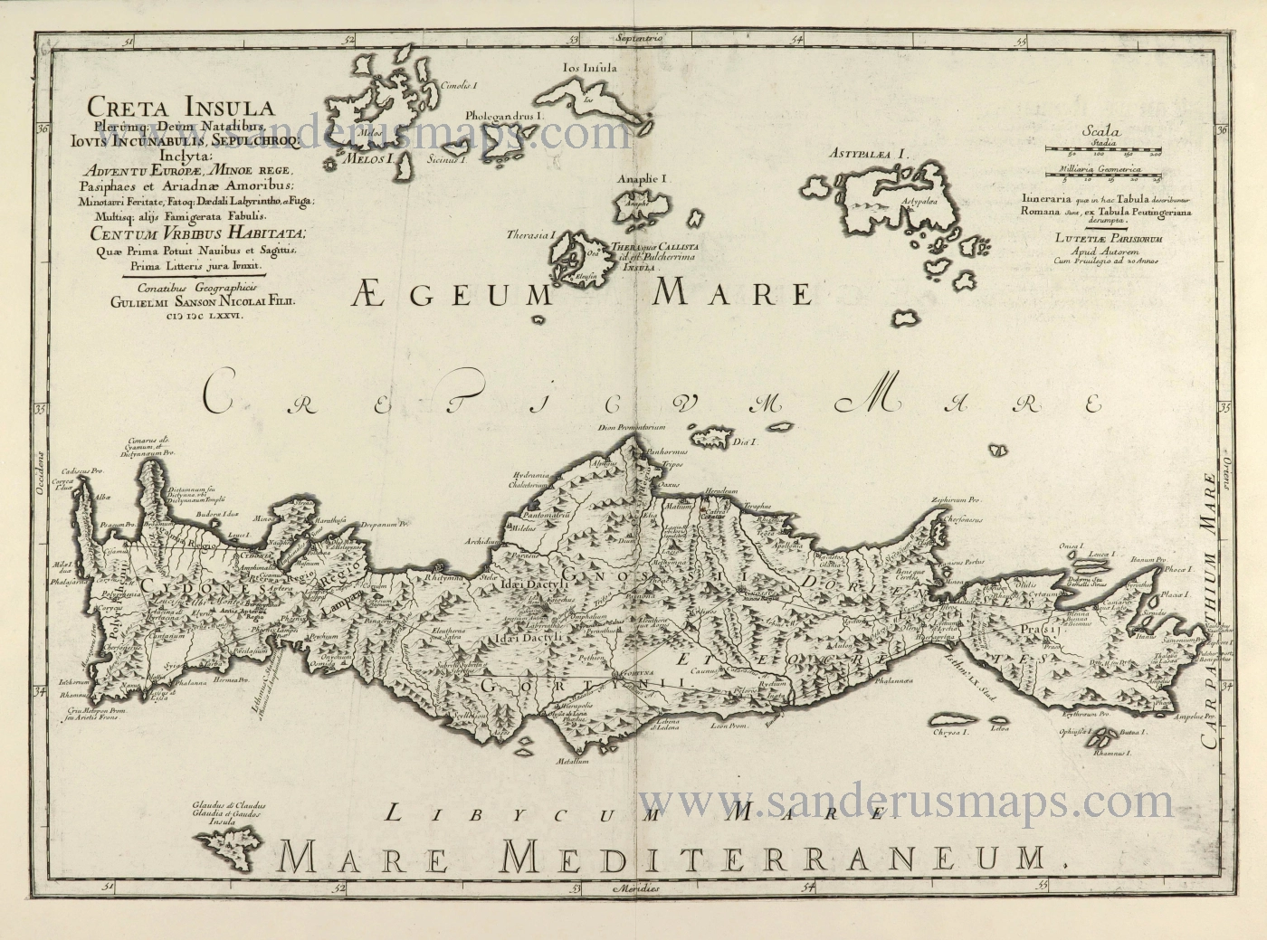
Creta Insula Olerumq: Deum Natalibus, Iovis Incunabulis, Sepulchroq: Inclyta: ... 1676
Crete by Guillaume Sanson.
[Item number: 28522]
Insula Candia olim Creta. 1666-77
Crete + view of the Turkish siege of Iraklion, by Nicolaes Visscher I
[Item number: 28574]