
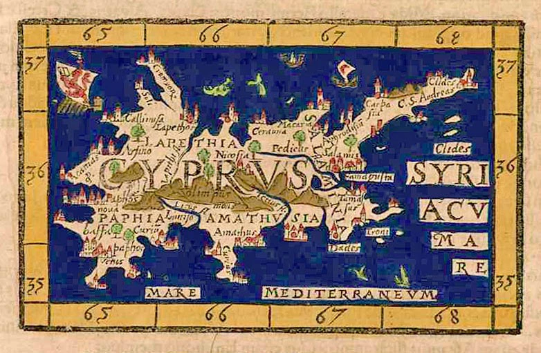
Cyprus, by Thomasso Porcacchi. 1590
The item displayed on this page has been sold. However, we have a similar map in stock:
Cyprus by Thomasso Porcacchi. 1590
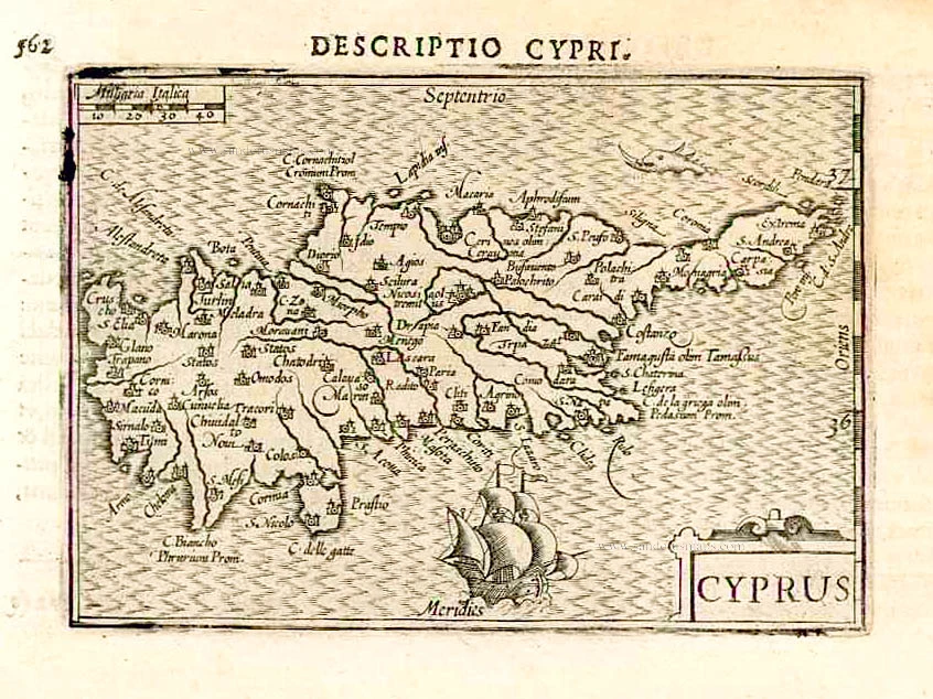
Cipro. - [Above map :] Descrittione dell'Isola di ...
[Item number: 29827]
![Cipro. - [Above map :] Descrittione dell'Isola di Cipro.](https://sanderusmaps.com/assets/RESIZED/thumb_m29827.jpg)


Thomaso (Tommaso) Porcacchi (1530-1585)
Thomaso Porcacchi was born in Castiglion Fiorentino (Arentino), Tuscany, into a poor family. Through the patronage of Duke Cosimo I de' Medici, he was able to pursue his studies; afterwards, he embarked on a career as a translator, editor and author, initially in Florence, often working with the humanist scholar Lodovico Domenichi. His speciality was classical texts, particularly of a geographical and historical nature. Through this work, he came into contact with the prominent Venetian publisher Gabriel Giolito de' Ferrari and, in 1559, he moved to Venice to form a fruitful association with Giolito, who had produced several books containing maps.
Later in his career, Porcacchi composed an isolario, L'isole piu famose del mondo ..., published by Simone Galignani de Karera and Girolamo Porro in 1572. In 1574 Porro engraved the plates for another Porcachi volume, Funerali antichi di diversi popoli, et nationi ..., and he later contributed the maps to a new edition of Claudius Prolemy's Geographiae universae tum veteris tum novae ..., edited by Giovanni Antonio Magini and published by the Heirs of Simone Galignani de Karera.
The first edition of Porcacchi's L'isole piu famose contained 30 engraved maps, set in text. The coverage was worldwide, albeit concentrated on the Mediterranean. For the second edition, the text was rewritten, and 17 additional maps were inserted, to make a total of 47.
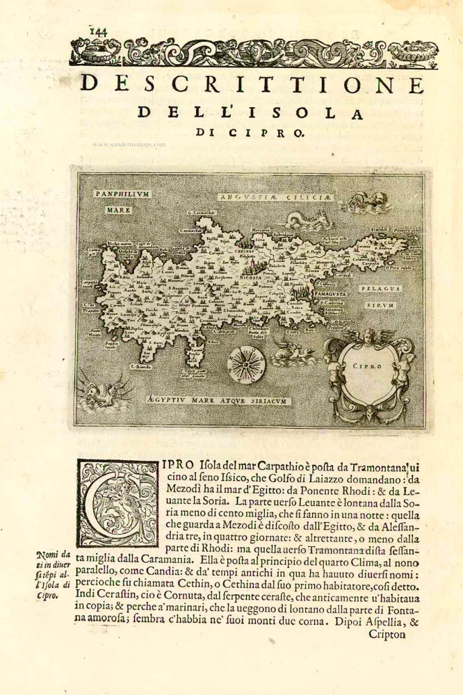
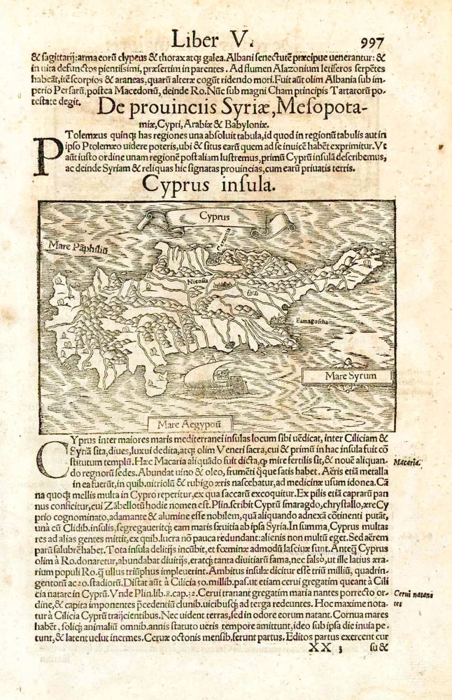
Cipro. - [Above map :] Descrittione dell'Isola di Cipro.
Item Number: 27508 Authenticity Guarantee
Category: Antique maps > Mediterranean Sea
Old, antique map of Cyprus, by Thomasso Porcacchi.
Title: Cipro. - [Above map :] Descrittione dell'Isola di Cipro.
Date of the first edition: 1572.
Date of this map: 1590.
Copper engraving, printed on paper.
Size (not including margins): 110 x 145mm (4.33 x 5.71 inches).
Verso: Italian text.
Condition: Excellent.
Condition Rating: A+.
From: Porcacchi T. L'Isole Piu Famose Del Mondo. Venice, Giorgio Angelieri for the Heirs of Simone Galignani, 1590.
Thomaso (Tommaso) Porcacchi (1530-1585)
Thomaso Porcacchi was born in Castiglion Fiorentino (Arentino), Tuscany, into a poor family. Through the patronage of Duke Cosimo I de' Medici, he was able to pursue his studies; afterwards, he embarked on a career as a translator, editor and author, initially in Florence, often working with the humanist scholar Lodovico Domenichi. His speciality was classical texts, particularly of a geographical and historical nature. Through this work, he came into contact with the prominent Venetian publisher Gabriel Giolito de' Ferrari and, in 1559, he moved to Venice to form a fruitful association with Giolito, who had produced several books containing maps.
Later in his career, Porcacchi composed an isolario, L'isole piu famose del mondo ..., published by Simone Galignani de Karera and Girolamo Porro in 1572. In 1574 Porro engraved the plates for another Porcachi volume, Funerali antichi di diversi popoli, et nationi ..., and he later contributed the maps to a new edition of Claudius Prolemy's Geographiae universae tum veteris tum novae ..., edited by Giovanni Antonio Magini and published by the Heirs of Simone Galignani de Karera.
The first edition of Porcacchi's L'isole piu famose contained 30 engraved maps, set in text. The coverage was worldwide, albeit concentrated on the Mediterranean. For the second edition, the text was rewritten, and 17 additional maps were inserted, to make a total of 47.
Related items
Parergon map
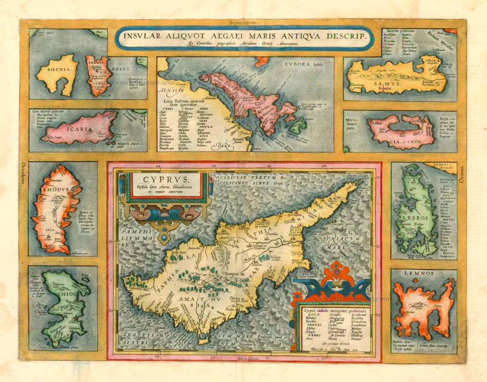
Insular. aliquot Aegaei Maris Antiqua Descrip. 1601
Cyprus & other Greek Islands by Abraham Ortelius.
[Item number: 12452]

Cyprus Insula - Candia, olim Creta. 1572
Cyprus - Crete, by A. Ortelius.
[Item number: 16585]
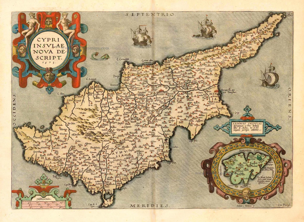
Cypri Insulae Nova Descript. 1573 1592
Cyprus, by Ortelius A.
[Item number: 22955]
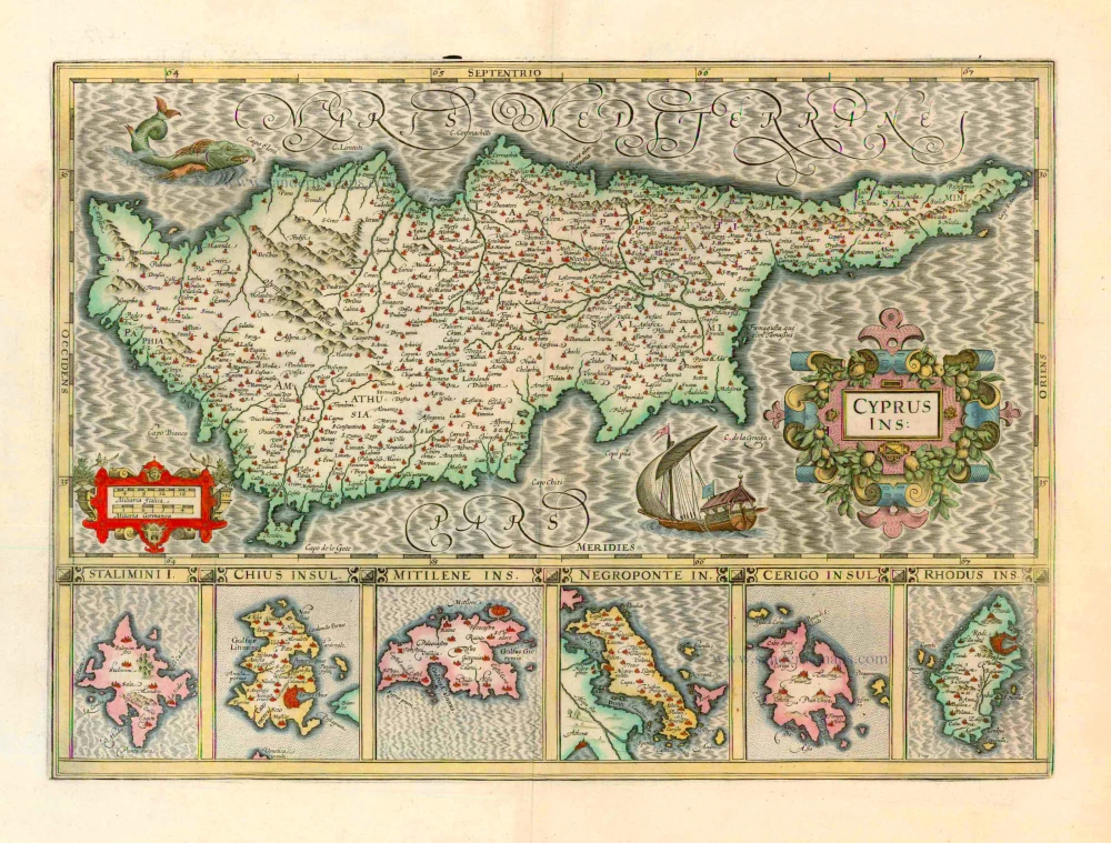
Cyprus Ins: 1633
Cyprus, by Jodocus Hondius.
[Item number: 24436]
Cyprus Insula. 1552
Cyprus, by S. Münster.
[Item number: 25723]

Cyprus Ins: 1641
Cyprus, by Henricus Hondius.
[Item number: 26436]
Cyprus. 1602
Cyprus, by Barent Langenes, published by P. Bertius.
[Item number: 26542]
Cyprus Insula. 1640-43
Cyprus, by W. & J. Blaeu.
[Item number: 26641]
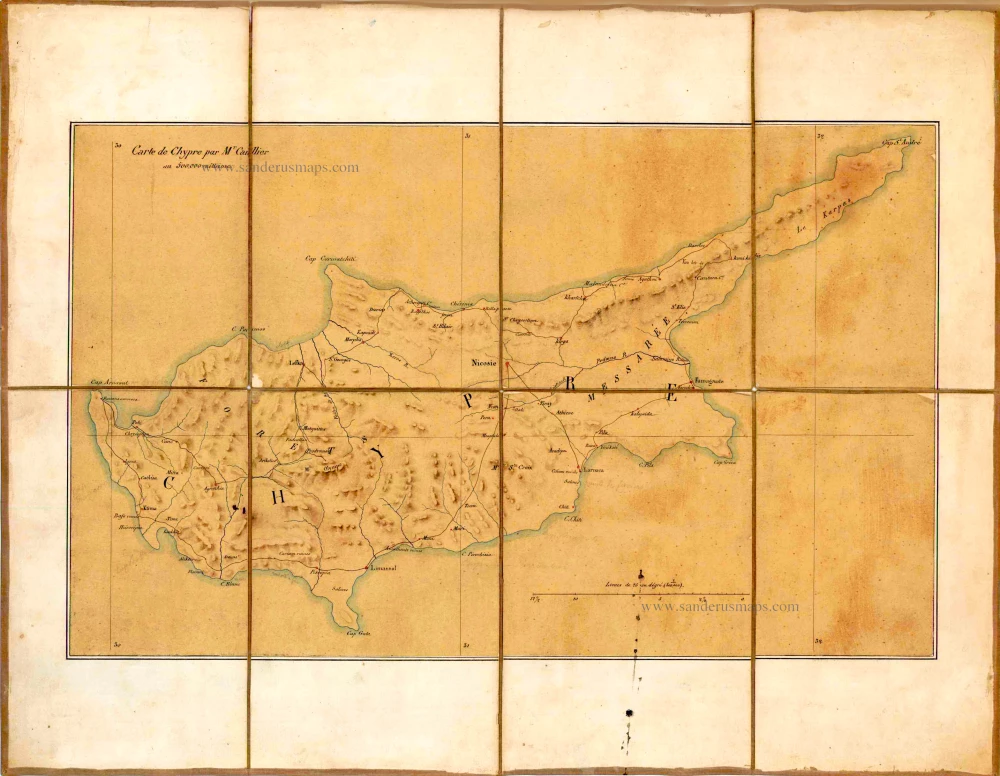
Carte de Chypre par Mr Caillier. c. 1850
Manuscript map of Cyprus, by Caillier.
[Item number: 26720]
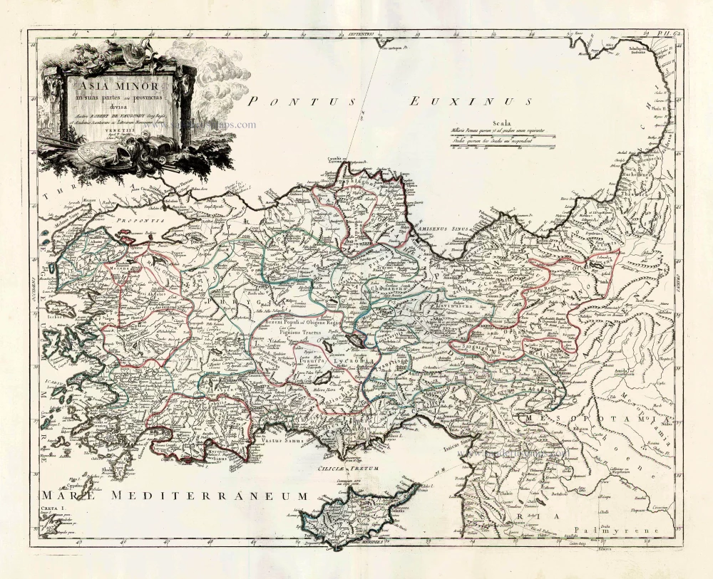
Asia Minor in suas partes seu provincias divisa. 1776-79
Turkey and Cyprus, by Paolo Santini.
[Item number: 27014]
Scarce
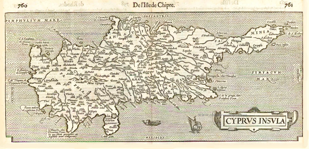
Cyprus Insula. - De L'Isle de Chipre. 1575
Cyprus, by François Belleforest.
[Item number: 27300]
Very rare.
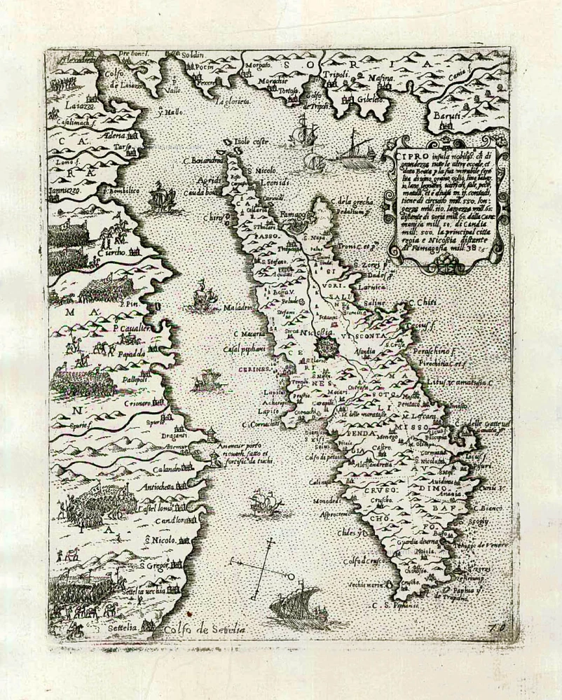
Cipro insula nobiliss. ... c. 1575
Cyprus by Giovanni Francesco Camocio
[Item number: 27577]
Cyprus. 1571
Cyprus by Johannes Honter.
[Item number: 27856]