
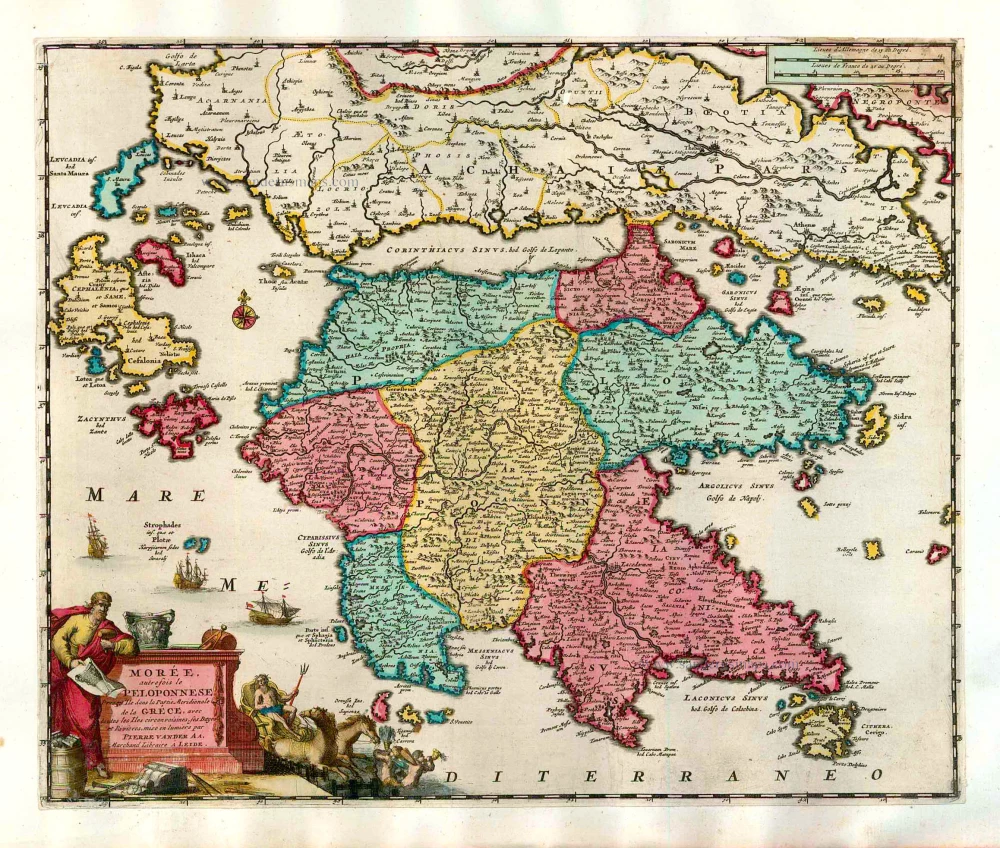
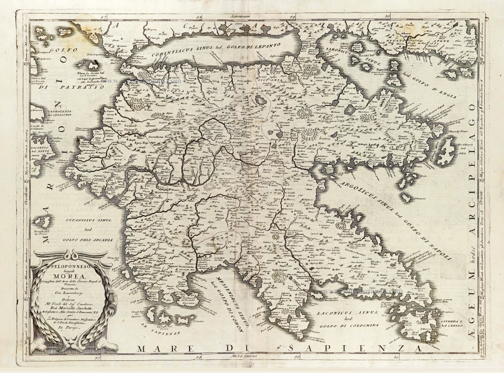
The Peloponnese by Pieter van der Aa. 1713
Pieter van der Aa (Leiden, 1659-1733)
Pieter van der Aa was already in 1682 owner of a bookshop and auction house. During his life, he has published an enormous amount of printed material.
After 1700, van der Aa increasingly specialised in books on geography and travel.
He published composite atlases, a series of geographical descriptions of European countries, and some very spectacular works. Between 1706 and 1708 he published the Naauweurige versameling der gedenkwaardigste zee- en land-reysen, in 28 volumes.
Many of Van der Aa’s publications are richly illustrated with maps and plates. He took over many copperplates and prints from other publishers such as Carel Allard and Frederik De Wit. The composite atlases that appeared from his workshop contain a curious mixture of his own material, copies of maps from other publishers, and reprints made from old copper plates, now with his own imprint.
The Galérie agréable du monde, was completed in 1729, and comprised 66 parts, bound in 27 volumes. Van der Aa presented it as a good investment; after publication, the antiquarian value of the work would double, the more so since it was printed in a limited edition of only one hundred copies.
Morée, autrefois le Peloponnese, Presqu'Ile dans la Partie Meridionale de la Gréce, avec toutes les Iles circonvoisines, ses Bayes et Eivieres.
Item Number: 26071 Authenticity Guarantee
Category: Antique maps > Mediterranean Sea
Old, antique map of the Peloponnese, by Pieter van der Aa.
Title: Morée, autrefois le Peloponnese, Presqu'Ile dans la Partie Meridionale de la Gréce, avec toutes les Iles circonvoisines, ses Bayes et Eivieres.
Date of the first edition: 1713.
Date of this map: 1713.
Copper engraving, printed on paper.
Size (not including margins): 300 x 360mm (11.81 x 14.17 inches).
Verso: Blank.
Condition: Original coloured, trimmed to platemark and mounted on heavy paper at an early time.
Condition Rating: A.
From: Nouvel Atlas, très exact et fort commode pour toutes sortes de personnes, Contenant Les Principales cartes géographiques. Leiden, P. Van der Aa, n.d. (1713) (Koeman, Aa7).
Pieter van der Aa (Leiden, 1659-1733)
Pieter van der Aa was already in 1682 owner of a bookshop and auction house. During his life, he has published an enormous amount of printed material.
After 1700, van der Aa increasingly specialised in books on geography and travel.
He published composite atlases, a series of geographical descriptions of European countries, and some very spectacular works. Between 1706 and 1708 he published the Naauweurige versameling der gedenkwaardigste zee- en land-reysen, in 28 volumes.
Many of Van der Aa’s publications are richly illustrated with maps and plates. He took over many copperplates and prints from other publishers such as Carel Allard and Frederik De Wit. The composite atlases that appeared from his workshop contain a curious mixture of his own material, copies of maps from other publishers, and reprints made from old copper plates, now with his own imprint.
The Galérie agréable du monde, was completed in 1729, and comprised 66 parts, bound in 27 volumes. Van der Aa presented it as a good investment; after publication, the antiquarian value of the work would double, the more so since it was printed in a limited edition of only one hundred copies.
Related items
Parergon map
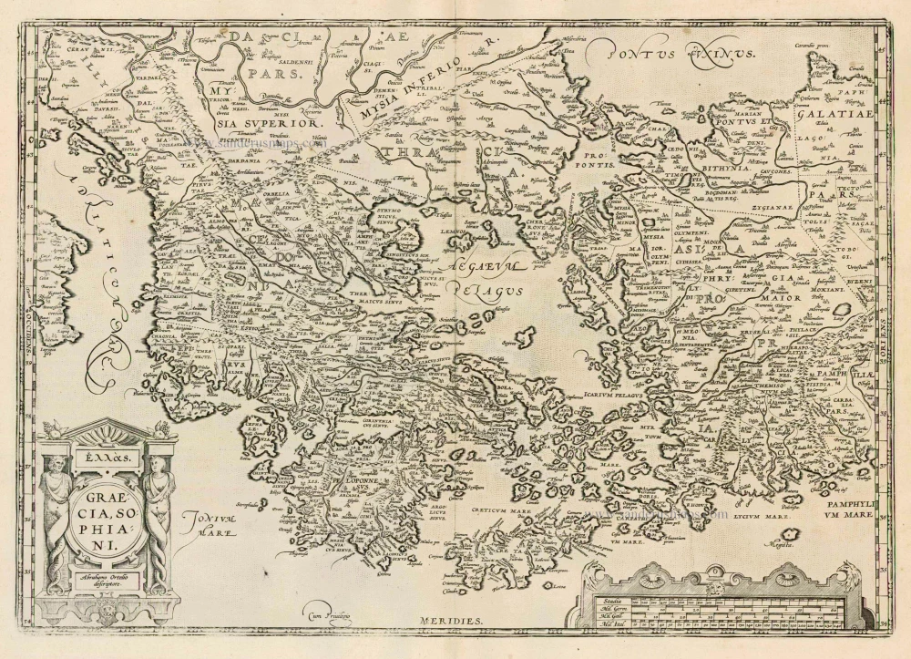
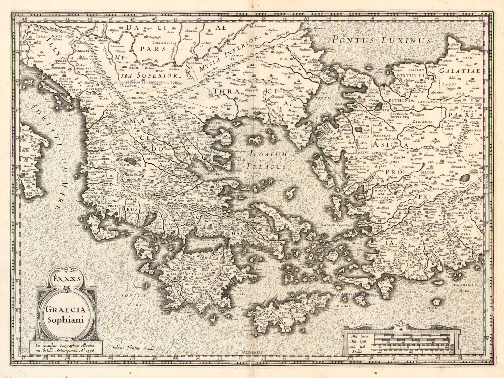
Graecia, Sophiani. 1624
Greece, by Ortelius A.
[Item number: 2050]
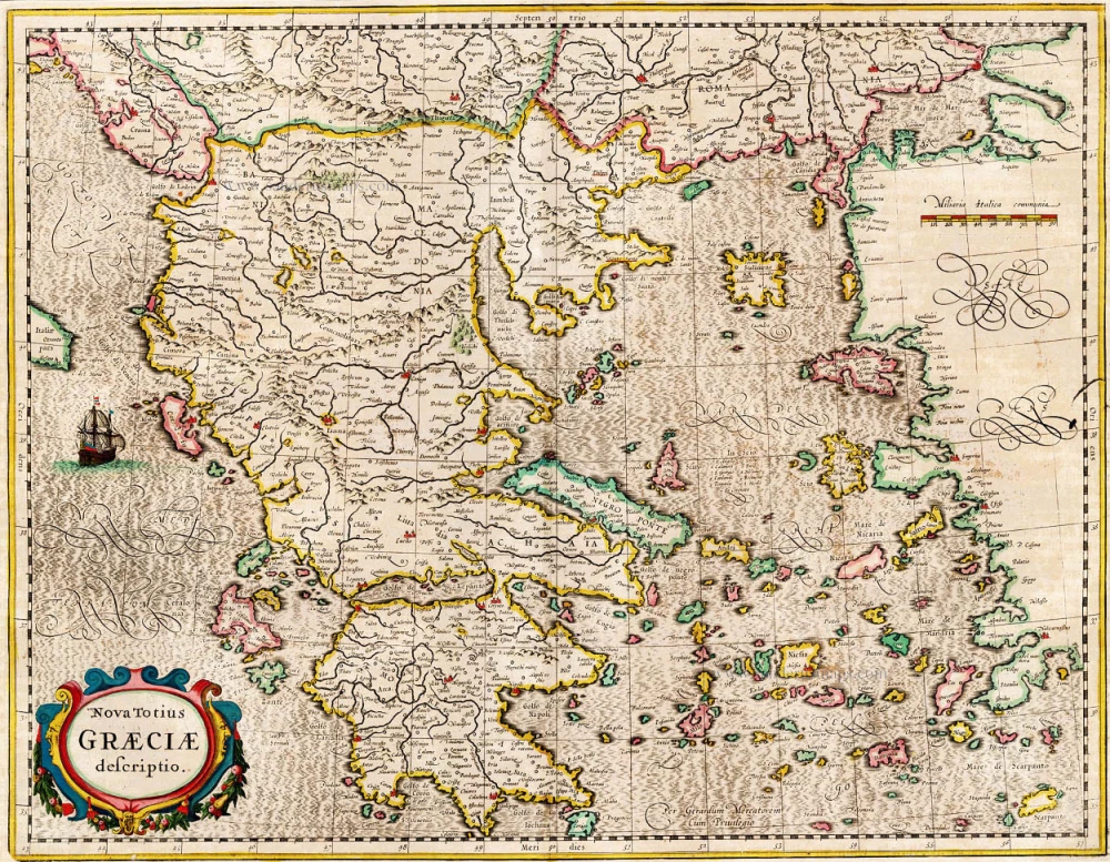
Nova Totius Graeciae descriptio. 1638
Greece, by J. Janssonius.
[Item number: 15357]
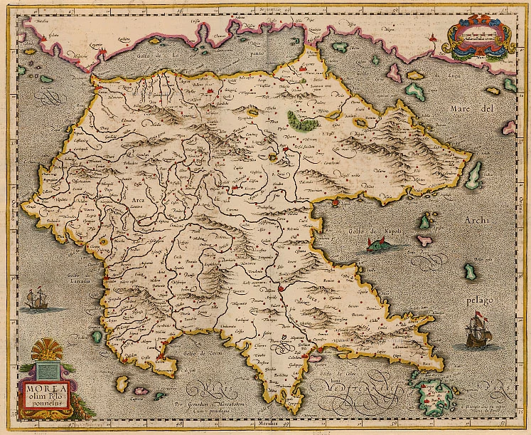
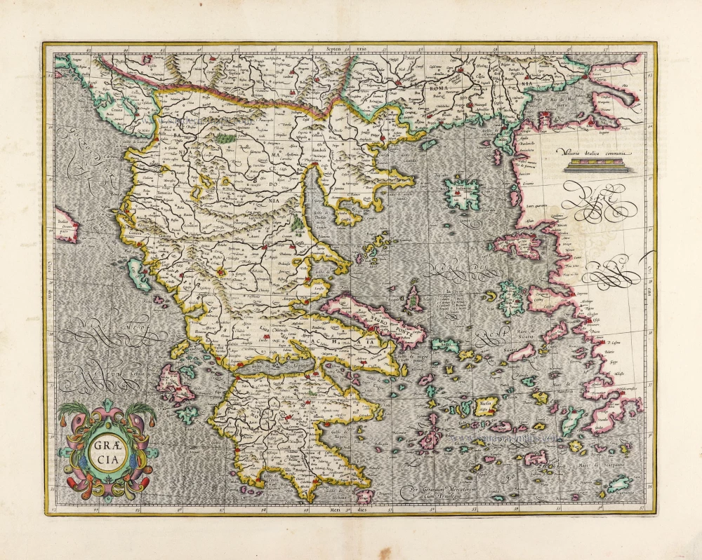
Morea. 1638
The Peloponnese, by Gerard Mercator.
[Item number: 14473]

Graeciae Universae Secundum Hodiernum Situm Neoterica Descriptio. Jacobo Castaldo Pedemontano Autore. 1608
Greece, by Matthias Quad.
[Item number: 18856]
Graecia. 1633
Greece, by Gerard Mercator.
[Item number: 16999]
Graecia Sophiani / Ex conatibus geographicis Abrahami Ortelii Antuerpiensis Ao. 1596 / Judocus Hondius excudit. 1618
Greece, by Bertius P. - Hondius J.
[Item number: 24541]
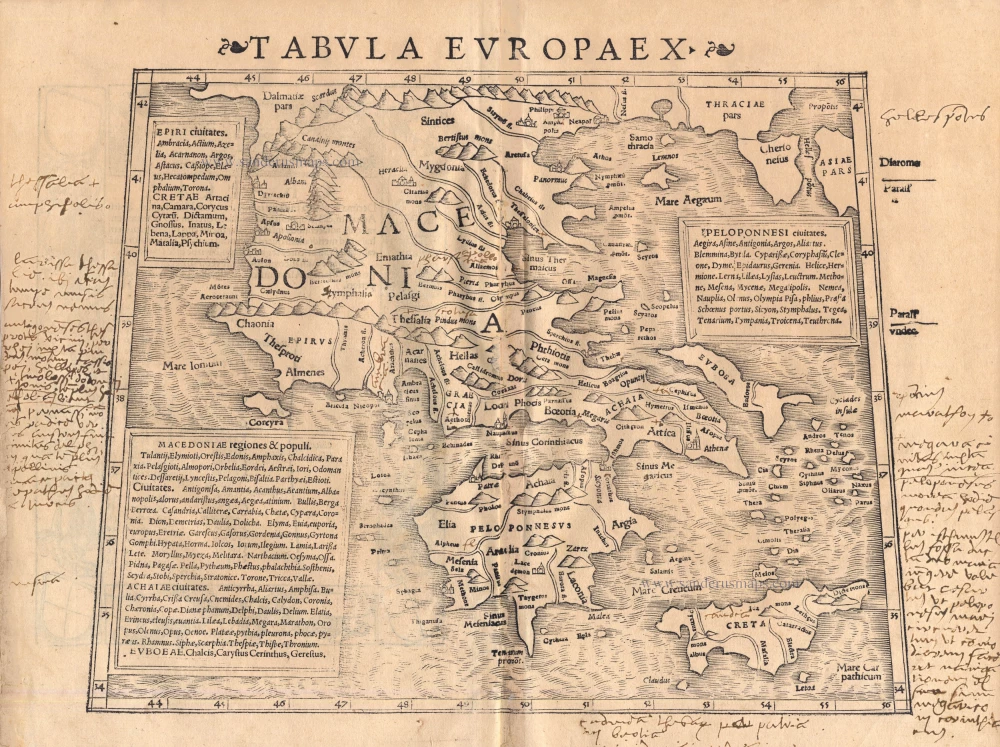
Tabula Europae X 1542
Greece, by Sebastian Münster.
[Item number: 14704]
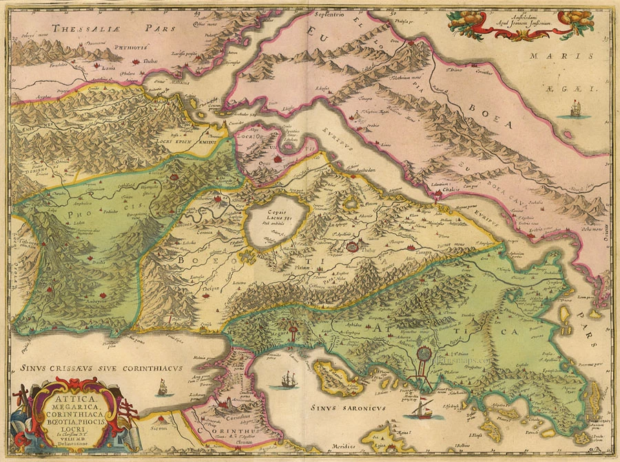
Attica, Megarica, Corinthiaca ... 1684
Greece - Attiki, by Janssonius à Waesberghe - Hornius.
[Item number: 10918]
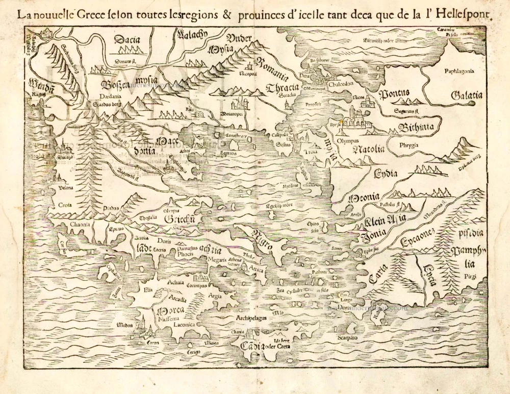
La nouvelle Grece selon toutes les regions & provinces d'icelle tant deca que de la l'Hellespont. 1555
Greece, by S. Munster.
[Item number: 25168]
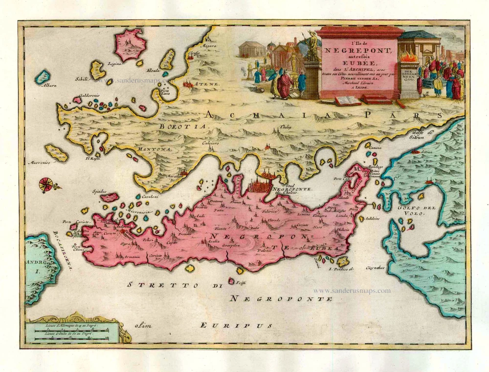
L'Ile de Negrepont, autrefois Eubée, dans l'Archipel, avec toutes ses Côtes. 1713
Euboea, by Pieter van der Aa.
[Item number: 26073]

Turquie en Europe. 1713
Greece, by P. Van der Aa.
[Item number: 26076]
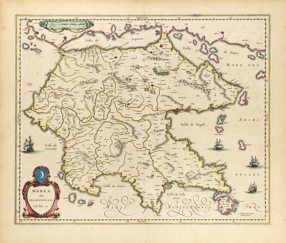
Morea olim Peloponessus. 1640
Peloponnese by Willem Blaeu.
[Item number: 28881]
Peloponneso, hoggidi Morea. 1696
Greece - Peloponnese by Vincenzo Coronelli.
[Item number: 29067]