
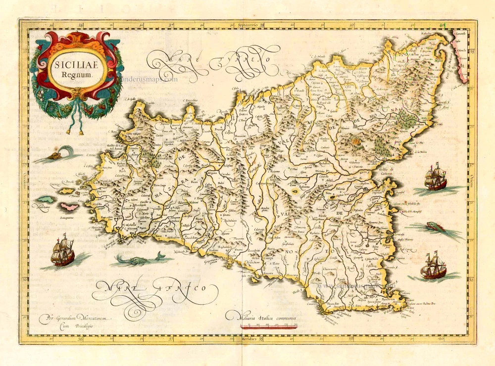
Sicily (Sicilia), by Willem & Joan Blaeu. 1650

The Blaeus: Willem Janszoon, Cornelis & Joan
Willem Jansz. Blaeu and his son Joan Blaeu are the seventeenth century's most widely known cartographic publishers.
Willem Jansz. (also written Guilielmus Janssonius) = Willem Janszoon Blaeu was born in Uitgeest (Netherlands), near Alkmaar, in 1571. He studied mathematics under Tycho Brahe and learned the theory and practice of astronomical observations and the art of instrument- and globe-making.
In 1596, he came to Amsterdam, where he settled down as a globe-, instrument- and map-maker. He published his first cartographic work (a globe) in 1599 and probably published his first printed map (a map of the Netherlands) in 1604. He specialised in maritime cartography, published the first edition of the pilot guide Het Licht der Zeevaert in 1608, and was appointed Hydrographer of the V.O.C. (United East India Company) in 1633. After publishing books, wall maps, globes, charts and pilot guides for thirty years, he brought out his first atlas, Atlas Appendix (1630). This was the beginning of the great tradition of atlas-making by the Blaeus.
In 1618, another mapmaker, bookseller and publisher, Johannes Janssonius, established himself in Amsterdam next door to Blaeu's shop. No wonder these two neighbours began accusing each other of copying and stealing their information and became fierce competitors who did not have a good word to say about each other. In about 1621 Willem Jansz. decided to end the confusion between his name and his competitor's and assumed his grandfather's nickname, 'blauwe Willem' ('blue Willem'), as the family name; after that, he called himself Willem Jansz. Blaeu.
Willem Janszoon Blaeu died in 1638, leaving his prospering business to his sons, Cornelis and Joan. We only know that Cornelis's name occurs in the prefaces of books and atlases until c. 1645.
Joan Blaeu, born in Amsterdam in 1596, became a partner in his father’s book trade and printing business. 1638, he was appointed his father’s successor in the Hydrographic Office of the V.O.C. His efforts culminated in the magnificent Atlas Major and the town books of the Netherlands and Italy – works unsurpassed in history and modern times, giving eternal fame to the name of the Blaeu's.
On February 23, 1672, a fire ruined the business. One year later, Dr Joan Blaeu died. The fire of 1672 and the passing away of the director gave rise to a complete sale of the stock of the Blaeu House. Five public auctions dispersed the remaining books, atlases, copperplates, globes, etc., among many other map dealers and publishers in Amsterdam. The majority was acquired by several booksellers acting in partnership.
In the succeeding years, the remaining printing department was left in the hands of the Blaeu family until 1695, when the printing house's inventory was sold at a public auction. That meant the end of the Blaeu's as a printing house of world renown.
Sicilia Regnum.
Item Number: 28774 Authenticity Guarantee
Category: Antique maps > Mediterranean Sea
Old, antique map of Sicily (Sicilia), by Willem & Joan Blaeu.
Title: Sicilia Regnum.
Apud Guiljelmum Blaeu.
Date of the first edition: 1634.
Date of this map: 1650.
Copper engraving, printed on paper.
Map size: 385 x 500mm (15.16 x 19.69 inches).
Sheet size: 540 x 630mm (21.26 x 24.8 inches).
Verso: Dutch text.
Condition: Original coloured, excellent.
Condition Rating: A+.
From: Toonneel des Aerdrycx, oft Nieuwe Atlas, uytgegeven door Wilhelm en Johan Blaeu. Tweede Deel. t'Amsterdam, By Johan Blaeu. MDCL. [1650]
The Blaeus: Willem Janszoon, Cornelis & Joan
Willem Jansz. Blaeu and his son Joan Blaeu are the seventeenth century's most widely known cartographic publishers.
Willem Jansz. (also written Guilielmus Janssonius) = Willem Janszoon Blaeu was born in Uitgeest (Netherlands), near Alkmaar, in 1571. He studied mathematics under Tycho Brahe and learned the theory and practice of astronomical observations and the art of instrument- and globe-making.
In 1596, he came to Amsterdam, where he settled down as a globe-, instrument- and map-maker. He published his first cartographic work (a globe) in 1599 and probably published his first printed map (a map of the Netherlands) in 1604. He specialised in maritime cartography, published the first edition of the pilot guide Het Licht der Zeevaert in 1608, and was appointed Hydrographer of the V.O.C. (United East India Company) in 1633. After publishing books, wall maps, globes, charts and pilot guides for thirty years, he brought out his first atlas, Atlas Appendix (1630). This was the beginning of the great tradition of atlas-making by the Blaeus.
In 1618, another mapmaker, bookseller and publisher, Johannes Janssonius, established himself in Amsterdam next door to Blaeu's shop. No wonder these two neighbours began accusing each other of copying and stealing their information and became fierce competitors who did not have a good word to say about each other. In about 1621 Willem Jansz. decided to end the confusion between his name and his competitor's and assumed his grandfather's nickname, 'blauwe Willem' ('blue Willem'), as the family name; after that, he called himself Willem Jansz. Blaeu.
Willem Janszoon Blaeu died in 1638, leaving his prospering business to his sons, Cornelis and Joan. We only know that Cornelis's name occurs in the prefaces of books and atlases until c. 1645.
Joan Blaeu, born in Amsterdam in 1596, became a partner in his father’s book trade and printing business. 1638, he was appointed his father’s successor in the Hydrographic Office of the V.O.C. His efforts culminated in the magnificent Atlas Major and the town books of the Netherlands and Italy – works unsurpassed in history and modern times, giving eternal fame to the name of the Blaeu's.
On February 23, 1672, a fire ruined the business. One year later, Dr Joan Blaeu died. The fire of 1672 and the passing away of the director gave rise to a complete sale of the stock of the Blaeu House. Five public auctions dispersed the remaining books, atlases, copperplates, globes, etc., among many other map dealers and publishers in Amsterdam. The majority was acquired by several booksellers acting in partnership.
In the succeeding years, the remaining printing department was left in the hands of the Blaeu family until 1695, when the printing house's inventory was sold at a public auction. That meant the end of the Blaeu's as a printing house of world renown.
Related items
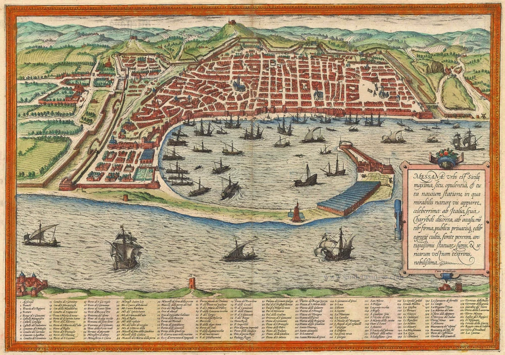
Messana, Urbs est Sicilie maxima, situ, opulentia, & tuta navium statione, ... 1574
Messina by Braun & Hogenberg
[Item number: 5497]
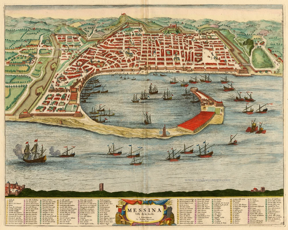
Messina Ville de la Sicile. 1704
Sicily - Messina, by Blaeu - Mortier.
[Item number: 18139]
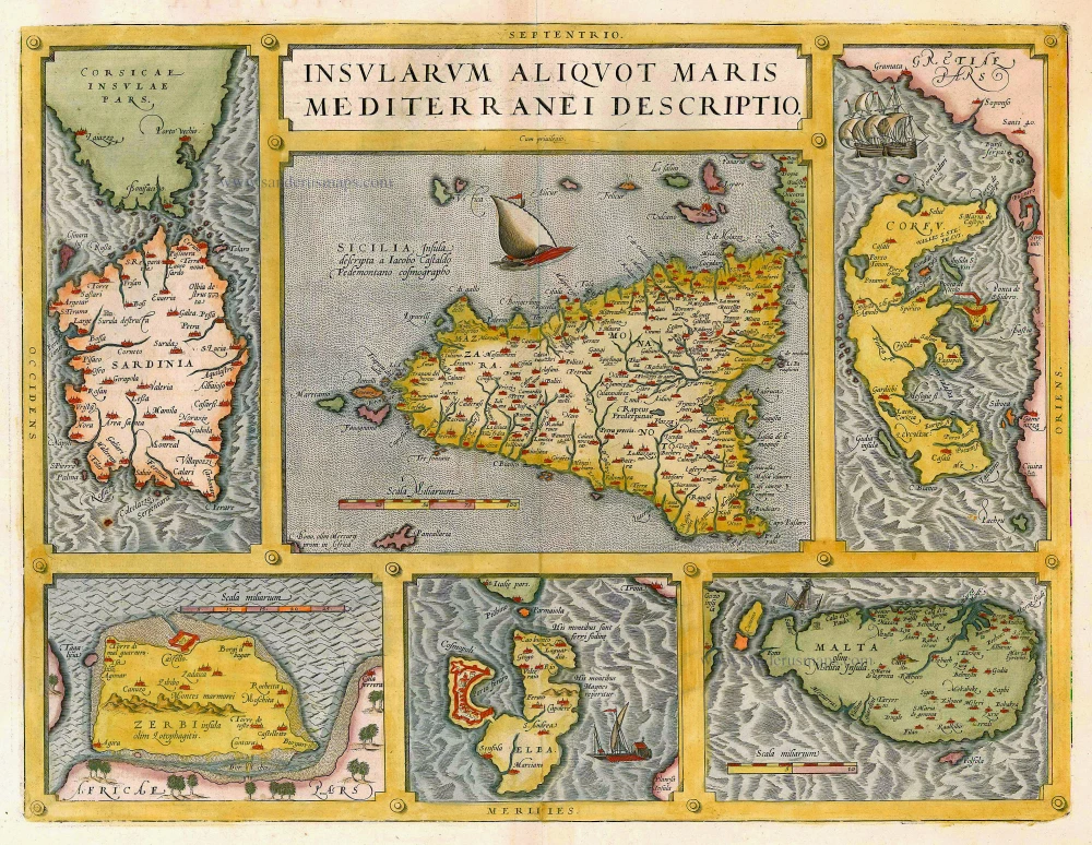
Insularum Aliquot Maris Mediterranei Descriptio. 1612
Sicily, Sardinia, Corfu, Djerba, Elba, Malta by Abraham Ortelius
[Item number: 20929]
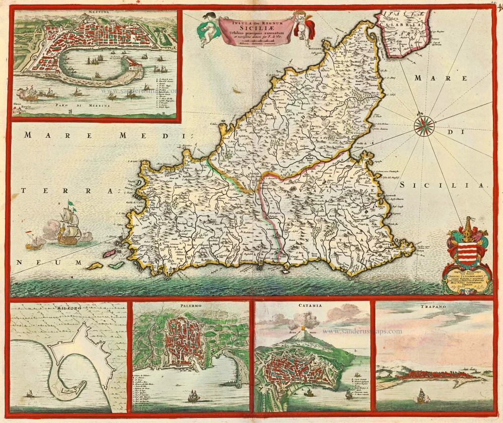
Insula sive Regnum Siciliae Urbibus praecipuis exornatum c. 1682
Sicily by Frederick de Wit.
[Item number: 24517]
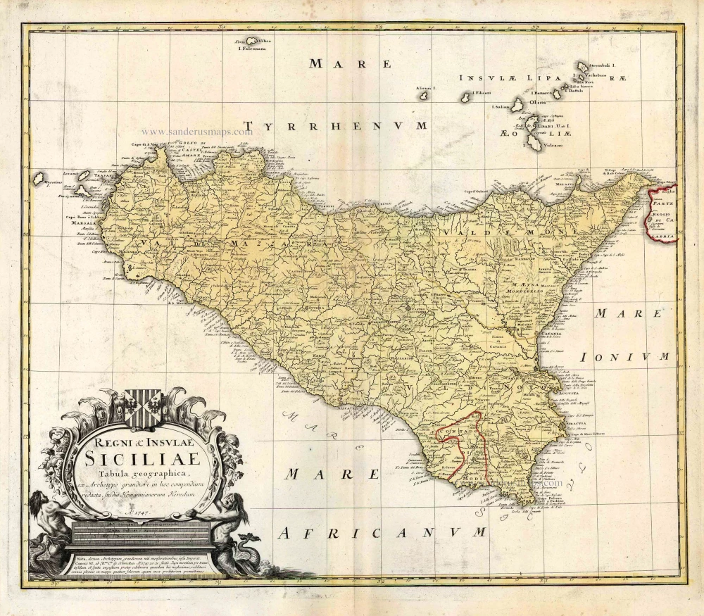
Regni & Insulae Siciliae Tabula Geographica ... c. 1720-65
Sicily, by Homann Heirs.
[Item number: 25478]
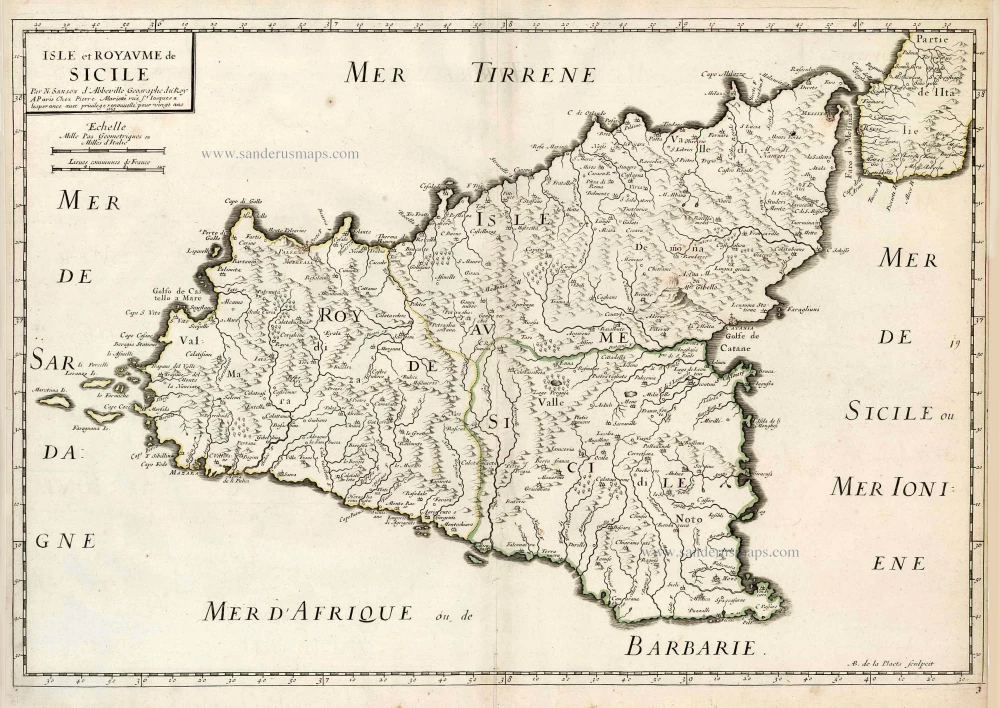
Isle et Royaume de Sicile. 1665
Sicily, by N. & G. Sanson.
[Item number: 25896]
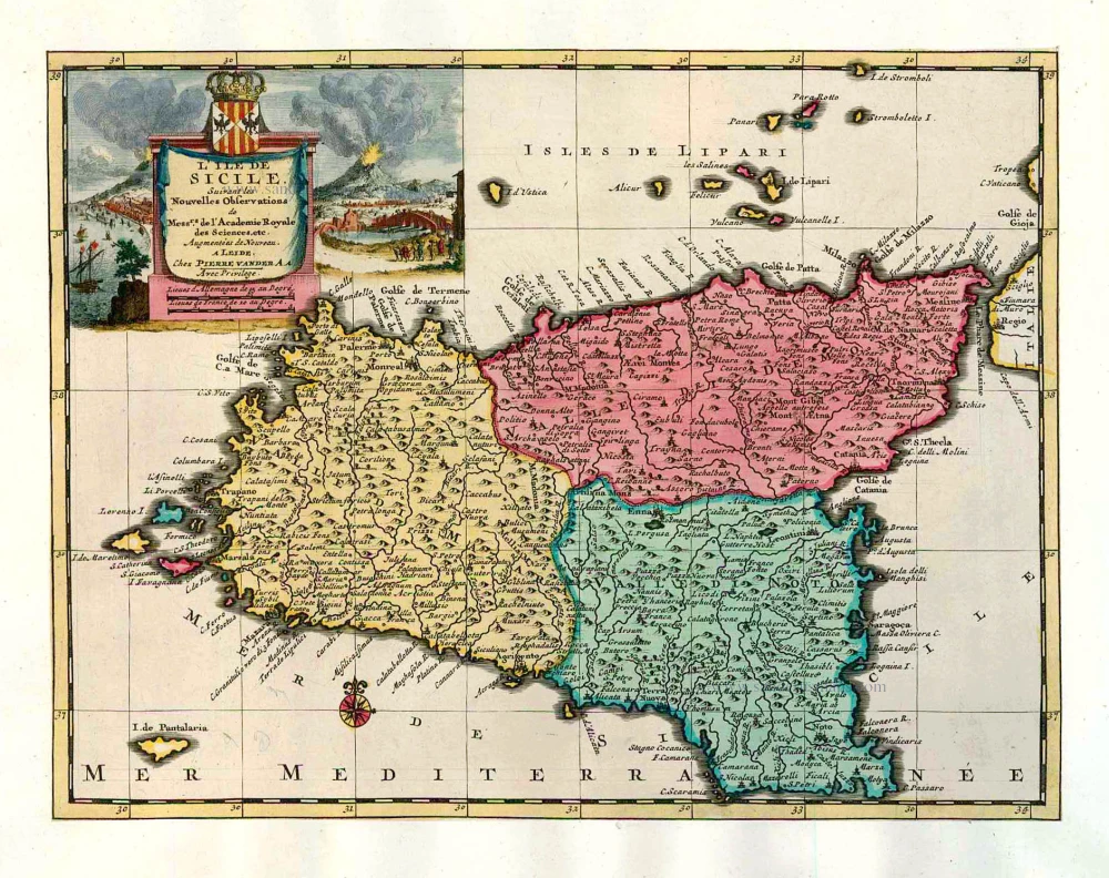
L'Ile de Sicile. 1713
Sicily, by Pieter Van der Aa.
[Item number: 26077]

Siciliae Veteris Typus. 1641
Ancient Sicily, by Johannes Janssonius.
[Item number: 26426]
Siciliae Regnum. 1641
Sicily, by Henricus Hondius.
[Item number: 26427]
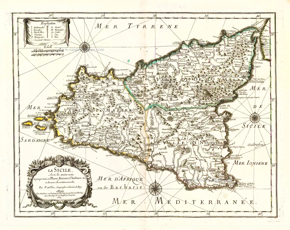
La Sicile, Avec les anciens noms de presque toutes ses Places, Rivieres, Chasteaux, &c. 1679
Sicily, by P. Duval.
[Item number: 26485]
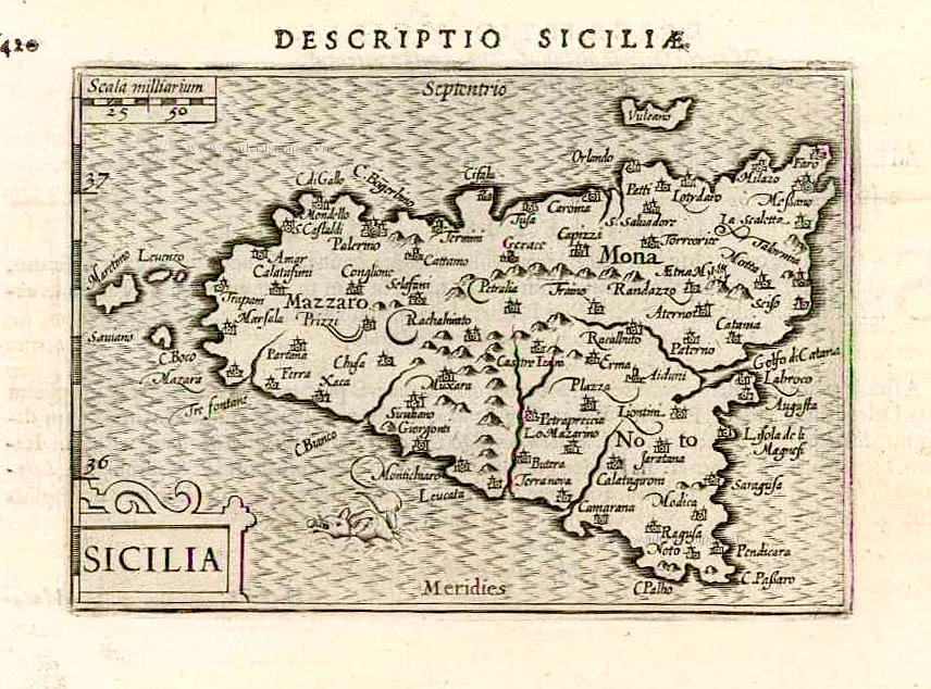
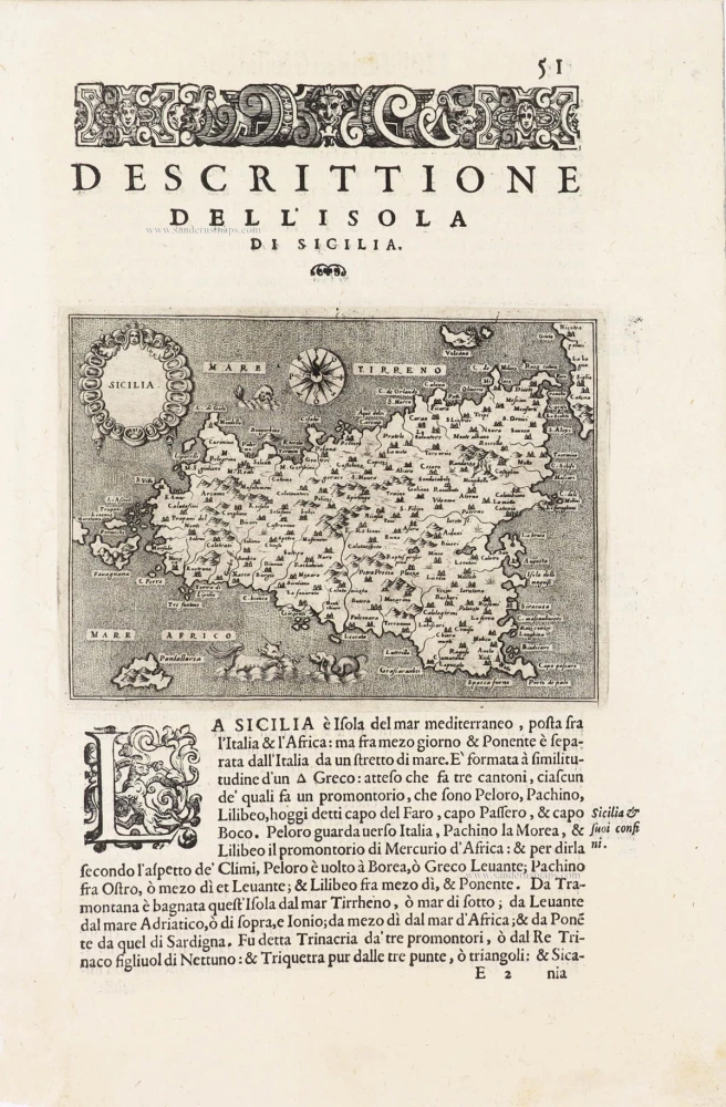
Sicilia. 1602
Sicily (Sicilia), by Langenes, published by P. Bertius.
[Item number: 26539]
Very rare!
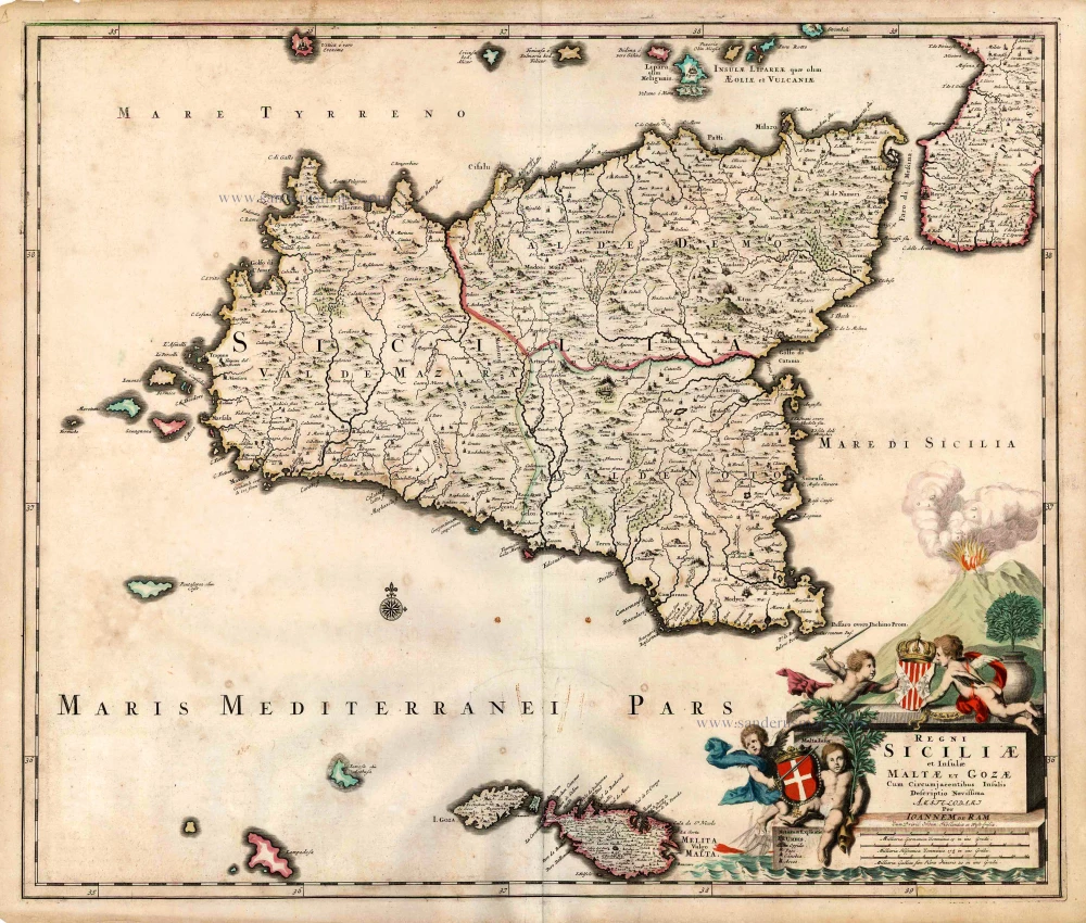
Regni Siciliae et Insulae Maltae et Gozae Cum Circumjacentibus Insulis. c. 1690
Sicily by Johannes De Ram.
[Item number: 26726]
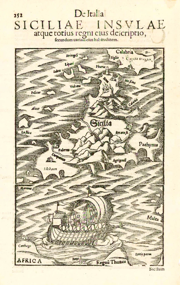
Sicilia. - Siciliae Insulae atque totius regni eius descriptio, ... 1552
Sicily, by Sebastian Münster.
[Item number: 27267]
Sicilia Insula. After 1575
Sicily (Sicilia) by Giovanni Francesco Camocio
[Item number: 27566]
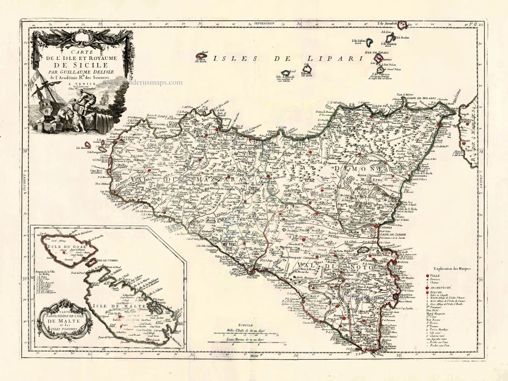
Carte de L'Isle et Royaume de Sicile. 1776-79
Sicily & Malta, by Paolo Santini.
[Item number: 27732]

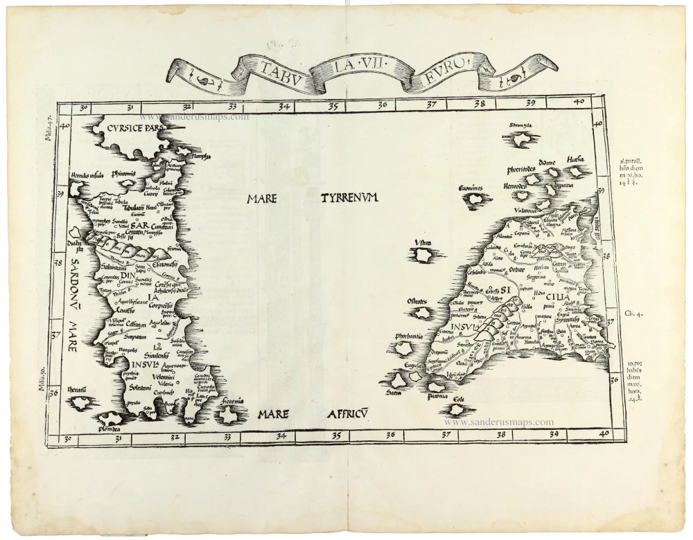
Tabula . VII . Euro. 1525
Sardinia & Sicily by Lorenz Fries.
[Item number: 28385]
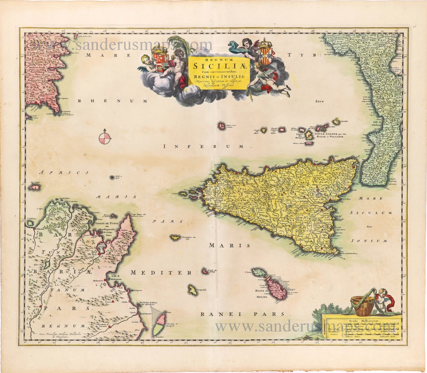
Regnum Siciliae cum circumjacentibus Regnis et Insulis. c. 1680
Sicily with the isles of Malta and Gozo, by Nicolaes Visscher I.
[Item number: 28607]
Isle et Royaume de Sicile. 1652
Sicily, by N. & G. Sanson.
[Item number: 29720]
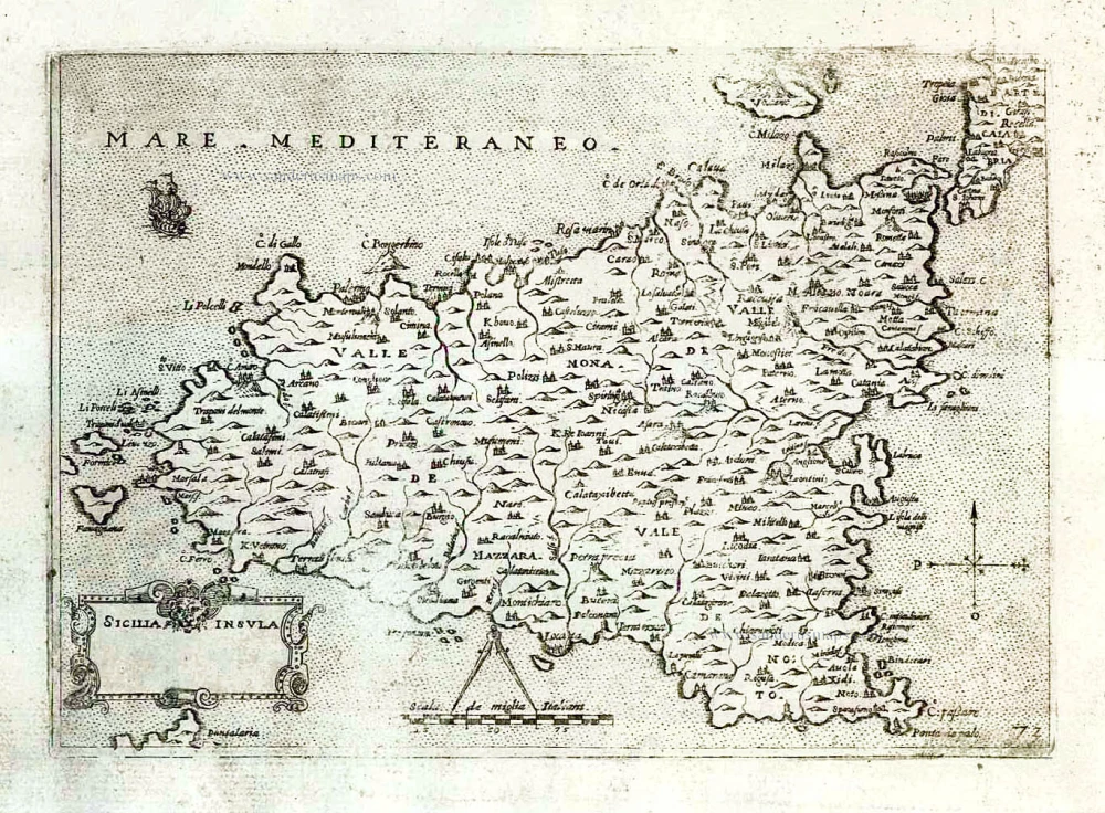
Sicilia - [Above map :] Descrittione dell'Isola di Sicilia. 1590
Sicily (Sicilia) by Thomaso Porcacchi.
[Item number: 29766]
Tabula . VII . Euro. 1525
Sardinia & Sicily by Lorenz Fries.
[Item number: 30534]