
Antique map of Cape Verde Islands by Van Keulen Johannes 1681
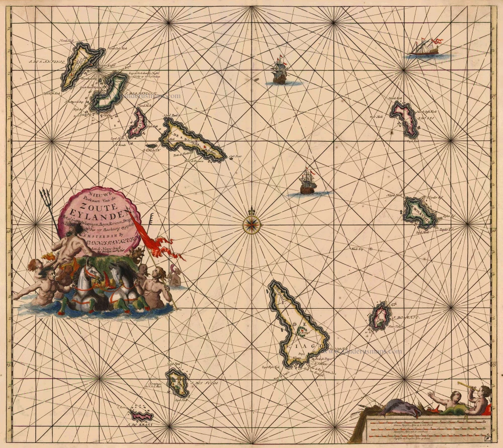
Nieuwe Paskaart van de Zoute Eylanden
Currently not available
Item Number: 5412 Authenticity Guarantee
Category: Antique maps > Oceans
Sea chart of the Cape Verde Islands, oriented to the North.
Early edition with engraved number 38.
Copper engraving
Size: 50 x 57cm (19.5 x 22.2 inches)
Verso: Blank
Condition: Old coloured, age-toned, minor spotting.
Condition Rating: B
References: Koeman, Keu (92).
From: De Nieuwe Groote Lichtende Zee-Fakkel, ... Amsterdam, J. van Keulen, 1697-1709.
Related items
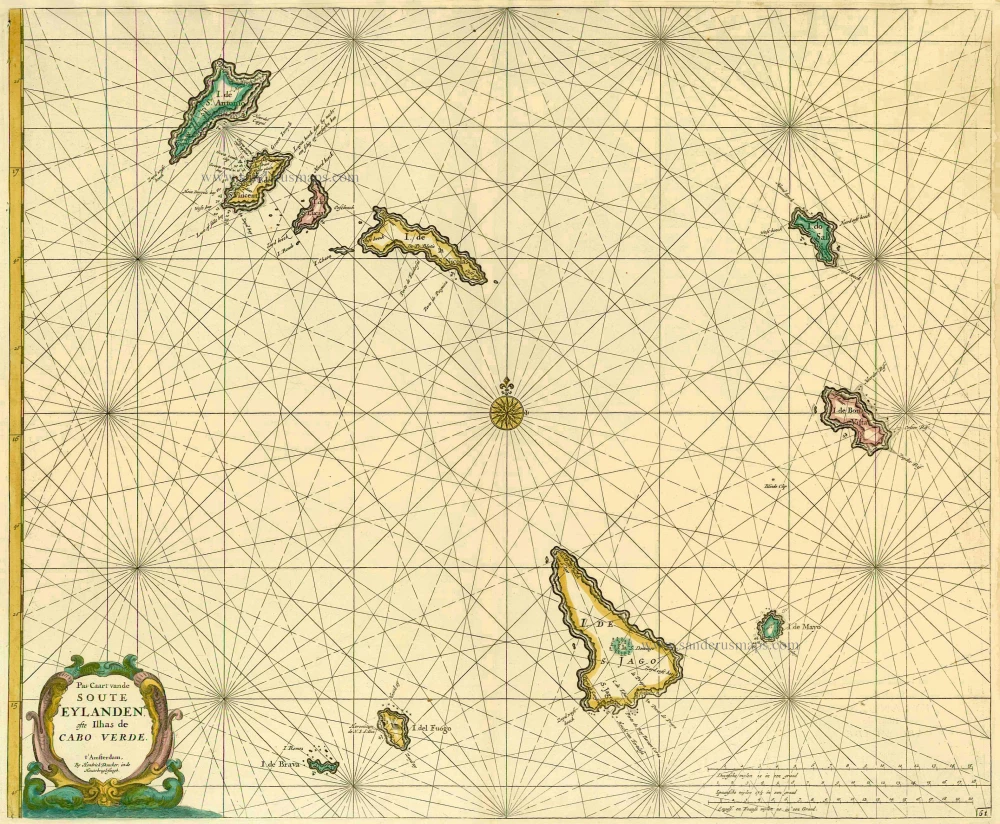
Pas-Caart vande Soute Eylanden ofte Ilhas de Cabo Verde 1686
Cape Verde Islands, by Doncker H.
[Item number: 13643]
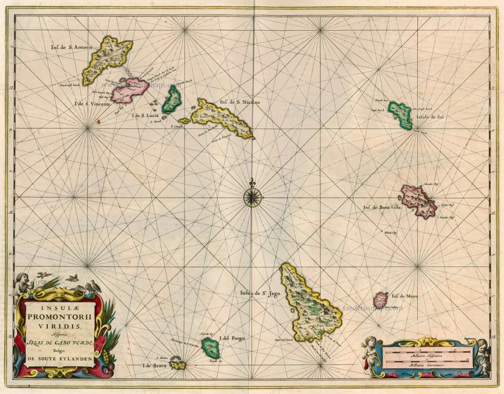
Insulae Promontorii Viridis, Hispanis Islas de Cabo Verde, Belgis de Soute Eylanden 1662
Cape Verde Islands, by Blaeu J.
[Item number: 22816]

Les Iles du Cap Verd, nommées par quelques Auteurs Iles de Sel. 1713
Cape Verde Islands, by Pieter van der Aa.
[Item number: 26164]