
New Guinea, by W.C. Schouten 1618
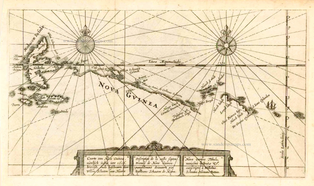
Caarte van Nova Guinea, Nieulijck inden iare 1616 bezeijlt, ende beschreven door Willem Schouten van Hoorn.
Item Number: 25400 Authenticity Guarantee
Category: Antique maps > Oceans
Old, antique chart of the north coast of New Guinea with the route of Eendrachtas far as Ternate, by W.C. Schouten.
Title also in French and Latin.
Copper engraving
Size (not including margins): 15 x 27cm (5.9 x 10.5 inches)
Verso: Blank
Condition: Excellent.
Condition Rating: A+
From: Journael ofte Beschrijyvinghe van de wonderlicke reyse gedaen ... Amsterdam, W. Blaeu, 1618.
"The mapping of this coast meant a noticeable improvement in its depiction." (Schilder).
Related items
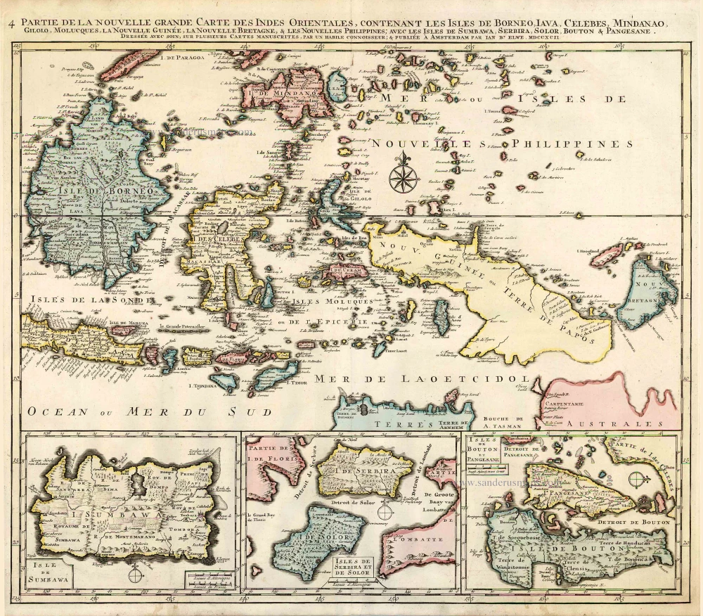
Partie de la Nouvelle Grande Carte des Indes Orientales, Contenant les Isles de Borneo, Iava, Celebes, Mindanao ... 1792
Indonesia - New Guinea - Australia by J.B. Elwe.
[Item number: 2293]

Kaart van de Papoasche Eilanden. c. 1770
New Guinea, by Tirion I.
[Item number: 19203]