
AMERICA - BRAZIL - ATLANTIC OCEAN by Doncker H. 1665
Hendrick Doncker (1625-1699)
Hendrick Doncker became a member of the bookseller's guild in 1647 and ran his shop successfully for fifty years. He was able to develop one of the most popular sets of maritime works published in Amsterdam during the Golden Age.
In 1651 he bought a house in the Nieuwe Brugsteeg in Amsterdam. It was called 'in 't Stuurmans gereetschap' (in the mariners' instruments) and stood opposite the house where Johannes van Keulen later settled.
Apart from the sea atlases, charts and pilot books, Hendrik Doncker published various editions of textbooks on the art of navigation.
After the death of Hendrick Doncker, the son, Hendrick II (c. 1664-c.1739), continued publishing the sea atlases Zeeatlas and Zeespiegel until 1708.
Doncker's charts were the most up-to-date in the second half of the 17th century. Although there is some similarity to those charts published by Van Loon, Goos, Lootsman, and Doncker, the latter's charts are original.
In 1655, Hendrick Doncker had begun with the publication of a pilot guide, the Lichtende Columne ofte Zeespiegel. In 1659 he published his first sea atlas, the Zee-Atlas of Waeter-waereld, with 19 maps. Between 1659 and 1669, he increased the number of charts from 19 to 30 and in 1669 he came with an edition containing 50, which was soon to be followed by an edition with large maps: the Nieuwe Groote Vermeerderde Zeeatlas, also with 50 charts. This beautiful atlas was reprinted and continually improved for more than 25 years. After the death of Hendrick Doncker in 1699, his son continued the publication and even enlarged and enhanced the sea-atlas.
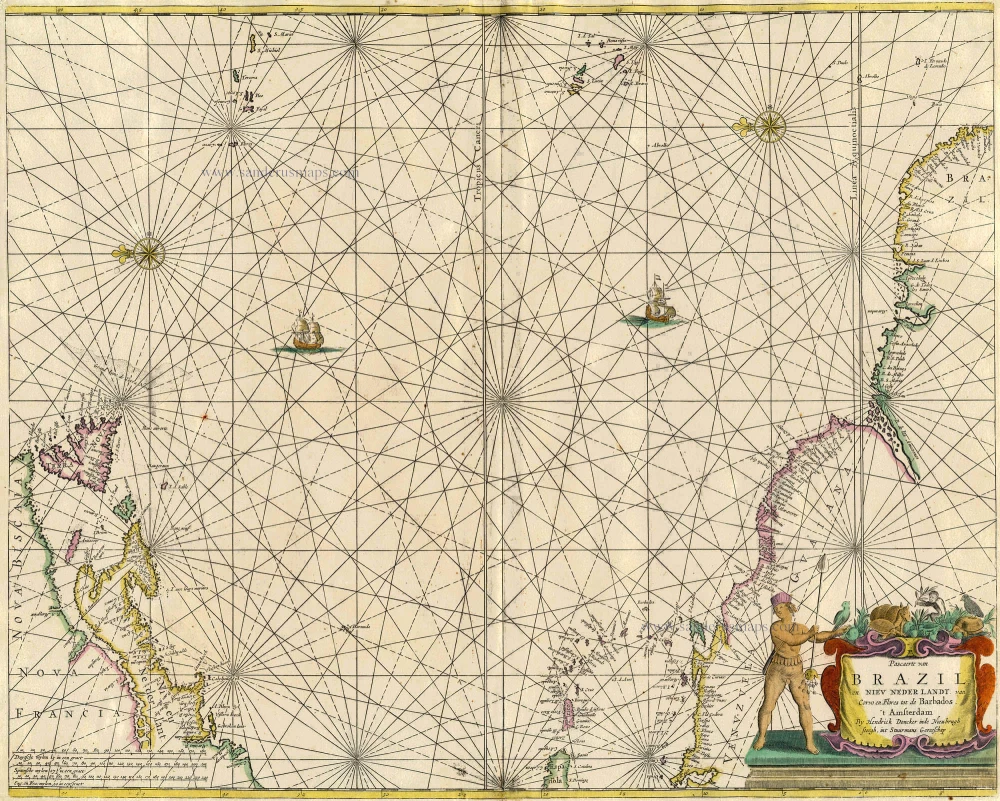
Pascaerte van Brazil en Nieu Nederlandt, van Corvo en Flores tot de Barbados.
Item Number: 18745 Authenticity Guarantee
Category: Antique maps > Oceans
Old, antique map of AMERICA - BRAZIL - ATLANTIC OCEAN, by Doncker H..
Title: Pascaerte van Brazil en Nieu Nederlandt, van Corvo en Flores tot de Barbados.
Copper engraving, printed on paper.
Size (not including margins): 430 x 535mm (16.93 x 21.06 inches).
Verso: Blank.
Condition: Old coloured, light age-toned, small reinforcement at lower centrefold, backed as issued.
Condition Rating: .
References: Koeman, Don8B, [17]
From: De Zee-Atlas of Water-Waerelt, ... Amsterdam, H. Doncker, 1665. (Koeman IV, Don8A)
Hendrick Doncker (1625-1699)
Hendrick Doncker became a member of the bookseller's guild in 1647 and ran his shop successfully for fifty years. He was able to develop one of the most popular sets of maritime works published in Amsterdam during the Golden Age.
In 1651 he bought a house in the Nieuwe Brugsteeg in Amsterdam. It was called 'in 't Stuurmans gereetschap' (in the mariners' instruments) and stood opposite the house where Johannes van Keulen later settled.
Apart from the sea atlases, charts and pilot books, Hendrik Doncker published various editions of textbooks on the art of navigation.
After the death of Hendrick Doncker, the son, Hendrick II (c. 1664-c.1739), continued publishing the sea atlases Zeeatlas and Zeespiegel until 1708.
Doncker's charts were the most up-to-date in the second half of the 17th century. Although there is some similarity to those charts published by Van Loon, Goos, Lootsman, and Doncker, the latter's charts are original.
In 1655, Hendrick Doncker had begun with the publication of a pilot guide, the Lichtende Columne ofte Zeespiegel. In 1659 he published his first sea atlas, the Zee-Atlas of Waeter-waereld, with 19 maps. Between 1659 and 1669, he increased the number of charts from 19 to 30 and in 1669 he came with an edition containing 50, which was soon to be followed by an edition with large maps: the Nieuwe Groote Vermeerderde Zeeatlas, also with 50 charts. This beautiful atlas was reprinted and continually improved for more than 25 years. After the death of Hendrick Doncker in 1699, his son continued the publication and even enlarged and enhanced the sea-atlas.
Related items
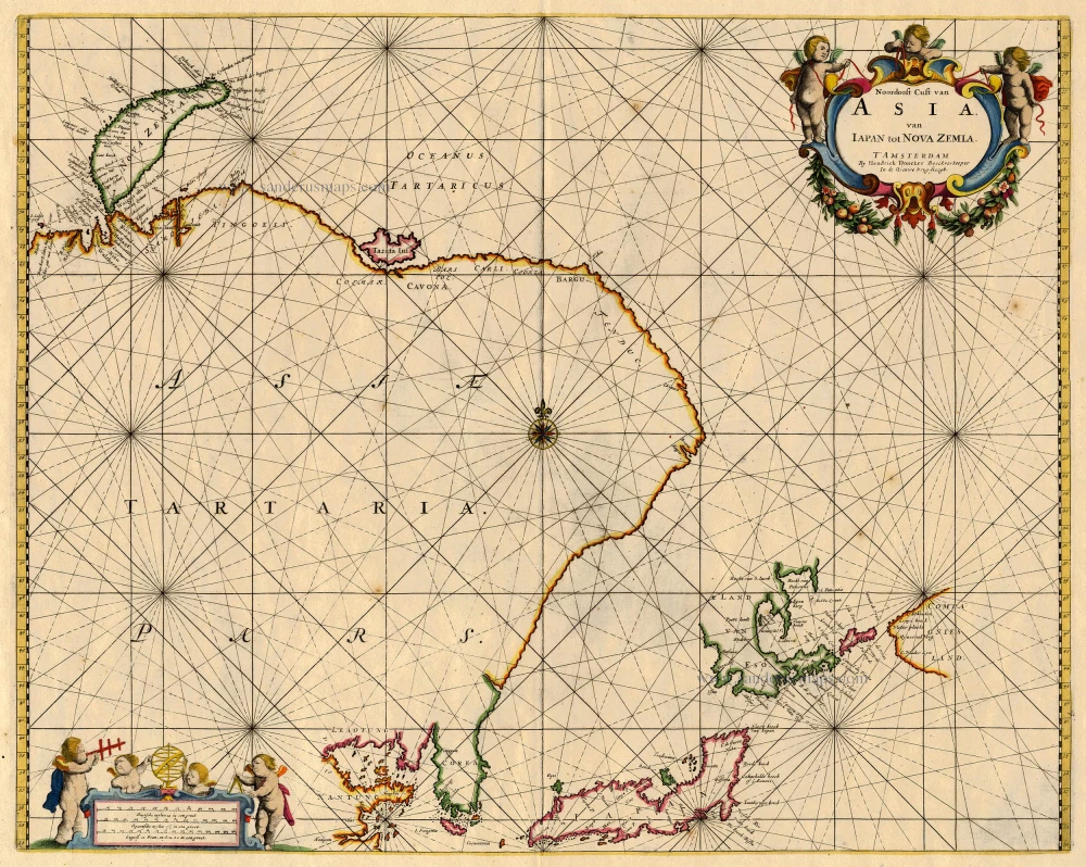
Noordoost Cust van Asia van Iapan tot Nova Zemla 1688
Northeast Asia, by Doncker H.
[Item number: 18466]
Heightened in gold
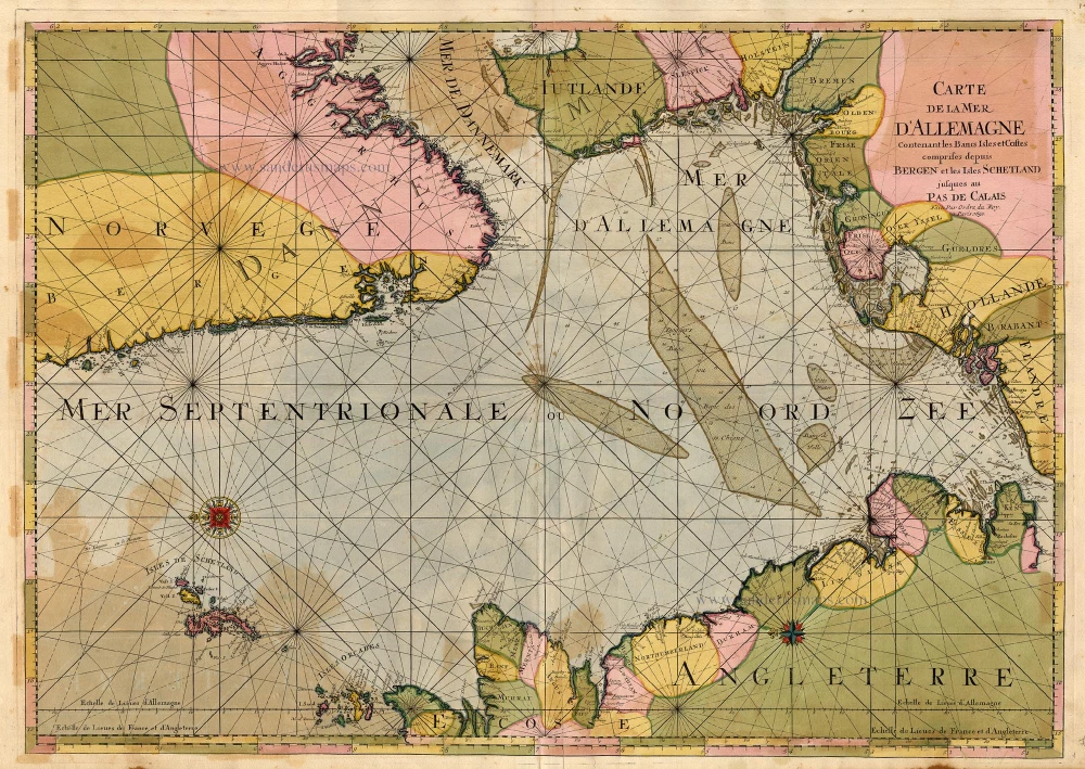
Carte de la Mer d'Allemagne ... 1693
The North Sea by P. Mortier.
[Item number: 15485]
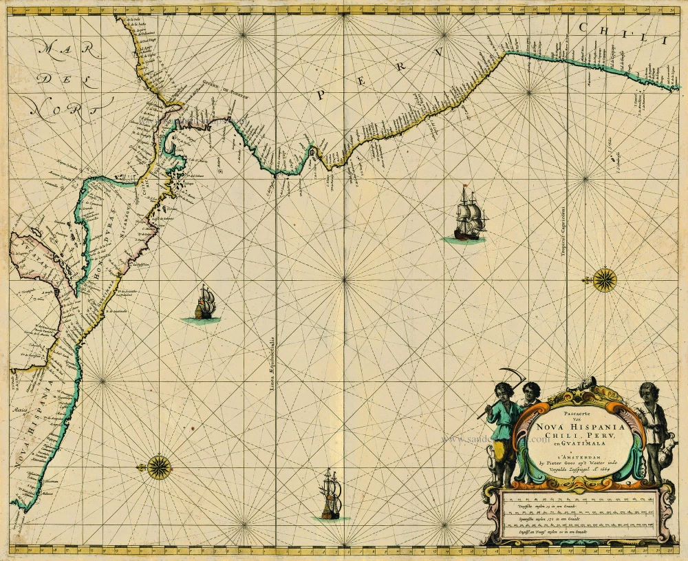
Pascaerte van Nova Hispania Chili, Peru, en Guatimala 1667
Central America, by Pieter Goos.
[Item number: 19031]
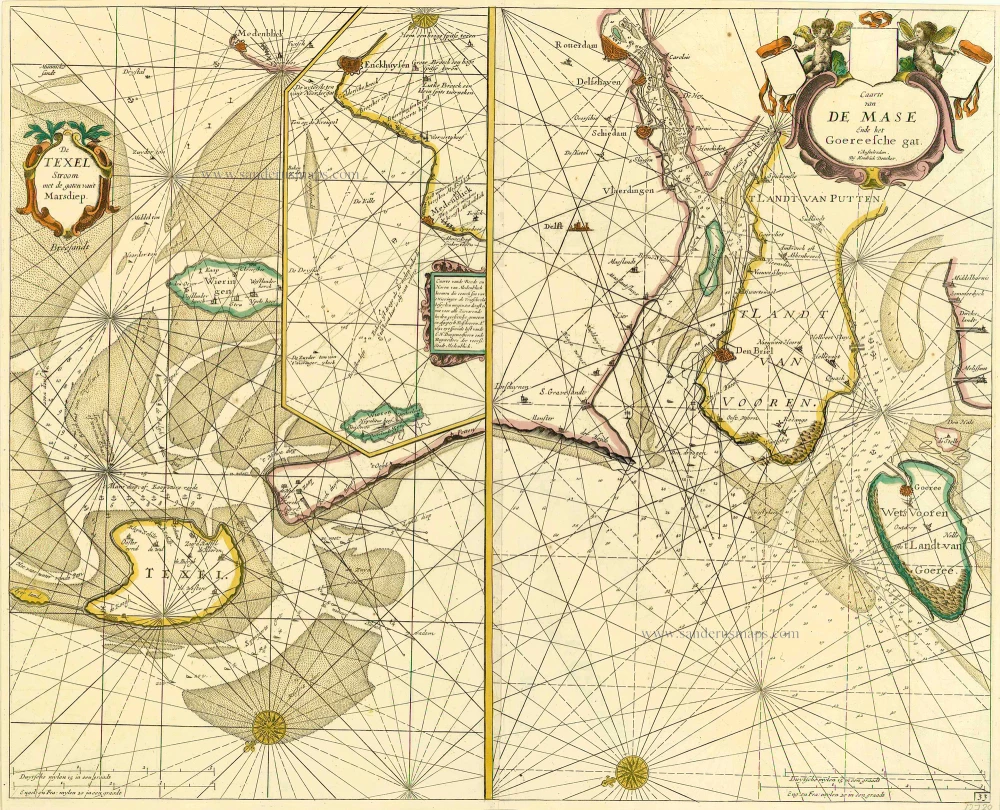
De Texel Stroom met de gaten vant Marsdiep. [On sheet with:] Caarte van De Mase ende het Goereesche Gat 1686
Texel & Maas, by Doncker H.
[Item number: 13738]
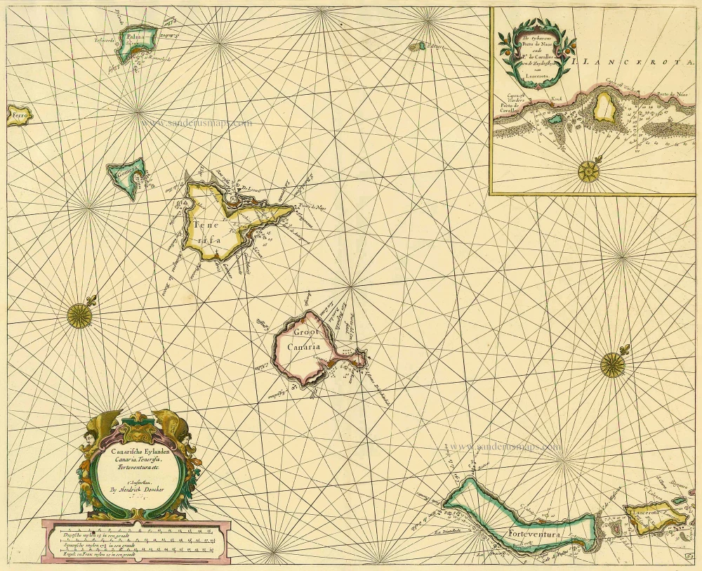
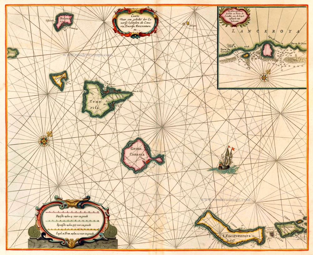
Canarische Eylanden Canaria Tenerifa, Forteventura etc. t' Amsterdam, 1686
Canary Islands, by Hendrick Doncker.
[Item number: 15419]
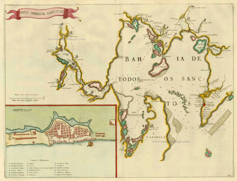
Sinus Omnium Sanctoru. 1664-65
Bahia de Todos los Sanctos, by J. Blaeu.
[Item number: 21226]
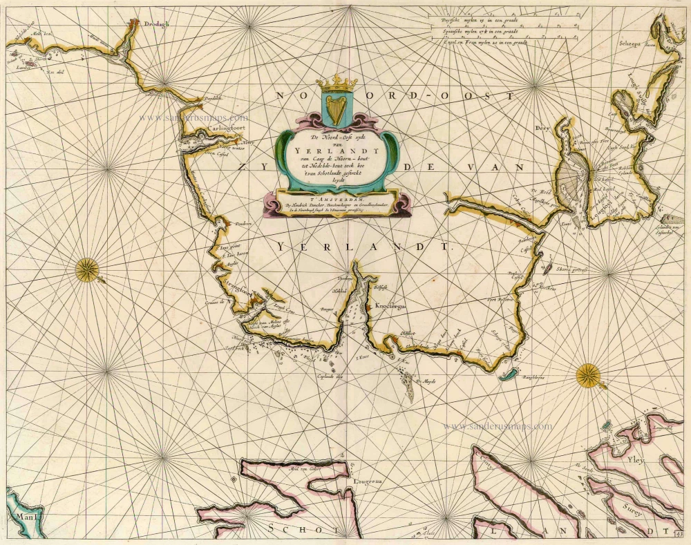
De Noord-Oost zyde van Yerlandt van Caap de Hoorn-hout tot Hedehde-hout oock hoe 't van Schotlandt gestrekt leydt 1686
Ireland, by Doncker H.
[Item number: 13644]
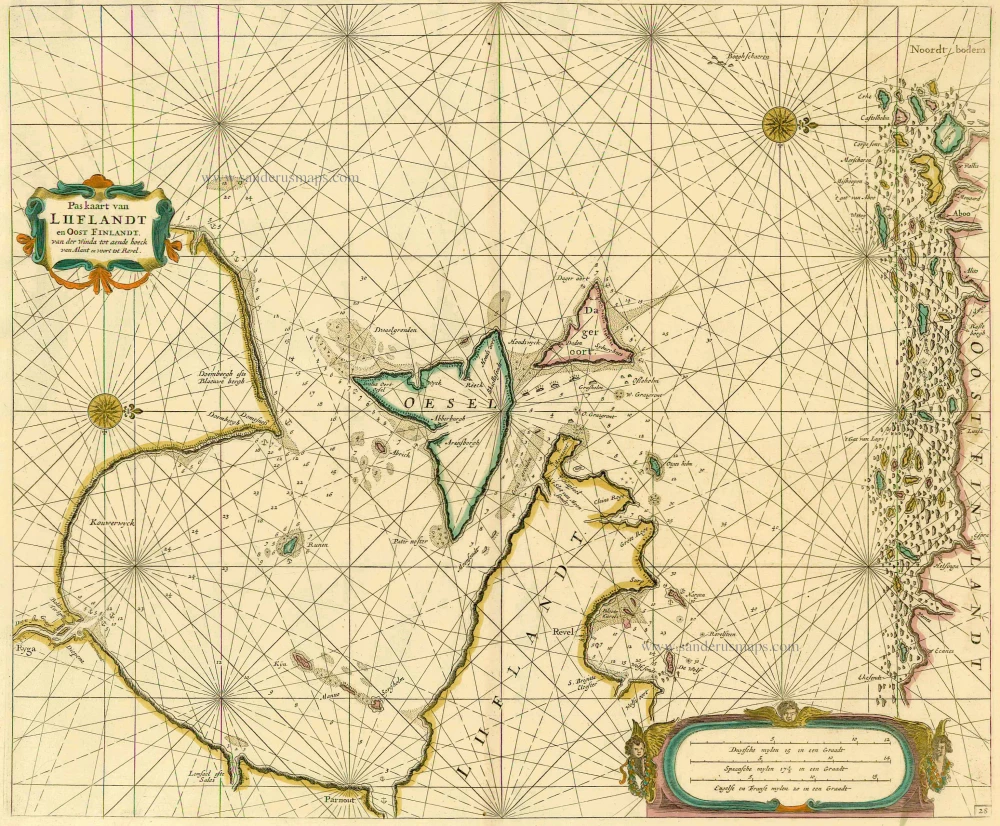
Pas kaart van Liiflandt en Oost Finlandt. van der Winda tot aende hoeck van Alant en voort tot Revel. 1686
Sea chart of the Gulf of Finland by Doncker
[Item number: 13660]

Caerte van de zeylage van Jacob le Maire over de Zuydzee, vertonende de Eylanden ende Landen aldaer by hem ghesien ende aenghedaen. / Tabula, ductum navigationis, quem in Mari Australi tenuit Iacobus Le Maire ... 1622
Rare chart showing the route taken by Schouten and le Maire from South America to New Guinea, by Michiel Colijn.
[Item number: 25104]

Ocean Atlantique et Mers Adjacentes en Quatre Feuilles Contenant les Cotes de l'Europe, de l'Afrique et de l'Amerique ... 1778
The Atlantic Ocean, by G.L. Le Rouge.
[Item number: 14086]
Important map in excellent condition
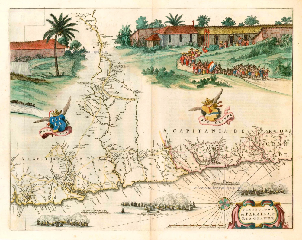
Praefecturae de Paraiba, et Rio Grande. 1663
Brazil - Paraiba, by Joan Blaeu.
[Item number: 25258]

Provincia de Brasil cum Adiacentibus Provinciis. 1630
Brazil, by Johannes de Laet.
[Item number: 25390]
Luxury colouring!
Caarte voor en Gedeelte der Canarise Eylanden als Canaria, Tenerifa, Forteventura, etc. 1666
The Canary Islands, by Pieter Goos.
[Item number: 25612]