
Bermuda, by Johannes Janssonius. 1641


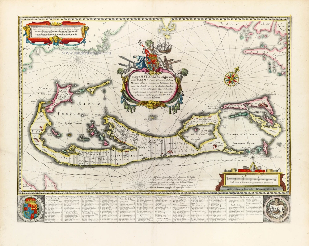
"The most striking and technically brilliant map of Bermuda in the 17th century" (Palmer)
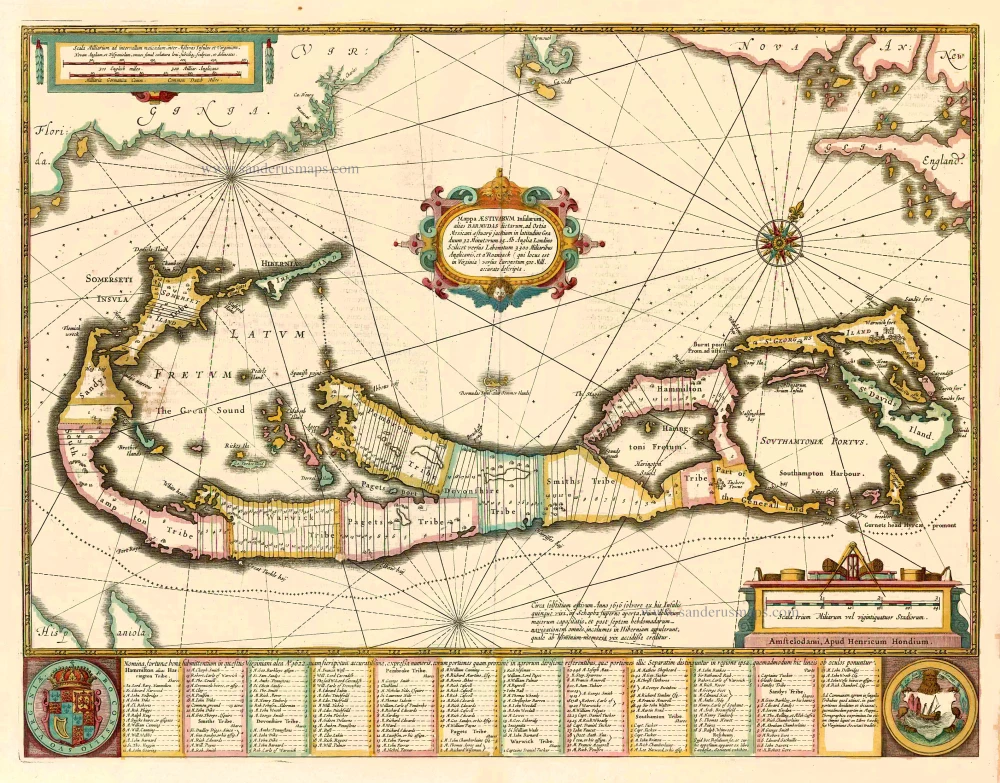
Bermuda is believed to have been discovered by accident in 1505 by a Spaniard, Juan de Bermudez. However, because it was so small, the group of islands remained uninhabited until an English expedition in 1609. In 1615 the Bermuda Company was founded to invest and profit from the new colony, and Richard Norwood was sent to survey the islands, using a canoe to travel around. In 1617 he divided Bermuda into firstly large parishes and then 25-acre (10-hectare) strips of shares to be sold to settlers, as depicted on the map. His island map was published in 1622, but no surviving example is known today. A derivative appeared in Speed's world atlas, the Prospect of the Most Famous Parts of the World, and this is believed to be the source for several continental copies. One of the most amusing cartographic mistakes developed from Norwood's map. To show the position of Bermuda in relation to the mainland, the outline of North America is shown, with New England on the right and Florida on the left, with a small depiction of Bermuda just under the cartouche. Later cartographers, including Herman Moll, George Louis Le Rouge and Antonio Zatta, copied the main map, leaving out the outline of North America but retaining the miniature version of Bermuda as extra islands. The mistake could be explained by using two names for the islands, the 'Summer Islands' or 'Bermuda'. (Baynton-Williams)
The Janssonius Family
Joannes Janssonius (Arnhem, 1588-1664), son of the Arnhem publisher Jan Janssen, married Elisabeth Hondius, daughter of Jodocus Hondius, in Amsterdam in 1612. After his marriage, he settled down in this town as a bookseller and publisher of cartographic material. In 1618, he established himself in Amsterdam next door to Blaeu’s bookshop. He entered into serious competition with Willem Jansz. Blaeu when copying Blaeu’s Licht der Zeevaert after the expiration of the privilege in 1620. His activities concerned the publication of atlases, books, single maps, and an extensive book trade with branches in Frankfurt, Danzig, Stockholm, Copenhagen, Berlin, Koningsbergen, Geneva, and Lyon. In 1631, he began publishing atlases together with Henricus Hondius.
In the early 1640s, Henricus Hondius left the atlas publishing business to Janssonius. Competition with Joan Blaeu, Willem’s son and successor, in atlas production, prompted Janssonius to enlarge his Atlas Novus finally into a work of six volumes, into which a sea atlas and an atlas of the Old World were inserted. Other atlases published by Janssonius are Mercator’s Atlas Minor, Hornius’s historical atlas (1652), the townbooks in eight volumes (1657), Cellarius’s Atlas Coelestis and several sea atlases and pilot guides.
After the death of Joannes Janssonius, the shop and publishing firm were continued by the heirs under the direction of Johannes van Waesbergen (c. 1616-1681), son-in-law of Joannes Janssonius. Van Waesbergen added Janssonius's name to his own.
In 1676, Joannes Janssonius’s heirs sold by auction “all the remaining Atlases in Latin, French, High and Low German, as well as the Stedeboecken in Latin, in 8 volumes, bound and unbound, maps, plates belonging to the Atlas and Stedeboecken.” The copperplates from Janssonius’s atlases were afterwards sold to Schenk and Valck.
Mappa Aestivarum Insularum alias Barmudas dictarum, ...
Item Number: 26460 Authenticity Guarantee
Category: Antique maps > Oceans
Old, antique map of Bermuda by J. Janssonius.
Oriented to the Northwest
Date of the first edition: 1633
Date of this map: 1641
Copper engraving, printed on paper.
Size (not including margins): 43 x 53cm (16.8 x 20.7 inches)
Verso text: French
Condition: Original coloured, slight shine-through of verso text.
Condition Rating: A+
References: Van der Krogt 1, 9660:1.1; Palmer, p.16 & pl.11.
From: Nouveau Theatre du Monde ou Nouvel Atlas comprenant Les Tables et Descriptions de toutes les Regions de la Terre. Amsterdam, H. Hondius, 1641. (Van der Krogt 1, 412)
"The most striking and technically brilliant map of Bermuda in the 17th century" (Palmer)
Bermuda is believed to have been discovered by accident in 1505 by a Spaniard, Juan de Bermudez. However, because it was so small, the group of islands remained uninhabited until an English expedition in 1609. In 1615 the Bermuda Company was founded to invest and profit from the new colony, and Richard Norwood was sent to survey the islands, using a canoe to travel around. In 1617 he divided Bermuda into firstly large parishes and then 25-acre (10-hectare) strips of shares to be sold to settlers, as depicted on the map. His island map was published in 1622, but no surviving example is known today. A derivative appeared in Speed's world atlas, the Prospect of the Most Famous Parts of the World, and this is believed to be the source for several continental copies. One of the most amusing cartographic mistakes developed from Norwood's map. To show the position of Bermuda in relation to the mainland, the outline of North America is shown, with New England on the right and Florida on the left, with a small depiction of Bermuda just under the cartouche. Later cartographers, including Herman Moll, George Louis Le Rouge and Antonio Zatta, copied the main map, leaving out the outline of North America but retaining the miniature version of Bermuda as extra islands. The mistake could be explained by using two names for the islands, the 'Summer Islands' or 'Bermuda'. (Baynton-Williams)
The Janssonius Family
Joannes Janssonius (Arnhem, 1588-1664), son of the Arnhem publisher Jan Janssen, married Elisabeth Hondius, daughter of Jodocus Hondius, in Amsterdam in 1612. After his marriage, he settled down in this town as a bookseller and publisher of cartographic material. In 1618, he established himself in Amsterdam next door to Blaeu’s bookshop. He entered into serious competition with Willem Jansz. Blaeu when copying Blaeu’s Licht der Zeevaert after the expiration of the privilege in 1620. His activities concerned the publication of atlases, books, single maps, and an extensive book trade with branches in Frankfurt, Danzig, Stockholm, Copenhagen, Berlin, Koningsbergen, Geneva, and Lyon. In 1631, he began publishing atlases together with Henricus Hondius.
In the early 1640s, Henricus Hondius left the atlas publishing business to Janssonius. Competition with Joan Blaeu, Willem’s son and successor, in atlas production, prompted Janssonius to enlarge his Atlas Novus finally into a work of six volumes, into which a sea atlas and an atlas of the Old World were inserted. Other atlases published by Janssonius are Mercator’s Atlas Minor, Hornius’s historical atlas (1652), the townbooks in eight volumes (1657), Cellarius’s Atlas Coelestis and several sea atlases and pilot guides.
After the death of Joannes Janssonius, the shop and publishing firm were continued by the heirs under the direction of Johannes van Waesbergen (c. 1616-1681), son-in-law of Joannes Janssonius. Van Waesbergen added Janssonius's name to his own.
In 1676, Joannes Janssonius’s heirs sold by auction “all the remaining Atlases in Latin, French, High and Low German, as well as the Stedeboecken in Latin, in 8 volumes, bound and unbound, maps, plates belonging to the Atlas and Stedeboecken.” The copperplates from Janssonius’s atlases were afterwards sold to Schenk and Valck.
Related items
Mappa Aestivarum Insularum alias Barmudas dictarum, ...
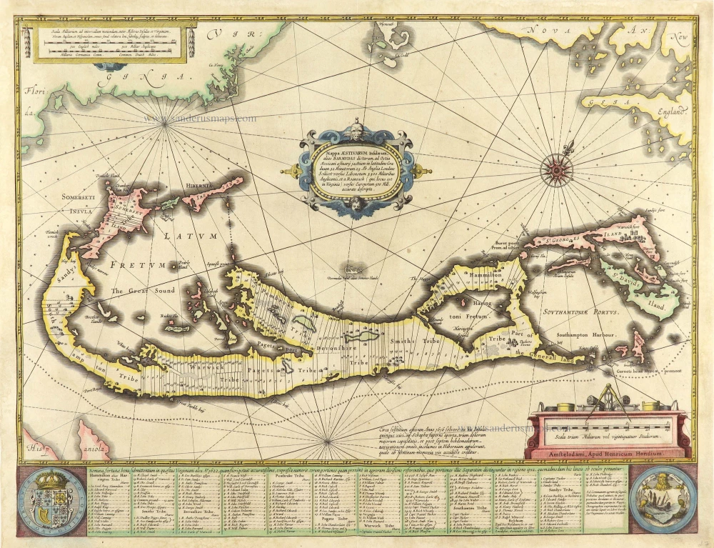
Bermuda by Henricus Hondius.
[Item number: 28831]
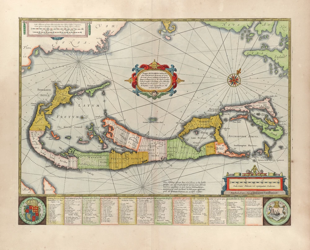
Mappa Aestivarum Insularum alias Barmudas dictarum, ... 1666
Bermuda by Joannes Janssonius.
[Item number: 29951]
The most striking and technically brilliant map of Bermuda in the 17th century
Mappa Aestivarum Insularum alias Barmudas dictarum, ad Ostia Mexicani aestuarij jacentium in Latitudine Graduum 32 Minutorum 25. ... accurate descripta. 1643
Bermuda by Willem Blaeu.
[Item number: 30007]