
Indian Ocean (North), by J.B. Elwe. 1792

Jan Barend Elwe (florished 1785-1809)
The Amsterdam bookseller and publisher, J.B. Elwe, was probably of foreign origin. His activities in the book trade date back to 1785, a date found on an atlas.
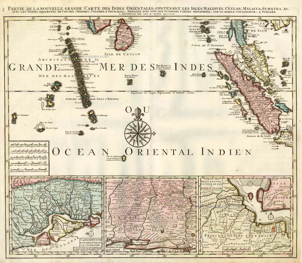
Partie de la Nouvelle Grande Carte des Indes Orientales, Contenant les Isles Maldives, Ceylan, Malacca, Sumatra &c.
Item Number: 2363 Authenticity Guarantee
Category: Antique maps > Oceans
Old, antique map of the Northern Ondian Ocean with Malaysia, Sumatra,the Maldives and Ceylon, by J.B. Elwe.
With 3 insets: Carte de Royaume de Couchin de Coilan et de Cranganor; Carte de Nigomob, Colombo; Carte de Princepaute de Soerabaye et Terre de Grissik.
Date of the first edition: 1792
Date of this map: 1792
Copper engraving, printed on paper.
Size (not including margins): 52.5 x 61cm (20.5 x 23.8 inches)
Verso: Blank
Condition: Original coloured, excellent.
Condition Rating: A+
References: Koeman, II El2 (29).
From: Atlas. Amsterdam, J.B. Elwe, 1792. (Koeman, II, El2)
This is the third map of Elwe's Southeast Asia in four sheets, made after R. & J. Ottens.
Jan Barend Elwe (florished 1785-1809)
The Amsterdam bookseller and publisher, J.B. Elwe, was probably of foreign origin. His activities in the book trade date back to 1785, a date found on an atlas.
Related items
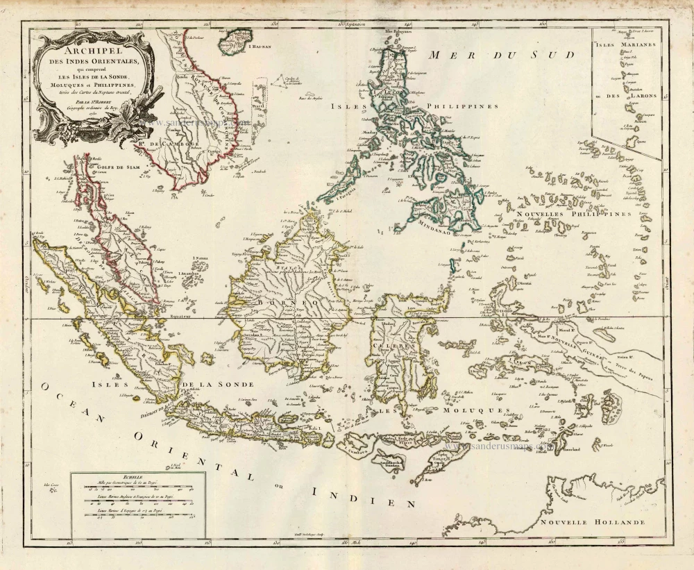
Archipel des Indes Orientales qui Comprend les Isles de la Sonde, Moluques et Philippines. c. 1757
Southeast Asia, par Robert de Vaugondy.
[Item number: 4751]
From the Cloppenburg edition
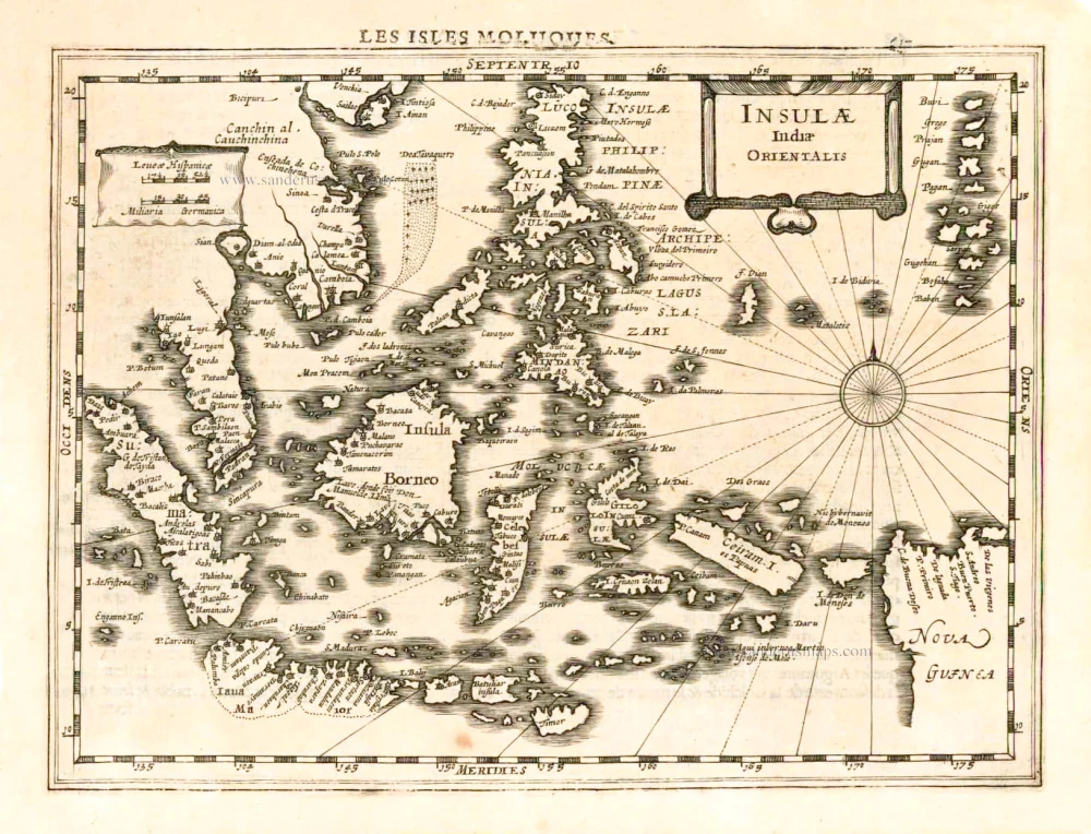
Insulae Indiae Orientalis. 1630
Southeast Asia, by G. Mercator - J. Hondius.
[Item number: 25234]

Sumatrae et Insularum Locorumque Nonnullorum Circumiacentium Tabula Nova. c. 1700
Sumatra, by G. Valk & P. Schenk.
[Item number: 25714]
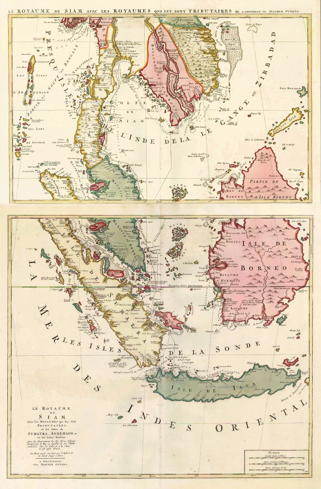
Le Royaume de Siam avec les Royaumes qui luy sont Tributaires, et les Isles de Sumatra, Andemaon, etc. et les Isles Voisine. c. 1700
Southeast Asia, by J. Ottens.
[Item number: 25716]
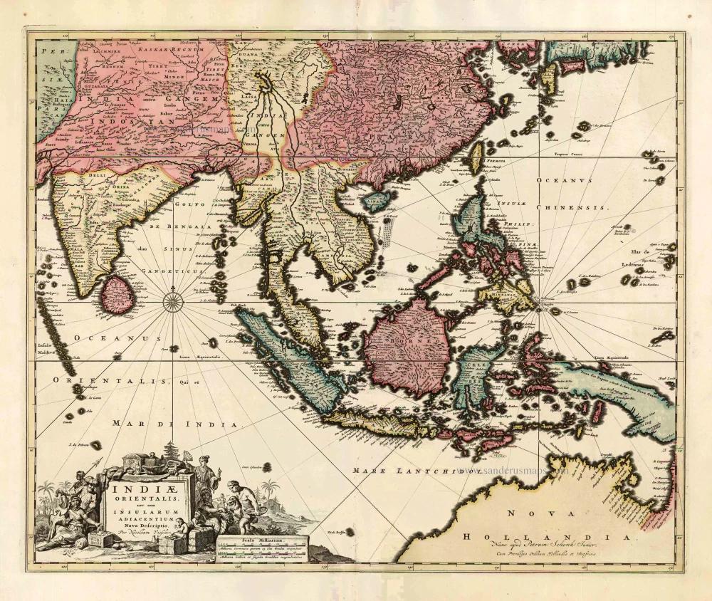
Indiae Orientalis nec non Insularum Adiacentium Nova Descriptio. c. 1740
Southeast Asia by Nicolaes Visscher, published by Petrus Schenk.
[Item number: 25718]
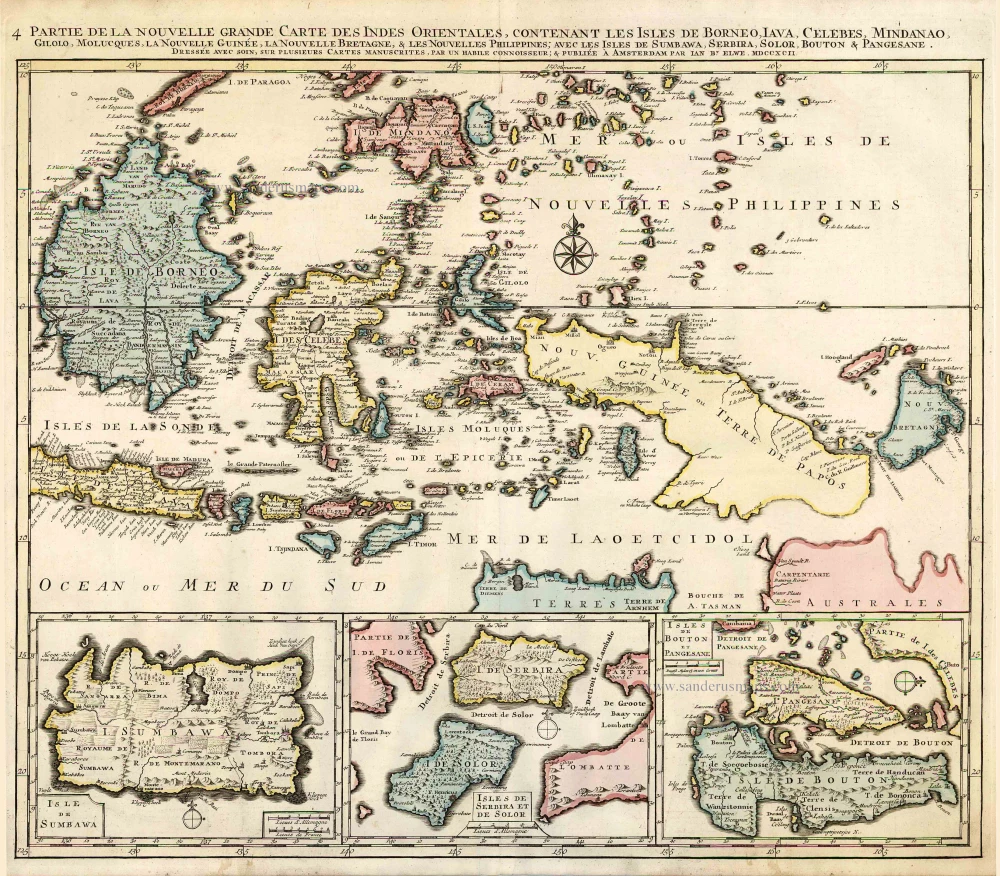
Partie de la Nouvelle Grande Carte des Indes Orientales, Contenant les Isles de Borneo, Iava, Celebes, Mindanao ... 1792
Indonesia - New Guinea - Australia by J.B. Elwe.
[Item number: 2293]
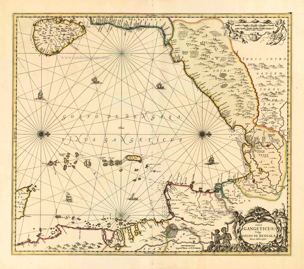
Sinus Gangeticus Vulgo Golfo de Bengala Nova Descriptio. c. 1700
Gulf of Bengal, by G. Valk & P. Schenk.
[Item number: 25835]
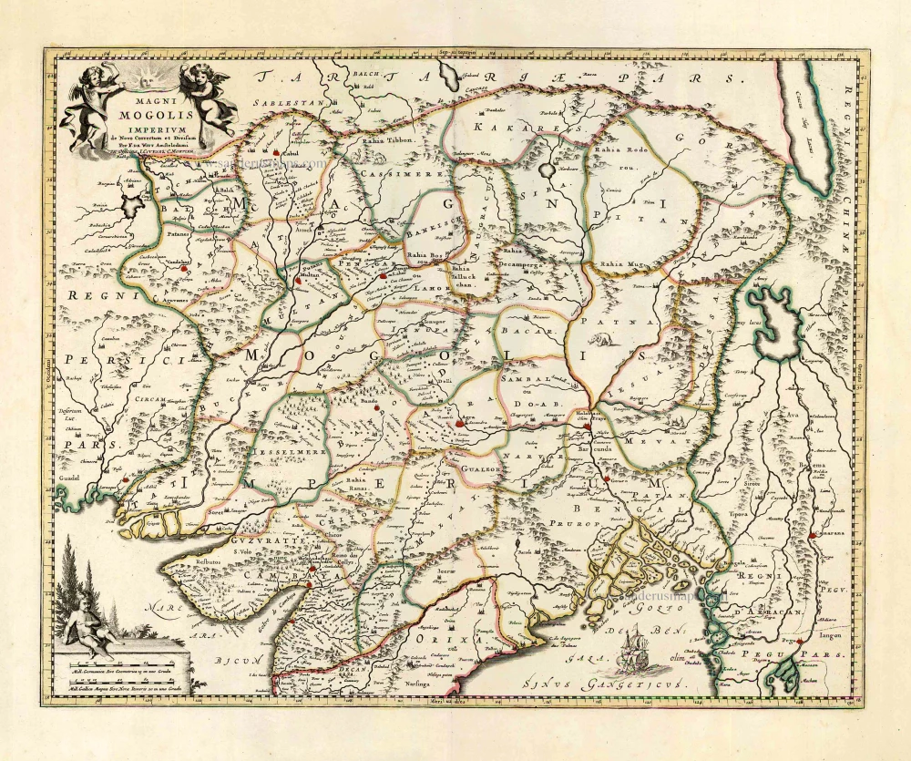
Magni Mogolis Imperium. After 1721
Mongol Empire, by Frederick de Wit - Covens & Mortier.
[Item number: 25838]
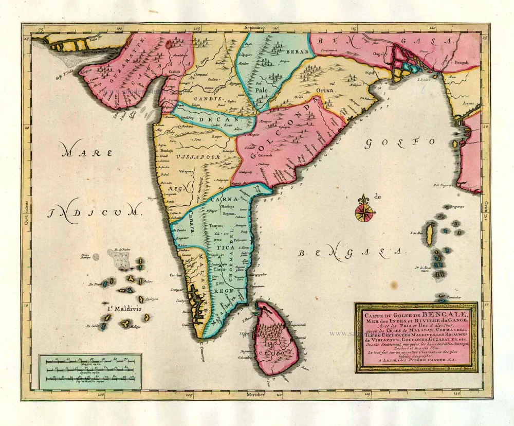
Carte du Golfe de Bengale, Mer des Indes, et Riviere du Gange, Avec les Païs et Iles d'alentour, Savoir les Côtes de Malabar, Cormandel, Ile de Ceylon, les Maldives, les Rolaumes de Visiapour, Golconda, Guzaratte, etc. 1713
India and Ceylon (Sri Lanka), by Pieter van der Aa.
[Item number: 26095]
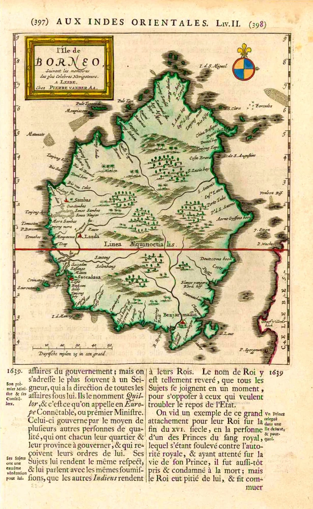
L'Île de Borneo. 1719
Borneo, by Pieter Van der Aa.
[Item number: 26419]
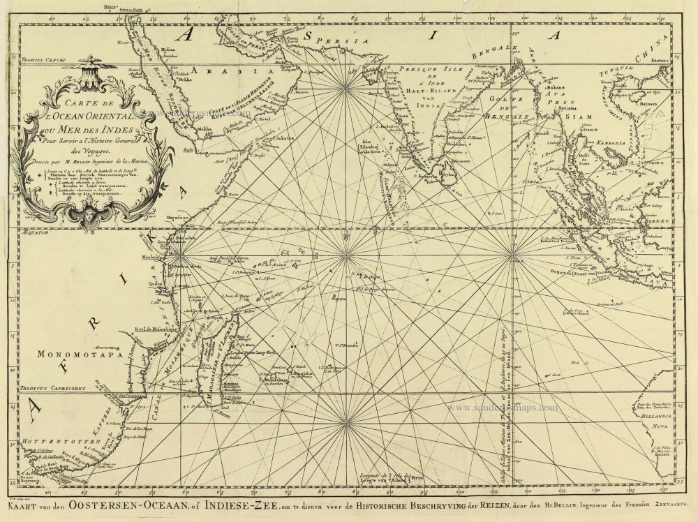
Carte de L'Ocean Oriental ou Mer des Indes. 1747
Indian Ocean by Jacques Nicolas Bellin.
[Item number: 28190]
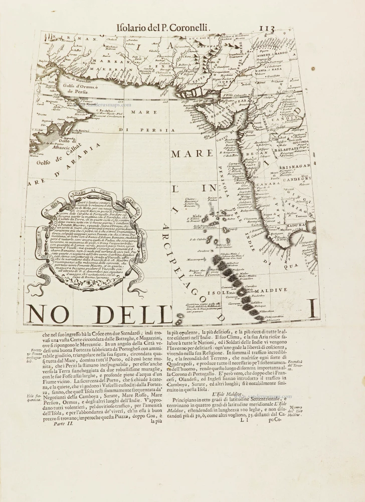
[No title.] 1696
Part of a globe gore showing the Indian Ocean with the coast of Oman, Iran, Pakistan, and the west coast of India, by Vincenzo Coronelli.
[Item number: 28901]