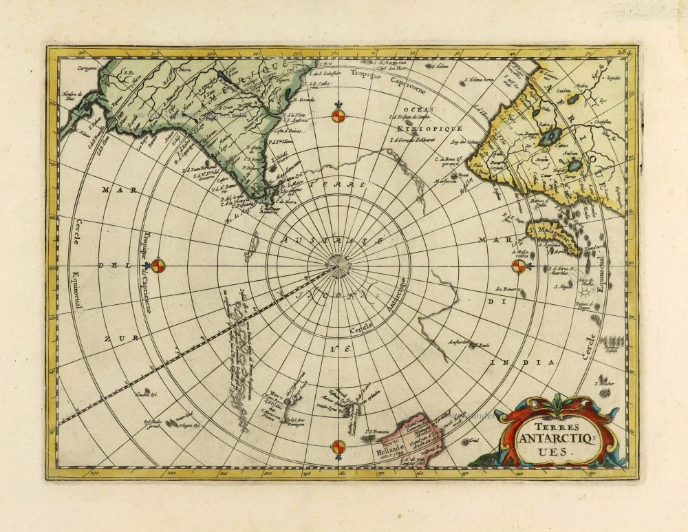
Antarctic Region by Petrus Bertius. 1618
Very rare.
An example of a mythical Australia joined to an Antarctic continent. It shows a large polar map with Beach Provincia marked just below Java Major bottom left and joined to the Solomon Islands top left.
In 1616 a new engraved series of plates were made for the editions of Bertius's Tabulae Geographicae Contractae, to be published by Jodocus Hondius Jr.
Petrus Bertius, the cosmographer of Louis XIII of France, was influenced by the king's desire to write a French text for the popular Tabularum Geographicarum. Bertius followed the Latin text of the edition of 1616.
Petrus Bertius (1565-1629)
Petrus Bertius, born at Beveren, Flanders in 1565, was related with Pieter van den Keere (Kaerius) and Jodocus Hondius. Both famous cartographers were brothers-in-law of Petrus Bertius. As a refugee, he settled in Amsterdam and, after finishing his studies, he became professor of mathematics and librarian at the University of Leiden. In 1618 he also became cosmographer and historiographer to Louis XIII of France and lived in Paris, where he died in 1629.
His enormous working power resulted in many geographical and theological works. He also contributed geographic materials to the works of Clüver and Herrera.
His fame among geographers was established by his text in the pocket atlas Tabularum Geographicarum and by his edition of Ptolemy’s Geographia.
The origin of the Tabularum Geographicum lies in the well-know miniature atlas Caert thresoor, published by Barent Langenes in 1598 in Middelburg. Bertius engraved 169 maps for this small but attractive atlas which was also sold for the first time in 1599 by Cornelis Claesz in Amsterdam. In 1600, Claesz published the pocket atlas with a Latin text composed by Petrus Bertius. From then on, new editions, often enlarged with new maps, regularly appeared, subsequently published by Cornellis Claesz, Jodocus Hondius, Johannes Janssonius and ultimately, in 1649, by Claes Jansz. Visscher.
Koeman divides this series of pocketbooks into two atlases: The Caert-thresoor, published by Langenes and Claesz., with five editions between 1598 and 1609; and the Tabularum Geographicarum Contractarum by Petrus Bertius with ten editions between 1600 and 1650.
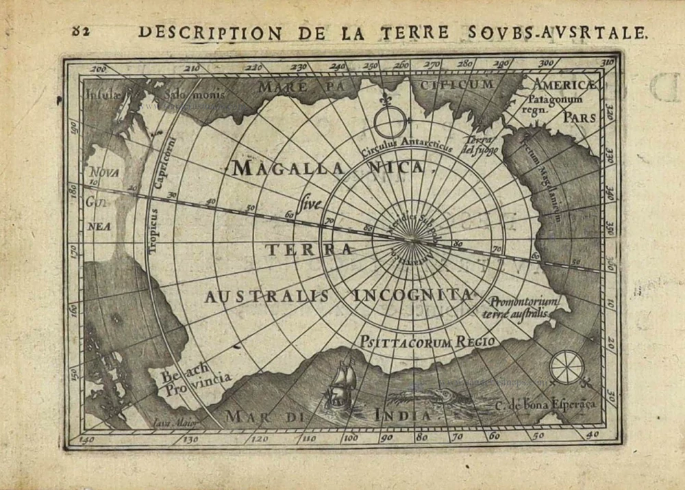
Magalanica sive Terra Australis Incognita. [Title above map:] Description de la Terre Sous-Ausrtale. [sic]
Item Number: 28391 Authenticity Guarantee
Category: Antique maps > World and Polar
Old, antique map of Antarctic Region, by Bertius Petrus.
Title: Magalanica sive Terra Australis Incognita. [Title above map:] Description de la Terre Sous-Ausrtale. [sic]
Date of the first edition: 1616.
Date of this map: 1618.
Copper engraving, printed on paper.
Map size: 95 x 135mm (3.74 x 5.31 inches).
Sheet size: 120 x 180mm (4.72 x 7.09 inches).
Verso: French text.
Condition: Excellent.
Condition Rating: A+.
References: Van der Krogt 3, 0020:342; Tooley (Australia), p. 24 #162
From: La Geographie Racourcie de Pierre Bertius. Amsterdam, Jodocus Hondius jr. 1618. (Van der Krogt 3, 342:11)
Very rare.
An example of a mythical Australia joined to an Antarctic continent. It shows a large polar map with Beach Provincia marked just below Java Major bottom left and joined to the Solomon Islands top left.
In 1616 a new engraved series of plates were made for the editions of Bertius's Tabulae Geographicae Contractae, to be published by Jodocus Hondius Jr.
Petrus Bertius, the cosmographer of Louis XIII of France, was influenced by the king's desire to write a French text for the popular Tabularum Geographicarum. Bertius followed the Latin text of the edition of 1616.
Petrus Bertius (1565-1629)
Petrus Bertius, born at Beveren, Flanders in 1565, was related with Pieter van den Keere (Kaerius) and Jodocus Hondius. Both famous cartographers were brothers-in-law of Petrus Bertius. As a refugee, he settled in Amsterdam and, after finishing his studies, he became professor of mathematics and librarian at the University of Leiden. In 1618 he also became cosmographer and historiographer to Louis XIII of France and lived in Paris, where he died in 1629.
His enormous working power resulted in many geographical and theological works. He also contributed geographic materials to the works of Clüver and Herrera.
His fame among geographers was established by his text in the pocket atlas Tabularum Geographicarum and by his edition of Ptolemy’s Geographia.
The origin of the Tabularum Geographicum lies in the well-know miniature atlas Caert thresoor, published by Barent Langenes in 1598 in Middelburg. Bertius engraved 169 maps for this small but attractive atlas which was also sold for the first time in 1599 by Cornelis Claesz in Amsterdam. In 1600, Claesz published the pocket atlas with a Latin text composed by Petrus Bertius. From then on, new editions, often enlarged with new maps, regularly appeared, subsequently published by Cornellis Claesz, Jodocus Hondius, Johannes Janssonius and ultimately, in 1649, by Claes Jansz. Visscher.
Koeman divides this series of pocketbooks into two atlases: The Caert-thresoor, published by Langenes and Claesz., with five editions between 1598 and 1609; and the Tabularum Geographicarum Contractarum by Petrus Bertius with ten editions between 1600 and 1650.