
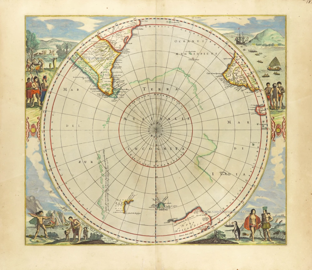
With Tasman discoveries.
South Pole by Henri Du Sauzet. 1734
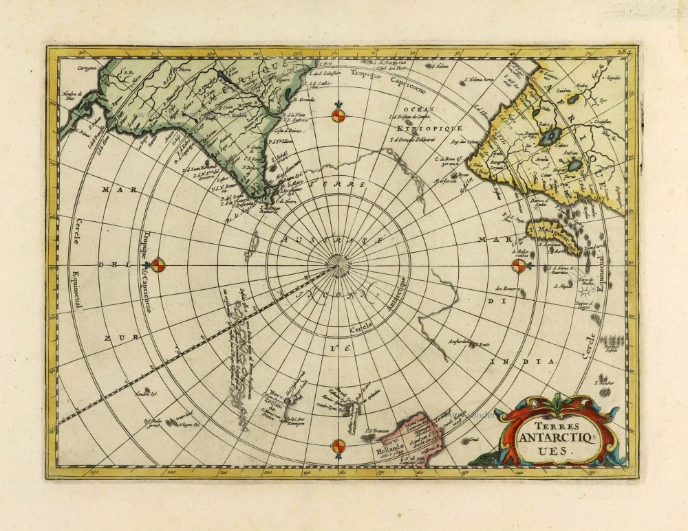
Terres Antarctiques.
Item Number: 28364 Authenticity Guarantee
Category: Antique maps > World and Polar
Old, antique map of South Pole, by Henri Du Sauzet.
Title: Terres Antarctiques.
Date of the first edition: 1734.
Date of this map: 1734.
Copper engraving, printed on paper.
Map size: 180 x 245mm (7.10 x 9.65 inches).
Sheet size: 240 x 300mm (9.45 x 11.80 inches).
Verso: Blank.
Condition: Hand coloured, excellent.
Condition Rating: A+.
From: Atlas portatif composé de CCLXXXV cartes, de plusieurs habiles geographes; où sont representées toutes les parties de la terre. Amsterdam, Henri Du Sauzet, 1734. (Koeman II, p. 546 Me 207).
Related items
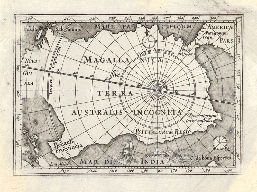
Magallanica sive Terra Australis Incognita. [Title in map] 1676
Antarctic Region by Johannes Janssonius van Waesbergen.
[Item number: 28836]
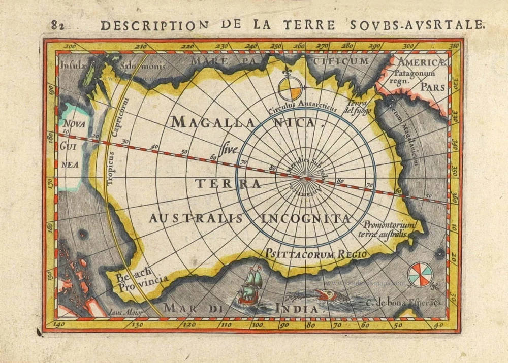
Magallanica sive Terra Australis Incognita. [Title in map] 1616
South Pole by Petrus Bertius.
[Item number: 29797]
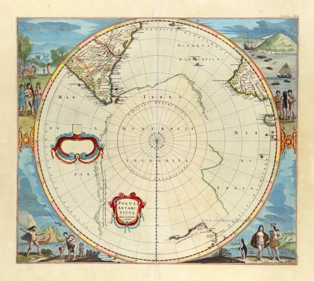
First state, 'Henricus Hondius'.
Polus Antarcticus. 1637
South Pole, by Henricus Hondius.
[Item number: 30054]
Scarce edition with New Zeeland & Tasmania by J. Janssonius.
Polus Antarcticus. 1666
South Pole, by Henricus Hondius, published by J. Janssonius.
[Item number: 30316]