
World map, by Laurenz Fries, after Martin Waldseemüller. 1525


Old, antique world map, by Laurent Fries after Martin Waldseemüller.
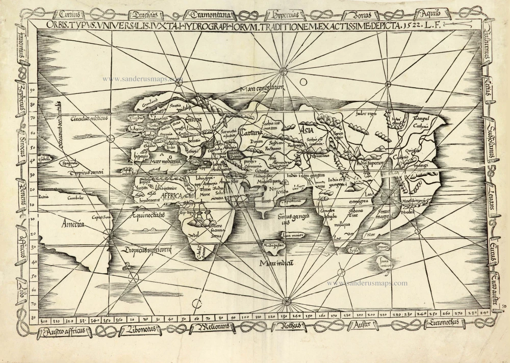
In 1522 Laurent Fries published an edition of Ptolemy's Geography in which virtually all maps, including this one, were reduced versions of Waldseemüller's, 1513. The first of the two modern world maps in the atlas is Fries' rendering which is dated 1522 and is initialled 'L.F.' in the main title. Directional lines crisscross the map's surface, and there is an unusual outer frame whereby banners containing the names of the winds are each linked by looped coils of rope.
Shirley: "... Fries' map is much sought after as it somehow reflects the ambiguities of his age." A framework of medieval thinking has to be re-cast to accept the as-yet unrealised extent of the newly conquered lands. The map has considerable attractions for decorative value, if not for accuracy. It was reprinted in the late Strassbourg, Lyons and Vienne editions of Ptolemy and it is one of the earliest world maps that collectors can still obtain.
Later editions have another title Tabu. Totius Orbis, printed on a large banner above the top of the map.
Lorenz Fries* (c. 1485 – 1532)
Lorenz Fries, a physician, astrologer, and cartographic editor, was a native Alsatian. Nothing is known about his youth and early schooling. His university education in philosophy and medicine has been acquired at several schools. He probably attended Vienna, Montpellier, Piacenza, and Pavia. He obtained a Doctor of Arts degree at one of these institutions.
His first professional position was in Sélestat, near Strasbourg. He practised medicine in Colmar from 1514 to 1518. He wrote several medical works, including a practice entitled Spiegel der Artzny (Mirror of Medicine), a trendy book with seven editions up to 1546. After 1519, he moved to Strasbourg, where he stayed until about 1527.
In 1520, Fries became involved in the publication of new editions of maps by Martin Waldseemüller. He collaborated with Peter Apian to publish a much-reduced version of Waldseemüller's map of 1507.
In the meantime, Fries was preparing a new edition of Ptolemy's Geographia. The book was printed in 1522 by Johannes Grüninger, an esteemed printer from Strasbourg who had previously published the Waldseemüller. It was based on Waldseemüller's editions of 1513 and 1520. Fries says in a note to the reader: "…, we declare that Martin Waldseemüller, piously deceased, originally constructed these maps and that they have been drawn in a format smaller than they ever had". The book sold well, and new editions would follow, printed with the same woodblocks.
In 1525, Willibald Pirkheimer, the Nuremberg humanist, published a new edition with Grüninger. The volume was published jointly with the Nuremberg printer Johannes Koberger. It included the same fifty Waldseemüller/Fries maps as the 1522 edition.
Michael Servetus (= Michael Villanovus) printed two more editions in Lyon in 1535 and 1541. Servetus was tried for heresy in 1553. One of the allegations was that he had written a statement on the verso of the map of the Holy Land describing it as primarily infertile. The idea originated in Fries's edition in 1522. Servetus was burned at the stake, and at Calvin's orders, many copies of Servetus's books followed him into the flames.
Fries also published other books on astrology and medicine. In addition, he undertook a reduction of Waldseemüller's large map of 1516, the Carta Marina Navigatoria, which he translated into German simultaneously. The map was published in 1525, but no copy of this edition survived. The earliest copy known is dated 1530.
In 1525, Strasbourg had become a thoroughly reformed city, and the Roman church's adherents found themselves increasingly unwelcome. For this reason, Fries probably renounced his citizenship and moved to Metz. During this period, he published his last two medical works.
*He should be distinct from the historian Lorenz Fries of Mergentheim (1491-1550).
Martin Waldseemüller (Ilacomilus) (c. 1473-1519)
Martin Walseemüller and his collaborator, Matthias Ringmann, are credited with the first recorded usage of the word America to name the New World in honour of the Italian explorer Amerigo Vespucci.
He was born about 1475, most probably in the village of Wolfenweiler near Freiburg in Breisgau (southern Germany). He studied at the University of Freiburg, where he met Johann Scott, the future printer of Waldseemüller’s edition of Ptolemy and Matthias Ringman, a poet who wrote Waldseemüller’s texts. Gregor Reisch was their tutor. He was noted for his philosophical work, Margaretha Philosophica (1503), a widely read book that included a world map in Ptolemaic form. He undoubtedly aroused the students’ interest in cosmography.
At the beginning of the 16th century, Walseemüller moved to St.Dié in the Vosges. He Hellenized his name to Ilacomilus and worked on an edition of Ptolemy. He learned the printing trade in Basle and became a professor of cosmography under the patronage of René II, Duke of Lorraine.
Together with a group of scholars, among them were Nicholas Lud and Matthias Ringmann, they installed a printing press in St. Dié. The first book appeared in 1507: Cosmographiae Introductio… Few books have generated as much interest and speculation as this book because it suggested that the new continent is named America in honour of Amerigo Vespucci, whose letters about his American “discoveries” form a large part of the book. Great interest was also attached to the two maps on the title page constituting part of the Cosmographiae Introductio: a large 12-panel wall map of the world and a set of globe gores. The map and globe were notable for showing the New World as a continent separate from Asia and naming the southern landmass America.
Ringmann wrote the Cosmographiae Introductio's text, using the name ‘America’. He died in 1511, and by then, Waldseemüller was having doubts about the name they had coined.
In 1511, Walseemüller published the Carta Itineraria Europae, a road map of Europe that showed essential trade routes and pilgrim routes from central Europe to Santiago de Compostela, Spain. It was the first printed wall map of Europe.
After Ringmann’s death, Waldseemüller concentrated on the new version of Ptolemy’s Geographia. The new edition was finally printed in 1513 by Johannes Scott in Strasbourg and is now regarded as the most important. Waldseemüller included twenty modern maps in the new Geographia as a separate appendix.
The 1507 wall map was lost for a long time, but Joseph Fischer found a copy in Schloss Wolfegg in southern Germany in 1901. It is the only known copy purchased by the United States Library of Congress in May 2003.
Orbis Typus Universalis Iuxta Hydrographorum Traditionem Exactissime Depicta 1522 L.F.
Item Number: 28044 Authenticity Guarantee
Category: Antique maps > World and Polar
Title: Orbis Typus Universalis Iuxta Hydrographorum Traditionem Exactissime Depicta 1522 L.F.
Cartographer: Martin Waldseemüller.
Date of the first edition: 1522.
Date of this map: 1525.
Date on map: 1522.
Woodcut, printed on paper.
Size (not including margins): 330 x 480mm (12.99 x 18.9 inches).
Verso: Latin text.
Condition: Excellent.
Condition Rating: A.
References: Shirley, #48; Nordenskiold, Plate XXXIX; Karrow, 28/51
From: L. Fries, Opus Geographiae. Strasbourg, J. Grüninger, 1525. (Karrow, 28/G.1; Shirley (Brit. Lib.), T.PTOL.7b))
Old, antique world map, by Laurent Fries after Martin Waldseemüller.
In 1522 Laurent Fries published an edition of Ptolemy's Geography in which virtually all maps, including this one, were reduced versions of Waldseemüller's, 1513. The first of the two modern world maps in the atlas is Fries' rendering which is dated 1522 and is initialled 'L.F.' in the main title. Directional lines crisscross the map's surface, and there is an unusual outer frame whereby banners containing the names of the winds are each linked by looped coils of rope.
Shirley: "... Fries' map is much sought after as it somehow reflects the ambiguities of his age." A framework of medieval thinking has to be re-cast to accept the as-yet unrealised extent of the newly conquered lands. The map has considerable attractions for decorative value, if not for accuracy. It was reprinted in the late Strassbourg, Lyons and Vienne editions of Ptolemy and it is one of the earliest world maps that collectors can still obtain.
Later editions have another title Tabu. Totius Orbis, printed on a large banner above the top of the map.
Lorenz Fries* (c. 1485 – 1532)
Lorenz Fries, a physician, astrologer, and cartographic editor, was a native Alsatian. Nothing is known about his youth and early schooling. His university education in philosophy and medicine has been acquired at several schools. He probably attended Vienna, Montpellier, Piacenza, and Pavia. He obtained a Doctor of Arts degree at one of these institutions.
His first professional position was in Sélestat, near Strasbourg. He practised medicine in Colmar from 1514 to 1518. He wrote several medical works, including a practice entitled Spiegel der Artzny (Mirror of Medicine), a trendy book with seven editions up to 1546. After 1519, he moved to Strasbourg, where he stayed until about 1527.
In 1520, Fries became involved in the publication of new editions of maps by Martin Waldseemüller. He collaborated with Peter Apian to publish a much-reduced version of Waldseemüller's map of 1507.
In the meantime, Fries was preparing a new edition of Ptolemy's Geographia. The book was printed in 1522 by Johannes Grüninger, an esteemed printer from Strasbourg who had previously published the Waldseemüller. It was based on Waldseemüller's editions of 1513 and 1520. Fries says in a note to the reader: "…, we declare that Martin Waldseemüller, piously deceased, originally constructed these maps and that they have been drawn in a format smaller than they ever had". The book sold well, and new editions would follow, printed with the same woodblocks.
In 1525, Willibald Pirkheimer, the Nuremberg humanist, published a new edition with Grüninger. The volume was published jointly with the Nuremberg printer Johannes Koberger. It included the same fifty Waldseemüller/Fries maps as the 1522 edition.
Michael Servetus (= Michael Villanovus) printed two more editions in Lyon in 1535 and 1541. Servetus was tried for heresy in 1553. One of the allegations was that he had written a statement on the verso of the map of the Holy Land describing it as primarily infertile. The idea originated in Fries's edition in 1522. Servetus was burned at the stake, and at Calvin's orders, many copies of Servetus's books followed him into the flames.
Fries also published other books on astrology and medicine. In addition, he undertook a reduction of Waldseemüller's large map of 1516, the Carta Marina Navigatoria, which he translated into German simultaneously. The map was published in 1525, but no copy of this edition survived. The earliest copy known is dated 1530.
In 1525, Strasbourg had become a thoroughly reformed city, and the Roman church's adherents found themselves increasingly unwelcome. For this reason, Fries probably renounced his citizenship and moved to Metz. During this period, he published his last two medical works.
*He should be distinct from the historian Lorenz Fries of Mergentheim (1491-1550).
Martin Waldseemüller (Ilacomilus) (c. 1473-1519)
Martin Walseemüller and his collaborator, Matthias Ringmann, are credited with the first recorded usage of the word America to name the New World in honour of the Italian explorer Amerigo Vespucci.
He was born about 1475, most probably in the village of Wolfenweiler near Freiburg in Breisgau (southern Germany). He studied at the University of Freiburg, where he met Johann Scott, the future printer of Waldseemüller’s edition of Ptolemy and Matthias Ringman, a poet who wrote Waldseemüller’s texts. Gregor Reisch was their tutor. He was noted for his philosophical work, Margaretha Philosophica (1503), a widely read book that included a world map in Ptolemaic form. He undoubtedly aroused the students’ interest in cosmography.
At the beginning of the 16th century, Walseemüller moved to St.Dié in the Vosges. He Hellenized his name to Ilacomilus and worked on an edition of Ptolemy. He learned the printing trade in Basle and became a professor of cosmography under the patronage of René II, Duke of Lorraine.
Together with a group of scholars, among them were Nicholas Lud and Matthias Ringmann, they installed a printing press in St. Dié. The first book appeared in 1507: Cosmographiae Introductio… Few books have generated as much interest and speculation as this book because it suggested that the new continent is named America in honour of Amerigo Vespucci, whose letters about his American “discoveries” form a large part of the book. Great interest was also attached to the two maps on the title page constituting part of the Cosmographiae Introductio: a large 12-panel wall map of the world and a set of globe gores. The map and globe were notable for showing the New World as a continent separate from Asia and naming the southern landmass America.
Ringmann wrote the Cosmographiae Introductio's text, using the name ‘America’. He died in 1511, and by then, Waldseemüller was having doubts about the name they had coined.
In 1511, Walseemüller published the Carta Itineraria Europae, a road map of Europe that showed essential trade routes and pilgrim routes from central Europe to Santiago de Compostela, Spain. It was the first printed wall map of Europe.
After Ringmann’s death, Waldseemüller concentrated on the new version of Ptolemy’s Geographia. The new edition was finally printed in 1513 by Johannes Scott in Strasbourg and is now regarded as the most important. Waldseemüller included twenty modern maps in the new Geographia as a separate appendix.
The 1507 wall map was lost for a long time, but Joseph Fischer found a copy in Schloss Wolfegg in southern Germany in 1901. It is the only known copy purchased by the United States Library of Congress in May 2003.
Related items
1757
WOMMELGEM - Zelzaten by CANT.- LEROY
[Item number: 3828]
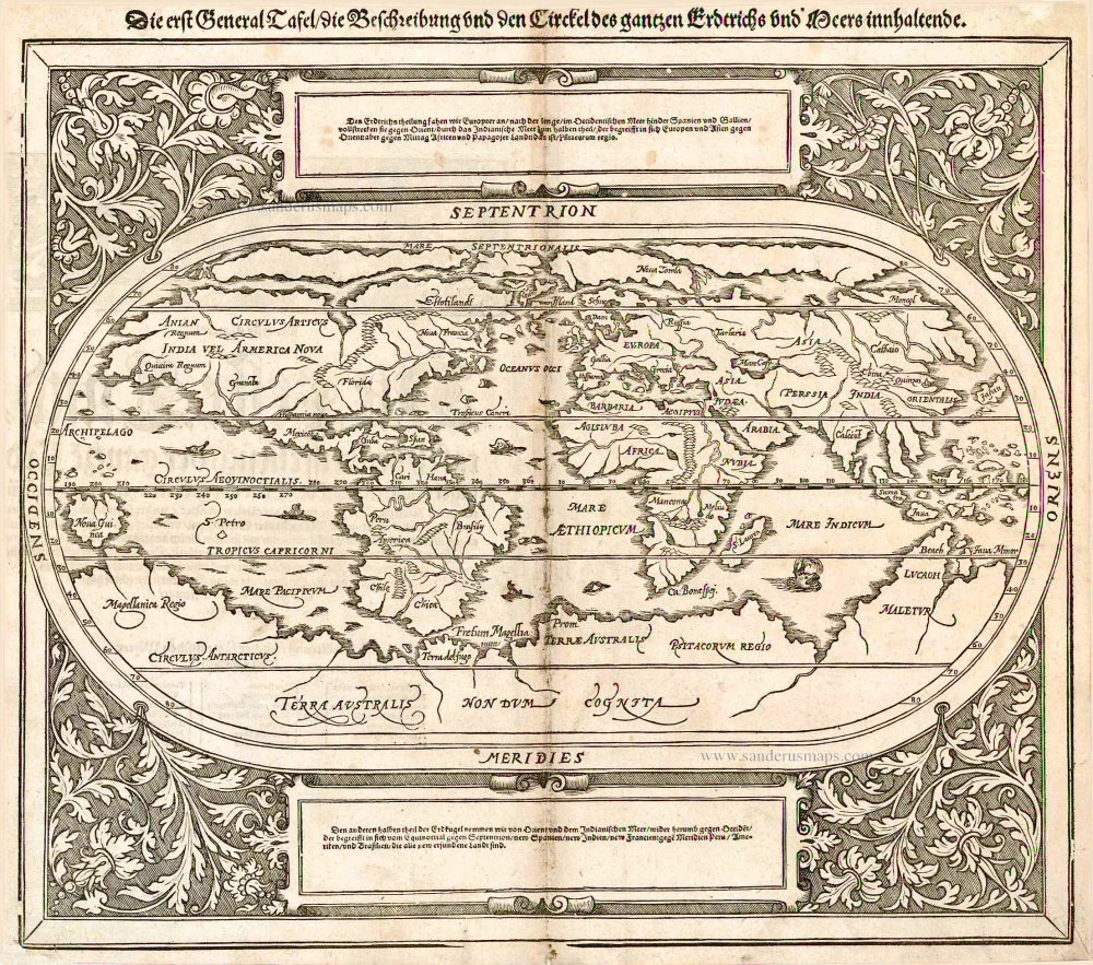
Die erst General Tafel / die Beschreibung und den Circkel des gantzen Erdtrichs und Meers innhaltende. 1588
World by Sebastian Münster.
[Item number: 25622]

Rare variant.
Cosmographia Universalis. 1592
World map by H. Bünting - D.A. Veleslavina.
[Item number: 26356]

Universi Orbis Descriptio. 1597
World by Giovanni Magini
[Item number: 27837]
One of the first double hemisphere world maps.
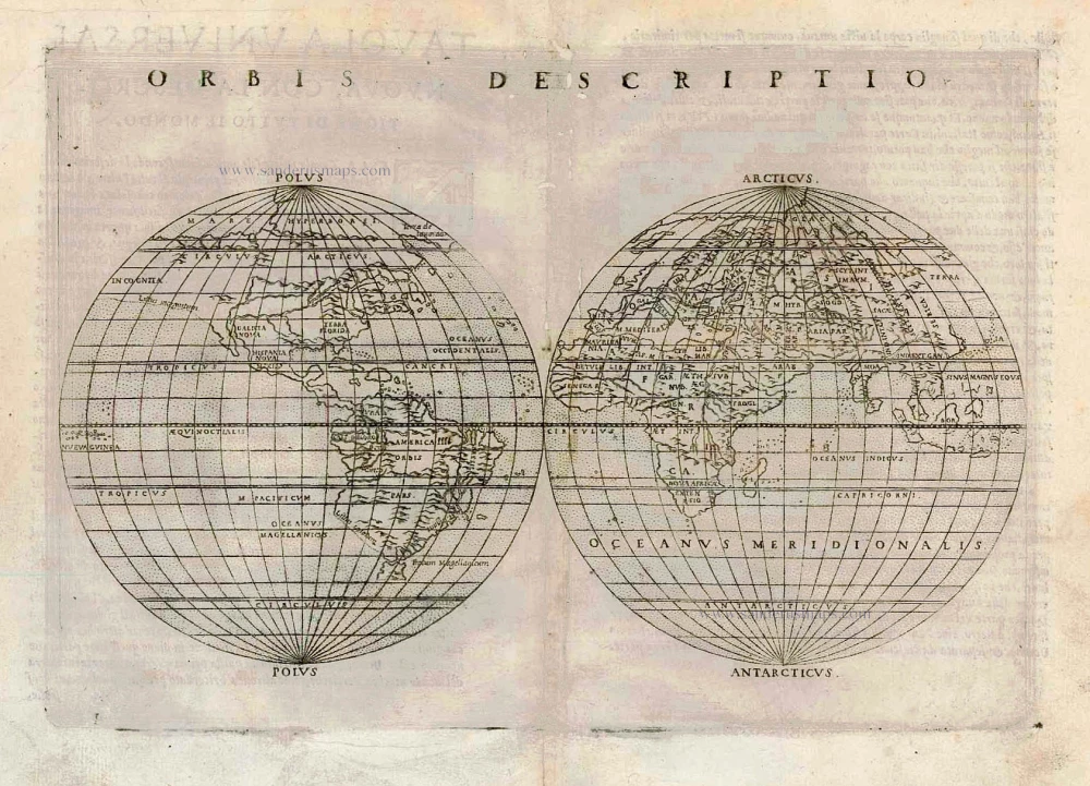
Orbis Descriptio. 1564
World by Girolamo Ruscelli.
[Item number: 27838]