Recueil de voyages de Mr Thevenot. Paris, Estienne Michallet, 1682.
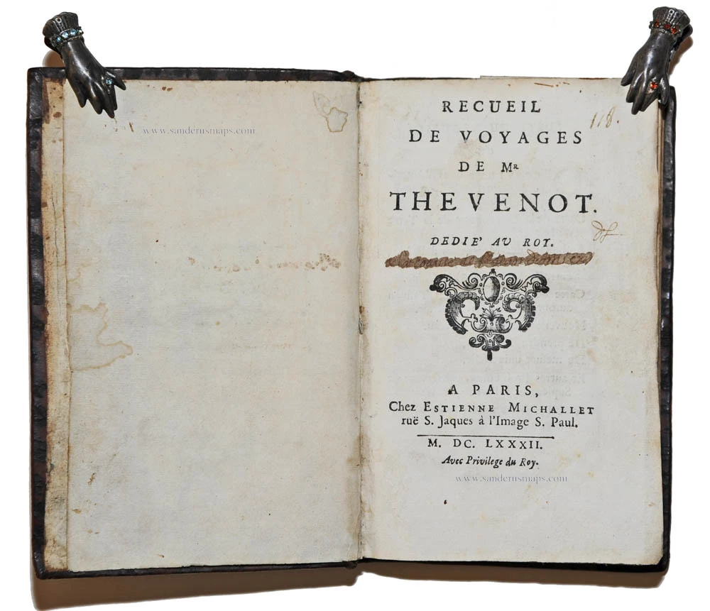

Recueil de voyages de Mr Thevenot. Paris, Estienne Michallet, 1682.
Item Number: 24532 Authenticity Guarantee
Category: Books > Travel Books
Sabin (America), 95332; Church, 672; Burden, 540; MCC 85, 1248
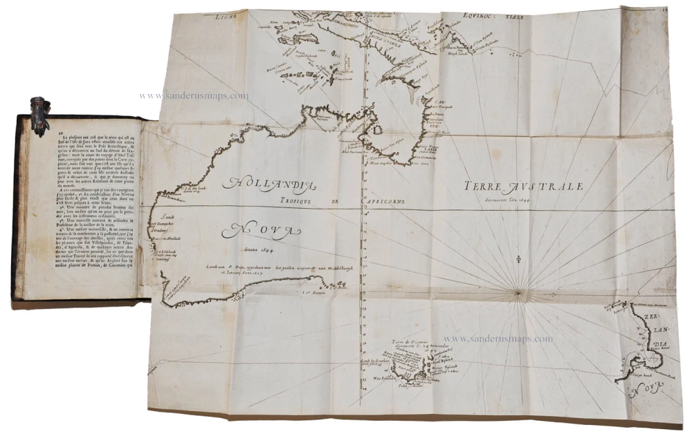
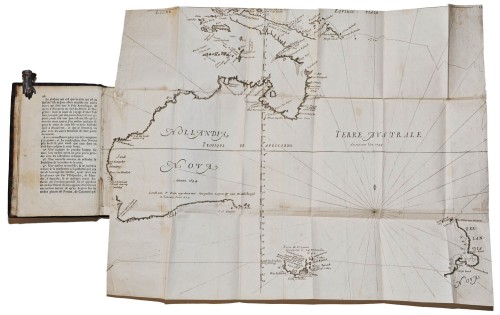
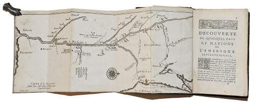
This very rare collection of travel accounts contains the first printed map of the Mississippi River valley, a map notable also as the first to name Lake Michigan. The second map is the first devoted to Australia, showing the discoveries of Abel Tasman, the third map is a very rare woodcut map of the northern hemisphere in equipolar projection.
The bibliography of this book is very complex. As the work is made up of several items with separate signatures, the order of binding varies in different copies. Many copies lack some of the natural history components. However, its importance and value derive from the travel sections.
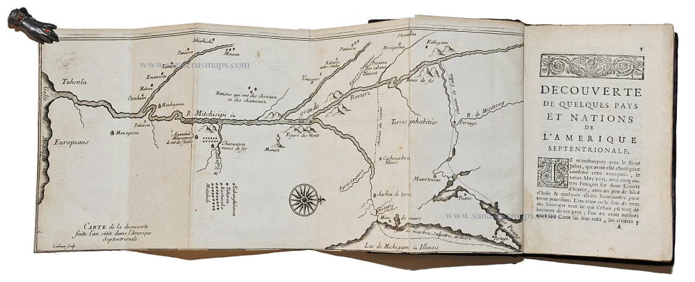
Melchisedech Thévenot (1620-92) was a traveller and author who collected accounts of voyages. His Recueil des Voyages of 1681 marked the first published account of the voyage of Louis Jolliet (1645-1700) and Jacques Marquette (1637-75). The Découverte de quelques pays et nations de l'Amérique septentrionale, includes a map of the discoveries: Carte de la decouverte/ faite l'an 1663 dans l'Amerique/ Septentrionale.// Liebaux sculp. (Burden, 540). The map (165x400mm), oriented with north to the right, is a major landmark of American cartography. It is the first devoted to the entire Mississippi River based on actual observation and the first to utilise the name Lake Michigan.
One of the most important Jesuit expeditions approved by Frontenac, the first governor of New France, was undertaken by Louis Jolliet and Jacques Marquette, who were the first Europeans to explore the Upper Mississippi region. In May 1673 they left the mission of St Ignace on the Straits of Mackinac, accompanied by five other people and two canoes. They entered Green Bay (Baye des Puans) and crossed the Fox River and the Wisconsin River (R. De Mississing) portage reaching the Mississippi River at Prairie de Chien on the 17 June. Continuing south they passed the great ox-bow bend in the Mississippi and came across the mouth of another great river, though this time appearing from the east. This was the Ouabouquigou, or Ohio. Here they encountered Indians who bore guns and powder from the 'Europeans on the eastern side'. They continued as far south as the Arkansas River, beyond which they perceived the risk of capture by the Spanish to be too great, so they turned back. On their return they discovered a new route back to Lake Michigan along the Illinois and Des Plaines Rivers to the portage through the site of present-day Chicago. Lac de Michigami òu Illinois is its first mention on a map.
The map is found in three states:
State 1: Lacking a title. Only known example in Paris, Archive de la Marine.
State 2: With the erroneous date 1663. Only known example in Ottawa, National Archives of Canada.
State 3: The date is corrected to 1673.
Our copy is with the Mississippi map in the second state. Until now known in only one example. NO COPY IN THE U.S.
The second important map is Thevenot's Tasman map (390x505mm), a cornerstone map of the mapping of Australia. It is one of the first to show parts of the Australian coastline in detail, based on Tasman's 1644 voyage. It shows part of the coast of New Guinea, Tasmania, and much of the east coast of Australia, and is a basic work of Australian cartography. The map is here present in its fourth state with the rhumblines, the Tropic of Capricorn and the route of Tasman.
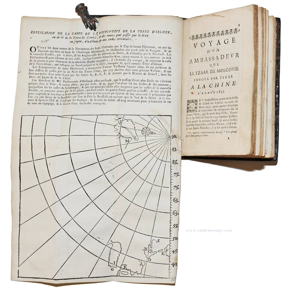
The third map is a woodcut map (190x195mm): "Explication de la carte de la decouverte de la terre d'Ielmer, au de-là de la Nouvelle Zemble, & des routes pour passer par le Nort au Japon, à la Chine, & aux Indes Orientales." The title is from an explanatory text printed in the upper margin of the map. This very rare map is a summary outline map of the Northern Hemisphere between latitude 35°N and the North Pole, and the western coast of Africa and northern China. It illustrates the search for a route to India through the northern polar regions.
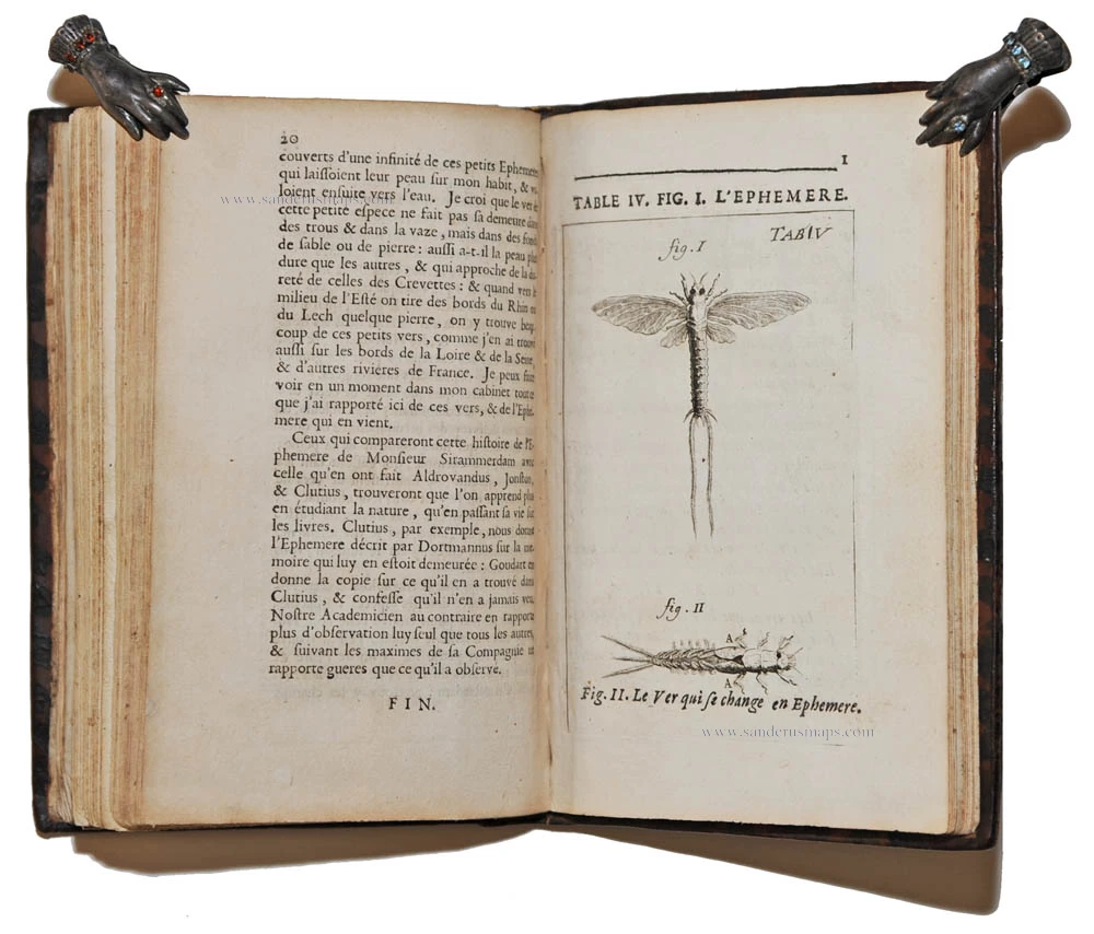
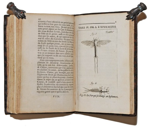
The next text is an account of a trip overland from Russia to China in 1653; then a discourse on navigation, and finally an illustrated natural history section.