
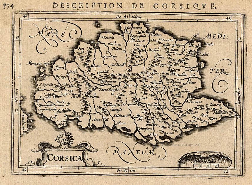
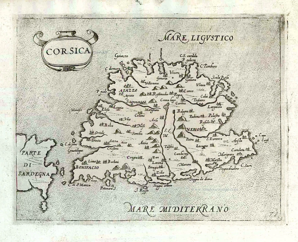
Corsica by Johannes Janssonius. After c. 1680.
The item displayed on this page has been sold. However, we have a similar map in stock:
Corse (Corsica) by Johannes Janssonius. 1666
Insulae Corsicae Nova & accurata Descriptio.
[Item number: 29793]


Cervoni incorrectly assigns this map to Joan Blaeu.
The Janssonius Family
Joannes Janssonius (Arnhem, 1588-1664), son of the Arnhem publisher Jan Janssen, married Elisabeth Hondius, daughter of Jodocus Hondius, in Amsterdam in 1612. After his marriage, he settled down in this town as a bookseller and publisher of cartographic material. In 1618, he established himself in Amsterdam next door to Blaeu’s bookshop. He entered into serious competition with Willem Jansz. Blaeu when copying Blaeu’s Licht der Zeevaert after the expiration of the privilege in 1620. His activities concerned the publication of atlases, books, single maps, and an extensive book trade with branches in Frankfurt, Danzig, Stockholm, Copenhagen, Berlin, Koningsbergen, Geneva, and Lyon. In 1631, he began publishing atlases together with Henricus Hondius.
In the early 1640s, Henricus Hondius left the atlas publishing business to Janssonius. Competition with Joan Blaeu, Willem’s son and successor, in atlas production, prompted Janssonius to enlarge his Atlas Novus finally into a work of six volumes, into which a sea atlas and an atlas of the Old World were inserted. Other atlases published by Janssonius are Mercator’s Atlas Minor, Hornius’s historical atlas (1652), the townbooks in eight volumes (1657), Cellarius’s Atlas Coelestis and several sea atlases and pilot guides.
After the death of Joannes Janssonius, the shop and publishing firm were continued by the heirs under the direction of Johannes van Waesbergen (c. 1616-1681), son-in-law of Joannes Janssonius. Van Waesbergen added Janssonius's name to his own.
In 1676, Joannes Janssonius’s heirs sold by auction “all the remaining Atlases in Latin, French, High and Low German, as well as the Stedeboecken in Latin, in 8 volumes, bound and unbound, maps, plates belonging to the Atlas and Stedeboecken.” The copperplates from Janssonius’s atlases were afterwards sold to Schenk and Valck.
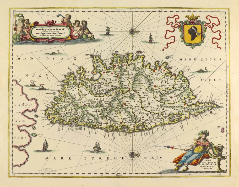
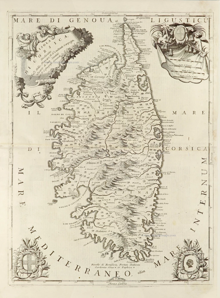
Insulae Corsicae.
Item Number: 28475 Authenticity Guarantee
Category: Antique maps > Europe > France
Old, antique map of Corsica, by Johannes Janssonius.
Title: Insulae Corsicae.
Amstelodami Apud Ioannem Ianßonium.
Oriented to the west.
Date of the first edition: 1645.
Date of this map: c. 1680.
Copper engraving, printed on paper.
Map size: 390 x 505mm (15.35 x 19.88 inches).
Sheet size: 440 x 555mm (17.32 x 21.85 inches).
Verso: Blank.
Condition: Original coloured, excellent.
Condition Rating: A+.
References: Van der Krogt 1, 7520:1B; Cervoni (Corsica), #37
From: Ioannis Ianssonii Novus Atlas, sive Theatrum Orbis Terrarum: Tabulae & Descriptiones Omnium Regionum Totius Universi Accuratissime Exhibentur. [after c. 1680]
Atlantis Pars tertia. in qua Anglia, Scotia, Hibernia, Italia, Sicilia, Graecia & Hispania. Amstelodami, Apud Ioannem Ianssonium. (Van der Krogt, 1:408.3).
This rare Atlas Novus is a re-issue of the 1675 Atlas Maior without the text.
Cervoni incorrectly assigns this map to Joan Blaeu.
The Janssonius Family
Joannes Janssonius (Arnhem, 1588-1664), son of the Arnhem publisher Jan Janssen, married Elisabeth Hondius, daughter of Jodocus Hondius, in Amsterdam in 1612. After his marriage, he settled down in this town as a bookseller and publisher of cartographic material. In 1618, he established himself in Amsterdam next door to Blaeu’s bookshop. He entered into serious competition with Willem Jansz. Blaeu when copying Blaeu’s Licht der Zeevaert after the expiration of the privilege in 1620. His activities concerned the publication of atlases, books, single maps, and an extensive book trade with branches in Frankfurt, Danzig, Stockholm, Copenhagen, Berlin, Koningsbergen, Geneva, and Lyon. In 1631, he began publishing atlases together with Henricus Hondius.
In the early 1640s, Henricus Hondius left the atlas publishing business to Janssonius. Competition with Joan Blaeu, Willem’s son and successor, in atlas production, prompted Janssonius to enlarge his Atlas Novus finally into a work of six volumes, into which a sea atlas and an atlas of the Old World were inserted. Other atlases published by Janssonius are Mercator’s Atlas Minor, Hornius’s historical atlas (1652), the townbooks in eight volumes (1657), Cellarius’s Atlas Coelestis and several sea atlases and pilot guides.
After the death of Joannes Janssonius, the shop and publishing firm were continued by the heirs under the direction of Johannes van Waesbergen (c. 1616-1681), son-in-law of Joannes Janssonius. Van Waesbergen added Janssonius's name to his own.
In 1676, Joannes Janssonius’s heirs sold by auction “all the remaining Atlases in Latin, French, High and Low German, as well as the Stedeboecken in Latin, in 8 volumes, bound and unbound, maps, plates belonging to the Atlas and Stedeboecken.” The copperplates from Janssonius’s atlases were afterwards sold to Schenk and Valck.
Related items

Creta Iovis magni, medio iacet insula ponto. Ex conatibus geographicis Abrahami Ortelij. [On sheet with:] Corsica [and:] Insulae Maris Ionii [and:] Sardinia 1624
Crete, Corsica and Sardinia by Ortelius A.
[Item number: 2052]
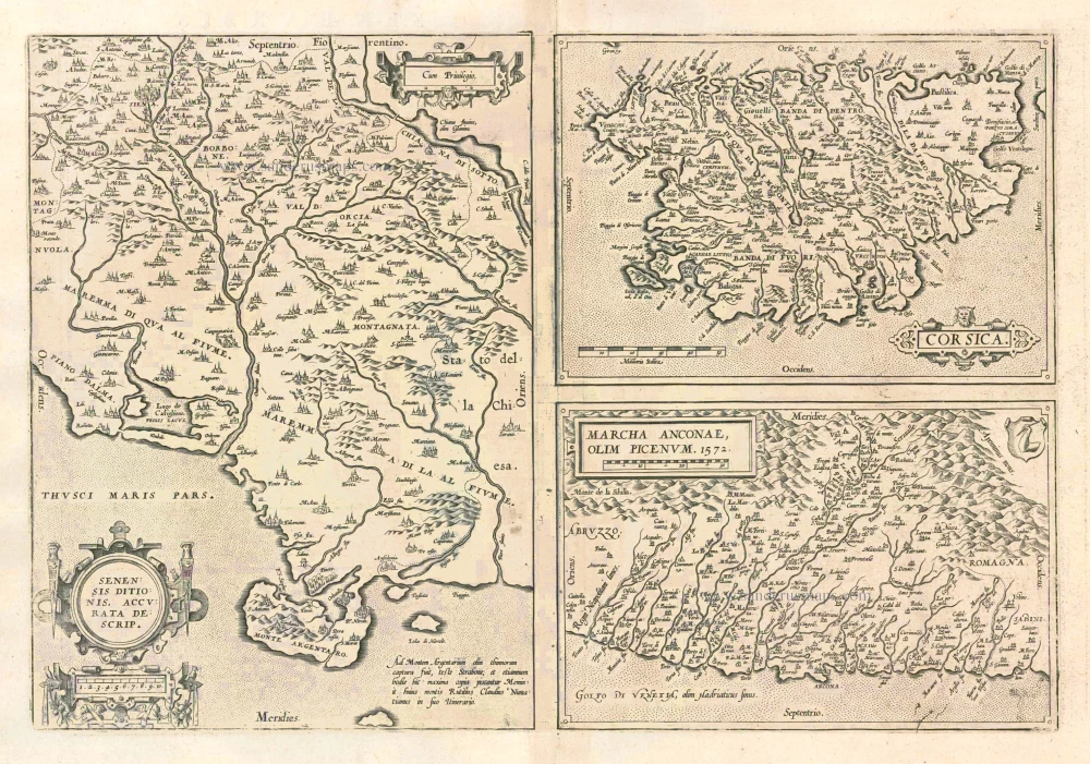
Senensis Ditionis - Corsica - Marcha Anconae olim Picenum. 1572. 1612
Siena - Corsica - Ancona, by Ortelius A.
[Item number: 22975]
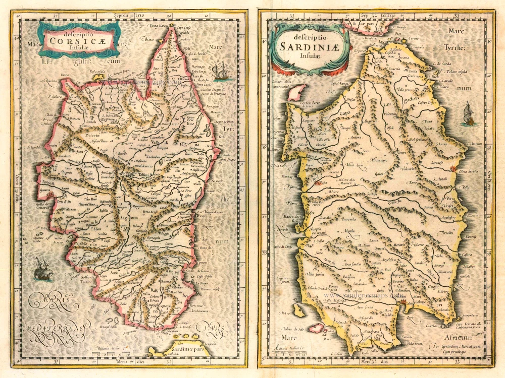
Descriptio Corsicae Insulae [on sheet with:] Descriptio Sardinae Insulae. 1639
CORSICA - SARDINIA by Mercator G. - Hondius H.
[Item number: 24455]
Corscica [on sheet with:] Sardinia. 1623
Corsica - Sardinia by Mercator Gerard - Hondius Henricus
[Item number: 24914]
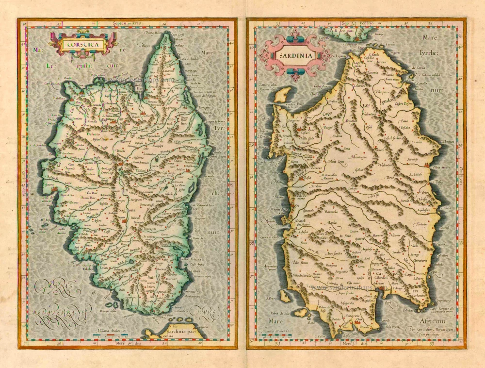
Insularum Sardiniae et Corsicae Descriptio. c. 1680
Corsica & Sardinia, by F. De Wit.
[Item number: 25914]
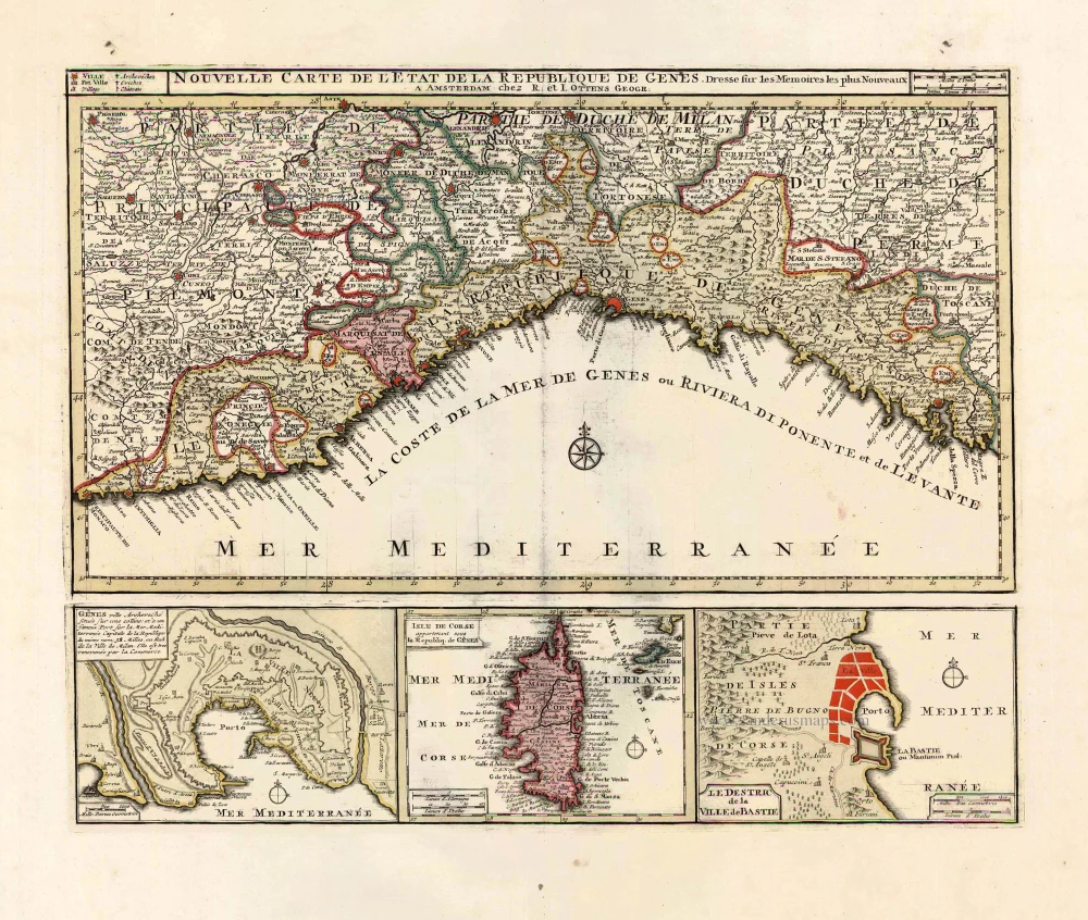
Nouvelle Carte de l'Etat et de la Republique de Genes. 1730-45
Liguria - Corsica, by Ottens R. & I.
[Item number: 25917]
Corsica. 1618
Corse (Corsica), by P. Bertius.
[Item number: 26538]

De L'Isle de Corse. 1575
Corsica, by François de Belleforest.
[Item number: 27286]
Rare et important
Corsica. After 1575
Corsica by Giovanni Francesco Camocio
[Item number: 27565]
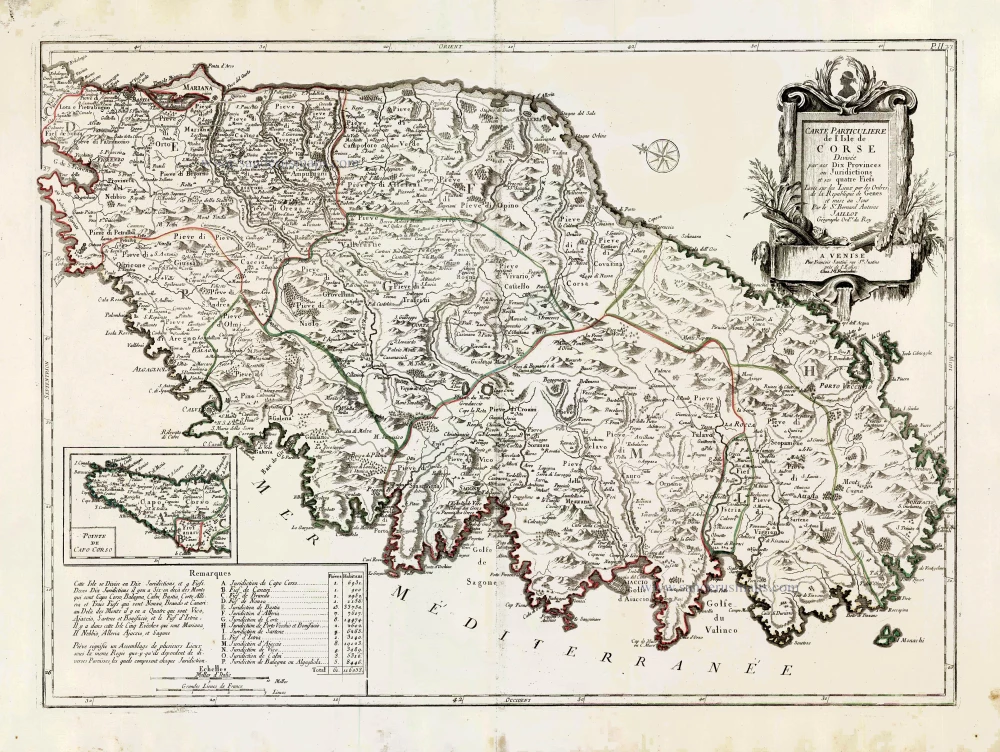
Carte Particulière de l'Isle de Corse. 1776-79
Corsica, by Francesco Santini.
[Item number: 27735]
Isola di Corsica, 1696
Corsica by Vincenzo Coronelli.
[Item number: 28720]