Our catalogue catalogue
- All recent additions
-
Antique maps
- Polar maps
- World
-
Europe
- Europe Continent
- Belgium
- Belgium - Cities
- The Low Countries
- The Netherlands
- The Netherlands - Cities
- Luxembourg
- France
- France - Cities
- Germany
- Germany - Cities
- Austria
- Italy
- Italy - Cities
- Spain and Portugal
- Greece & Greek Islands
- Switzerland
- British Isles
- British Isles - Cities
- Northern Europe
- Central Europe
- Eastern Europe
- Southeastern Europe
- America
- Asia
- Africa
- Mediterranean Sea
- Australia
- Oceans
- Celestial Maps
- Curiosities
- Title Pages
- Books
- Medieval manuscripts
- Prints
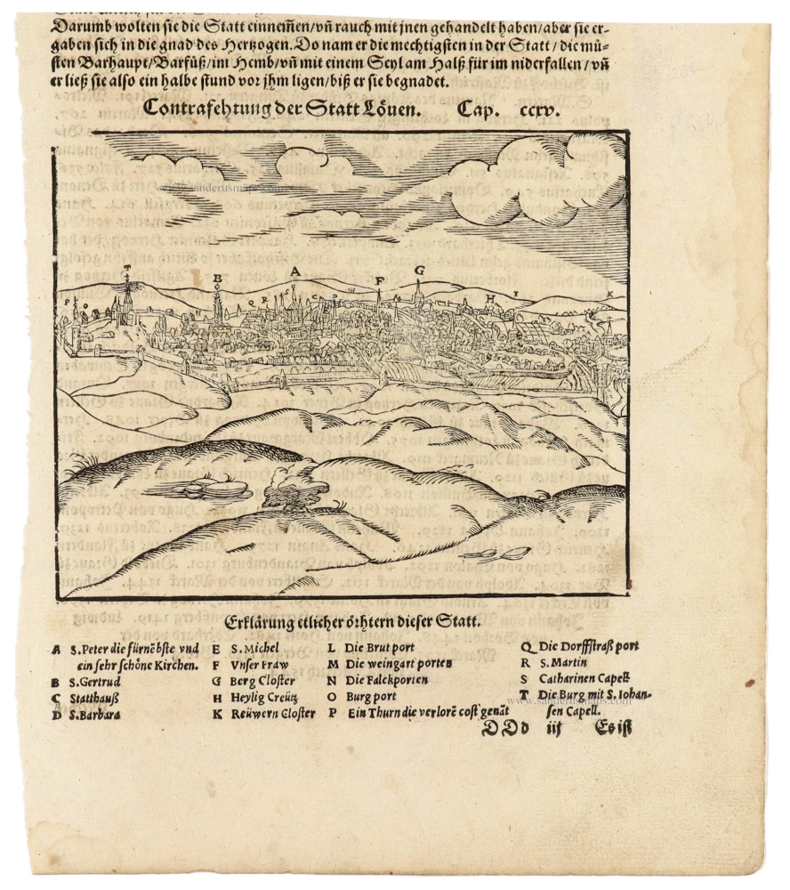
Leuven (Louvain) by Sebastian Münster 1574
Contrafehtung der Statt Loeven.
[Item number: 33202]
new
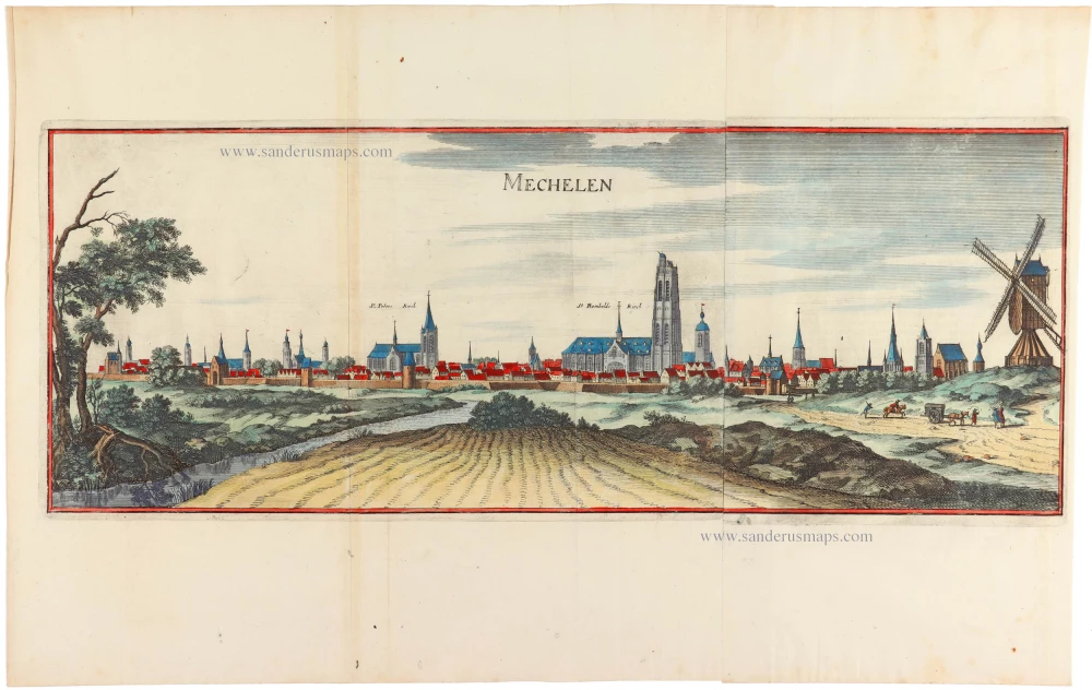
Mechelen, door Matthäus Merian & Martin Zeiller. 1659
Mechelen.
[Item number: 33201]
new

Utrecht, by Joan Blaeu. 1649
Traiectum Wttrecht.
[Item number: 33200]
new
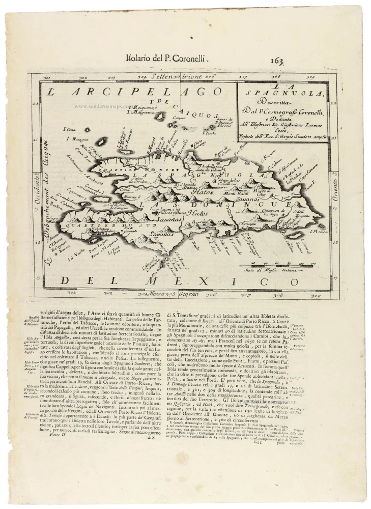
Hispaniola by Vincenzo Coronelli. 1696
La Spagnuola.
[Item number: 33199]
new

Panoramic view of Nijmegen, by Georg Braun & Frans Hogenberg. 1582
Noviomagium sive Noviomagu vulgo Nymmegen inclyta quondam...
[Item number: 33198]
new
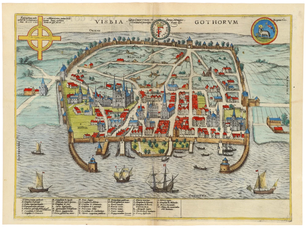
Visby by Braun & Hogenberg 1596
Visbia Gothorum
[Item number: 33197]
new
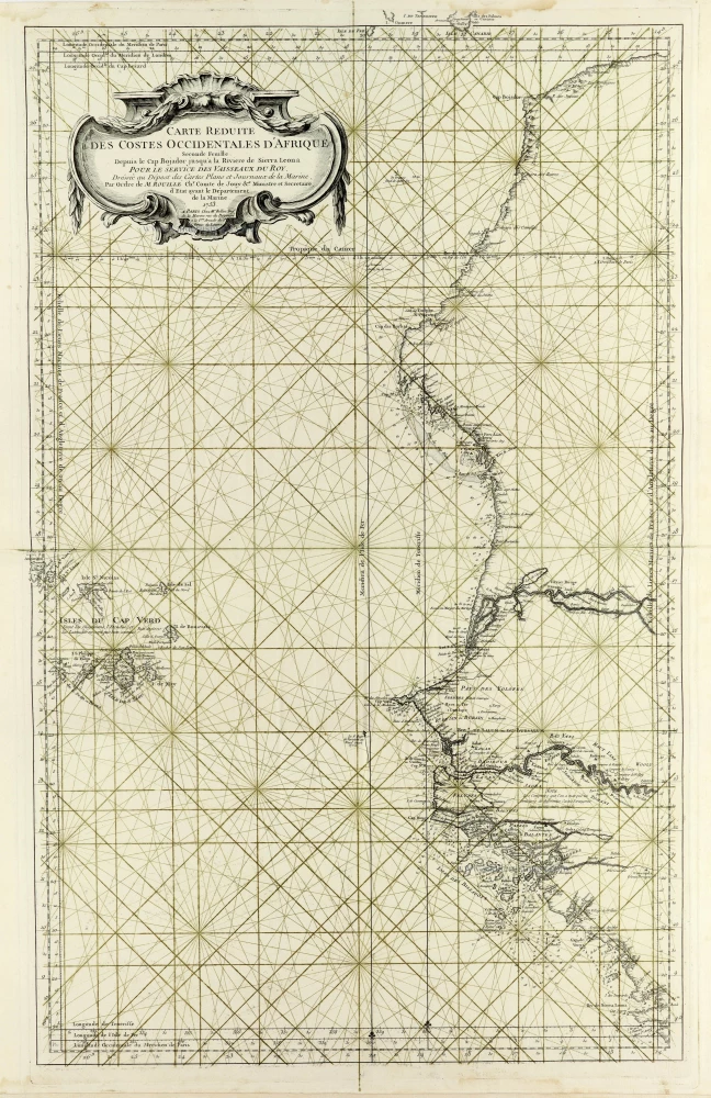
Western Africa and the Cape Verde Islands, by J.N. Bellin. 1756-1770
Carte Réduite des Costes Occidentales d'Afrique Depuis le Cap...
[Item number: 33186]
new
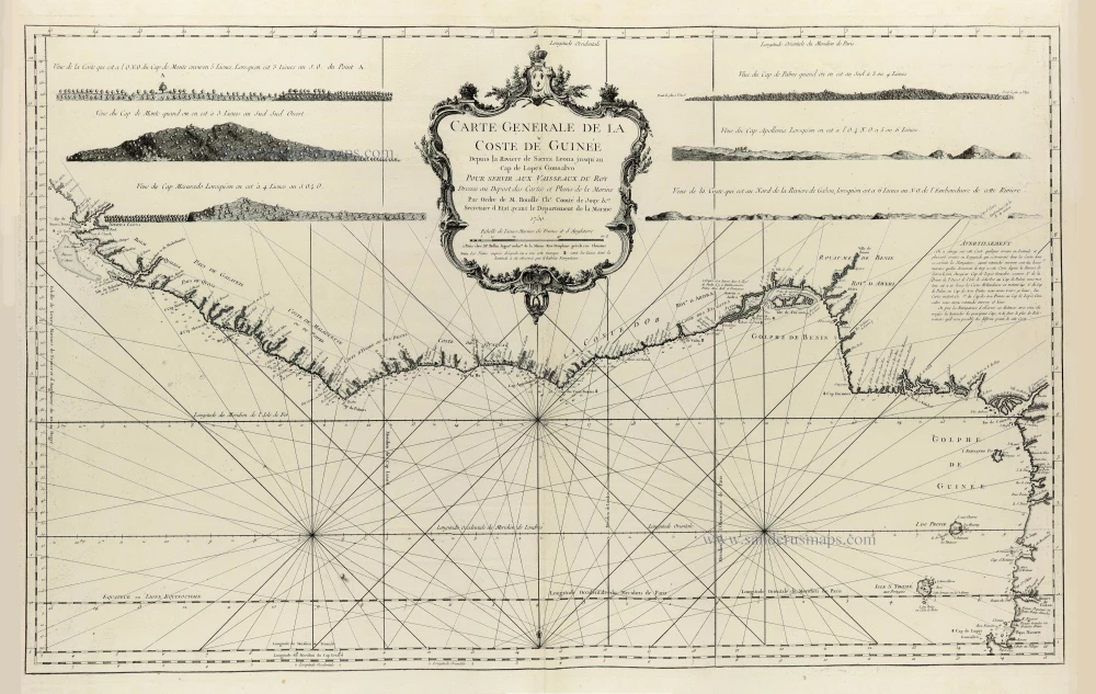
Coasts of Guinea, by J.N. Bellin. 1756-1770
Carte Generale de la Coste de Guinée Depuis la Riviere de Sierra...
[Item number: 33185]
new
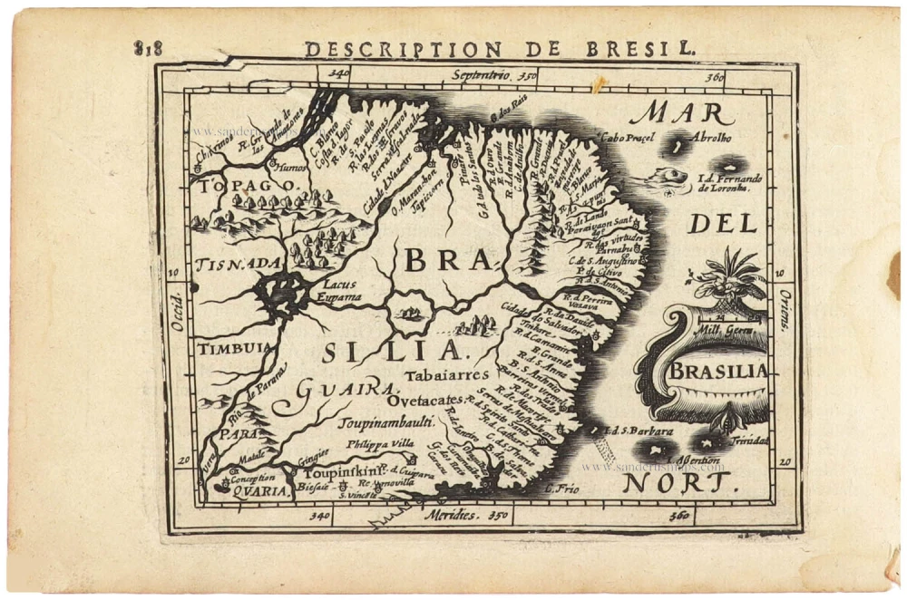
Brazil by Petrus Bertius. 1618
Brasilia.
[Item number: 33184]
new

World by Petrus Bertius. 1618
Typus Orbis Terrarum.
[Item number: 33183]
new
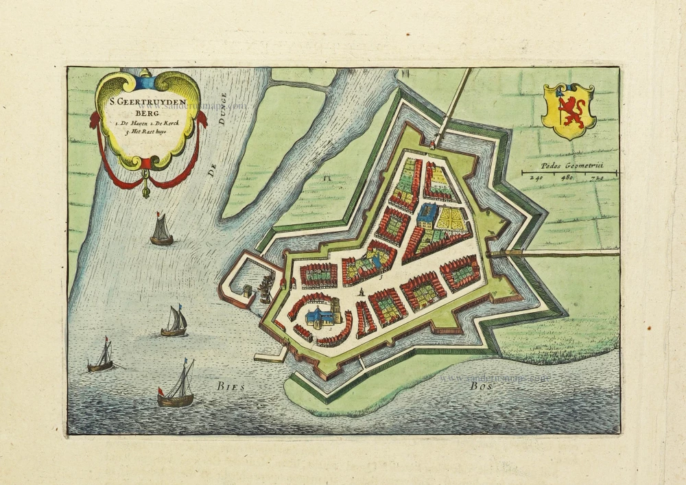
Geertruidenberg by Joan Blaeu. 1649
S. Geertruydenberg
[Item number: 33176]
new
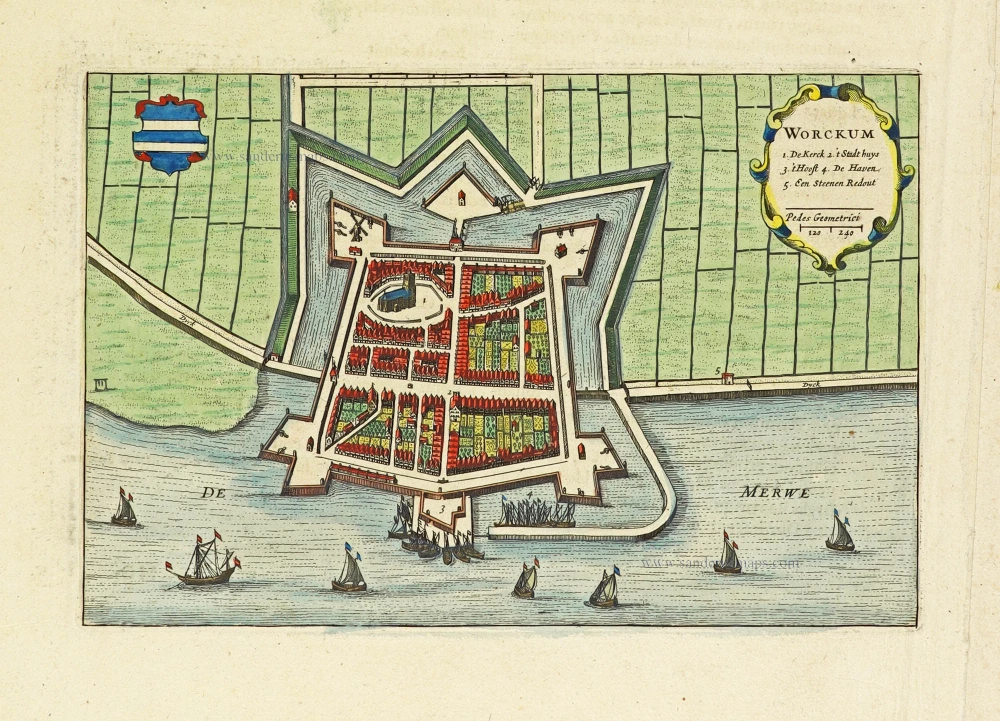
Woudrichem by Joan Blaeu. 1649
Worckum
[Item number: 33177]
new
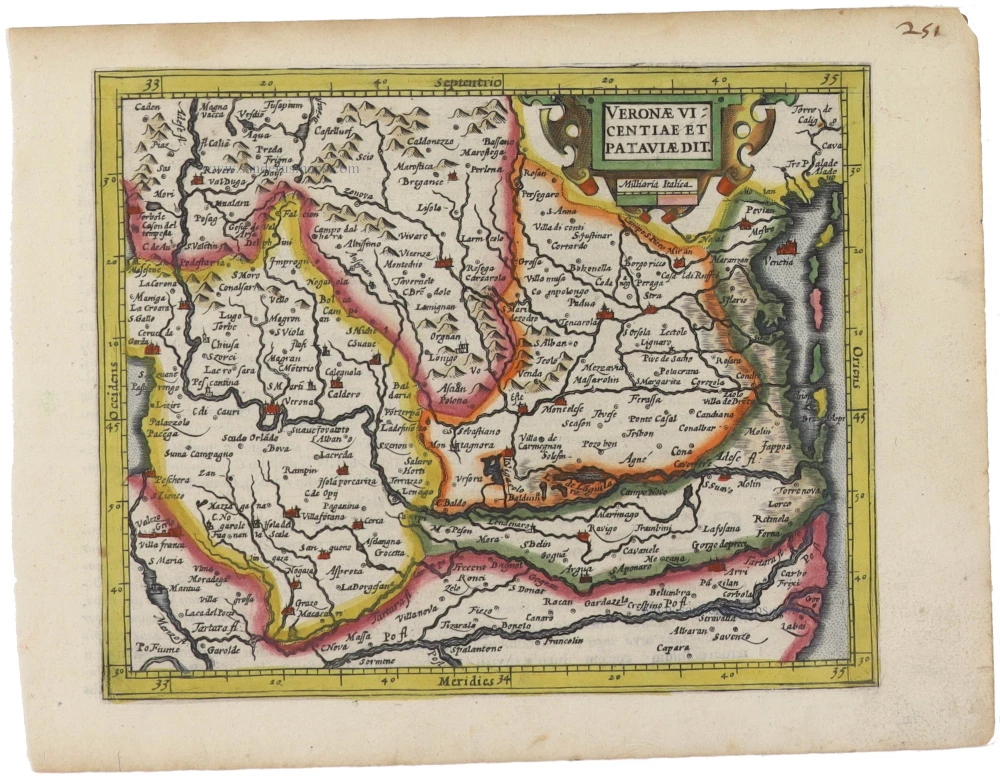
Verona, Vincenza, and Padova by Gerard Mercator, published by Jodocus Hondius. 1607
Veronae Vicentiae et Pataviae dit.
[Item number: 33178]
new
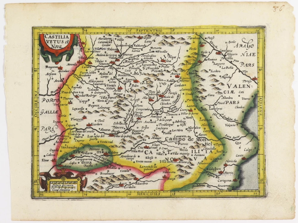
Castilla by Gerard Mercator, published by Jodocus Hondius. 1607
Castilia Vetus et Nova.
[Item number: 33179]
new
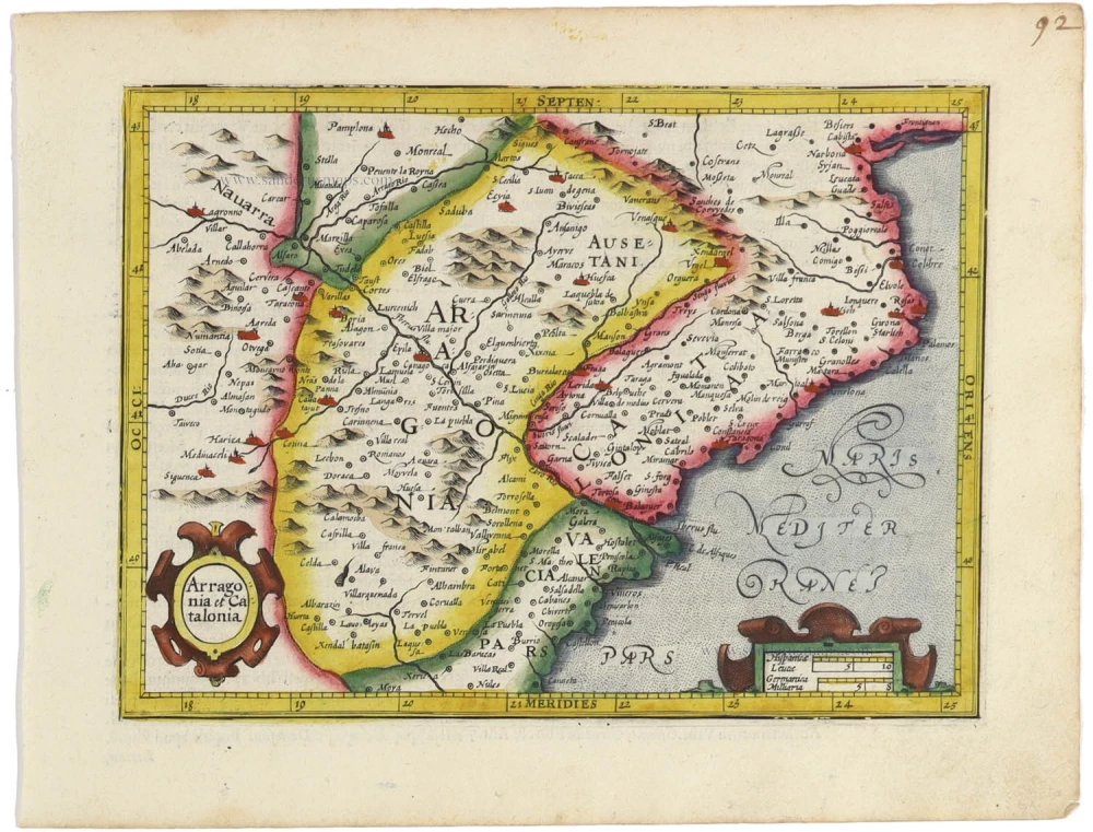
Catalunya and Aragon by Gerard Mercator, published by Jodocus Hondius. 1607
Aragonia et Catalonia
[Item number: 33181]
new
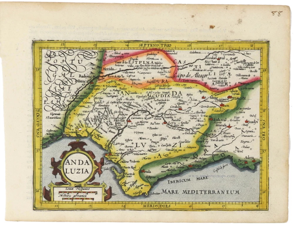
Andalucia by Gerard Mercator, published by Jodocus Hondius. 1607
Andaluzia
[Item number: 33180]
new
Rare first state
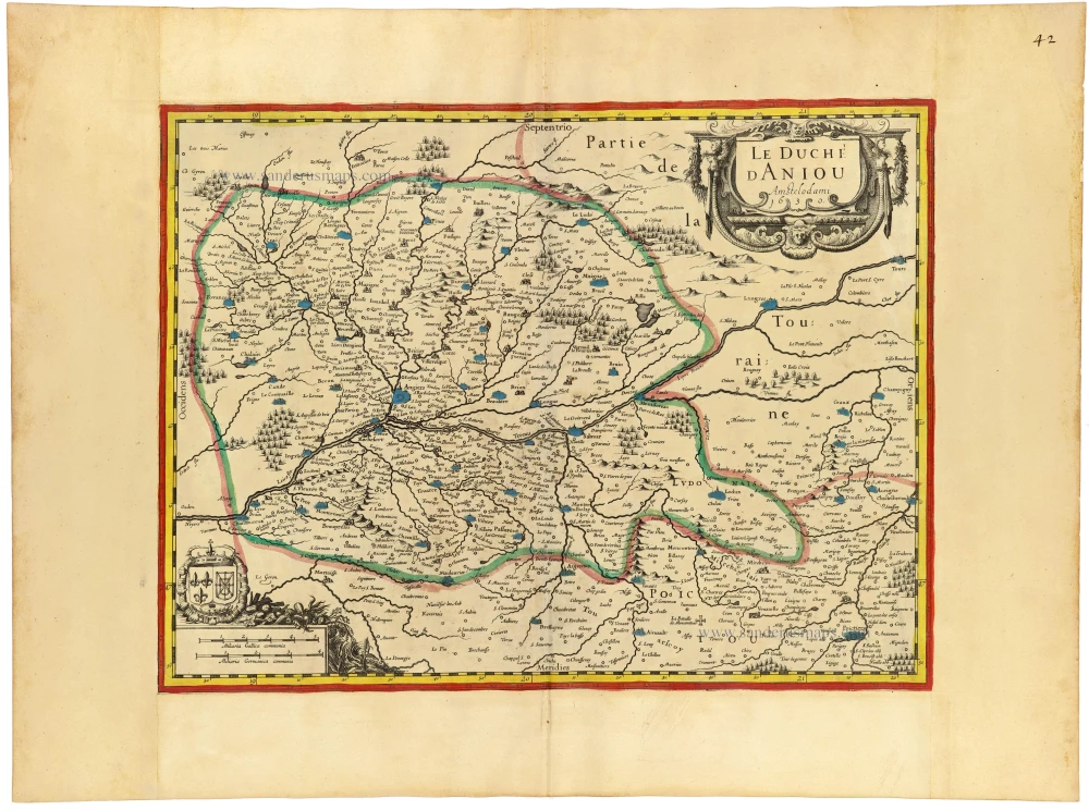
Anjou by J. Janssonius. c. 1631
Le Duché d Anjou. Anno 1630.
[Item number: 33117]
new
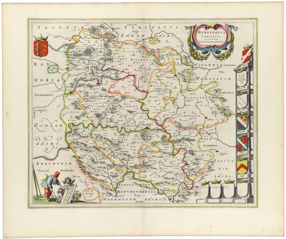
Hereford by Joan Blaeu 1645
Herefordia Comitatus. Hereford-Shire
[Item number: 33172]
new

Sicily by Frederick de Wit. 1682-88
Insula sive Regnum Siciliae Urbibus praecipuis exornatum
[Item number: 33168]
new
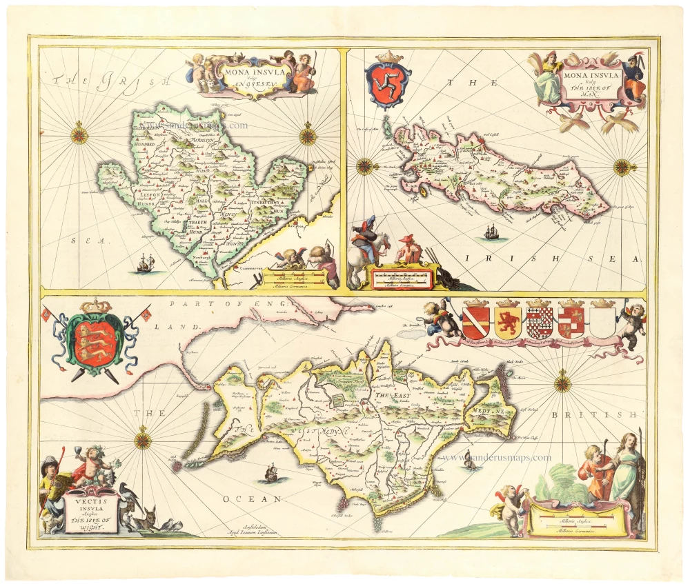
Anglesey - Isle of Man - Isle of Wight by Janssonius J. 1646
Mona Insula Vulgo Anglesey - Vectis Insula Vulgo The Isle of Man...
[Item number: 33154]
new

England by Willem & Joan Blaeu 1640-43
Anglia Regnum
[Item number: 25594]
new

The only Spanish edition of Doncker's sea-atlas
Title page of Hendrick Doncker's sea-atlas 1669
La Atlas del Mundo o El Mundo Aguado Enseña Todas las Entradas...
[Item number: 33153]
new

Atlas Title Page by Frederick de Wit. c. 1680
Atlas.
[Item number: 33152]
new

An extremely decorative sea chart (Norwhich)
Indian Ocean - Southeast Asia - Australia by Johannes Van Keulen 1683
Nieuwe Pascaert van Oost Indien Verthoonende hen van C. De Bona...
[Item number: 33150]
new
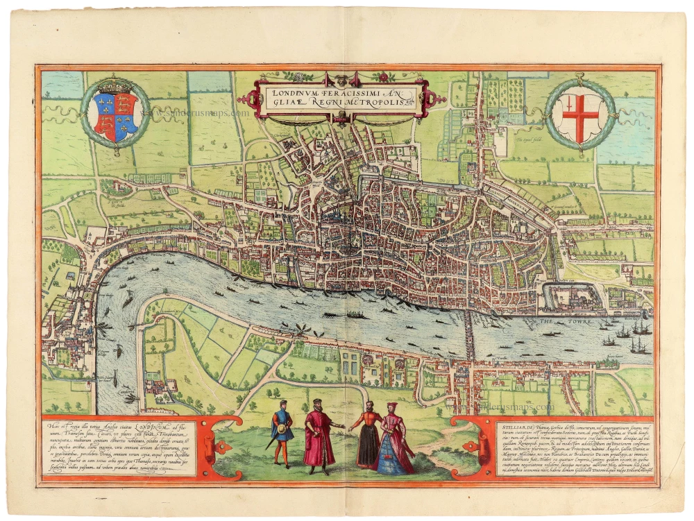
Beautiful example of the rare first edition, first state
London by Georg Braun & Frans Hogenberg 1572
Londinum Feracissimi Angliae Regni Metropolis.
[Item number: 33149]
new
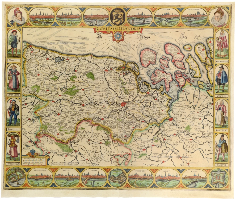
The most beautiful 17th-century map of Flanders, with four decorative borders.
Vlaanderen by C.J. Visscher. 1652
Comitatus Flandriae.
[Item number: 33151]
new

The famous Sea Monster Map
Iceland, by Abraham Ortelius. 1598
Islandia.
[Item number: 33075]
new

Optical view of Cadiz. ca. 1790
Vuë d'un côté de la Lameda de Cadis.
[Item number: 33140]
new

Florida & Texas by Pieter Van der Aa c. 1707
'T Amerikaans Gewest van Florida Door Ferdinand de Soto nader...
[Item number: 33093]
new

Extremely rare first edition
Formosa (Taiwan) by a French missionary, engraved by Gonzalez. 1753-57
Mapa de la parte de la Isla Formosa, perteneciente al Emperador...
[Item number: 33076]
new

Europe by Petrus Bertius, published by Melchior Tavernier. c. 1630-1650
Carte de L'Europe, corrigée et augmentée dessus toutes les...
[Item number: 33121]
new
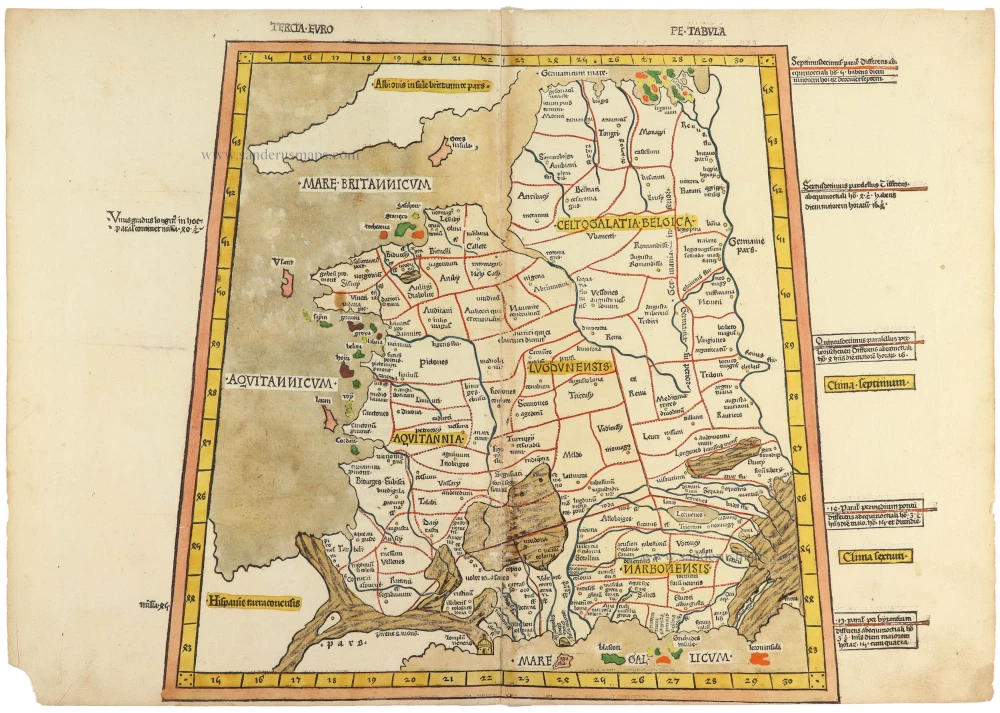
From the famous Ulm-Ptolemy atlas. 1482-1486
Ptolemy map of France, printed in Ulm by Johann Reger. 1486
Tercia Europe Tabula.
[Item number: 33070]
new

Optical view of the port of Cadiz. ca. 1760
Départ de la flote de Cadix pour la Vera Crux.
[Item number: 33139]
new

Optical view of Cadiz. ca. 1760
Prospect von dem Seehaven zu Cadix gegen Niedergang. / Vuë du...
[Item number: 33138]
new

Coast of Sierra Leone, published by Thomas Astley.
A map of the coast and country about Sierra Lione and Sherbro...
[Item number: 33137]
new

Mauritius, Réunion, and Rodrigues, by Rigobert Bonne. 1780
Carte Générale des Isles, dont les figures ci-dessus offrent un...
[Item number: 33136]
new