Antique maps catalogue
- All recent additions
-
Antique maps
- Polar maps
- World
-
Europe
- Europe Continent
- Belgium
- Belgium - Cities
- The Low Countries
- The Netherlands
- The Netherlands - Cities
- Luxembourg
- France
- France - Cities
- Germany
- Germany - Cities
- Austria
- Italy
- Italy - Cities
- Spain and Portugal
- Greece & Greek Islands
- Switzerland
- British Isles
- British Isles - Cities
- Northern Europe
- Central Europe
- Eastern Europe
- Southeastern Europe
- America
- Asia
- Africa
- Mediterranean Sea
- Australia
- Oceans
- Celestial Maps
- Curiosities
- Title Pages
- Books
- Medieval manuscripts
- Prints

Very decorative map in excellent condition.
Bejing by Joan Blaeu. 1655-1659
Pecheli, sive Peking Imperii Sinarum Provincia Prima.
[Item number: 29021]

Beautiful map in excellent condition
Joan Blaeu, the Province of Canton with the Pearl River delta and the Island of Hainan. 1655-1659
Quantung, Imperii Sinarum Provincia Duodecima.
[Item number: 29248]

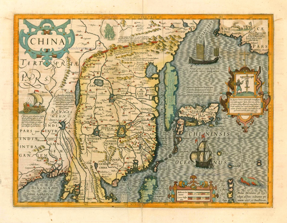
China by Abraham Ortelius. 1584
Chinae, Olim Sinarum regionis, nova descriptio.
[Item number: 32005]

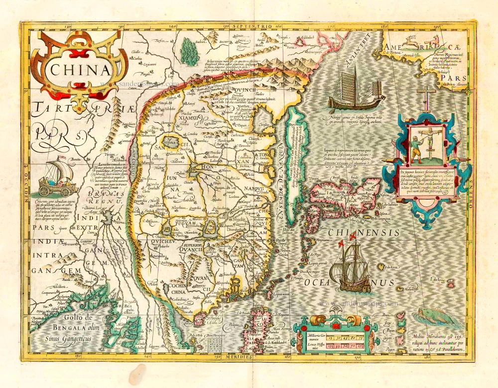
Important and rare China map.
China by Cornelis de Jode 1593
China Regnum.
[Item number: 30312]

Rare 1525 edition in nice old colour.
China - Japan by Lorenz Fries, after Martin Waldseemüller. 1525
No title - on verso: Ta. Superioris Indiae et Tartariae Maioris.
[Item number: 30659]

Early 1525 edition
China - Japan, by Lorenz Fries after Martin Waldseemüller. 1525
Ta. Superioris Indiae et Tartariae Maioris.
[Item number: 27928]
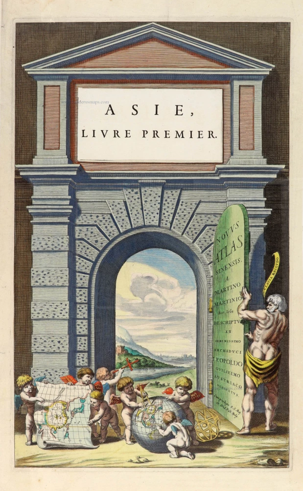
Title page for Blaeu's atlas of China as part of the Theatrum Orbis Terrarum. 1655
Novus Atlas Sinensis a Martino Martinio Soc. Iesu Descriptus et...
[Item number: 30153]
With Korea as an island.
China, Korea and Japan by J. Hondius. 1619
China
[Item number: 6494]
China, Japan, Korea by Henricus Hondius. 1641
China.
[Item number: 26440]

From the Martini atlas
China by Joan Blaeu, published by Frederick de Wit. c. 1691-97
Imperii Sinarum Nova Descriptio.
[Item number: 29431]

In rare original colour
Formosa and the Pescadores, by Pieter van der Aa. 1713
L'Île de Formosa ou sont exactement marquez les Bancs de Sables,...
[Item number: 26098]

Taiwan (Formosa) by François Valentyn (Valentijn). 1724-26
Kaart van het Eyland Formosa en de Eylanden van Piscadores.
[Item number: 26885]
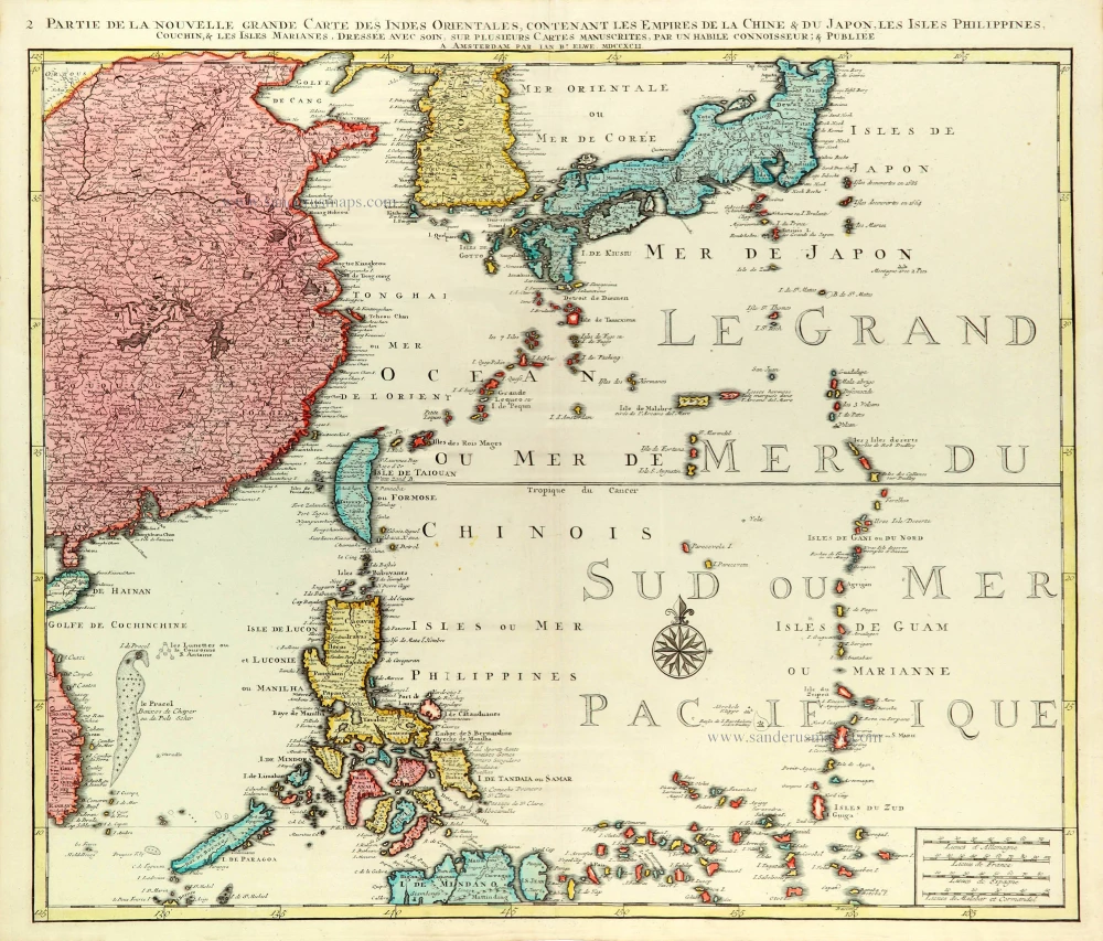
East Asia (Japan - Philippines) by J.B. Elwe. 1792
Partie de la Nouvelle Grande Carte des Indes Orientales...
[Item number: 31803]
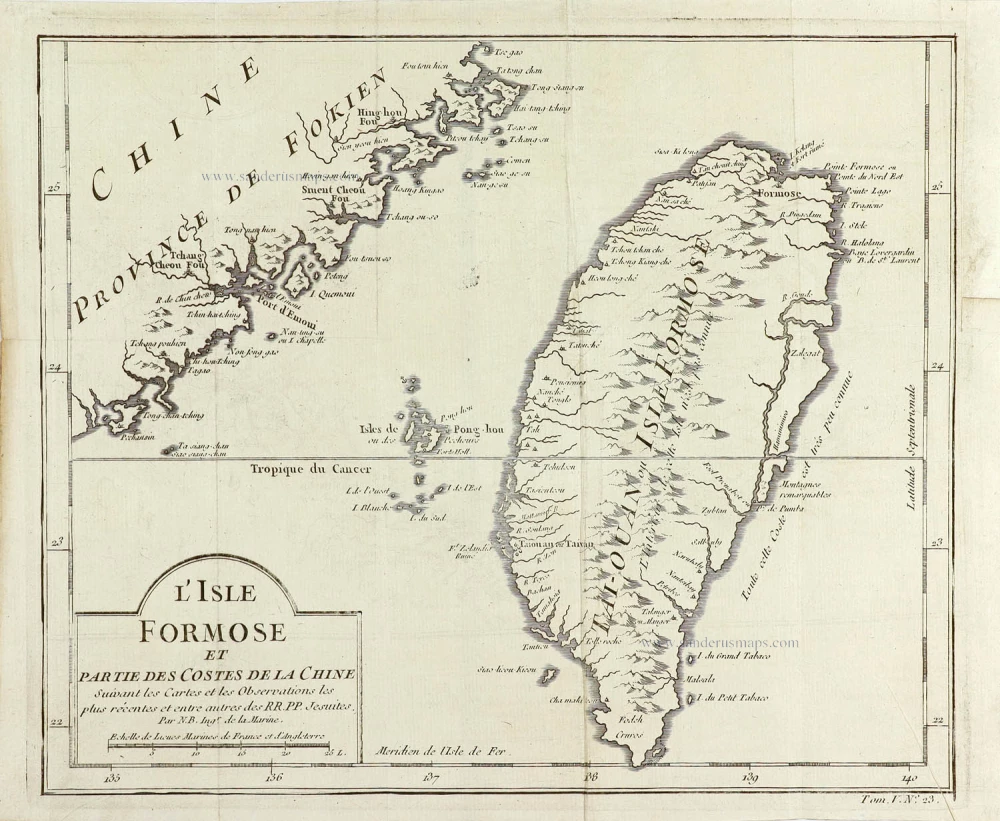
Taiwan (Formosa), by Jacques Nicolas Bellin. 1763
L'Isle Formose et Partie des Costes de la Chine.
[Item number: 29304]
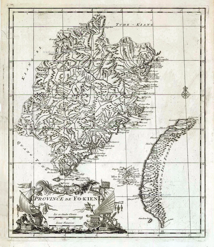
Fokien (Fujian) & Formosa (Taiwan), by Jean-Baptiste Bourguignon d'Anville 1735
Province de Fo-Kien.
[Item number: 27899]

Taiwan by J. Stöcklein. (Formosa) 1726
Die Insel Formosa neu abgemessen auf Befehl Kaysers Kamhi.
[Item number: 30143]

Extremely rare
Playing cards of the capitals of the world
Un Tour dans les Capitales du Monde. Jeu instructif.
[Item number: 30802]

China - Japan - Korea, by Willem & Joan Blaeu. 1649-55
China Veteribus Sinarum Regio Nunc Incolis Tame Dicta.
[Item number: 27043]

Scarce
Bay of Bengal and Thailand, by Pieter Van der Aa. 1707
Scheeps-Togt van Malacca na de Golf van Bengale, en de Kusten...
[Item number: 32330]

Che-chiang, by J. Blaeu. 1655-1659
Chekiang, Imperii Sinarum Provincia Decima.
[Item number: 26588]

China - Chiang-hsi, by J. Blaeu. 1655-1659
Kiangsi, Imperii Sinarum Provincia Octava.
[Item number: 26589]

China, by Pieter van der Aa. 1713
La Chine, Suivant les Nouvelles Observations.
[Item number: 27095]
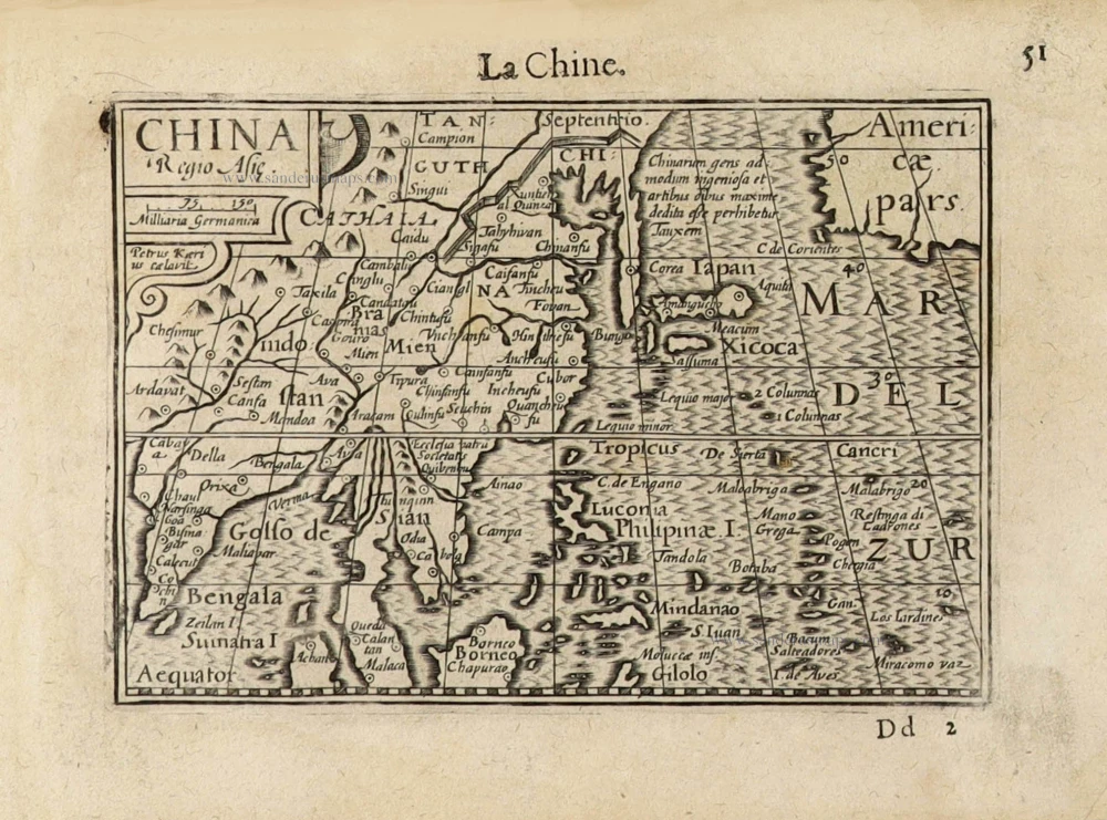
China by Barent Langenes. c. 1600
China Regio Asiae.
[Item number: 32299]

China by Petrus Bertius, published by Jodocus Hondius II. 1618
China.
[Item number: 32151]

China by Nicolas Sanson, published by Simon de Vries. 1682
Royaume de la Chine.
[Item number: 30235]

China by N. Bellin. 1748
L'Empire de la Chine
[Item number: 30260]
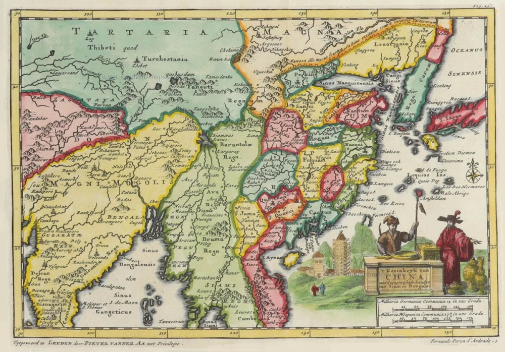
China by Pieter Van der Aa. 1706
't Koninkryk van China, met d'aangrensende Landen van Siam en...
[Item number: 31842]

China with Korea and Japan, by Paolo Santini. 1776-79
L'Empire de la Chine, avec la Tartarie Chinoise d'après l'Atlas...
[Item number: 26974]
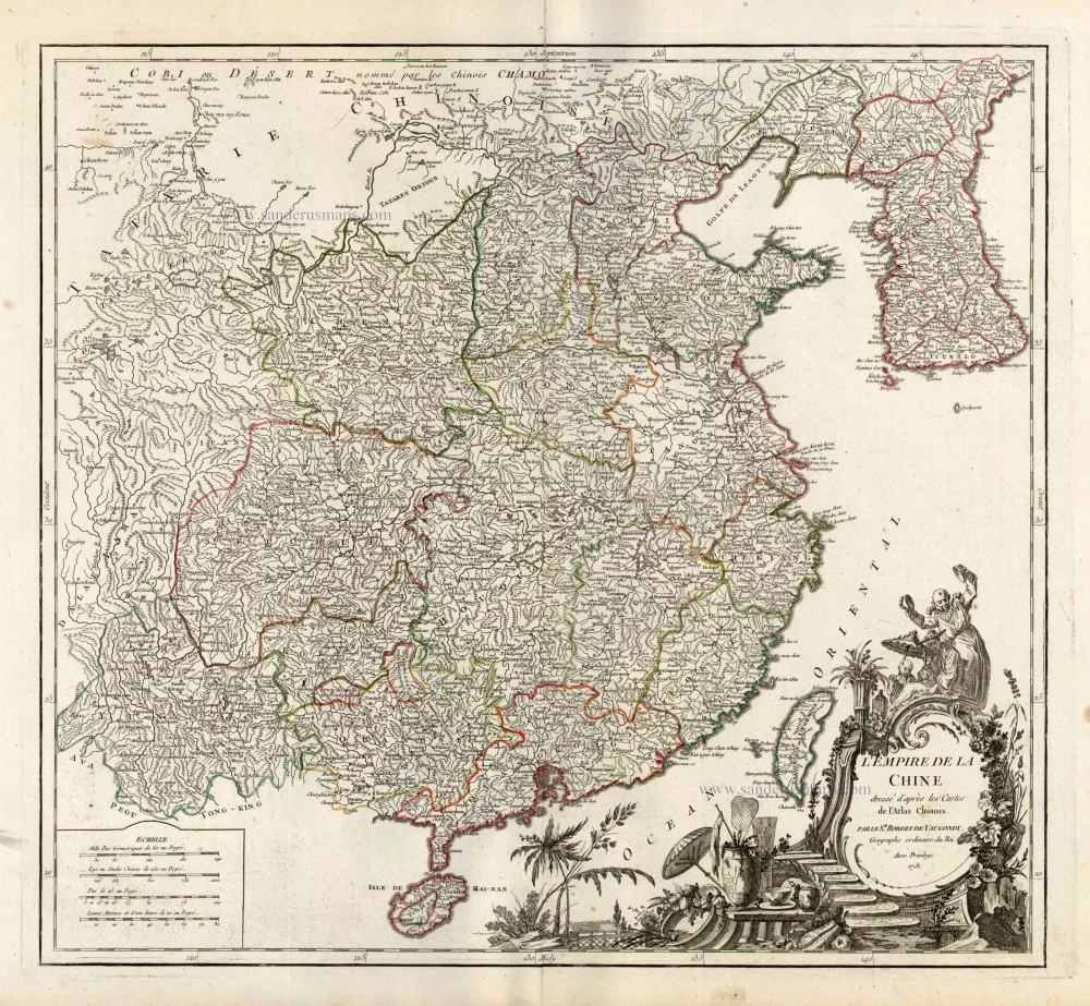
China, by Robert de Vaugondy. c. 1757
L'Empire de la Chine Dresse d'apres les Cartes de l'Atlas...
[Item number: 5093]
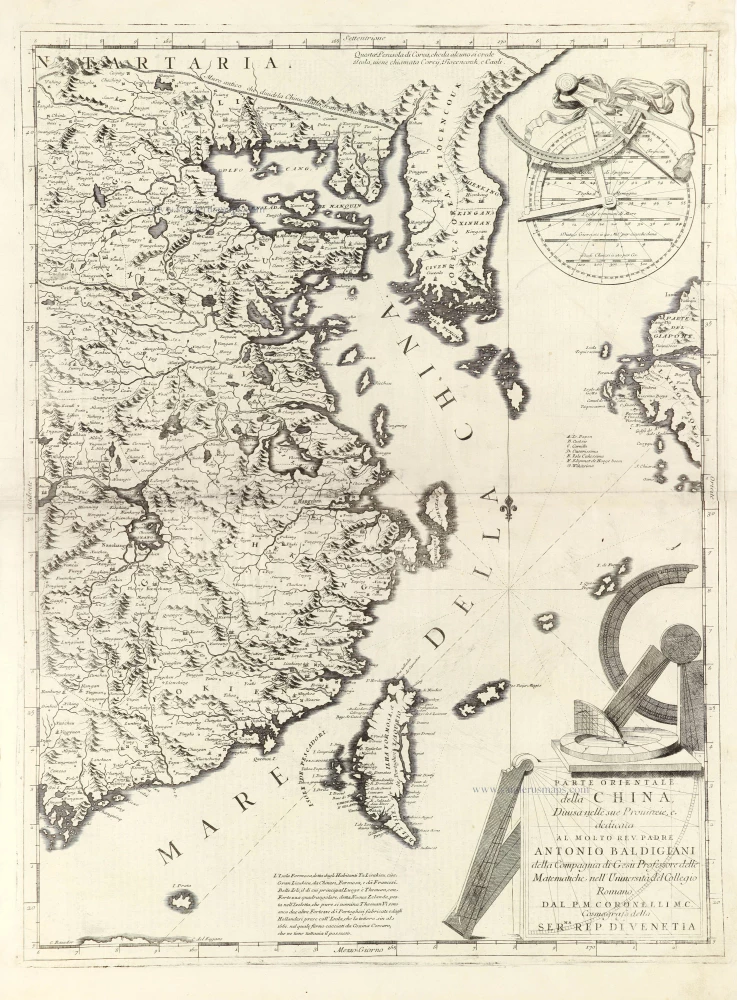
Eastern part of China with Korea and Formosa (Taiwan), by Vincenzo Coronelli. 1696
Parte Orientale della China,
[Item number: 28775]

Fokien by Joan Blaeu 1659
Fokien Imperii Sinarum Provincia Undecima.
[Item number: 28379]

China - Honan, by J. Blaeu. 1655-1659
Honan, Imperii Sinarum Provincia Quinta.
[Item number: 26423]

Honan by Joan Blaeu 1655-1659
Honan, Imperii Sinarum Provincia Quinta.
[Item number: 28593]

Hukuang (China), by J. Blaeu. 1655-1659
Huquang, Imperii Sinarum Provincia Septima.
[Item number: 26359]

China - Japan - Korea - Taiwan by Nicolaes Visscher I After 1665
Imperii Sinarum Nova Descriptio.
[Item number: 28559]

China with Japan, Korea and Taiwan, by J. Janssonius. c. 1680.
Imperii Sinarum Nova Descriptio.
[Item number: 2618]