
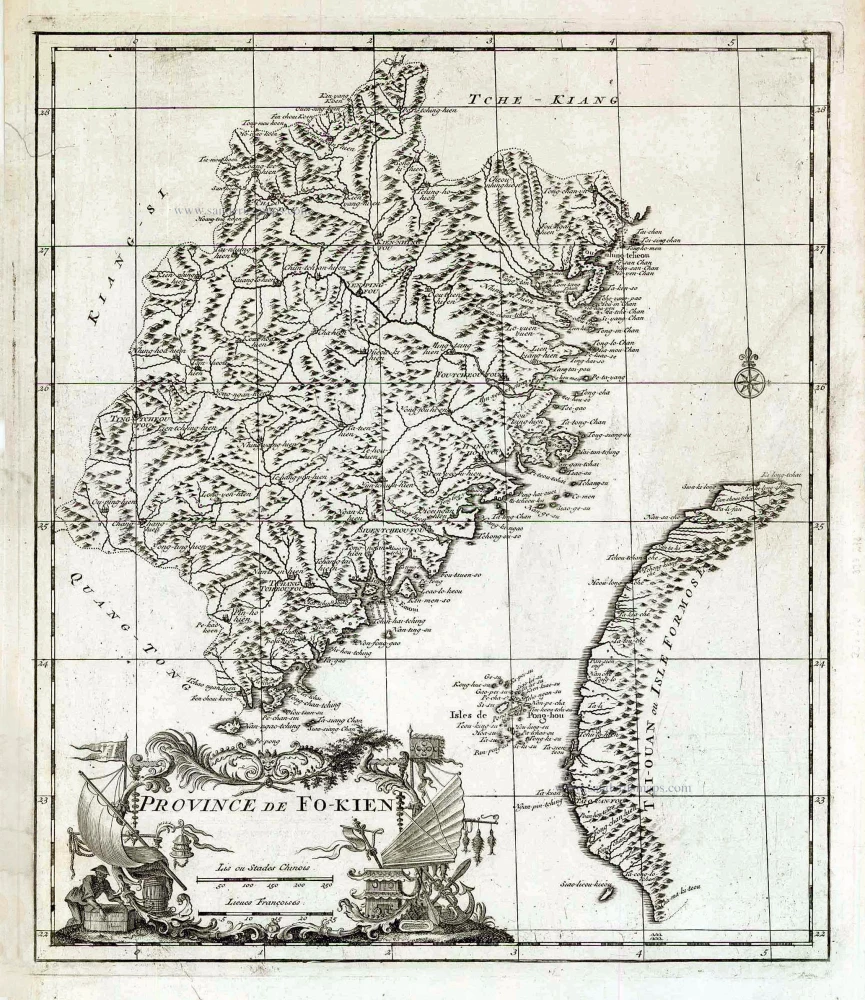
Fokien (Fujian) & Formosa (Taiwan), by Jean-Baptiste Bourguignon d'Anville 1735
Jean-Baptiste Du Halde (1674 - 1743)
French Jesuit historian, professor at the College of Paris and author of the Description Geographique Historique, Chronologique, Politique, et Physique de l'Empire de la Chine et de la Tartare Chinoise, published in Paris in 1735. It contained the first map of Korea by Jean-Baptiste Régis and 42 maps of Chinese provinces by Jean Baptiste Bouguignon d'Anville.
Jean-Baptiste Bourguignon d'Anville (1697 -1782)
French geographer and cartographer to the king. He made more than 200 maps during his life. His maps remained the reference point in cartography throughout the 19th century.
Province de Fo-Kien.
Item Number: 27899 Authenticity Guarantee
Category: Antique maps > Asia > China
Old, antique map of China, by Jean Baptiste du Halde.
Title: Province de Fo-Kien.
Cartographer: Jean-Baptiste Bourguignon d'Anville.
Date of the first edition: 1735.
Date of this map: 1735.
Copper engraving, printed on paper.
Size (not including margins): 380 x 325mm (14.96 x 12.8 inches).
Verso: Blank.
Condition: Small tear in left margin reinforced.
Condition Rating: A
From: J.B. Du Halde. Description Geographique Historique, Chronologique, Politique, et Physique de l'Empire de la Chine et de la Tartare Chinoise, ... Paris, P.G. Mercier, 1735.
Jean-Baptiste Du Halde (1674 - 1743)
French Jesuit historian, professor at the College of Paris and author of the Description Geographique Historique, Chronologique, Politique, et Physique de l'Empire de la Chine et de la Tartare Chinoise, published in Paris in 1735. It contained the first map of Korea by Jean-Baptiste Régis and 42 maps of Chinese provinces by Jean Baptiste Bouguignon d'Anville.
Jean-Baptiste Bourguignon d'Anville (1697 -1782)
French geographer and cartographer to the king. He made more than 200 maps during his life. His maps remained the reference point in cartography throughout the 19th century.
Related items
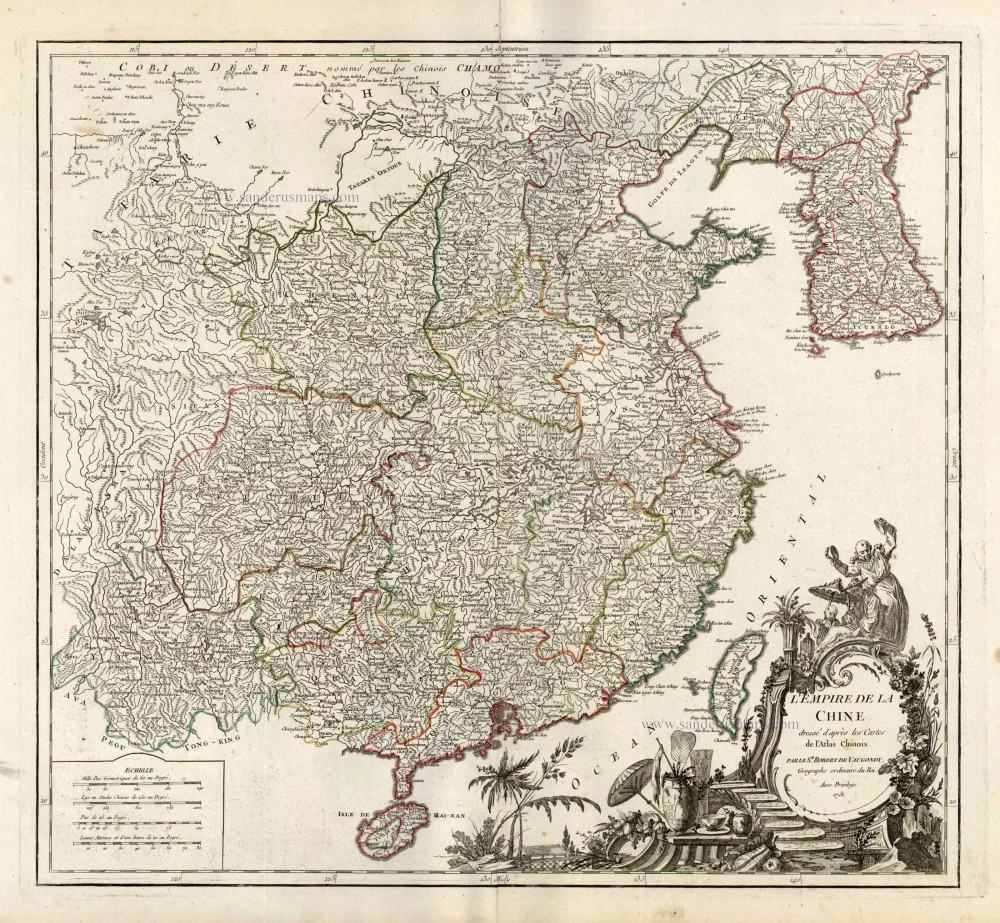
L'Empire de la Chine Dresse d'apres les Cartes de l'Atlas Chinois ... c. 1757
China, by Robert de Vaugondy.
[Item number: 5093]
With Korea as an island.
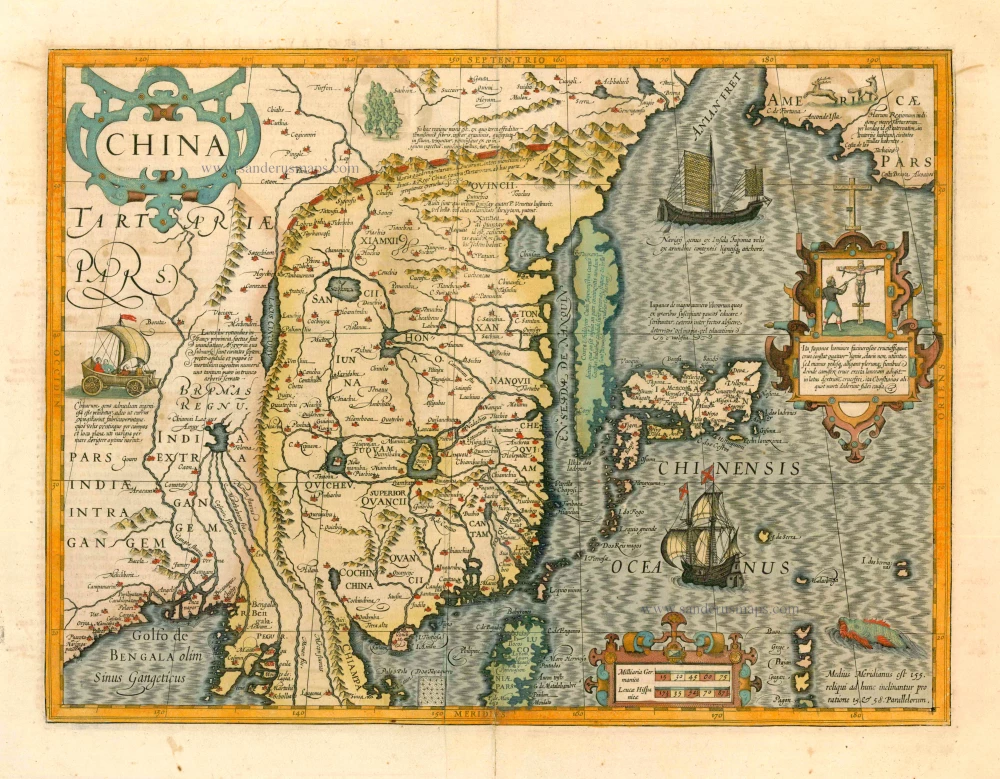
China 1619
China, Korea and Japan by J. Hondius.
[Item number: 6494]
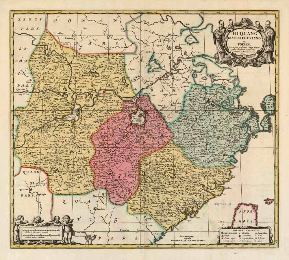
Huquang, Kiangsi, Che Kiang, ac Fokien. Provin: sivae praefecturae Regni Sinen:s, versus Vulturnum, in plaga inter Orientem ac Meridiem media, sitae. c. 1700
Eastern China, by Valk and Schenk.
[Item number: 8453]

La Chine, Suivant les Nouvelles Observations. 1713
China, by Pieter van der Aa.
[Item number: 27095]