
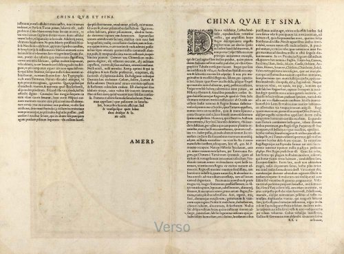
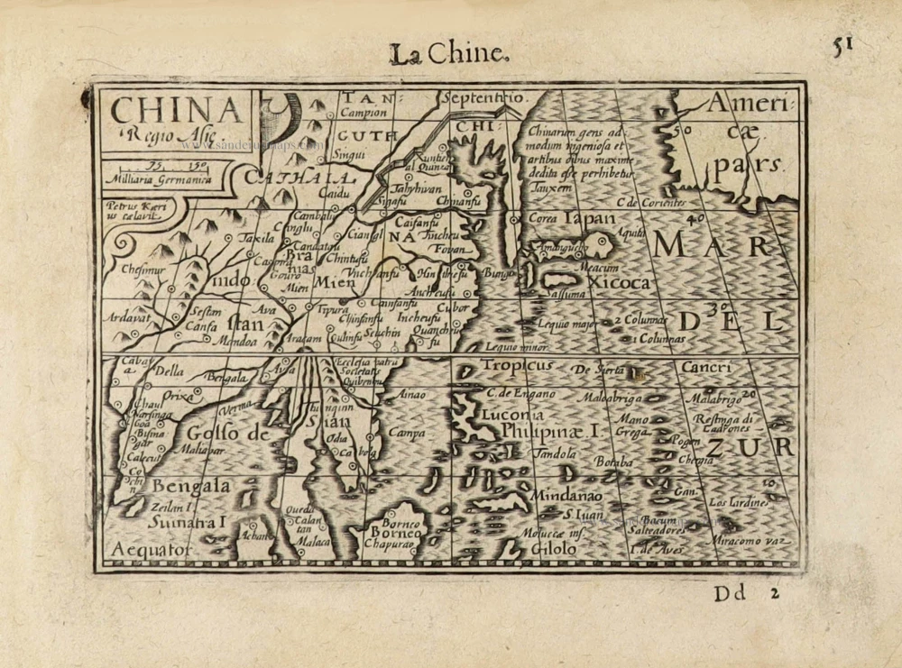
Important and rare China map.
China by Cornelis de Jode 1593


Gerard and Cornelis de Jode
Gerard de Jode (Judaeus) (1508(?)-1591), a native of Nijmegen, began his career as a printer and engraver in Antwerp about 1550. He lived near the Bourse on the Catelijne Veste, or on "de Catte". He was in regular contact with Christoffel Plantin, to whom he sold many prints and maps. De Jode's business, which must have been a major one among Antwerp's many booksellers and printers, was represented at the Frankfurt fair, where de Jode bought maps that he later copied or resold. Most of the maps sold by De Jode have prototypes of Italian or German origin. Apart from his many separately published maps, Gerard de Jode is known for his atlas, Speculum Orbis Terrarum, published in 1578. Part of the engraving was done by himself, and part by his brothers Jan and Lucas van Doetecum.
Gerard de Jode and Abraham Ortelius, who both lived partly as map sellers, were competitors and were only sometimes on good terms.
After the death of Gerard de Jode in 1591, the business was carried on by his widow, Pascale van Gelder and his son, Cornelis (1568-1600). More a publisher than an engraver, the latter reissued the Speculum in 1593, adding new maps and revising others.
Despite all its deficiencies, the Speculum must have had a good reputation. It is mentioned alongside Mercator's Atlas and Ortelius's Theatrum in Petrus Montanus's preface to Pieter van den Keere's Germania Inferior.
China Regnum.
Item Number: 30312 Authenticity Guarantee
Category: Antique maps > Asia > China
China and Japan by Cornelis de Jode.
Title: China Regnum.
Date of the first edition: 1593.
Date of this map: 1593.
First and only edition.
Copper engraving, printed on paper.
Image size: 360 x 450mm (14.17 x 17.72 inches).
Sheet size: 410 x 555mm (16.14 x 21.85 inches).
Verso: Latin text.
Condition: Original coloured, excellent.
Condition Rating: A+.
From: Speculum Orbis Terrae. Antwerpen, C. De Jode, 1593. (Van der Krogt 3, 2:02)
Gerard and Cornelis de Jode
Gerard de Jode (Judaeus) (1508(?)-1591), a native of Nijmegen, began his career as a printer and engraver in Antwerp about 1550. He lived near the Bourse on the Catelijne Veste, or on "de Catte". He was in regular contact with Christoffel Plantin, to whom he sold many prints and maps. De Jode's business, which must have been a major one among Antwerp's many booksellers and printers, was represented at the Frankfurt fair, where de Jode bought maps that he later copied or resold. Most of the maps sold by De Jode have prototypes of Italian or German origin. Apart from his many separately published maps, Gerard de Jode is known for his atlas, Speculum Orbis Terrarum, published in 1578. Part of the engraving was done by himself, and part by his brothers Jan and Lucas van Doetecum.
Gerard de Jode and Abraham Ortelius, who both lived partly as map sellers, were competitors and were only sometimes on good terms.
After the death of Gerard de Jode in 1591, the business was carried on by his widow, Pascale van Gelder and his son, Cornelis (1568-1600). More a publisher than an engraver, the latter reissued the Speculum in 1593, adding new maps and revising others.
Despite all its deficiencies, the Speculum must have had a good reputation. It is mentioned alongside Mercator's Atlas and Ortelius's Theatrum in Petrus Montanus's preface to Pieter van den Keere's Germania Inferior.
Related items

Imperii Sinarum Nova Descriptio. c. 1680.
China with Japan, Korea and Taiwan, by J. Janssonius.
[Item number: 2618]
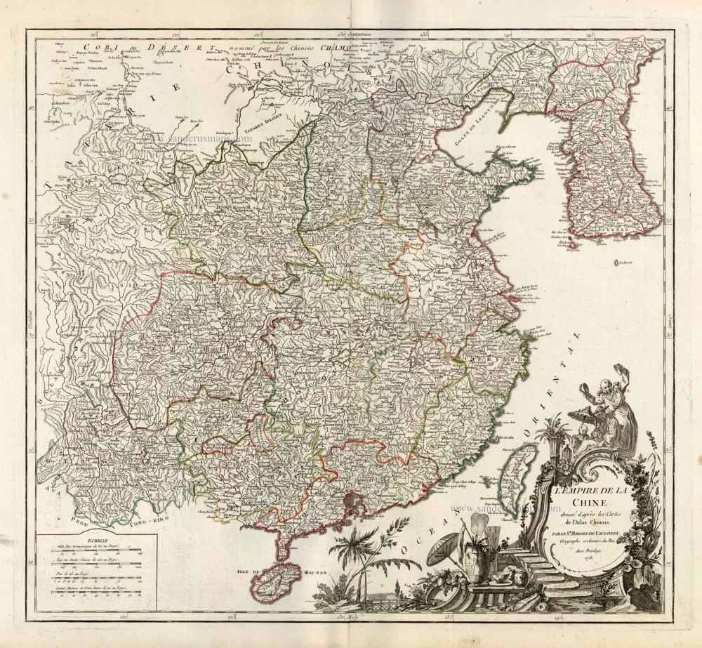
L'Empire de la Chine Dresse d'apres les Cartes de l'Atlas Chinois ... c. 1757
China, by Robert de Vaugondy.
[Item number: 5093]
With Korea as an island.
China 1619
China, Korea and Japan by J. Hondius.
[Item number: 6494]
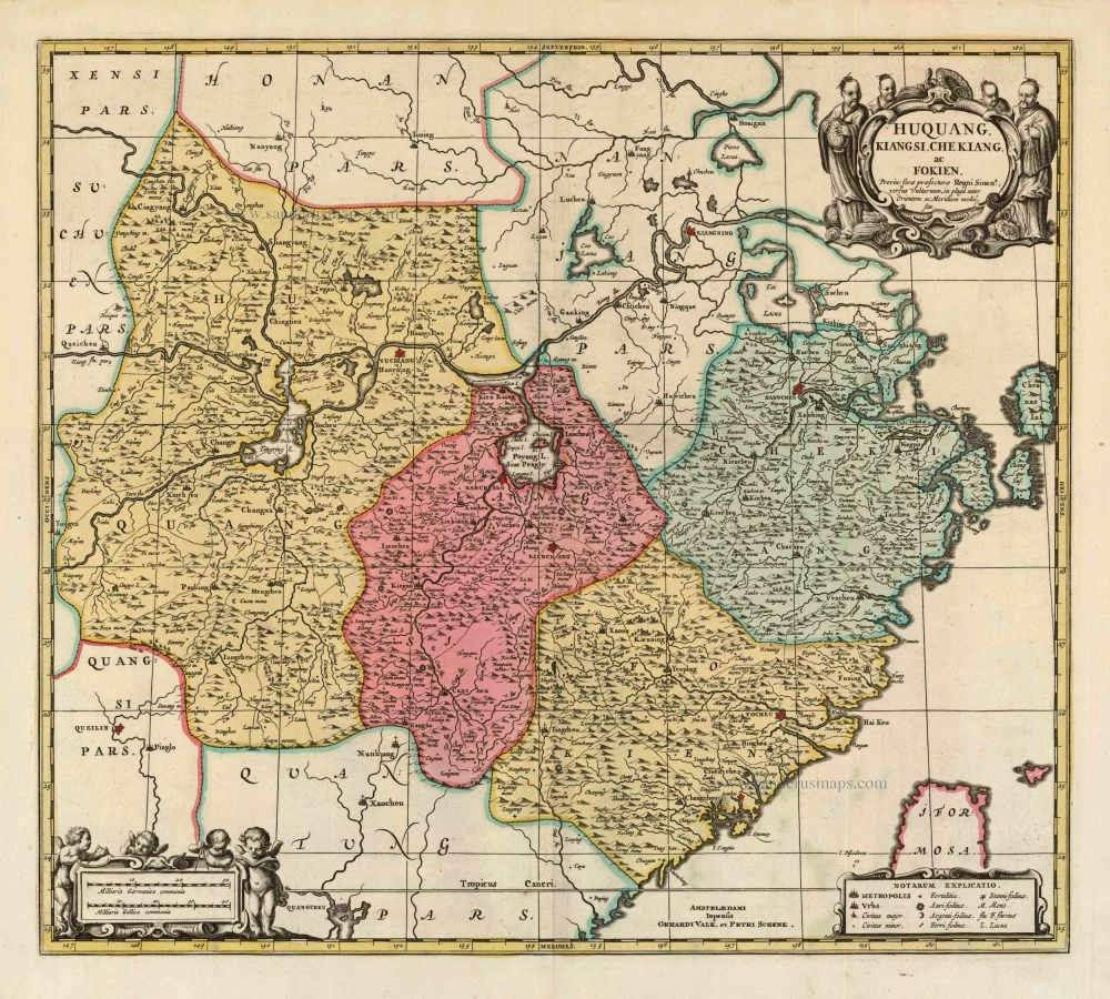
Huquang, Kiangsi, Che Kiang, ac Fokien. Provin: sivae praefecturae Regni Sinen:s, versus Vulturnum, in plaga inter Orientem ac Meridiem media, sitae. c. 1700
Eastern China, by Valk and Schenk.
[Item number: 8453]

L'Empire de la Chine, avec la Tartarie Chinoise d'après l'Atlas Chinois. 1776-79
China with Korea and Japan, by Paolo Santini.
[Item number: 26974]

China Veteribus Sinarum Regio Nunc Incolis Tame Dicta. 1649-55
China - Japan - Korea, by Willem & Joan Blaeu.
[Item number: 27043]

La Chine, Suivant les Nouvelles Observations. 1713
China, by Pieter van der Aa.
[Item number: 27095]

Early 1525 edition
Ta. Superioris Indiae et Tartariae Maioris. 1525
China - Japan, by Lorenz Fries after Martin Waldseemüller.
[Item number: 27928]

Carte du Katay, ou Empire de Kin. 1750
China - Korea by Jacques Nicolas Bellin.
[Item number: 28177]

La Chine avec la Korée et les Parties de la Tartarie les plus voisines, 1749
China - Korea by Jacques Nicolas Bellin.
[Item number: 28195]

Honan, Imperii Sinarum Provincia Quinta. 1655-1659
Honan by Joan Blaeu
[Item number: 28593]

From the Martini atlas
Imperii Sinarum Nova Descriptio. c. 1691-97
China by Joan Blaeu, published by Frederick de Wit.
[Item number: 29431]

Royaume de la Chine. 1682
China by Nicolas Sanson, published by Simon de Vries.
[Item number: 30235]

L'Empire de la Chine 1748
China by N. Bellin.
[Item number: 30260]
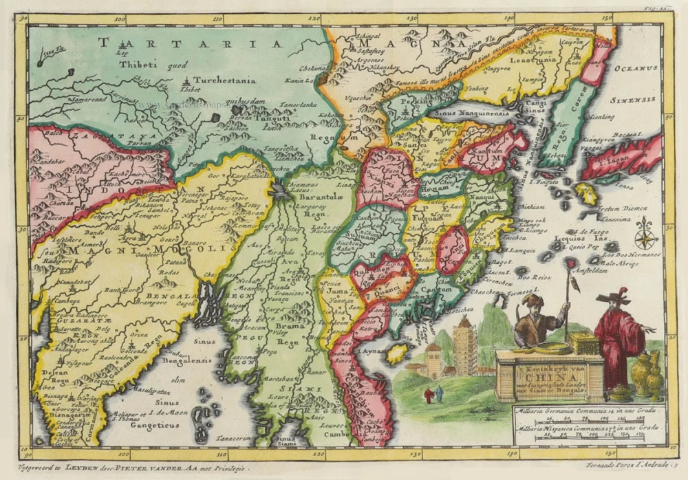
't Koninkryk van China, met d'aangrensende Landen van Siam en Bengale. 1706
China by Pieter Van der Aa.
[Item number: 31842]

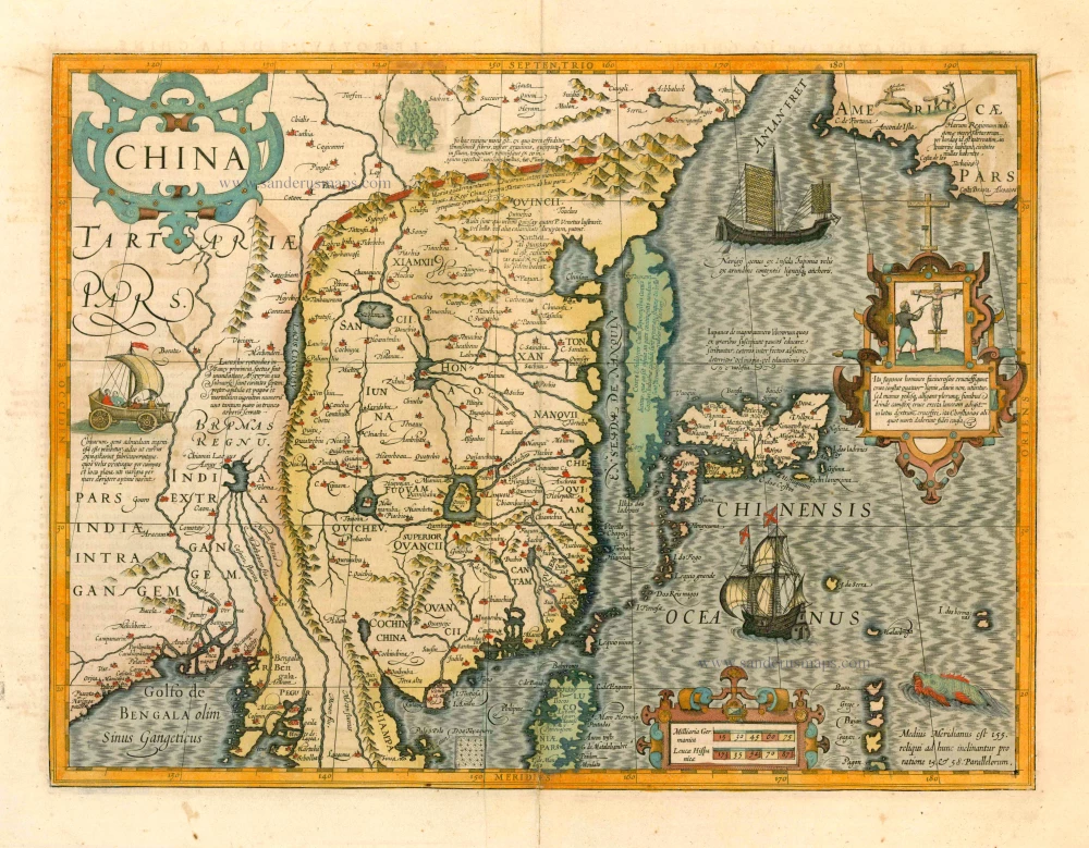
Chinae, Olim Sinarum regionis, nova descriptio. 1584
China by Abraham Ortelius.
[Item number: 32005]

China. 1618
China by Petrus Bertius, published by Jodocus Hondius II.
[Item number: 32151]
China Regio Asiae. c. 1600
China by Barent Langenes.
[Item number: 32299]