
China by N. Bellin. 1748
Jacques-Nicolas Bellin (1703-1772)
Jacques-Nicolas Bellin, a French geographer, was among the most important mapmakers of the eighteenth century. In 1721, at the age of 18, he was appointed hydrographer of the Ministry of the Navy following the French hydrographic office's creation and the Dépot of charts and plans of the Navy. Appointed hydrographic engineer in August 1741. Member of the Academy of the Navy and the Royal Society of London.
Over the course of a 50-year career, he drew the maps of several major works of his time such as Histoire et description générale de la Nouvelle-France de Charlevoix (1744); Histoire générale des voyages de l'Abbé Prévost (published between 1746 and 1759) ); Neptune François (1753), Hydrographie Françoise (1756-1765), and Petit Atlas Français (1763) - reissued as Petit Atlas Maritime (1765). He is the most copied cartographer of the 18th century.
His maps of Canada and the French territories of North America are of considerable value. This is all the more remarkable since, an archetype of the cabinet cartographer, Bellin never came to America. For his cartography of the St. Lawrence River, he entrusted handwritten maps to navigators to correct and enrich. With each return of these maps, he was updating his knowledge. Two basic needs drive its cartography of North America: to secure navigation on the St. Lawrence River and to claim for France the lands explored by the French in the Great Lakes region and along the Mississippi River.
Jacques-Nicolas Bellin died on March 21, 1772, in Versailles. In the burial certificate, he is described as "the first engineer of the navy and the deposit of plans, royal censor of the academy of navy and the royal society of London".
Antoine François Prévost (l'abbé)
Antoine François Prévost (1697–1763), also known as Abbé Prévost, was a French writer, historian, and traveller, best remembered for his literary works, particularly Manon Lescaut. However, beyond his contributions to literature, Prévost also played a notable role in disseminating geographical and cartographical knowledge during the 18th century.
Prévost demonstrated a keen interest in geography and exploration, which was reflected in his ambitious historical and travel writings. One of his most significant contributions to the field of cartography came through his monumental work "Histoire générale des voyages", published between 1746 and 1759. This multi-volume series compiled detailed narratives of travels and discoveries from various parts of the world, accompanied by maps and illustrations.
Though Prévost was not a cartographer by profession, his work was instrumental in popularising geographical knowledge in Enlightenment Europe. The maps included in Histoire générale des voyages were often created by prominent contemporary cartographers and engravers, providing readers with visual representations of remote and little-known regions. Through these collaborations, Prévost helped disseminate some of the era’s most critical cartographical works to a broader, non-specialist audience.
His writings, along with the associated maps, made a significant contribution to the European understanding of global geography, colonial territories, and navigation routes during a period of rapid maritime exploration and expansion. Prévost's work stands as a testament to the interconnection between literature, travel writing, and cartography in the Enlightenment period.
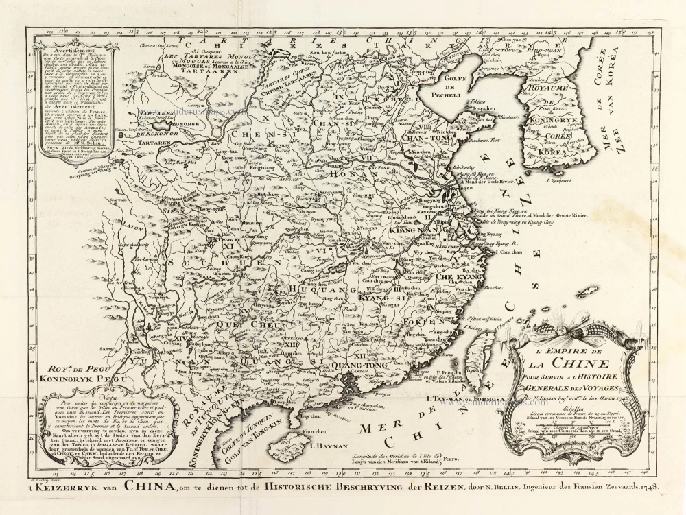
L'Empire de la Chine
Item Number: 30260 Authenticity Guarantee
Category: Antique maps > Asia > China
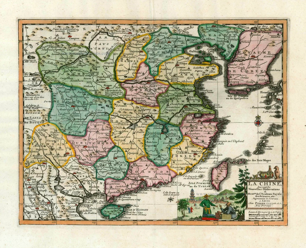
China by N. Bellin.
Title: L'Empire de la Chine
Pour servir à l'Histoire Générale des Voyages.
Par N. Bellin Ingr. ord.re de la Marine 1748.
[Sub-title at the bottom:] '( Keizerryk van China, om te dienen tot de Historische Beschryving der Reizen, door N. Bellin, Ingenier des Franssen Zeevaards, 1748.
Date: 1748.
Copper engraving, printed on paper.
Image size: 290 x 395mm (11.42 x 15.55 inches).
Sheet size: 380 x 445mm (14.96 x 17.52 inches).
Verso: Blank.
Condition: Folds as issued, excellent.
Condition Rating: A+.
From: Prévost d'Exiles A. Fr. Historische Beschryving der Reizen. Den Haag, P. De Hondt, 1747-80. Enlarged Dutch translation of the French edition of 1746-89.
Jacques-Nicolas Bellin (1703-1772)
Jacques-Nicolas Bellin, a French geographer, was among the most important mapmakers of the eighteenth century. In 1721, at the age of 18, he was appointed hydrographer of the Ministry of the Navy following the French hydrographic office's creation and the Dépot of charts and plans of the Navy. Appointed hydrographic engineer in August 1741. Member of the Academy of the Navy and the Royal Society of London.
Over the course of a 50-year career, he drew the maps of several major works of his time such as Histoire et description générale de la Nouvelle-France de Charlevoix (1744); Histoire générale des voyages de l'Abbé Prévost (published between 1746 and 1759) ); Neptune François (1753), Hydrographie Françoise (1756-1765), and Petit Atlas Français (1763) - reissued as Petit Atlas Maritime (1765). He is the most copied cartographer of the 18th century.
His maps of Canada and the French territories of North America are of considerable value. This is all the more remarkable since, an archetype of the cabinet cartographer, Bellin never came to America. For his cartography of the St. Lawrence River, he entrusted handwritten maps to navigators to correct and enrich. With each return of these maps, he was updating his knowledge. Two basic needs drive its cartography of North America: to secure navigation on the St. Lawrence River and to claim for France the lands explored by the French in the Great Lakes region and along the Mississippi River.
Jacques-Nicolas Bellin died on March 21, 1772, in Versailles. In the burial certificate, he is described as "the first engineer of the navy and the deposit of plans, royal censor of the academy of navy and the royal society of London".
Antoine François Prévost (l'abbé)
Antoine François Prévost (1697–1763), also known as Abbé Prévost, was a French writer, historian, and traveller, best remembered for his literary works, particularly Manon Lescaut. However, beyond his contributions to literature, Prévost also played a notable role in disseminating geographical and cartographical knowledge during the 18th century.
Prévost demonstrated a keen interest in geography and exploration, which was reflected in his ambitious historical and travel writings. One of his most significant contributions to the field of cartography came through his monumental work "Histoire générale des voyages", published between 1746 and 1759. This multi-volume series compiled detailed narratives of travels and discoveries from various parts of the world, accompanied by maps and illustrations.
Though Prévost was not a cartographer by profession, his work was instrumental in popularising geographical knowledge in Enlightenment Europe. The maps included in Histoire générale des voyages were often created by prominent contemporary cartographers and engravers, providing readers with visual representations of remote and little-known regions. Through these collaborations, Prévost helped disseminate some of the era’s most critical cartographical works to a broader, non-specialist audience.
His writings, along with the associated maps, made a significant contribution to the European understanding of global geography, colonial territories, and navigation routes during a period of rapid maritime exploration and expansion. Prévost's work stands as a testament to the interconnection between literature, travel writing, and cartography in the Enlightenment period.
Related items
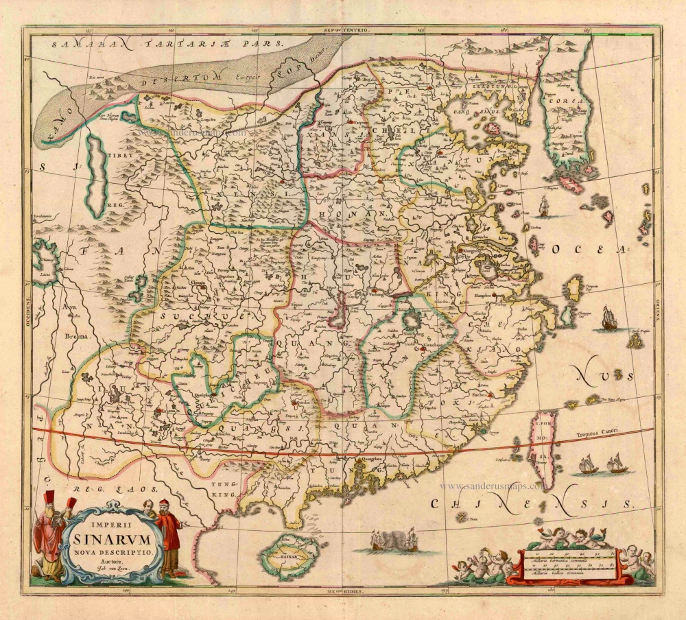
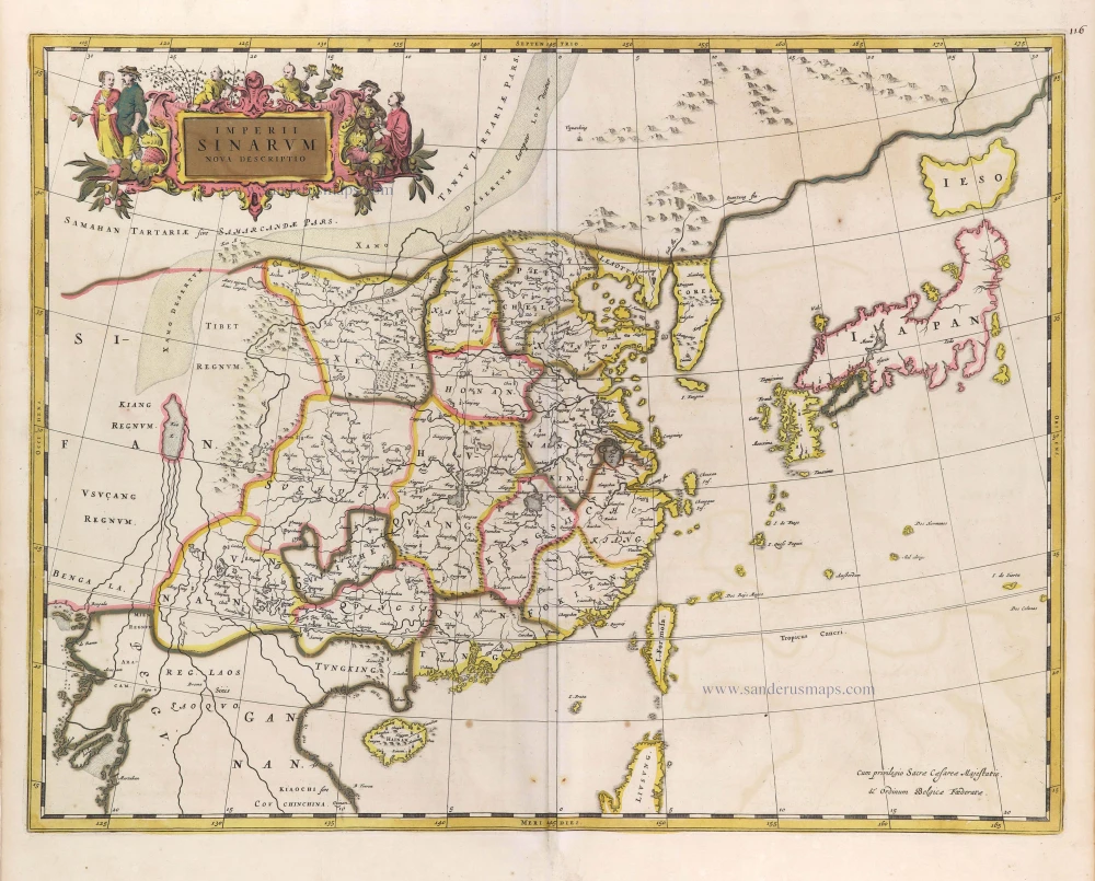
Imperii Sinarum Nova Descriptio. c. 1680.
China with Japan, Korea and Taiwan, by J. Janssonius.
[Item number: 2618]
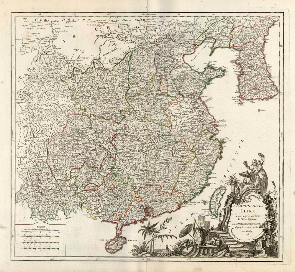
L'Empire de la Chine Dresse d'apres les Cartes de l'Atlas Chinois ... c. 1757
China, by Robert de Vaugondy.
[Item number: 5093]

With Korea as an island.
China 1619
China, Korea and Japan by J. Hondius.
[Item number: 6494]
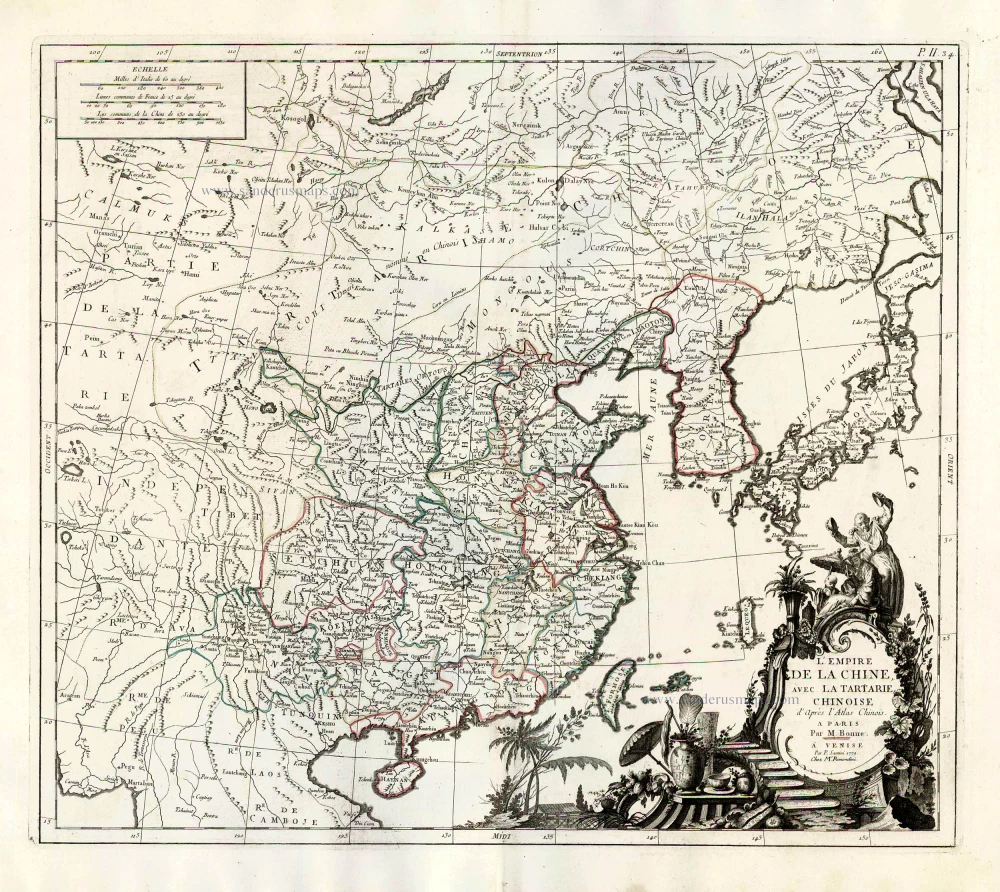
L'Empire de la Chine, avec la Tartarie Chinoise d'après l'Atlas Chinois. 1776-79
China with Korea and Japan, by Paolo Santini.
[Item number: 26974]
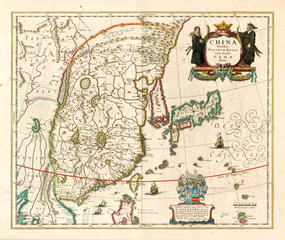
China Veteribus Sinarum Regio Nunc Incolis Tame Dicta. 1649-55
China - Japan - Korea, by Willem & Joan Blaeu.
[Item number: 27043]
La Chine, Suivant les Nouvelles Observations. 1713
China, by Pieter van der Aa.
[Item number: 27095]
Early 1525 edition
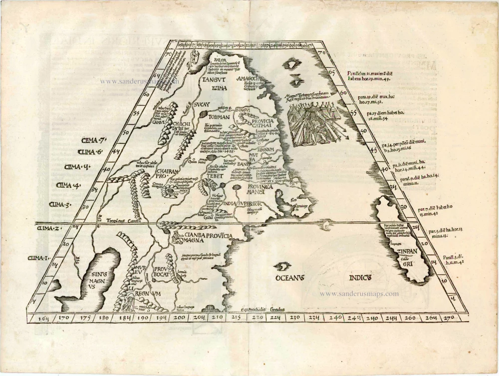
Ta. Superioris Indiae et Tartariae Maioris. 1525
China - Japan, by Lorenz Fries after Martin Waldseemüller.
[Item number: 27928]
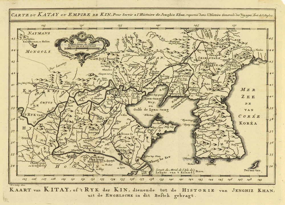
Carte du Katay, ou Empire de Kin. 1750
China - Korea by Jacques Nicolas Bellin.
[Item number: 28177]
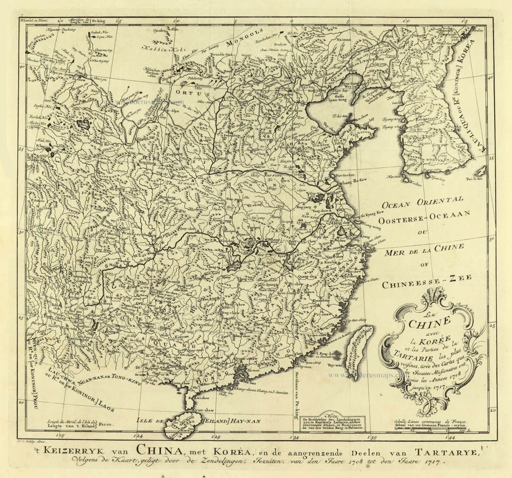
La Chine avec la Korée et les Parties de la Tartarie les plus voisines, 1749
China - Korea by Jacques Nicolas Bellin.
[Item number: 28195]
From the Martini atlas
Imperii Sinarum Nova Descriptio. c. 1691-97
China by Joan Blaeu, published by Frederick de Wit.
[Item number: 29431]
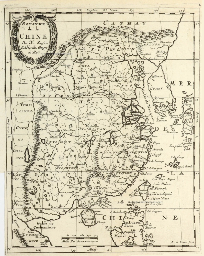
Royaume de la Chine. 1682
China by Nicolas Sanson, published by Simon de Vries.
[Item number: 30235]
Important and rare China map.
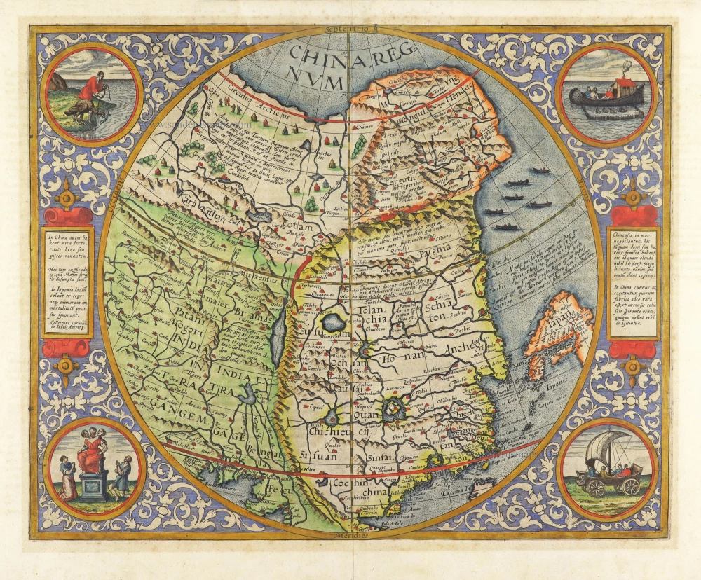
China Regnum. 1593
China by Cornelis de Jode
[Item number: 30312]

't Koninkryk van China, met d'aangrensende Landen van Siam en Bengale. 1706
China by Pieter Van der Aa.
[Item number: 31842]

Chinae, Olim Sinarum regionis, nova descriptio. 1584
China by Abraham Ortelius.
[Item number: 32005]

China. 1618
China by Petrus Bertius, published by Jodocus Hondius II.
[Item number: 32151]
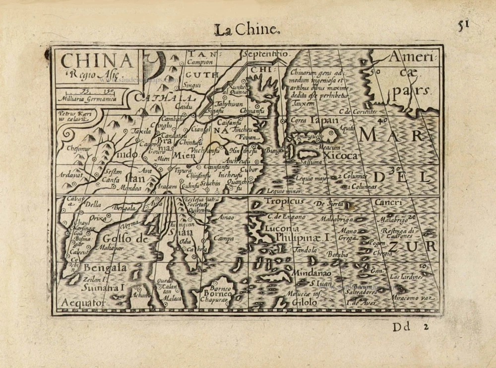
China Regio Asiae. c. 1600
China by Barent Langenes.
[Item number: 32299]