
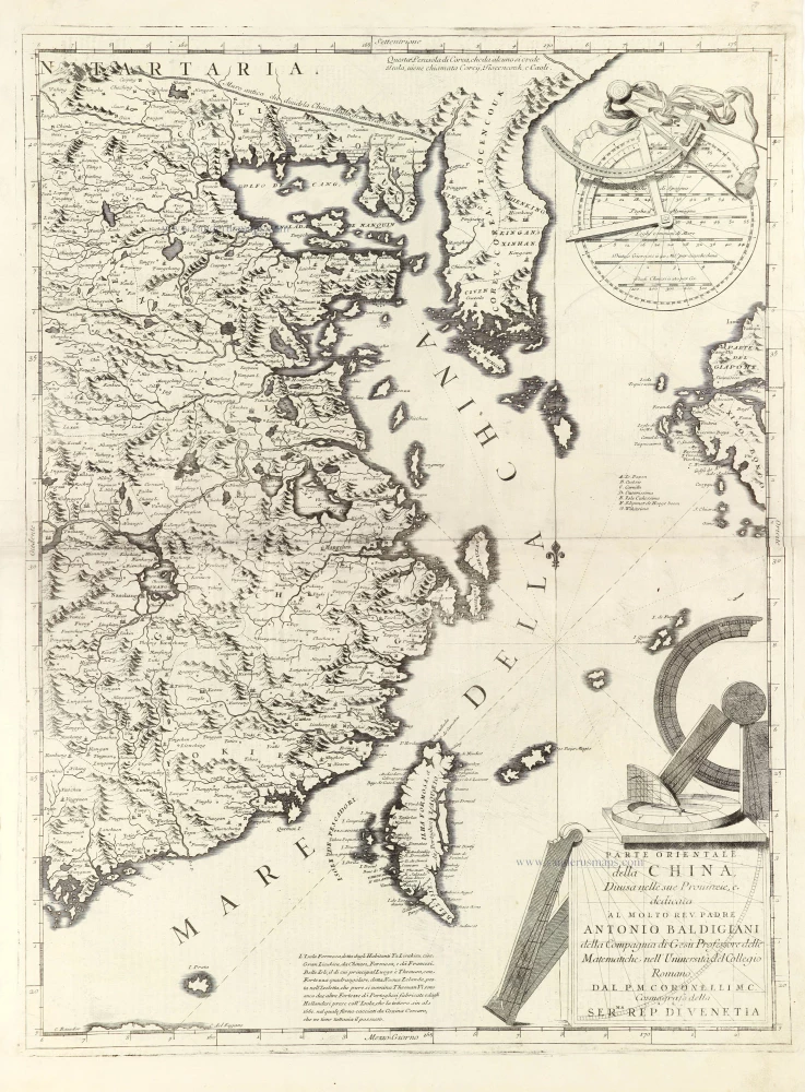
Eastern part of China with Korea and Formosa (Taiwan), by Vincenzo Coronelli. 1696
Vincenzo Coronelli (1650-1718)
Vincenzo Coronelli was born in Venice on 16 August 1650 and primarily brought up in Ravenna. He returned to Venice in 1665 and joined the convent of the Minor Conventuals. Five years later, he was sent to Rome to study, and by 1673, he was already a doctor of theology.
Having achieved fame by constructing two globes for the Duke of Parma, he was invited to Paris for three years in 1681 and made two enormous examples for Louis XIV. On his return to Venice, he assiduously collected cartographic material and founded the Academy of the Argonauts. In 1685, he was appointed Cosmographer to the Republic of Venice and authorised to publish a large atlas. He became a geography lecturer at the University of Venice and brought out an Atlante Veneto the following year.
In 1696, he visited Germany, Holland and southern England. During intervals in compiling his vast encyclopaedia, he continued with cartographic projects up to 1709. He died in his native Venice on 9 December 1718.
Coronelli became famous for his globes. In addition, he was a renowned encyclopaedist, mapmaker and geographer. Most of his maps and other material are gathered in his Atlante Veneto (13 vols, 1690-1705). The first volume, subtitled Descrizione generale istorica geografica, was his masterpiece, planned as an extension of Blaeu’s atlas.
Other volumes of the atlas which contain maps are Isolario, two parts (1696-8), with detailed maps and plans, mostly of islands; Corso geografico, two parts based on the edition 1694-7; Libro de’ globi (1697); and Lo Specchio del Mare, a reprint of Levanto's Lo Specchio del Mare Mediterraneo of 1664.
The other vital aspects of his mapping are those arising from the Venetian conquest and his travels. His most extensive military compilation was the Teatro della Guerra, in more than 30 volumes.
Parte Orientale della China,
Item Number: 28775 Authenticity Guarantee
Category: Antique maps > Asia > China
Old, antique map of the eastern part of China with Korea and Formosa (Taiwan), by Vincenzo Coronelli.
Title: Parte Orientale della China,
Divisa nelle sue Provincie, e
dedicata al Molto Rev. Padre Antonio Baldigiani della Compagnia di Gesu Professore delle Matematiche nell' Università del Collegio Romano.
Dal P.M. Coronelli M.C. Cosmografo della Ser.ma Rep. di Venetia.
Date of the first edition: 1696.
Date of this map: 1696.
Copper engraving, printed on paper.
Map size: 605 x 450mm (23.82 x 17.72 inches).
Sheet size: 700 x 485mm (27.56 x 19.09 inches).
Verso: Italian text and a picture: "Valcello Serpente della China" (12.5 x 16 cm)
Condition: Closed tear on the left running 12 cm into the image.
Condition Rating: B.
From: Isolario Descrittione Geografico-Historica, Sacro-Profano, Antico-Moderna, Politica, Naturale e Poetica ... di Tutti l'Isole ... Tomo II dell'Atlante Veneto ... del P.Maestro Vincenzo Coronelli ... A'Spese dell'Autore MDCLXXXXVI. (Shirley (Brit.Lib), T.CORO-13a)
Vincenzo Coronelli (1650-1718)
Vincenzo Coronelli was born in Venice on 16 August 1650 and primarily brought up in Ravenna. He returned to Venice in 1665 and joined the convent of the Minor Conventuals. Five years later, he was sent to Rome to study, and by 1673, he was already a doctor of theology.
Having achieved fame by constructing two globes for the Duke of Parma, he was invited to Paris for three years in 1681 and made two enormous examples for Louis XIV. On his return to Venice, he assiduously collected cartographic material and founded the Academy of the Argonauts. In 1685, he was appointed Cosmographer to the Republic of Venice and authorised to publish a large atlas. He became a geography lecturer at the University of Venice and brought out an Atlante Veneto the following year.
In 1696, he visited Germany, Holland and southern England. During intervals in compiling his vast encyclopaedia, he continued with cartographic projects up to 1709. He died in his native Venice on 9 December 1718.
Coronelli became famous for his globes. In addition, he was a renowned encyclopaedist, mapmaker and geographer. Most of his maps and other material are gathered in his Atlante Veneto (13 vols, 1690-1705). The first volume, subtitled Descrizione generale istorica geografica, was his masterpiece, planned as an extension of Blaeu’s atlas.
Other volumes of the atlas which contain maps are Isolario, two parts (1696-8), with detailed maps and plans, mostly of islands; Corso geografico, two parts based on the edition 1694-7; Libro de’ globi (1697); and Lo Specchio del Mare, a reprint of Levanto's Lo Specchio del Mare Mediterraneo of 1664.
The other vital aspects of his mapping are those arising from the Venetian conquest and his travels. His most extensive military compilation was the Teatro della Guerra, in more than 30 volumes.
Related items

Imperii Sinarum Nova Descriptio. c. 1680.
China with Japan, Korea and Taiwan, by J. Janssonius.
[Item number: 2618]

Pecheli, Xansi, Xantung, Honan, Nanking, In plaga Regni Sinensis in ter Septentrionem ac OrientemCeciam versus sitae Provinciae. c. 1700
Northeastern China, by Valk G. & Schenk P.
[Item number: 2694]
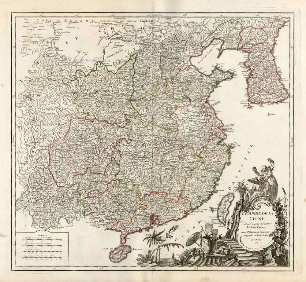
L'Empire de la Chine Dresse d'apres les Cartes de l'Atlas Chinois ... c. 1757
China, by Robert de Vaugondy.
[Item number: 5093]
With Korea as an island.
China 1619
China, Korea and Japan by J. Hondius.
[Item number: 6494]
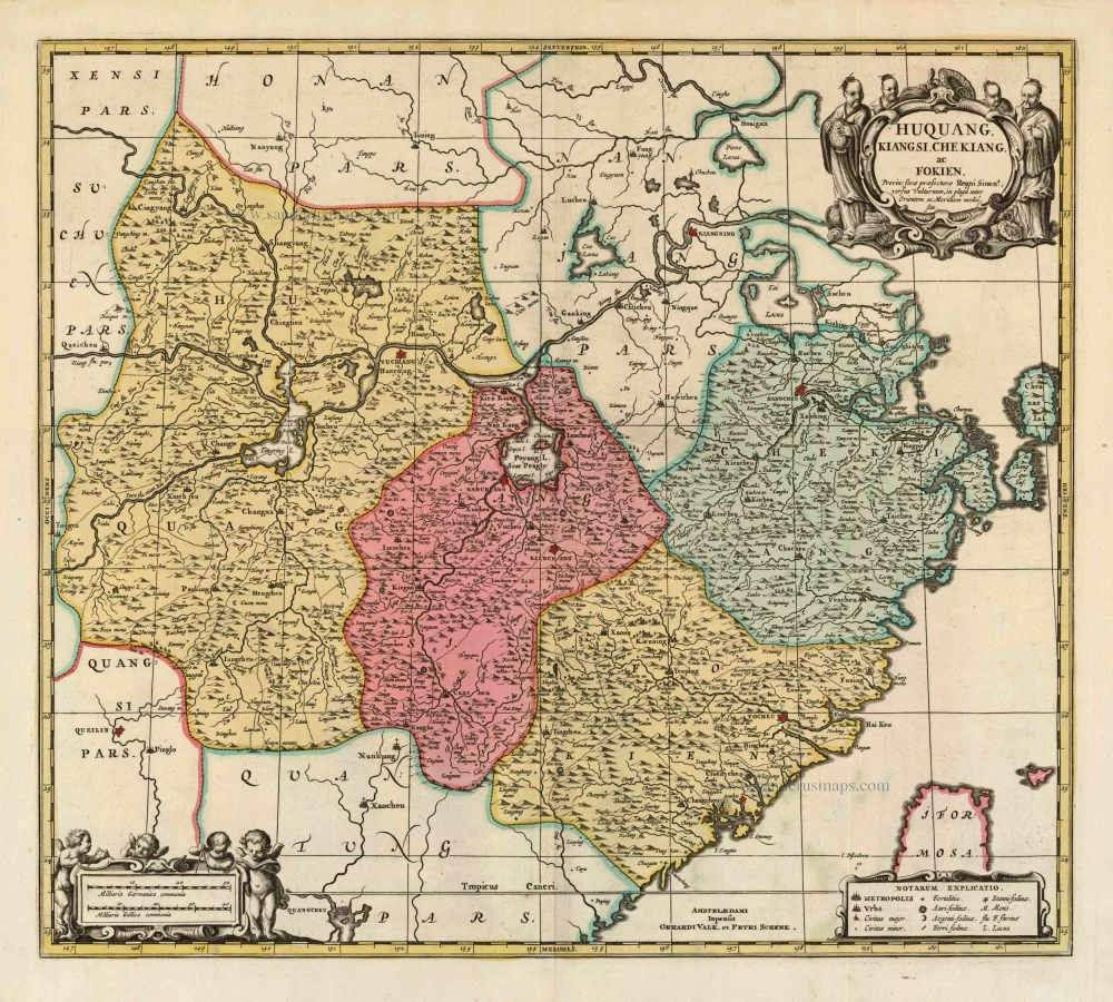
Huquang, Kiangsi, Che Kiang, ac Fokien. Provin: sivae praefecturae Regni Sinen:s, versus Vulturnum, in plaga inter Orientem ac Meridiem media, sitae. c. 1700
Eastern China, by Valk and Schenk.
[Item number: 8453]

In rare original colour
L'Île de Formosa ou sont exactement marquez les Bancs de Sables, Rochers et Brasses d'Eau. 1713
Formosa and the Pescadores, by Pieter van der Aa.
[Item number: 26098]

Iaponiae Nova Desciptio. 1641
Japan & Korea by Johannes Janssonius
[Item number: 26441]

L'Empire de la Chine, avec la Tartarie Chinoise d'après l'Atlas Chinois. 1776-79
China with Korea and Japan, by Paolo Santini.
[Item number: 26974]

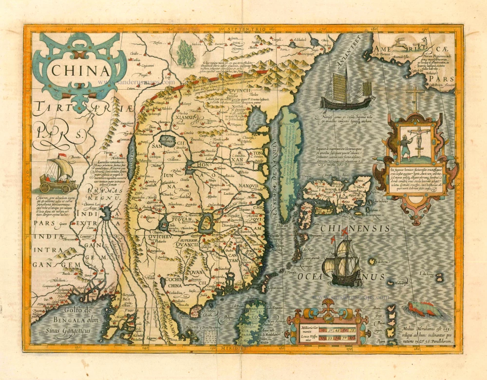
China Veteribus Sinarum Regio Nunc Incolis Tame Dicta. 1649-55
China - Japan - Korea, by Willem & Joan Blaeu.
[Item number: 27043]

Carte du Katay, ou Empire de Kin. 1750
China - Korea by Jacques Nicolas Bellin.
[Item number: 28177]

La Chine avec la Korée et les Parties de la Tartarie les plus voisines, 1749
China - Korea by Jacques Nicolas Bellin.
[Item number: 28195]

Isola del Giapone e Penisola di Corea. 1696
Japan - Korea by Vincenzo Coronelli.
[Item number: 28757]

Die Insel Formosa neu abgemessen auf Befehl Kaysers Kamhi. 1726
Taiwan by J. Stöcklein. (Formosa)
[Item number: 30143]

Carte du Katay ou Empire de Kin. 1747
Northern China and Korea by Jacques-Nicolas Bellin, published by A.F. Prévost.
[Item number: 31884]

China. 1618
China by Petrus Bertius, published by Jodocus Hondius II.
[Item number: 32151]
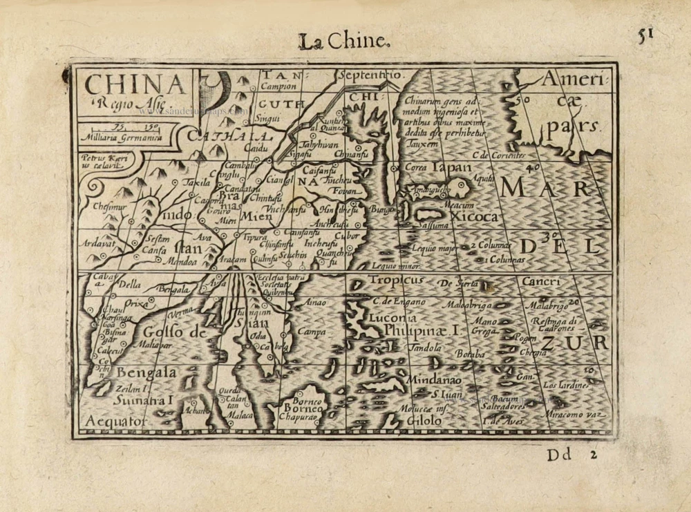
China Regio Asiae. c. 1600
China by Barent Langenes.
[Item number: 32299]

Extremely rare first edition
Mapa de la parte de la Isla Formosa, perteneciente al Emperador de la China sacado por Orden de su Mag. 1753-57
Formosa (Taiwan) by a French missionary, engraved by Gonzalez.
[Item number: 33076]
new