Antique maps catalogue
- All recent additions
-
Antique maps
- Polar maps
- World
-
Europe
- Europe Continent
- Belgium
- Belgium - Cities
- The Low Countries
- The Netherlands
- The Netherlands - Cities
- Luxembourg
- France
- France - Cities
- Germany
- Germany - Cities
- Austria
- Italy
- Italy - Cities
- Spain and Portugal
- Greece & Greek Islands
- Switzerland
- British Isles
- British Isles - Cities
- Northern Europe
- Central Europe
- Eastern Europe
- Southeastern Europe
- America
- Asia
- Africa
- Mediterranean Sea
- Australia
- Oceans
- Celestial Maps
- Curiosities
- Title Pages
- Books
- Medieval manuscripts
- Prints
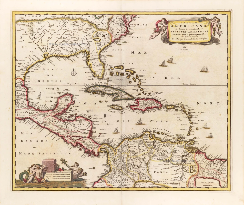
The Antilles by Nicolaes Visscher II. c. 1705
Insulae Americanae in Oceano Septentrionali ac Regiones...
[Item number: 29126]
Heightened in gold and silver
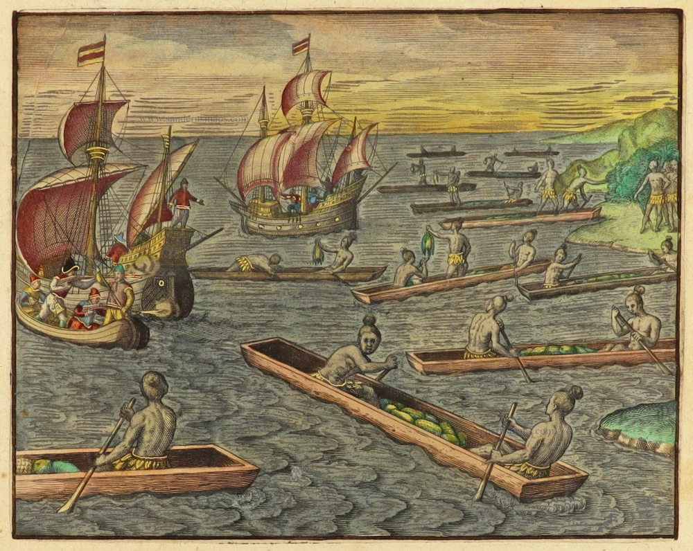
What was delivered to Cavendish on his voyage by a number of Indians. Great Voyages, De Bry, 1599
Quidam indiani ducem candisch in itinere adoriuntur.
[Item number: 30707]

Big and spectacular map in excellent condition
Central America by Pieter Mortier (Pierre). c. 1705
Teatre de la Guerre en Amerique, telle qu'elle est a Present...
[Item number: 27766]

North America by Giovanni De Rossi, after Nicolas Sanson. 1677
L' America Settentrionale.
[Item number: 32889]

Early 'Texas' map
North America, by Girolamo Ruscelli. 1574
Nueva Hispania Tabula Nova.
[Item number: 27755]
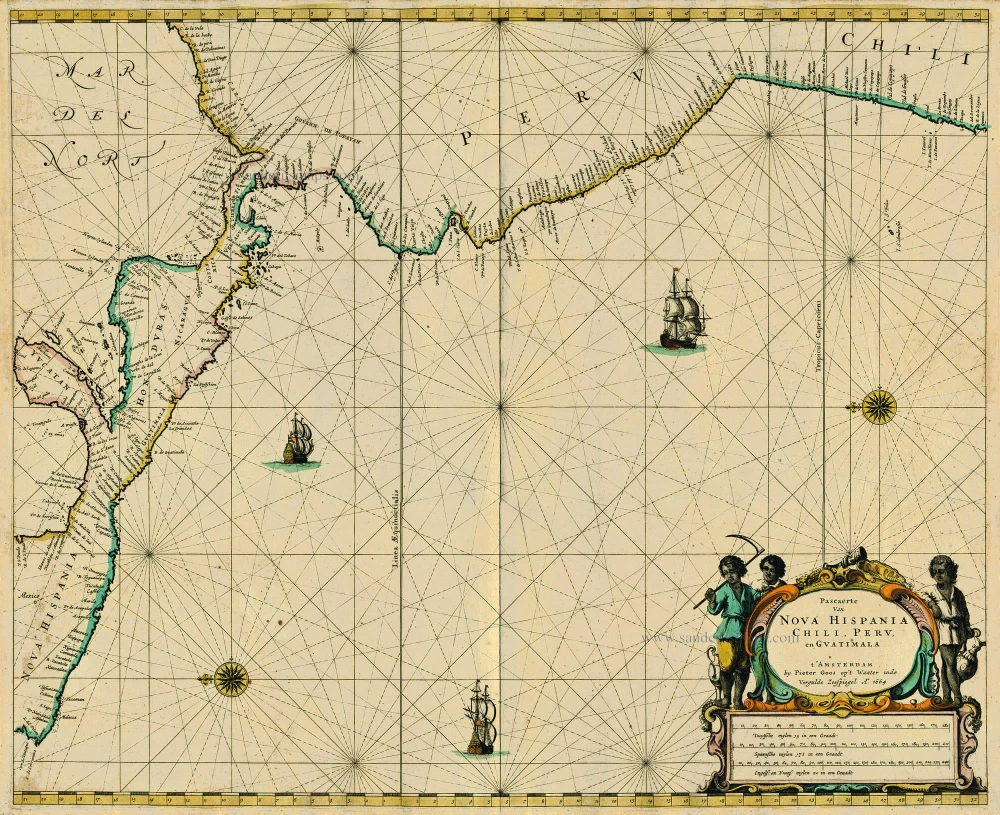
Central America, by Pieter Goos. 1667
Pascaerte van Nova Hispania Chili, Peru, en Guatimala
[Item number: 19031]

Pacific Coast of America, by Frederick de Wit. ca. 1680
Novae Hispaniae, Chili, Peruviae, et Guatimalae Littorae.
[Item number: 29177]

The Caribbean Sea, by Johannes Van Keulen. 1697-1709
Pas-Kaart van de Golff de Guanaios. Met 't Canaal tusschen...
[Item number: 13037]

Central America by Jacques-Nicolas Bellin, published by A.F. Prévost. 1758
Carte des Provinces de Tabasco, Chiapa, Verapaz, Guatimala,...
[Item number: 31886]
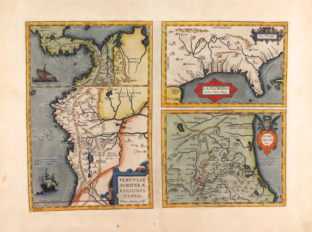
Florida, Peru and Mexico by Abraham Ortelius. 1595
Peruviae Auriferae Regionis Typus. - La Florida - Guastecan ...
[Item number: 29711]

Peru, by Pieter Van der Aa. 1707
Zee en Landtogt door Fr. Pizarrus en D. Almagrus van Panama...
[Item number: 32399]
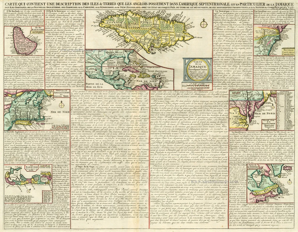
West Indies, Bermuda, New England, Virginia by Châtelain. 1713-1719
Carte qui Contient une Description des Iles & Terres que les...
[Item number: 16834]

Yucatan by Petrus Bertius. 1616
Iucatana.
[Item number: 28486]

Mexico, by C. van Wytfliet. 1607
Hispania Nova.
[Item number: 26501]