
Hawaii by Vandermaelen Philippe. (Sandwich Islands) 1827
Philippe Vandermaelen (Brussels, 1795-1869)
Cartographer, publisher and globemaker. Founder of Etablissement Géographique de Bruxelles. Produced educational maps, geographical dictionaries, numerous globes of different sizes, and works in geology, botany, chemistry and military science.
He published one of the most remarkable world atlases ever made: a world atlas with 400 maps on a uniform scale of ca. 1:1,6 million. This work, which appeared in 1827, was far ahead of his time, but the unparalleled zeal of its author could only justify its appearance. Philippe Vandermaelen, born in Brussels in 1795, educated himself in geography after his father died in 1816. Supported by his parents' fortune and assisted by his brother, Jean-François, he built a spacious Geographical Institute in 1829, where he installed a map-drawing section, a library and a museum. Between 1816 and 1825, he developed an enthusiastic interest in cartography, culminating in the conception of a predecessor of the International Map of the World: his world atlas on the scale of 1:1,6 million. This Atlas Universel drew wide attention, and the author was honoured by various learned societies. Shortly after its completion, Vandermaelen published another great work, the Atlas de l'Europe, with 165 maps on the uniform scale of 1:600.000. At that time, such a work superseded any other map of Europe.
After his rather sudden death in 1869, his brother, Jean-François, and his son, Joseph, tried in vain to continue the work of the Institute. In 1878, it ceased its activities, and in 1880, the heirs agreed to sell the Institute with its collections and libraries by auction.
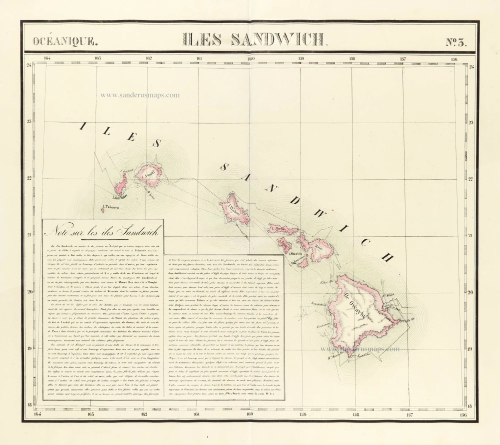
Iles Sandwich.
Item Number: 29556 Authenticity Guarantee
Category: Antique maps > America > Central America
Old, antique map of Hawaii (Sandwich Islands) by Philippe Vandermaelen.
Title: Iles Sandwich.
Date of the first edition: 1827.
Date of this map: 1827.
Lithograph, printed on paper.
Map size: 470 x 535mm (18.5 x 21.06 inches).
Sheet size: 540 x 710mm (21.26 x 27.95 inches).
Verso: Blank.
Condition: Original hand coloured, excellent.
Condition Rating: A+.
From: Atlas Universel de Géographie Physique, Statistique et Minéralogique ... dressé par Ph. Vandermaelen. Bruxelles, 1827. (Koeman III, p. 142, Vdm1)
Philippe Vandermaelen (Brussels, 1795-1869)
Cartographer, publisher and globemaker. Founder of Etablissement Géographique de Bruxelles. Produced educational maps, geographical dictionaries, numerous globes of different sizes, and works in geology, botany, chemistry and military science.
He published one of the most remarkable world atlases ever made: a world atlas with 400 maps on a uniform scale of ca. 1:1,6 million. This work, which appeared in 1827, was far ahead of his time, but the unparalleled zeal of its author could only justify its appearance. Philippe Vandermaelen, born in Brussels in 1795, educated himself in geography after his father died in 1816. Supported by his parents' fortune and assisted by his brother, Jean-François, he built a spacious Geographical Institute in 1829, where he installed a map-drawing section, a library and a museum. Between 1816 and 1825, he developed an enthusiastic interest in cartography, culminating in the conception of a predecessor of the International Map of the World: his world atlas on the scale of 1:1,6 million. This Atlas Universel drew wide attention, and the author was honoured by various learned societies. Shortly after its completion, Vandermaelen published another great work, the Atlas de l'Europe, with 165 maps on the uniform scale of 1:600.000. At that time, such a work superseded any other map of Europe.
After his rather sudden death in 1869, his brother, Jean-François, and his son, Joseph, tried in vain to continue the work of the Institute. In 1878, it ceased its activities, and in 1880, the heirs agreed to sell the Institute with its collections and libraries by auction.