Our catalogue catalogue
- All recent additions
-
Antique maps
- Polar maps
- World
-
Europe
- Europe Continent
- Belgium
- Belgium - Cities
- The Low Countries
- The Netherlands
- The Netherlands - Cities
- Luxembourg
- France
- France - Cities
- Germany
- Germany - Cities
- Austria
- Italy
- Italy - Cities
- Spain and Portugal
- Greece & Greek Islands
- Switzerland
- British Isles
- British Isles - Cities
- Northern Europe
- Central Europe
- Eastern Europe
- Southeastern Europe
- America
- Asia
- Africa
- Mediterranean Sea
- Australia
- Oceans
- Celestial Maps
- Curiosities
- Title Pages
- Books
- Medieval manuscripts
- Prints

Aalst - St.-Maartenskerk, door Antonius Sanderus 1644 (= first edition)
Ecclesia Collegiata Sti Martini, Alosti.
[Item number: 32987]
new
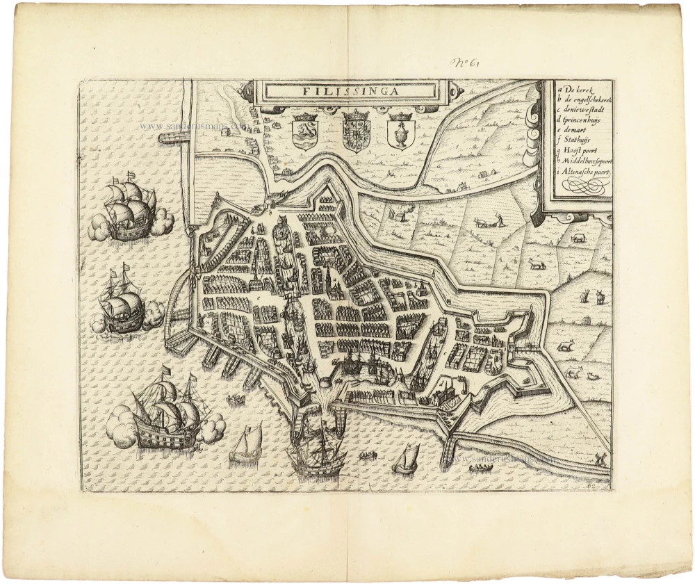
Vlissingen by Guicciardini Lodovico 1612
Filissinga
[Item number: 32991]
new

Lo-Reninge by Antonius Sanderus. 1644 (= first edition)
Loo - Opidum et Abbatia S. Petri Loensis ordinis Canonicorum...
[Item number: 32998]
new
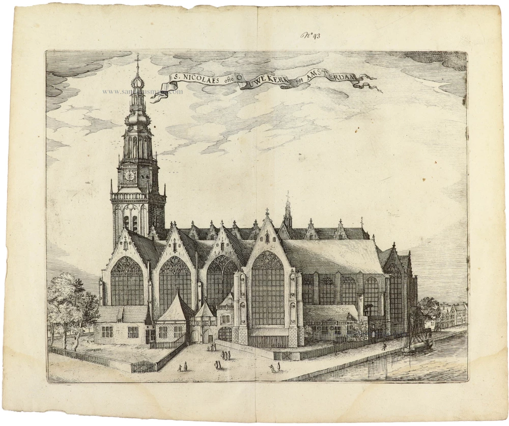
Amsterdam - Oude Kerk, by Lodovico Guicciardini. 1612
S. Nicolaes ofte Ouwe Kerk tot Amsterdam.
[Item number: 32968]
new
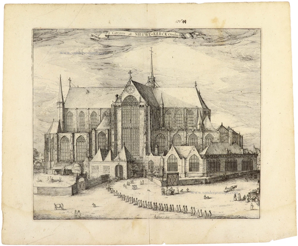
Amsterdam - Nieuwe Kerk, by Lodovico Guicciardini. 1612
S Catrynen ofte Nieuwe-Kerck t' Amsterdam.
[Item number: 32969]
new

Veurne (Kasselrij) by Antonius Sanderus. 1644 (= first edition)
Nova et Exacta Castellaniae Furnensis Tabula Geographica, Vulgo...
[Item number: 33006]
new
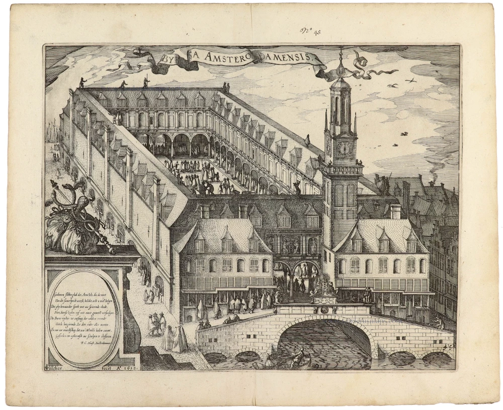
Amsterdam - Beurs (Stock exchange), by Lodovico Guicciardini. 1612
Byrsa Amsterodamensis
[Item number: 32970]
new

Amsterdam - Stadhuis & Waag, by Lodovico Guicciardini. 1612
Het Stathuys Amsterdam - de Waegh
[Item number: 32971]
new

Hoorn, by Lodovico Guicciardini. 1612
Hooren in westvrieslant.
[Item number: 32973]
new

Gorinchem by Lodovico Guicciardini. 1612
Gorchum
[Item number: 32981]
new

Dunkerque (Duinkerke) by Guicciardini Lodovico 1612
Duijnkerken.
[Item number: 33015]
new
![Civitas Mons Geertrudan[us] sicuti erat dum occuparet' ab excelent: sua Mauritio de Naßou.](https://sanderusmaps.com/assets/WEBP/m32983.webp)
Geertruidenberg by Guicciardini Lodovico 1612
Civitas Mons Geertrudan[us] sicuti erat dum occuparet' ab...
[Item number: 32983]
new

Arnemuiden by Guicciardini Lodovico 1612
Arnemuyden
[Item number: 33001]
new
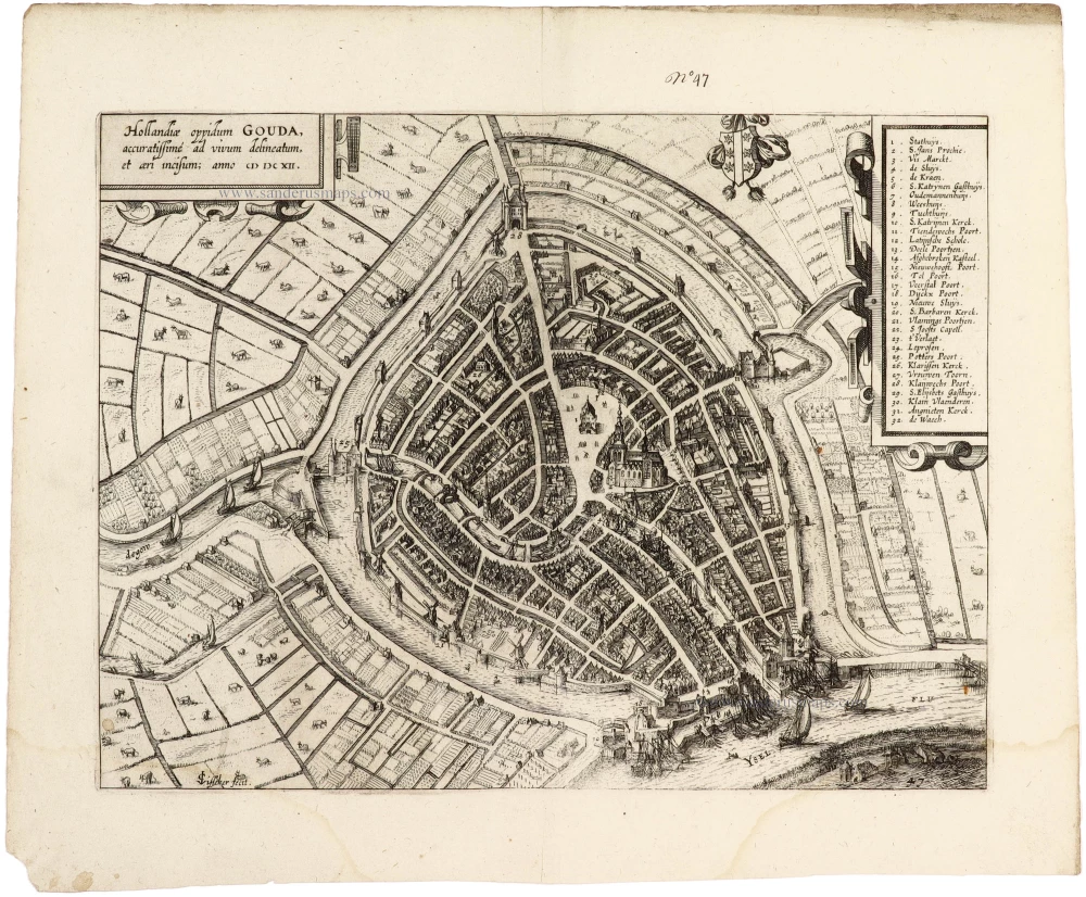
Gouda, by Lodovico Guicciardini. 1612
Hollandiae oppidum Gouda, accuratissime ad vivum delineatum, et...
[Item number: 32972]
new
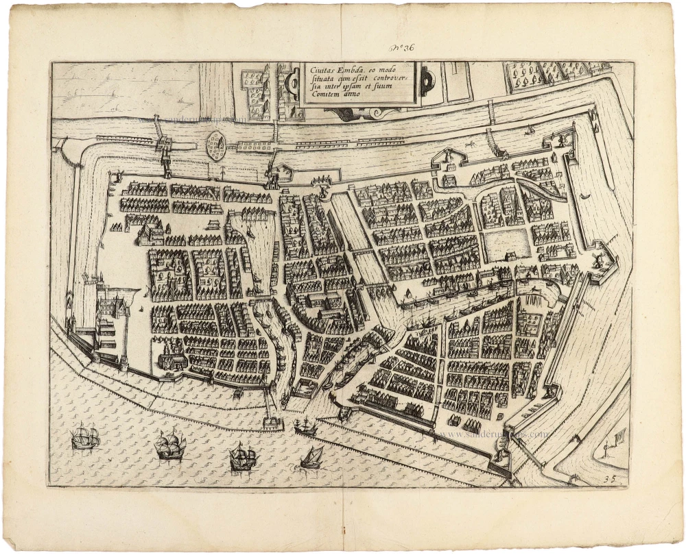
Emden, by Ludovicus Guicciardini. 1612
Civitas Embda, eo modo situata cum essit controversia inter...
[Item number: 32950]
new
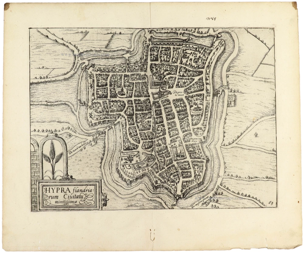
Ieper (Ypres) by Guicciardini Lodovico 1612
Hypra flandriarum Civitatu minitißima;
[Item number: 33003]
new
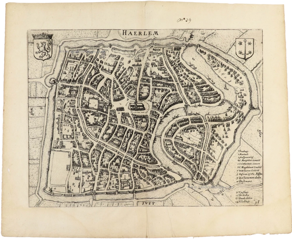
Haarlem, by Ludovicus Guicciardini. 1612
Haerlem.
[Item number: 32951]
new

Utrecht by Guicciardini Lodovico 1612
Trajectum
[Item number: 32989]
new
![Watou [verso:] Praetorium D. Adriani vander Burcht Toparchi de Elverdinge in Cast. Furnensi.](https://sanderusmaps.com/assets/WEBP/m32999.webp)
Poperinge - Watou / Ieper - Elverdinge by Antonius Sanderus. 1644 (= first edition)
Watou [verso:] Praetorium D. Adriani vander Burcht Toparchi de...
[Item number: 32999]
new
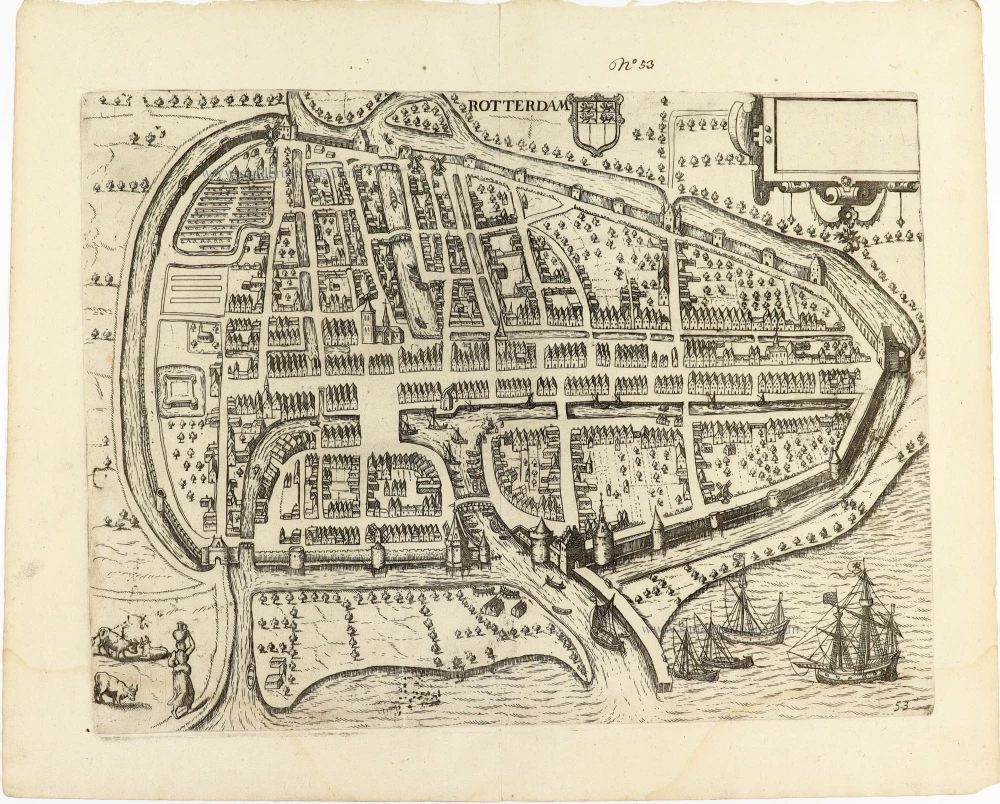
Rotterdam by Guicciardini Lodovico 1612
Rotterdam.
[Item number: 32982]
new
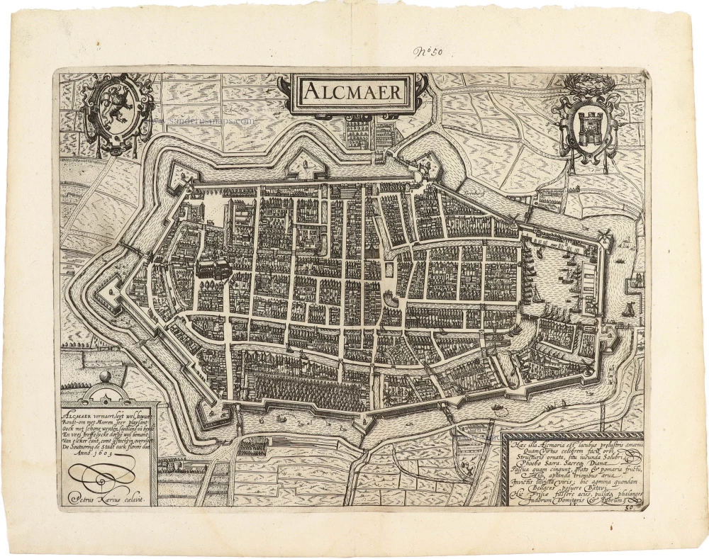
Alkmaar by Lodovico Guicciardini 1612
Alcmaer.
[Item number: 32980]
new
![Landgraviatus Alsatiae tam Superioris quam Inferi[oris] cum utroque Marchionatu Badensi ut et tractu Herciniae Silvae ac Ditione quatuor Urbium Silvestr[ium].](https://sanderusmaps.com/assets/WEBP/m32926.webp)
Alsace - Baden, by J.B. Homann. c. 1720
Landgraviatus Alsatiae tam Superioris quam Inferi[oris] cum...
[Item number: 32926]
new

Archbishopric and Electorate of Cologne, including the Duchies of Jülich and Berg, as well as the County of Meurs, by J.B. Homann. c. 1720
Archiepiscopatus et Electoratus Coloniensis ut et Duvatuum...
[Item number: 32927]
new

Denmark, by Guillaume Sanson, published by Giovanni de Rossi. 1687
Regno di Danimarca.
[Item number: 32958]
new
![Groninga opule[n]ta populosa, et valide contra hostiles insultus nivinita Phrisie urbs Ptolemeo Phileum, constracta et denominata a Grunno Anthenoris Regis Francorum fr[atr]e, Anno ante incarnationem Christi, CCCLXXVII ut Humbaldes Schribit :](https://sanderusmaps.com/assets/WEBP/m32949.webp)
Groningen, by Ludovicus Guicciardini, after Braun & Hogenberg. 1612
Groninga opule[n]ta populosa, et valide contra hostiles insultus...
[Item number: 32949]
new
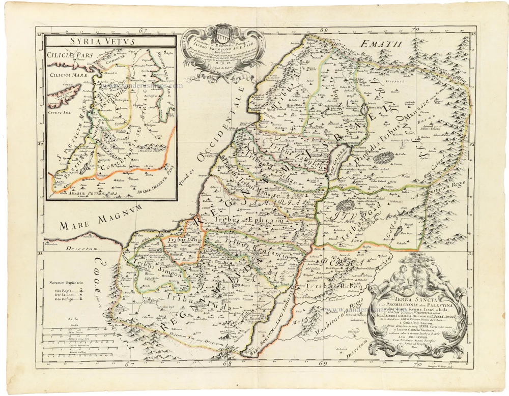
Holy Land, by Guillaume Sanson, adapted by Giacomo Cantelli da Vignola, and published by Giovanni de Rossi. 1687
Terra Sancta sive Promissionis, olim Palestina, in duo divisa...
[Item number: 32957]
new
![Graven Hage, t'Hof van Holla[n]t.](https://sanderusmaps.com/assets/WEBP/m32984.webp)
Den Haag by Guicciardini Lodovico 1612
Graven Hage, t'Hof van Holla[n]t.
[Item number: 32984]
new

Iberian Peninsula (Spain & Portugal), by Guillaume & Nicolas Sanson, published by Giovanni Giacomo de Rossi. 1677
La Spagna.
[Item number: 32908]
new
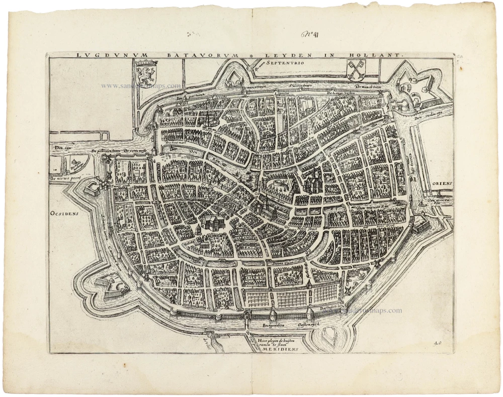
Leiden, by Ludovicus Guicciardini. 1612
Lugdunum Batavorum * Leyden in Hollant.
[Item number: 32952]
new
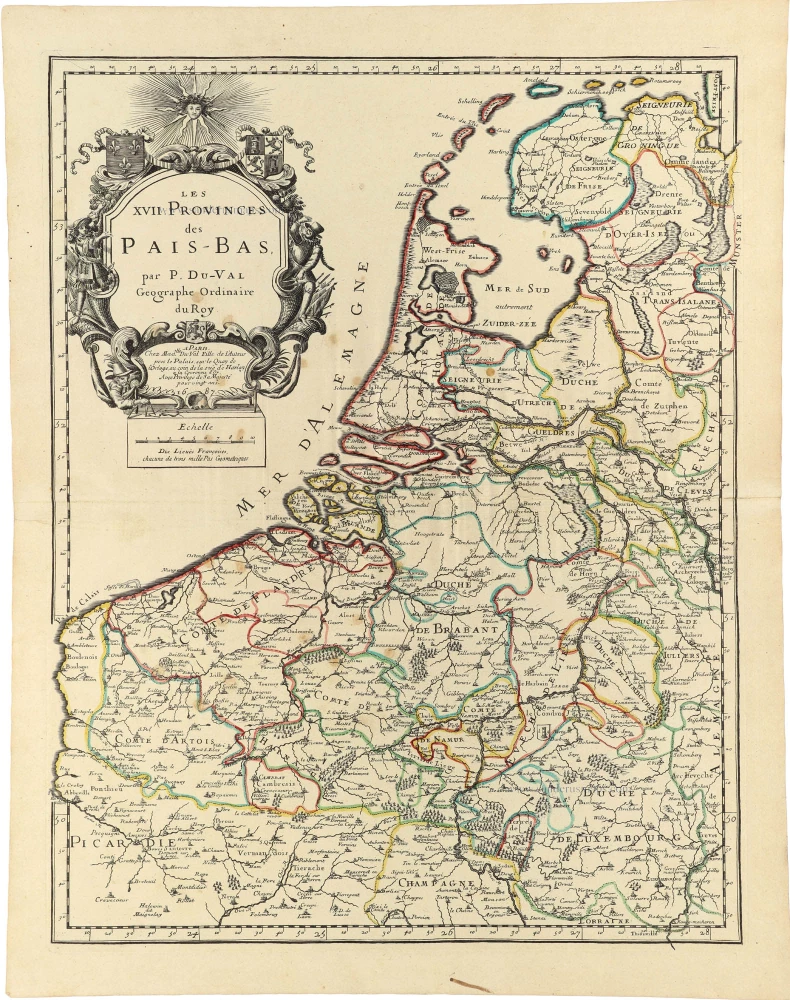
17 Provinces by P. Duval. 1688
Les XVII. Provinces des Pays-Bas.
[Item number: 32902]
new
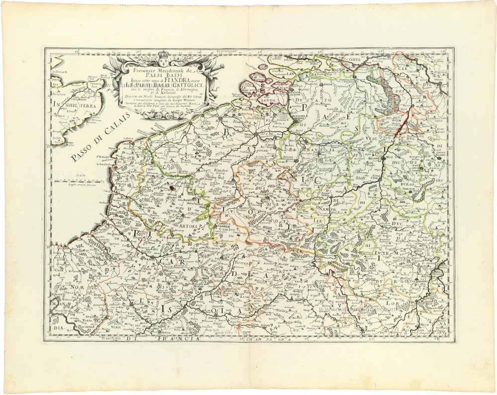
Southern Netherlands (Zuidelijke Nederlanden) by Nicolas Sanson, published by Giovanni Giacomo de Rossi. 1677
Provincie Meridionali de Paesi Bassi, Intese sotto nome di...
[Item number: 32903]
new

Catalonia by Giacomo Cantelli da Vignola, published by Giovanni de Rossi. 1692
Il Principato di Catalogna diviso nelle sue Diecisette Vicarie
[Item number: 32909]
new

The Roussillon and the Cerdagne, by Giacomo Cantelli da Vignola, published by Giovanni de Rossi. 1692
La Contea di Rossilione divisa nella Vicaria di Perpignano, e...
[Item number: 32910]
new

Campagna di Roma (Latium), by Giovanni de Rossi. 1687
Tavola Esatta dell' antico Latio e Nova Campagna di Roma.
[Item number: 32920]
new

Lower Danube by Giacomo Cantelli da Vignola, by Giovanni de Rossi. 1687
Corso del Danubio da Belgrado fino al Mar Ner
[Item number: 32921]
new
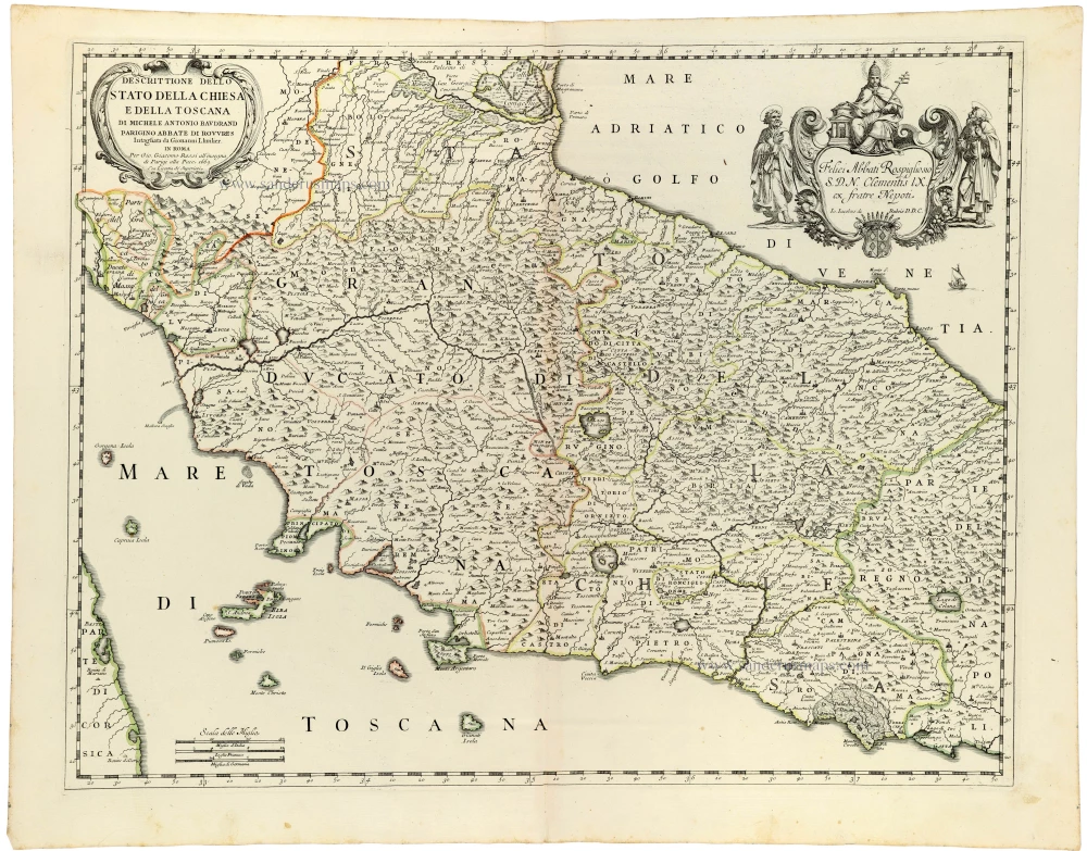
Papal States - Tuscany (Toscana), by Michel Antoine Baudrand, published by Giovanni de Rossi. 1687
Descrittione dello Stato della Chiesa e della Toscana
[Item number: 32919]
new