Our catalogue catalogue
- All recent additions
-
Antique maps
- Polar maps
- World
-
Europe
- Europe Continent
- Belgium
- Belgium - Cities
- The Low Countries
- The Netherlands
- The Netherlands - Cities
- Luxembourg
- France
- France - Cities
- Germany
- Germany - Cities
- Austria
- Italy
- Italy - Cities
- Spain and Portugal
- Greece & Greek Islands
- Switzerland
- British Isles
- British Isles - Cities
- Northern Europe
- Central Europe
- Eastern Europe
- Southeastern Europe
- America
- Asia
- Africa
- Mediterranean Sea
- Australia
- Oceans
- Celestial Maps
- Curiosities
- Title Pages
- Books
- Medieval manuscripts
- Prints
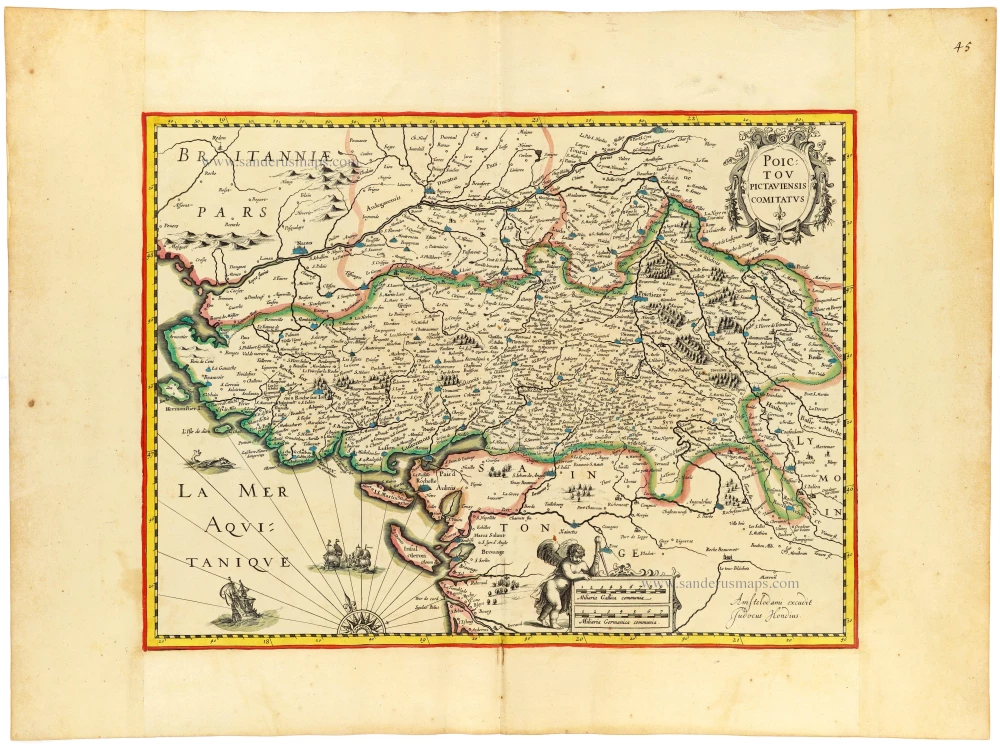
Poitou by Jodocus Hondius, published by J. Janssonius. c. 1631
Poictou Pictaviensis Comitatus.
[Item number: 33119]
new

Luxury colouring with gold
North-West African Coast by Pieter Goos. 1666
De Cust van Barbaria, Gualata, Arguyn, en Genheo, van Capo S....
[Item number: 33067]
new

Luxury colouring with gold
Bay of Biscay by Pieter Goos. 1666
Paskaerte vande Bocht van Vranckrijck Biscajen en Galisen...
[Item number: 33068]
new

Extremely rare Italian Scotland-map
Scotland by an Italian mapmaker, derived from a map by A. Lafreri and Bishop Leslie.
Scotiae nova et accurata descriptio. - Scotia Britannicae Insule...
[Item number: 33066]
new

God Almighty Enthroned, by Michael Wolgemut, published by Hartmann Schedel. 1493
[Item number: 33041]
new

Parergon map
Ancient Sicily, by Abraham Ortelius. 1592
Siciliae Veteris Typus.
[Item number: 33064]
new

Tasmania - Hobart Town, by A. Belin after de Sainson, published by J. Tastu.
Vue de la Rade. de Hobart=Town. (Ille Van-Diemen.).
[Item number: 33065]
new

Richly heightened in gold
17 Provinces, by Frederik de Wit. c. 1675
Novissima et accuratissima XVII provinciarum Germaniae...
[Item number: 33063]
new

Wales, by Joan Blaeu. 1645
Wallia Principatus vulgo Wales.
[Item number: 33047]
new

Virginia by Willem Blaeu. 1644
Nova Virginiae Tabula
[Item number: 33044]
new
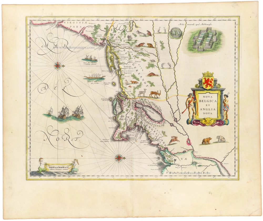
New England by Willem Blaeu 1645
Nova Belgica et Anglia Nova.
[Item number: 33023]
new

Elbe River - Hamburg by Blaeu W. 1642-43
Celeberrimi Fluvii Albis nova delineatio
[Item number: 18728]
new
![De Opere quarte diei [verso:] De Opere quinte diei.](https://sanderusmaps.com/assets/IMG/webp/33074_1779465139_m33074.webp)
The Creation of the World - Day four [verso:] Day five, by Hartmann Schedel. 1493
De Opere quarte diei [verso:] De Opere quinte diei.
[Item number: 33074]
new

Zeeland by M. Smallegange, published by P. van der Aa. 1728
Naeukeurige Nieuwe Land-Caert des Graefschaps Zeeland.
[Item number: 33042]
new
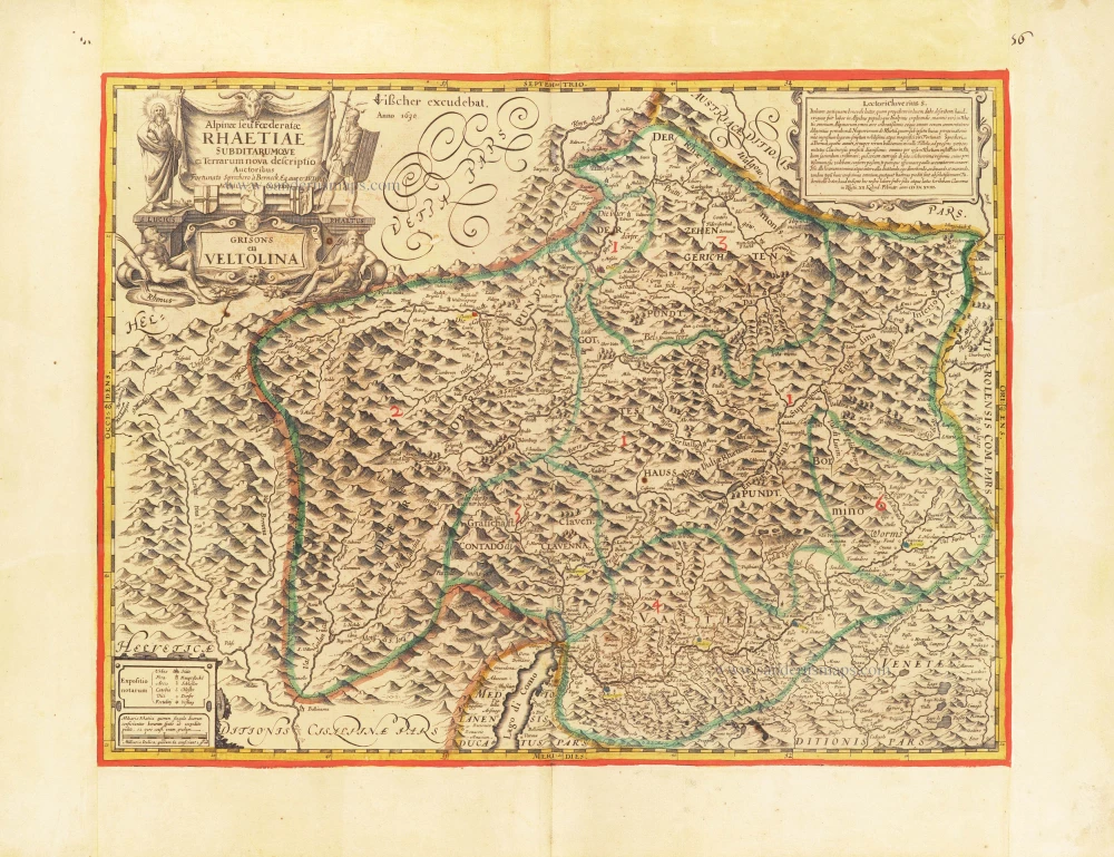
The first modern map of the Canton of Graubunden.
Italian and Swiss Alps by C.J. Visscher, after Philipp Cluverius. 1630
Alpinae seu foederatae Rhaetiae subdirarumque ei Terrarum nova...
[Item number: 30936]
new

Apocalypse (Armageddon) by Hartmann Schedel. 1493
Septima etas mundi.
[Item number: 33040]
new

Important sea chart
Portugal by Waghenaer L.J. 1586
Die Zee Caerte van Portugal, tusschen Camino en Montego, alsoe...
[Item number: 33037]
new
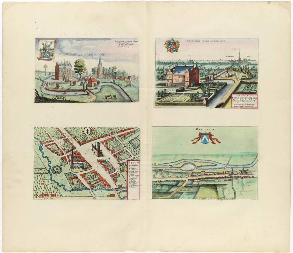
Boezinge, Roeselare, Potegem, Harelbeke by A. Sanderus, published by J. Blaeu. 1652
Praetorium D. Ioannis Casparis de Trompe Toparchi de Boesinghen....
[Item number: 30807]
new