
Ottoman Empire, by Jodocus Hondius, 1628

The Hondius Family
Jodocus Hondius the Elder (1563-1612)
Joost d’Hondt was born at Wakken (Flanders) in 1563. Two years later, his family settled in Ghent, where young Joost displayed an excellent gift for drawing and calligraphy. Through study and lessons, he developed his talents and became an engraver with a good reputation.
Due to the circumstances of the war, he moved to London in 1584, where he settled down as an engraver, instrument-maker, and map-maker. In 1587, he married Coletta van den Keere, sister of the well-known engraver Pieter van den Keere (Petrus Kaerius); some years earlier, his sister, Jacomina, had married Pieter van den Berghe (Petrus Montanus). Joost, who had Latinized his name to Jodocus Hondius, closely co-operated with his two brothers-in-law.
The political situation in the Northern Netherlands in 1593 was such that Jodocus seemed justified in establishing himself in Amsterdam, where many Antwerp printers, publishers, and engravers had gone. In this new centre of cartography, Jodocus Hondius set up his business “In de Wackere Hondt” (in the vigilant dog), this name being an allusion to his birthplace and name. He engraved many maps and published atlases and many other works, such as his continuation of Gerard Mercator’s Atlas.
He suddenly passed away in February 1612. The publishing firm of Jodocus Hondius was continued by his widow, later on, by his two sons, Jodocus Jr. and Henricus, and by his son-in-law, J. Janssonius.
Jodocus Hondius II (1594-1629) & Henricus Hondius (1597-1651)
After the father’s death, the widow and her seven children continued publishing the atlases under the name of Jodocus Hondius till 1620. The firm was reinforced by the very welcome help of Joannes Janssonius (1588-1664), who married 24-year-old Elisabeth Hondius in 1612. After 1619, Mercator’s Atlas was published under the name of Henricus Hondius.
One of the most dramatic events in the early history of commercial cartography in Amsterdam was the sale of Jodocus Hondius Jr.’s copper plates to Willem Jansz. Blaeu in 1629, the year of his death. At least 34 plates, from which Jodocus II had printed single-sheet maps for his benefit, passed into the hands of his great competitor. Immediately after that, his brother, Henricus, and Joannes Janssonius ordered the engraving of identical plates.
Henricus devoted all his energy to publishing the Atlas for an extended period. He saw its growth up to and including the fourth part in 1646; after that, his name no longer figures on the title pages. After 1638, the title of the Atlas was changed to Atlas Novus; Joannes Janssonius mainly carried it on.
The competition with the Blaeu's dates from 1630. In 1630, Willem Janszoon (=Blaeu) first attacked with his Atlantis Appendix. In 1635, Blaeu completed his Theatrum Orbis Terrarum in two volumes with French, Latin, Dutch, and German texts, prompting Henricus Hondius to speed up the enlargement of his Atlas.
Turcici Imperii Imago.
Item Number: 32688 Authenticity Guarantee
Category: Antique maps > Asia > Middle East
Ottoman Empire, by Jodocus Hondius,.
Title: Turcici Imperii Imago.
Date of the first edition: 1606.
Date of this map: 1628.
Copper engraving, printed on paper.
Image size: 365 x 490mm (14¼ x 19¼ inches).
Sheet size: 480 x 570mm (19 x 22½ inches).
Verso: French text.
Condition: Hand coloured, excellent.
Condition Rating: A+.
From: Gerardi Mercatoris - ATLAS Sive Cosmographicae Meditationes de Fabrica Mundi et Fabricati Figura. Amsterdam, H. Hondius, 1628. (Van der Krogt 1, 1:114)
With portrait of 'Sultan Mahumet Turcorum Imperat.'
The Hondius Family
Jodocus Hondius the Elder (1563-1612)
Joost d’Hondt was born at Wakken (Flanders) in 1563. Two years later, his family settled in Ghent, where young Joost displayed an excellent gift for drawing and calligraphy. Through study and lessons, he developed his talents and became an engraver with a good reputation.
Due to the circumstances of the war, he moved to London in 1584, where he settled down as an engraver, instrument-maker, and map-maker. In 1587, he married Coletta van den Keere, sister of the well-known engraver Pieter van den Keere (Petrus Kaerius); some years earlier, his sister, Jacomina, had married Pieter van den Berghe (Petrus Montanus). Joost, who had Latinized his name to Jodocus Hondius, closely co-operated with his two brothers-in-law.
The political situation in the Northern Netherlands in 1593 was such that Jodocus seemed justified in establishing himself in Amsterdam, where many Antwerp printers, publishers, and engravers had gone. In this new centre of cartography, Jodocus Hondius set up his business “In de Wackere Hondt” (in the vigilant dog), this name being an allusion to his birthplace and name. He engraved many maps and published atlases and many other works, such as his continuation of Gerard Mercator’s Atlas.
He suddenly passed away in February 1612. The publishing firm of Jodocus Hondius was continued by his widow, later on, by his two sons, Jodocus Jr. and Henricus, and by his son-in-law, J. Janssonius.
Jodocus Hondius II (1594-1629) & Henricus Hondius (1597-1651)
After the father’s death, the widow and her seven children continued publishing the atlases under the name of Jodocus Hondius till 1620. The firm was reinforced by the very welcome help of Joannes Janssonius (1588-1664), who married 24-year-old Elisabeth Hondius in 1612. After 1619, Mercator’s Atlas was published under the name of Henricus Hondius.
One of the most dramatic events in the early history of commercial cartography in Amsterdam was the sale of Jodocus Hondius Jr.’s copper plates to Willem Jansz. Blaeu in 1629, the year of his death. At least 34 plates, from which Jodocus II had printed single-sheet maps for his benefit, passed into the hands of his great competitor. Immediately after that, his brother, Henricus, and Joannes Janssonius ordered the engraving of identical plates.
Henricus devoted all his energy to publishing the Atlas for an extended period. He saw its growth up to and including the fourth part in 1646; after that, his name no longer figures on the title pages. After 1638, the title of the Atlas was changed to Atlas Novus; Joannes Janssonius mainly carried it on.
The competition with the Blaeu's dates from 1630. In 1630, Willem Janszoon (=Blaeu) first attacked with his Atlantis Appendix. In 1635, Blaeu completed his Theatrum Orbis Terrarum in two volumes with French, Latin, Dutch, and German texts, prompting Henricus Hondius to speed up the enlargement of his Atlas.
Related items

Turquie d'Europe. 1776-79
The Ottoman Empire, by Francesco Santini.
[Item number: 26972]

Imperium Turcicum in Europa, Asia et Africa, divisum in sua Regna et Regiones, nempe Graeciam, Natoliam, Armeniam, Arabiam, Aegyptum, Regna Algeriae, Tunetanum, Tripoleos et Barcae, cum reliquis adjacentibus regionibus. c. 1700
Ottoman Empire by Gerard and Leonard Valck.
[Item number: 28322]

Turcicum Imperium. ca. 1691-96
Ottoman Empire, by De Wit F.
[Item number: 28988]

Turcicum Imperium. 1652-53
Ottoman Empire by Henricus Hondius.
[Item number: 29168]

Danubii Fluvii Sive Turcici Imperii in Europa. c. 1705
Danube and European Ottoman Empire, by Frederick de Wit.
[Item number: 29279]

Carte de l'Empire Othoman considerée dans les Etats de cette Puissance, et des Etats qui l'avoisinent ou qui luy sont Tributaires, ainsi que deux petites Cartes pour conduire à l'Histoire Universelle, et en particulier à l'Histoire d'Alexandre le Grand, 1714
Ottoman Empire, by Zacharias Châtelain.
[Item number: 29399]

Estats de l'Empire du Grand Seigneur des Turqs ou Sultan des Ottomans en Asie, en Afrique, et en Europe. 1659
Ottoman Empire by Nicolas Sanson.
[Item number: 29713]

Estats de l'Empire du Grand Seigneur des Turcs en Europe, en Asie, et en Afrique ... 1692
Ottoman Empire by N. Sanson, so-called published by Hubert Jaillot. (Pirated edition by Pierre Mortier).
[Item number: 31198]

Turcicum Imperium. 1618
Ottoman Empire, by Petrus Bertius
[Item number: 32176]

Scarce
Accuratissima et Maxima Totius Turcici Imperii Tabula cum omnibus suis Regionibus. c. 1680
Ottoman Empire by Danckerts J.
[Item number: 32518]

Turcici Imperii Descriptio. 1579
Ottoman Empire by Ortelius Abraham
[Item number: 32692]
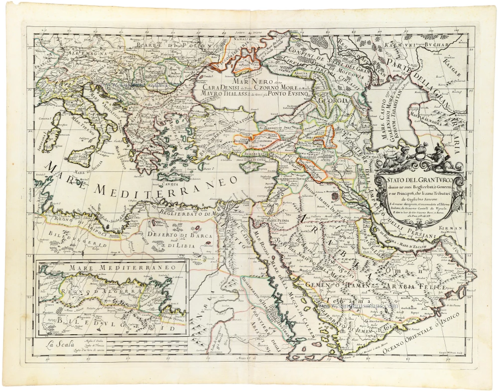
Stato del Gran Turco diviso ne suoi Beglierbau, ò Governi, e ne Principati, che li sono Tributari. 1687
Ottoman Empire, by Guillaume Sanson, adapted by Giacomo Cantelli da Vignola, and published by Giovanni de Rossi.
[Item number: 32955]

Turcicum Imperium. 1666
Ottoman Empire by Joannes Janssonius.
[Item number: 33094]
new