
Fondi by Georg Braun & Frans Hogenberg after Joris (Georg) Hoefnagel. 1617
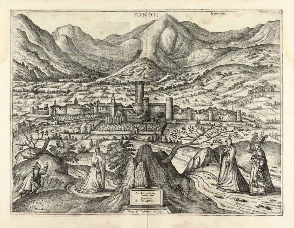
COMMENTARY BY BRAUN: "Fondi, a town in the Roman Campagna, situated on the plain, is richly populated. The paved Via Appia passes through the town centre. To the east and north, it is surrounded by mountains; to the south and west, it lies on the sea. Those travelling to Formia see Lake Fondi on the right. Ferdinand, King of Aragon and Naples, awarded the town and others to the excellent and brave Prince Prospero Colonna for his faithful services. In 1534, Hayreddin Barbarossa, the Turkish emperor's pirate, a sea admiral, caused the Fondani exceedingly great harm, for he took away all the inhabitants in slavery."
Fondi is shown from the south in a pleasant location at the foot of the Ausoni Mountains, beside the Via Appia (B), some 20 km northwest of Gaeta. The fortifications date back to the 1st century BC, and the Castello Baronale dominate the townscape. To the left of the baronial castle lies the cathedral of San Pietro, originally a Gothic structure. Visible further left, behind the tower of San Pietro, is the square tower of Santa Maria in Piazza. In Aragonese possession in the 16th century, Fondi was given to the Colonna family as a fief. As the court of Giulia Gonzaga, who ruled in her name after the death of her husband, Vespasiano Colonna, Fondi blossomed into a centre of arts. In 1534, the Ottoman corsair Hayreddin Barbarossa attempted to take Giulia Gonzaga prisoner. When she succeeded in escaping, he massacred the inhabitants of the town. In 1594, Fondi was raided again by the Saracens. This second attack marked the start of the town's decline. (Taschen)
Braun G. & Hogenberg F. and the Civitates Orbis Terrarum.
The Civitates Orbis Terrarum, also known as the 'Braun & Hogenberg', is a six-volume town atlas and the most excellent book of town views and plans ever published: 363 engravings, sometimes beautifully coloured. It was one of the best-selling works in the last quarter of the 16th century. Georg Braun, a skilled writer, wrote the text accompanying the plans and views on the verso. Many plates were engraved after the original drawings of a professional artist, Joris Hoefnagel (1542-1600). The first volume was published in Latin in 1572 and the sixth in 1617. Frans Hogenberg, a talented engraver, created the tables for volumes I through IV, and Simon van den Neuwel made those for volumes V and VI. Other contributors were cartographers Daniel Freese and Heinrich Rantzau, who provided valuable geographical information. Works by Jacob van Deventer, Sebastian Münster, and Johannes Stumpf were also used as references. Translations appeared in German and French, making the atlas accessible to a wider audience.
Since its original publication of volume 1 in 1572, the Civitates Orbis Terrarum has left an indelible mark on the history of cartography. The first volume was followed by seven more editions in 1575, 1577, 1582, 1588, 1593, 1599, and 1612. Vol.2, initially released in 1575, saw subsequent editions in 1597 and 1612. The subsequent volumes, each a treasure trove of historical insights, graced the world in 1581, 1588, 1593, 1599, and 1606. The German translation of the first volume, a testament to its widespread appeal, debuted in 1574, followed by the French edition in 1575.
Several printers were involved: Theodor Graminaeus, Heinrich von Aich, Gottfried von Kempen, Johannis Sinniger, Bertram Buchholtz, and Peter von Brachel, all of whom worked in Cologne.
Georg Braun (1541-1622)
Georg Braun, the author of the text accompanying the plans and views in the Civitates Orbis Terrarum, was born in Cologne in 1541. After his studies in Cologne, he entered the Jesuit Order as a novice, indicating his commitment to learning and intellectual pursuits. In 1561, he obtained his bachelor's degree; in 1562, he received his Magister Artium, further demonstrating his academic achievements. Although he left the Jesuit Order, he continued his studies in theology, gaining a licentiate in theology. His theological background likely influenced the content and tone of the text in the Civitates Orbis Terrarum, adding a unique perspective to the work.
Frans Hogenberg (1535-1590)
Frans Hogenberg was a Flemish and German painter, engraver, and mapmaker. He was born in Mechelen as the son of Nicolaas Hogenberg.
By the end of the 1560s, Frans Hogenberg was employed upon Abraham Ortelius's Theatrum Orbis Terrarum, published in 1570; he is named an engraver of numerous maps. In 1568, he was banned from Antwerp by the Duke of Alva and travelled to London, where he stayed a few years before emigrating to Cologne. He immediately embarked on his two most important works, the Civitates, published in 1572 and the Geschichtsblätter, which appeared in several series from 1569 until about 1587.
Thanks to large-scale projects like the Geschichtsblätter and the Civitates, Hogenberg's social circumstances improved with each passing year. He died as a wealthy man in Cologne in 1590.
Fondi.
Item Number: 30109 Authenticity Guarantee
Category: Antique maps > Europe > Italy - Cities
Old, antique bird’s-eye view plan of Fondi by Georg Braun & Frans Hogenberg after Joris (Georg) Hoefnagel.
Title: Fondi.
Deping. G. Houfnaglius A° 1578.
Date of the first edition: 1596.
Date of this map: 1617.
Date on map: 1578.
Copper engraving, printed on paper.
Image size: 365 x 490mm (14.37 x 19.29 inches).
Sheet size: 400 x 435mm (15.75 x 17.13 inches).
Verso: Latin text.
Condition: Some staining in margins and upper part.
Condition Rating: A.
From: G. Braun & F. Hogenberg. Civitates Orbis Terrarum. - Urbium Praecipuarum Mundi Theatrum Quintum. Cologne, Petrus von Brachel, 1617. (Van der Krogt 41:1.5 (1617)).
COMMENTARY BY BRAUN: "Fondi, a town in the Roman Campagna, situated on the plain, is richly populated. The paved Via Appia passes through the town centre. To the east and north, it is surrounded by mountains; to the south and west, it lies on the sea. Those travelling to Formia see Lake Fondi on the right. Ferdinand, King of Aragon and Naples, awarded the town and others to the excellent and brave Prince Prospero Colonna for his faithful services. In 1534, Hayreddin Barbarossa, the Turkish emperor's pirate, a sea admiral, caused the Fondani exceedingly great harm, for he took away all the inhabitants in slavery."
Fondi is shown from the south in a pleasant location at the foot of the Ausoni Mountains, beside the Via Appia (B), some 20 km northwest of Gaeta. The fortifications date back to the 1st century BC, and the Castello Baronale dominate the townscape. To the left of the baronial castle lies the cathedral of San Pietro, originally a Gothic structure. Visible further left, behind the tower of San Pietro, is the square tower of Santa Maria in Piazza. In Aragonese possession in the 16th century, Fondi was given to the Colonna family as a fief. As the court of Giulia Gonzaga, who ruled in her name after the death of her husband, Vespasiano Colonna, Fondi blossomed into a centre of arts. In 1534, the Ottoman corsair Hayreddin Barbarossa attempted to take Giulia Gonzaga prisoner. When she succeeded in escaping, he massacred the inhabitants of the town. In 1594, Fondi was raided again by the Saracens. This second attack marked the start of the town's decline. (Taschen)
Braun G. & Hogenberg F. and the Civitates Orbis Terrarum.
The Civitates Orbis Terrarum, also known as the 'Braun & Hogenberg', is a six-volume town atlas and the most excellent book of town views and plans ever published: 363 engravings, sometimes beautifully coloured. It was one of the best-selling works in the last quarter of the 16th century. Georg Braun, a skilled writer, wrote the text accompanying the plans and views on the verso. Many plates were engraved after the original drawings of a professional artist, Joris Hoefnagel (1542-1600). The first volume was published in Latin in 1572 and the sixth in 1617. Frans Hogenberg, a talented engraver, created the tables for volumes I through IV, and Simon van den Neuwel made those for volumes V and VI. Other contributors were cartographers Daniel Freese and Heinrich Rantzau, who provided valuable geographical information. Works by Jacob van Deventer, Sebastian Münster, and Johannes Stumpf were also used as references. Translations appeared in German and French, making the atlas accessible to a wider audience.
Since its original publication of volume 1 in 1572, the Civitates Orbis Terrarum has left an indelible mark on the history of cartography. The first volume was followed by seven more editions in 1575, 1577, 1582, 1588, 1593, 1599, and 1612. Vol.2, initially released in 1575, saw subsequent editions in 1597 and 1612. The subsequent volumes, each a treasure trove of historical insights, graced the world in 1581, 1588, 1593, 1599, and 1606. The German translation of the first volume, a testament to its widespread appeal, debuted in 1574, followed by the French edition in 1575.
Several printers were involved: Theodor Graminaeus, Heinrich von Aich, Gottfried von Kempen, Johannis Sinniger, Bertram Buchholtz, and Peter von Brachel, all of whom worked in Cologne.
Georg Braun (1541-1622)
Georg Braun, the author of the text accompanying the plans and views in the Civitates Orbis Terrarum, was born in Cologne in 1541. After his studies in Cologne, he entered the Jesuit Order as a novice, indicating his commitment to learning and intellectual pursuits. In 1561, he obtained his bachelor's degree; in 1562, he received his Magister Artium, further demonstrating his academic achievements. Although he left the Jesuit Order, he continued his studies in theology, gaining a licentiate in theology. His theological background likely influenced the content and tone of the text in the Civitates Orbis Terrarum, adding a unique perspective to the work.
Frans Hogenberg (1535-1590)
Frans Hogenberg was a Flemish and German painter, engraver, and mapmaker. He was born in Mechelen as the son of Nicolaas Hogenberg.
By the end of the 1560s, Frans Hogenberg was employed upon Abraham Ortelius's Theatrum Orbis Terrarum, published in 1570; he is named an engraver of numerous maps. In 1568, he was banned from Antwerp by the Duke of Alva and travelled to London, where he stayed a few years before emigrating to Cologne. He immediately embarked on his two most important works, the Civitates, published in 1572 and the Geschichtsblätter, which appeared in several series from 1569 until about 1587.
Thanks to large-scale projects like the Geschichtsblätter and the Civitates, Hogenberg's social circumstances improved with each passing year. He died as a wealthy man in Cologne in 1590.
Related items
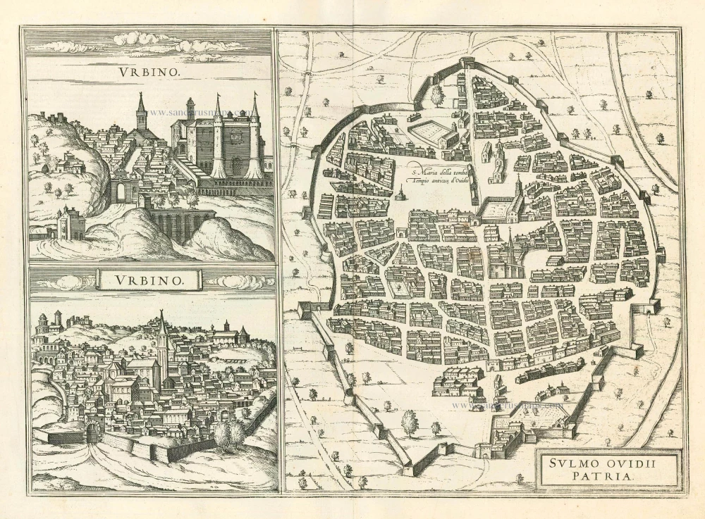
Urbino - Sulmo Ovidii Patria 1599
Urbino and Sulmona, by Braun and Hogenberg.
[Item number: 24126]
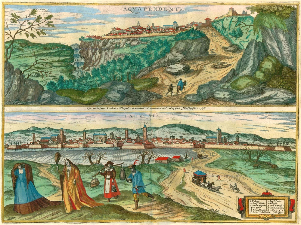
Aquapendente [on sheet with] Tarvisi 1596-1640
Acquapendente and Tarvisio by Braun and Hogenberg.
[Item number: 24195]
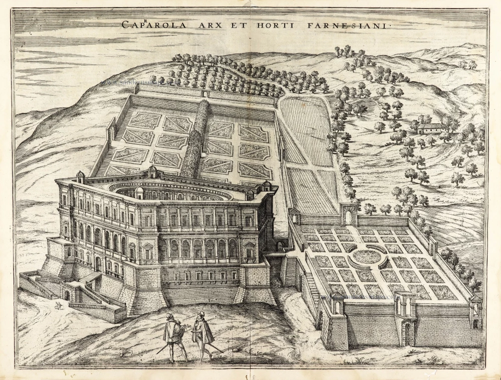
Caprarola arx et horti Farnesiani. 1600
Caprarola (Latium) and the Farnese Palace, by Georg Braun and Frans Hogenberg.
[Item number: 30110]