
Antique map of Africa by H. Moll. c. 1726
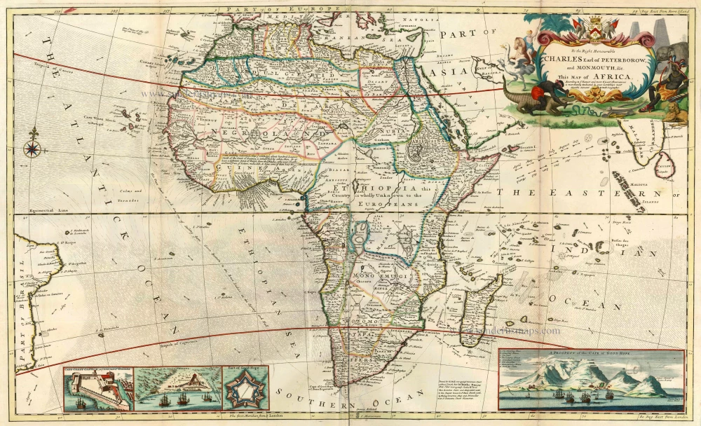
To the Right Honourable Charles Earl of Peterborow, and Monmouth, &c. This Map of Africa, According to ye Newest and Most Exact Observations is Most Humbly Dedicated by your Lordship's Most Humble Servant H:Moll Geographer
Item Number: 4219 Authenticity Guarantee
Category: Antique maps > Africa
Map of Africa with insets of Cape of Good Hope, James Fort on St Helena and Cape Coiast Castle on the Guinea Coast.
Copper engraving, printed from two plates, joined.
Size: 58 x 97cm (22.6 x 37.8 inches)
Verso: Blank
Condition: Old coloured with later additions, some browning along right fold.
Condition Rating: A
References: Norwich, 67.
From: Moll Herman, The World Described, or a New and Correct Sett of Maps . . . London, J. & T. Bowles, c. 1726. (Phillips (Atlases), 554)