
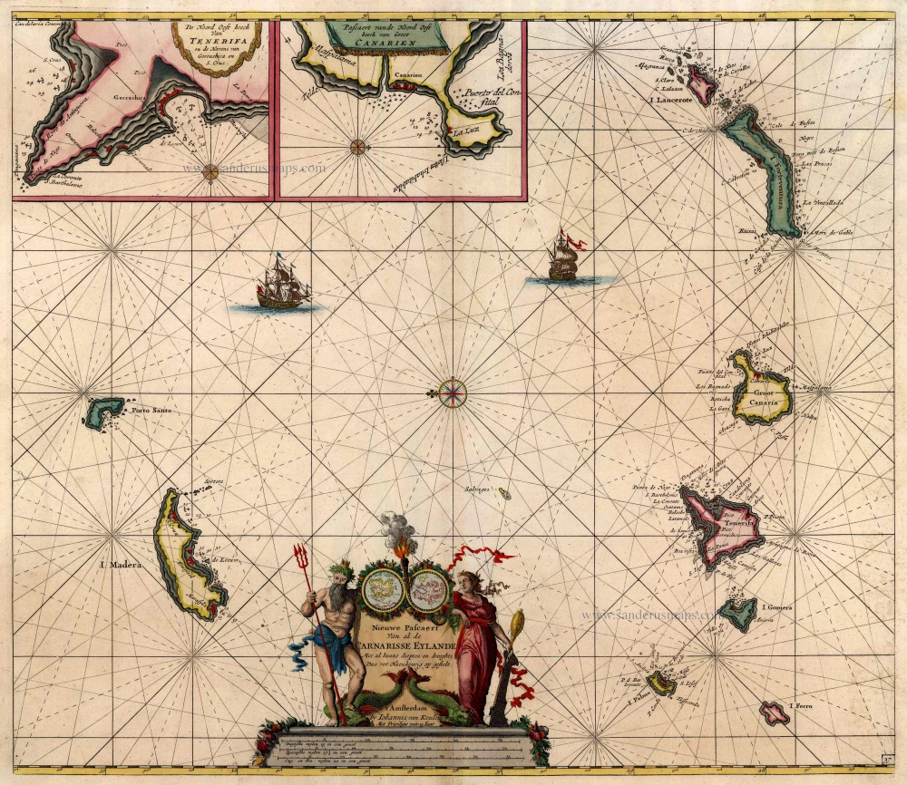
Antique map of Canary Islands - Madeira Islands by Van Keulen Johannes 1697-1709
back
References: Koeman - Keu (97)
Nieuwe Pascaert van Al de Carnarisse Eylande. ...
SOLD
Item Number: 14581 Authenticity Guarantee
Category: Antique maps > Africa
Sea chart of the Canary Islands and Madeira Islands, oriented to the East
Insets of Tenerife with Porto de Cavallos and Lanzarote with Porto de Naos. Cartouche includes two small circular maps of fictitious islands.
Copper engraving
Size: 50.5 x 58cm (19.7 x 22.6 inches)
Verso: Blank
Condition: Old coloured, excellent
Condition Rating: A
References: Koeman, Keu (97).
From: De Nieuwe Groote Lichtende Zee-Fakkel, ... Amsterdam, J. van Keulen, 1697-1709.