
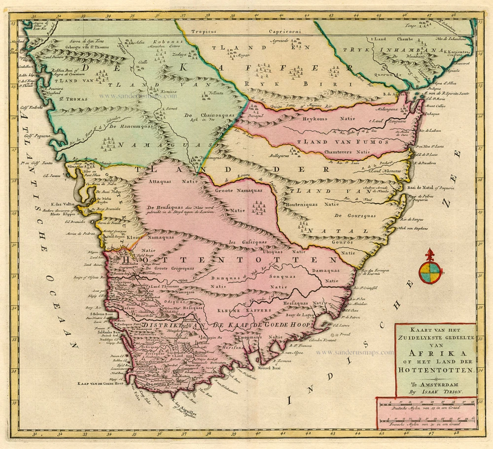
Antique map of Southern Africa by Tirion I. Ca. 1770
back
References:
Kaart van het Zuidelykste Gedeelte van Afrika of het Land der Hottentotten
SOLD
Item Number: 19198 Authenticity Guarantee
Category: Antique maps > Africa
Copper engraving
Size: 33 x 36.5cm (12.9 x 14.2 inches)
Verso: Blank
Condition: Old coloured.
References: Koeman 3, Tir 4-6 (93);.
From: Nieuwe en Beknopte Hand-Atlas, bestaande in eene Verzameling van eenige der algemeenste en nodigste Landkaarten ... Amsterdam, I. Tirion, ca 1770. (Koeman III, Tir 4)