
Sea chart of Guinea, by J. Van Loon. 1661

Pascaerte van Guinea, tusschen C. Verde, tot Cabo de bona Esperanca.
Item Number: 24328 Authenticity Guarantee
Category: Antique maps > Africa
Old, antique sea chart of Guinea, by J. Van Loon.
Title: Pascaerte van Guinea, tusschen C. Verde, tot Cabo de bona Esperanca.
Oriented to the east.
Date: 1661.
Copper engraving, printed on paper.
Size (not including margins): 430 x 540mm (16.93 x 21.26 inches).
Verso: Blank.
Condition: Old coloured, new upper margin with reinstatement of upper neatline, good copy.
Condition Rating: B+.
From: Klaer Lichtende Noort-Ster Ofte Zee Atlas; Waer in vertoont wordt De Gelegentheydt van alle de Zeekusten des geheelen Aerdtbodems, Niewelicks uytgegeven door Joannes van Loon. Amsterdam, 1661.
Related items

Guinea c. 1680
Guinea by F. De Wit.
[Item number: 2646]

Pas-Caert vande Goud Cust in Guinea van C. Tres Puntas tot Acara ... 1683
Sea chart of Guinea, by Van Keulen Johannes.
[Item number: 4059]

Guinea 1664
Guinea by Blaeu J.
[Item number: 12151]

Guineae Nova Descriptio. 1623
Guinea, by Jodocus Hondius.
[Item number: 21985]

Guinea 1721-41
Guinea, by F. De Wit after W. Blaeu.
[Item number: 23613]

Guinée, Grand Pays de L'Afrique, avec toutes ses Côtes, Havres et Rivieres. 1713
Guinea, by Pieter van der Aa.
[Item number: 26156]

Carte de la Guinée contenant les Isles du Cap Verd, le Senegal, la Côte de Guinée proprement dite, les Royaumes de Loango, Congo, Angola et Benguela, avec les Pays voisins autant qu ils sont connus. 1776-79
West Africa, by Francesco Santini.
[Item number: 28100]
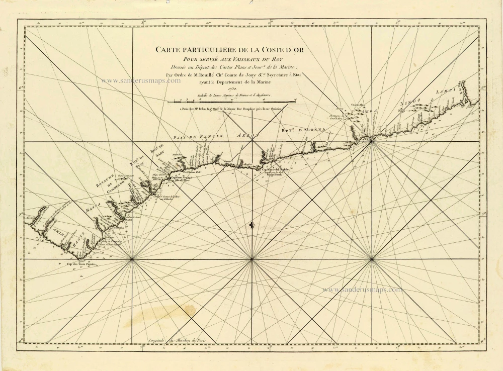
Carte Particulière de la Coste d'Or. 1756-1770
African Gold Coast (Guinea), by J.N. Bellin.
[Item number: 28125]
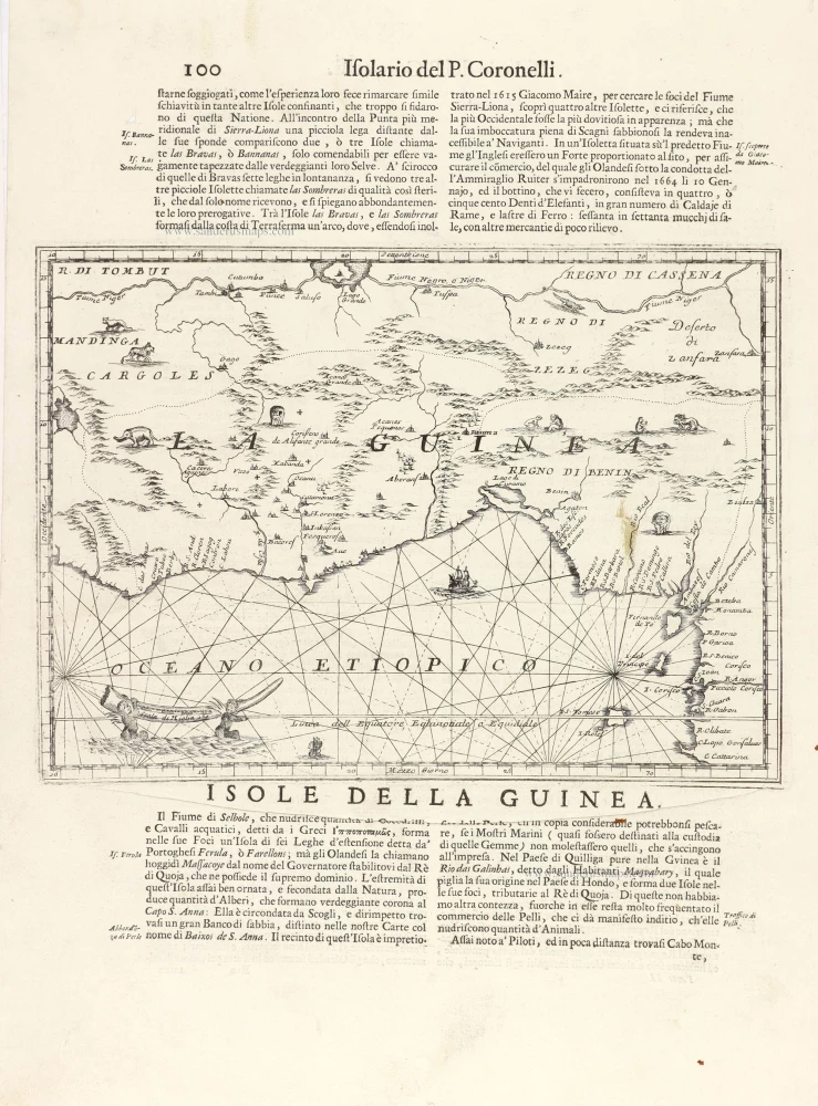
La Guinea. 1696
Guinea, by Vincenzo Coronelli.
[Item number: 29023]